muddy run pumped storage project (ferc no. 2355) - Exelon ...
muddy run pumped storage project (ferc no. 2355) - Exelon ...
muddy run pumped storage project (ferc no. 2355) - Exelon ...

Create successful ePaper yourself
Turn your PDF publications into a flip-book with our unique Google optimized e-Paper software.
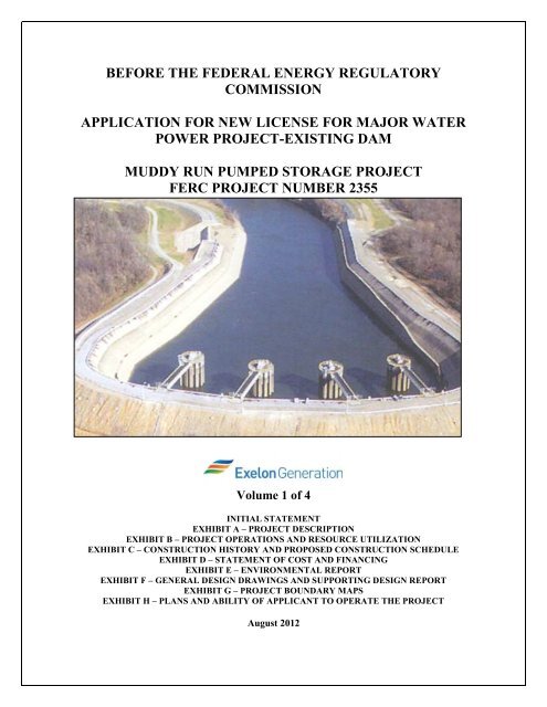
BEFORE THE FEDERAL ENERGY REGULATORY<br />
COMMISSION<br />
APPLICATION FOR NEW LICENSE FOR MAJOR WATER<br />
POWER PROJECT-EXISTING DAM<br />
MUDDY RUN PUMPED STORAGE PROJECT<br />
FERC PROJECT NUMBER <strong>2355</strong><br />
Volume 1 of 4<br />
INITIAL STATEMENT<br />
EXHIBIT A – PROJECT DESCRIPTION<br />
EXHIBIT B – PROJECT OPERATIONS AND RESOURCE UTILIZATION<br />
EXHIBIT C – CONSTRUCTION HISTORY AND PROPOSED CONSTRUCTION SCHEDULE<br />
EXHIBIT D – STATEMENT OF COST AND FINANCING<br />
EXHIBIT E – ENVIRONMENTAL REPORT<br />
EXHIBIT F – GENERAL DESIGN DRAWINGS AND SUPPORTING DESIGN REPORT<br />
EXHIBIT G – PROJECT BOUNDARY MAPS<br />
EXHIBIT H – PLANS AND ABILITY OF APPLICANT TO OPERATE THE PROJECT<br />
August 2012
MUDDY RUN PUMPED STORAGE PROJECT (FERC NO. <strong>2355</strong>)<br />
INITIAL STATEMENT<br />
INITIAL STATEMENT PER 18 CFR § 4.51<br />
APPLICATION FOR NEW LICENSE MAJOR WATER POWER PROJECT - EXISTING DAM<br />
(1) <strong>Exelon</strong> Generation Company, LLC (“<strong>Exelon</strong>” or “Applicant”) applies to the Federal Energy<br />
Regulatory Commission (“Commission” or “FERC”) for a new license for the existing Muddy<br />
Run Pumped Storage Project (“the Project”), FERC Project Number <strong>2355</strong>, as described in the<br />
attached Exhibits. The current license for the Muddy Run Project was issued on September 21,<br />
1964 and expires on August 31, 2014.<br />
(2) The location of the Project is:<br />
State: Pennsylvania<br />
Counties: York and Lancaster<br />
Townships: Drumore, Martic and Peach Bottom<br />
Stream: Muddy Run<br />
(3) The exact name, address, and telephone number of the Applicant are:<br />
<strong>Exelon</strong> Generation Company, LLC<br />
300 <strong>Exelon</strong> Way<br />
Kennett Square, PA 19348<br />
Tel: (610) 765-5959<br />
The exact name, address, and telephone number of each person authorized to act as agent for the<br />
Applicant in this application are:<br />
Colleen E. Hicks<br />
Manager Regulatory and Licensing, Hydro<br />
<strong>Exelon</strong> Power<br />
300 <strong>Exelon</strong> Way<br />
Kennett Square, PA 19348<br />
Tel: (610) 765-6791<br />
Colleen.hicks@exeloncorp.com<br />
Kathleen Barrón<br />
Vice President<br />
Federal Regulatory Affairs and Wholesale Market Policy<br />
<strong>Exelon</strong> Corporation<br />
101 Constitution Ave.<br />
Washington, DC 20001<br />
Tel: (202) 347-7500<br />
Kathleen.Barron2@exeloncorp.com<br />
(4) The Applicant is a domestic corporation and is <strong>no</strong>t claiming preference under section 7(a) of the<br />
Federal Power Act, 16 U.S.C. 796.<br />
i
MUDDY RUN PUMPED STORAGE PROJECT (FERC NO. <strong>2355</strong>)<br />
INITIAL STATEMENT<br />
(5) (i) The statutory or regulatory requirements of the state(s) which affect the Project as it exists with<br />
respect to bed and banks and the appropriation, diversion, and use of water for power purposes,<br />
and with respect to the right to engage in the business of developing, transmitting, and<br />
distributing power and in any other business necessary to accomplish the purpose of the license<br />
under the Federal Power Act, are:<br />
� Applicant is subject to Water Quality Certification from the Pennsylvania Department of<br />
Environmental Protection and Section 401 (a)(1) of the Clean Water Act.<br />
(5) (ii) The steps which the Applicant has taken or plans to take to comply with the regulations cited<br />
above are:<br />
� The Applicant will submit a request for Water Quality Certification from the Pennsylvania<br />
Department of Environmental Protection. Since this is an application for a new license for an<br />
existing waterpower <strong>project</strong>, the Applicant expects to continue to operate the facility pursuant<br />
to approvals, licenses, permits, and exemptions already in effect.<br />
(6) <strong>Exelon</strong> owns the existing Project facilities; there are <strong>no</strong> federally owned or operated facilities<br />
associated with the Project.<br />
ii
MUDDY RUN PUMPED STORAGE PROJECT (FERC NO. <strong>2355</strong>)<br />
INITIAL STATEMENT<br />
ADDITIONAL INFORMATION REQUIRED BY 18 C.F.R. § 5.18(A)<br />
(1) Identify every person, citizen, association of citizens, domestic corporation, municipality, or<br />
state that has or intends to obtain and will maintain any proprietary right necessary to<br />
construct, operate or maintain the <strong>project</strong>:<br />
<strong>Exelon</strong> Generation Company, LLC, a Pennsylvania limited liability company, currently owns and<br />
will continue to maintain all proprietary rights necessary to construct, operate and maintain the<br />
Project.<br />
(2) Identify (providing names and mailing addresses):<br />
(i) Every county in which any part of the <strong>project</strong> and any Federal facilities that would<br />
be used by the <strong>project</strong> would be located;<br />
York County<br />
100 W Market Street<br />
York, PA, 17401<br />
(ii) Every city, town, or similar local political subdivision:<br />
iii<br />
Lancaster County<br />
50 North Duke Street<br />
Lancaster, PA. 17608<br />
i. In which any part of the Project, and any Federal facility that would be used by<br />
the <strong>project</strong>, would be located; or<br />
Martic Township<br />
370 Steinman Farm Road<br />
Pequea, PA 17565<br />
Drumore Township<br />
1675 Furniss Road<br />
Drumore, PA 17518-9768<br />
Peach Bottom Township<br />
545 Broad Street Extended<br />
Delta, PA 17314<br />
Lower Chanceford Township<br />
4120 Delta Road<br />
Airville, PA 17302<br />
ii. That has a population of 5,000 or more people and is located within 15 miles of<br />
the <strong>project</strong> dam.<br />
Martic Township<br />
370 Steinman Farm Road<br />
Pequea, PA 17565<br />
Chanceford Township<br />
51 Muddy Creek Forks Rd<br />
Brogue, PA 17309<br />
East Lampeter Township<br />
2250 Old Philadelphia Pike<br />
Lancaster, PA 17602<br />
Lower Windsor Township<br />
2425 Craley Road<br />
Wrightsville, PA 17368<br />
Millersville Borough<br />
100 Municipal Drive<br />
Millersville, PA 17551<br />
Oxford Borough<br />
401 Market Street<br />
Oxford PA 19363
(3)<br />
MUDDY RUN PUMPED STORAGE PROJECT (FERC NO. <strong>2355</strong>)<br />
INITIAL STATEMENT<br />
East Nottingham Township<br />
158 Election Road<br />
Oxford, PA 19363<br />
Fulton Township<br />
777 Nottingham Rd<br />
Peach Bottom, PA 17563<br />
City of Lancaster<br />
120 N Duke St<br />
Lancaster, PA 17608<br />
Lower Oxford Township<br />
220 Township Road<br />
Oxford, PA 19363<br />
iv<br />
Paradise Township<br />
12 Township Dr.<br />
Paradise PA 17562<br />
Providence Township<br />
200 Mt. Airy Road<br />
New Providence, PA 17560<br />
West Lampeter Township<br />
852 Village Road,<br />
Lampeter, PA 17537<br />
(iii) Every irrigation district, drainage district or similar special purpose political<br />
subdivision (A) in which any part of the <strong>project</strong> is located, and any Federal facility<br />
that is or is proposed to be used by the <strong>project</strong> is located, or (B) that owns, operates,<br />
maintains, or uses any <strong>project</strong> facility or any Federal facility that is or is proposed to<br />
be used by the <strong>project</strong>:<br />
There is <strong>no</strong> irrigation district, drainage district, or similar special purpose political<br />
subdivision in which any part of the <strong>project</strong> is located or that owns, operates, maintains,<br />
or uses any <strong>project</strong> facility. The <strong>project</strong> uses <strong>no</strong> Federal facilities and occupies <strong>no</strong> Federal<br />
lands.<br />
(iv) Every other political subdivision in the general area of the Project that there is<br />
reason to believe would likely be interested in, or affected by, the application.<br />
There are <strong>no</strong> other political subdivisions in the general area of the Project that would<br />
likely be interested in, or affected by, the <strong>no</strong>tification.<br />
(v) All Indian tribes that may be affected by the Project.<br />
Delaware Nation<br />
P.O. Box 825<br />
Anadarko, OK 73005<br />
(i) For a license (other than a license under section 15 of the Federal Power Act) state<br />
that the Applicant has made a good faith effort to give <strong>no</strong>tification by certified mail<br />
of the filing of the application to:<br />
(A) Every property owner of record of any interest in the property within the<br />
bounds of the Project, or in the case of the Project without a specific<br />
boundary, each such owner of property which would underlie or be adjacent<br />
to any Project works, including any impoundments; and
MUDDY RUN PUMPED STORAGE PROJECT (FERC NO. <strong>2355</strong>)<br />
INITIAL STATEMENT<br />
(B) The entities identified in paragraph (2) above, as well as any other federal,<br />
state, municipal or other local government agencies that there is reason to<br />
believe would likely be interested in or affected by the application.<br />
PURPA Benefits<br />
Because <strong>Exelon</strong> is seeking a new license under section 15 of the Federal Power<br />
Act, this requirement does <strong>no</strong>t apply. However, <strong>Exelon</strong> is <strong>no</strong>tifying resource<br />
agencies, stakeholders, and members of the public consulted through the<br />
integrated licensing process of the filing of this License Application as required<br />
by section 5.17(d)(1) of the Commission’s regulations.<br />
<strong>Exelon</strong> is <strong>no</strong>t seeking any PURPA benefits in association with the relicensing of the Project.<br />
v
MUDDY RUN PUMPED STORAGE PROJECT (FERC NO. <strong>2355</strong>)<br />
ACRONYMS AND ABBREVIATIONS<br />
ACRONYMS AND ABBREVIATIONS<br />
ACHP Advisory Council on Historic Preservation<br />
ADA Americans with Disabilities Act<br />
ADAAG Accessibility Guidelines for Buildings and Facilities<br />
APE Area of Potential Effect<br />
BEMP Bald Eagle Management Plan<br />
BTMP Bog Turtle Management Plan<br />
CEQ Council of Environmental Quality<br />
CFR Code of Federal Regulations<br />
CU Consumptive Use<br />
CWA Clean Water Act<br />
cfs Cubic Feet per Second<br />
dBA Decibel<br />
°C Degrees Centigrade<br />
°F Degrees Fahrenheit<br />
DO Dissolved Oxygen<br />
DLA Draft License Application<br />
EA Environmental Assessment<br />
EIS Environmental Impact Statement<br />
ESA Endangered Species Act<br />
<strong>Exelon</strong> <strong>Exelon</strong> Generation Company, LLC<br />
FERC Federal Energy Regulatory Commission<br />
FLA Final License Application<br />
FPA Federal Power Act<br />
FPC Federal Power Commission<br />
fps Feet Per Second<br />
ft Feet<br />
HPMP Historic Properties Management Plan<br />
IBA Important Bird Area<br />
ILP Integrated Licensing Process<br />
IVM Integrated Vegetation Management<br />
kg Kilogram<br />
vii
MUDDY RUN PUMPED STORAGE PROJECT (FERC NO. <strong>2355</strong>)<br />
ACRONYMS AND ABBREVIATIONS<br />
kV Kilovolts<br />
kVA Kilovolt-Ampere<br />
MAAC Mid-Atlantic Area Council<br />
MDNR Maryland Department of Natural Resources<br />
MGD Millions Gallons per Day<br />
mg/L Milligrams Per Liter<br />
MW Megawatt<br />
MWh Megawatt-Hour<br />
NAI Natural Areas Inventory<br />
NEPA National Environmental Policy Act of 1969<br />
NERC North American Electric Reliability Council<br />
NGVD 1929 National Geodetic Vertical Datum of 1929<br />
NHPA National Historic Preservation Act<br />
NGO Non-Governmental Organization<br />
NID National Inventory of Dams<br />
NMFS National Marine Fisheries Service<br />
NPDES National Pollution Discharge Elimination System<br />
NRCS Natural Resources Conservation Service<br />
NRHP National Register of Historic Places<br />
NOI Notice of Intent<br />
NTU Nephelometric Turbidity Unit<br />
NWI National Wetland Inventory<br />
PAD Pre-Application Document<br />
PADEP Pennsylvania Department of Environmental Protection<br />
PADCNR Pennsylvania Department of Conservation and Natural Resources<br />
PBAPS Peach Bottom Atomic Power Station<br />
PECO PECO Energy Company<br />
PEPCo PECO Energy Power Company<br />
PFBC Pennsylvania Fish and Boat Commission<br />
PGC Pennsylvania Game Commission<br />
PGS Pennsylvania Geological Survey<br />
pH The measure of the acidity or alkalinity of a substance or liquid<br />
PHMC Pennsylvania Historical and Museum Commission<br />
viii
MUDDY RUN PUMPED STORAGE PROJECT (FERC NO. <strong>2355</strong>)<br />
ACRONYMS AND ABBREVIATIONS<br />
PJM Pennsylvania, New Jersey, Maryland Interconnection<br />
PM&E Protection, Mitigation and Enhancement<br />
PSP Proposed Study Plan<br />
REA Ready for Environmental Analysis<br />
RM River Mile<br />
RMP Recreation Management Plan<br />
RSP Revised Study Plan<br />
ROW Right of Way<br />
SD1 FERC Scoping Document 1<br />
SD2 FERC Scoping Document 2<br />
SHPO Pennsylvania State Historic Preservation Officer<br />
SMP Shoreline Management Plan<br />
SRAFRC Susquehanna River Anadromous Fish Restoration Committee<br />
SRBC Susquehanna River Basin Commission<br />
SSURGO Soil Survey Geographic Database<br />
TL Total Length<br />
TMDL Total Maximum Daily Loads<br />
TSF Trout Stocking<br />
USACE United States Army Corps of Engineers<br />
USDA United States Department of Agriculture<br />
USDOI United States Department of the Interior<br />
USEPA United States Environmental Protection Agency<br />
USFWS United States Fish and Wildlife Service<br />
USGS United States Geological Survey<br />
WMA Wildlife Management Area<br />
WQMAR 2010 Pennsylvania Integrated Water Quality Monitoring and Assessment Report<br />
WWF Warm Water Fishes<br />
WY Water Year<br />
ix
MUDDY RUN PUMPED STORAGE PROJECT (FERC NO. <strong>2355</strong>)<br />
APPLICATION FOR NEW LICENSE<br />
EXHIBIT A-PROJECT DESCRIPTION
MUDDY RUN PUMPED STORAGE PROJECT (FERC NO. <strong>2355</strong>)<br />
EXHIBIT A-PROJECT DESCRIPTION<br />
TABLE OF CONTENTS<br />
Section 1.0 Project Structures ........................................................................................................... 2<br />
1.1 Main Dam Embankment ................................................................................................................ 2<br />
1.2 East Dike ........................................................................................................................................ 3<br />
1.3 Recreation Pond Dam and Spillway .............................................................................................. 3<br />
1.4 Canal Embankment ........................................................................................................................ 4<br />
1.5 Upper Reservoir Spillway .............................................................................................................. 4<br />
1.6 Intake Structure .............................................................................................................................. 4<br />
1.7 Powerhouse .................................................................................................................................... 5<br />
Section 2.0 Surface Area, Elevation and Storage Capacity ............................................................ 5<br />
2.1 Muddy Run Power Reservoir ........................................................................................................ 5<br />
2.2 Muddy Run Recreation Pond ......................................................................................................... 5<br />
2.3 Lower Reservoir (Co<strong>no</strong>wingo Pond) ............................................................................................. 5<br />
Section 3.0 Turbines and Generators ............................................................................................... 6<br />
Section 4.0 Transmission Lines ......................................................................................................... 6<br />
Section 5.0 Additional Equipment .................................................................................................... 6<br />
Section 6.0 Lands of the United States .............................................................................................. 6<br />
A-i
MUDDY RUN PUMPED STORAGE PROJECT (FERC NO. <strong>2355</strong>)<br />
EXHIBIT A-PROJECT DESCRIPTION<br />
LIST OF TABLES<br />
Table 1.6-1: Turbine Intake Structure and Tailrace (Co<strong>no</strong>wingo Pond) Characteristics ................... 7<br />
Table 3-1: Turbine Unit Characteristics ................................................................................................... 8<br />
LIST OF FIGURES<br />
Figure 1-1: Muddy Run Project Structures ............................................................................................. 9<br />
Figure 1.5-1: Muddy Run Upper Reservoir Spillway Rating Curve .................................................... 10<br />
A-ii
MUDDY RUN PUMPED STORAGE PROJECT (FERC NO. <strong>2355</strong>)<br />
EXHIBIT A-PROJECT DESCRIPTION<br />
EXHIBIT A – PROJECT DESCRIPTION<br />
The following excerpt from the Code of Federal Regulations (CFR) at 18 CFR § 4.51(b) describes the<br />
required content of this Exhibit.<br />
Exhibit A is a description of the <strong>project</strong>. This exhibit need <strong>no</strong>t include information on <strong>project</strong> works<br />
maintained and operated by the U.S. Army Corps of Engineers, the Bureau of Reclamation, or any other<br />
department or agency of the United States, except for any <strong>project</strong> works that are proposed to be altered<br />
or modified. If the <strong>project</strong> includes more than one dam with associated facilities, each dam and the<br />
associated component parts must be described together as a discrete development. The description for<br />
each development must contain:<br />
(1) The physical composition, dimensions, and general configuration of any dams, spillways, penstocks,<br />
powerhouses, tailraces, or other structures, whether existing or proposed, to be included as part of the<br />
<strong>project</strong>;<br />
(2) The <strong>no</strong>rmal maximum surface area and <strong>no</strong>rmal maximum surface elevation (mean sea level), gross<br />
<strong>storage</strong> capacity, and usable <strong>storage</strong> capacity of any impoundments to be included as part of the <strong>project</strong>;<br />
(3) The number, type, and rated capacity of any turbines or generators, whether existing or proposed, to<br />
be included as part of the <strong>project</strong>;<br />
(4) The number, length, voltage, and interconnections of any primary transmission lines, whether existing<br />
or proposed, to be included as part of the <strong>project</strong> (see 16 U.S.C. 796(11));<br />
(5) The specifications of any additional mechanical, electrical, and transmission equipment appurtenant<br />
to the <strong>project</strong>; and<br />
(6) All lands of the United States that are enclosed within the <strong>project</strong> boundary described under<br />
paragraph (h) of this section (Exhibit G), identified and tabulated by legal subdivisions of a public land<br />
survey of the affected area or, in the absence of a public land survey, by the best available legal<br />
description. The tabulation must show the total acreage of the lands of the United States within the<br />
<strong>project</strong> boundary.)<br />
A-1
SECTION 1.0<br />
MUDDY RUN PUMPED STORAGE PROJECT (FERC NO. <strong>2355</strong>)<br />
EXHIBIT A-PROJECT DESCRIPTION<br />
PROJECT STRUCTURES<br />
The Muddy Run Power Project (Muddy Run Project or Project) is a <strong>pumped</strong>-<strong>storage</strong> hydroelectric<br />
generating facility located approximately 22 miles upstream of the Chesapeake Bay on the eastern<br />
shoreline of the Susquehanna River, within Drumore and Martic Townships, Lancaster County,<br />
Pennsylvania.<br />
The Project (Figure 1-1) consists of: 1) a main dam embankment, 2) the east dike, 3) recreation pond dam<br />
and spillway 4) canal dam embankment, 5) upper reservoir spillway 6), intake structure 7) a powerhouse<br />
and 8) primary transmission line.<br />
The recreation pond’s sole purpose is for environmental mitigation and recreation, and its water levels are<br />
<strong>no</strong>t affected by fluctuations within the Power Reservoir. The recreation pond impoundment level is<br />
maintained by an uncontrolled open channel spillway.<br />
1.1. Main Dam Embankment<br />
Muddy Run Reservoir was created by building a rock-filled dam with a central impervious core across the<br />
Muddy Run ravine, approximately 2,500 feet from the Muddy Run Powerhouse. The Muddy Run Main<br />
Dam Embankment (Main Dam) (National Inventory of Dams (NID) PA00266) is 4,800 feet long, has a<br />
maximum height of 260 feet, and has upstream and downstream slopes of 2.5H:1V and 2.2H:1V,<br />
respectively. The downstream slope includes a 20-foot wide bench/road at midslope across the highest<br />
section of the dam. The top few feet of the embankment (above the maximum <strong>no</strong>rmal reservoir level) are<br />
constructed with upstream and downstream slopes of 1.5H: 1V.<br />
The crest of the dam is at elevation 533 feet, is 34 feet wide and is traversed by a 20-foot-wide two-laned<br />
roadway (River Road). The crest provides 13 feet of freeboard when the Muddy Run Reservoir water<br />
level is at elevation 520 feet.<br />
The Main Dam embankment is constructed as a “zoned” embankment with an impervious core. The<br />
structure includes two filter zones on each side of the core and upstream and downstream rockfill shells.<br />
The rockfill consists of excavated schist bedrock. Less weathered rockfill was placed on the downstream<br />
slope and upper parts of the upstream shell. More weathered rockfill was placed in the downstream shell<br />
and lower parts of the upstream shell under a 20-foot-thick “fresh rock” cover. The downstream shell also<br />
includes a zone of 10-foot-thick random material layers alternating with 3-foot-thick layers of weathered<br />
rock.<br />
A-2
MUDDY RUN PUMPED STORAGE PROJECT (FERC NO. <strong>2355</strong>)<br />
EXHIBIT A-PROJECT DESCRIPTION<br />
The core is centrally located and symmetrical, 20 feet wide at the top and increasing by 0.6 feet with each<br />
foot of depth. The core is constructed of silty soil which is the product of extreme weathering of the<br />
schists close to the ground surface. The core is carried in a trench down to hard fresh rock in the gorge of<br />
Muddy Run, to firm weathered rock between elevations 370 and 470, and to a depth of 10 feet where the<br />
ground surface is above elevation 470. A grout curtain was installed by advancing drill holes (3 rows of<br />
drill holes below El. 470 and 1 row below El. 470) from which the grouting was completed in stages. In<br />
addition to vertical drill holes, inclined drill holes were used in order to better intersect a steeply dipping<br />
system of bedrock joints.<br />
Drainage of the downstream shell, downstream filter and foundation rock is provided by longitudinal<br />
drains beneath the downstream shell. Eleven relief wells are installed at the toe of the embankment in the<br />
gorge, and seven wells are installed on the <strong>no</strong>rth abutment.<br />
1.2. East Dike<br />
The East Dike (NID PA83010) is approximately 800 feet long, has a crest width of 20 feet, has a<br />
maximum height of about 12 feet and has upstream and downstream slopes of 2.5H:1V and 2.2H:1V,<br />
respectively. The east dike is also a zoned earth and rock-fill embankment with an impervious core. The<br />
crest of the east dike has an elevation of 530.8 feet.<br />
1.3. Recreation Pond Dam and Spillway<br />
The Recreation Pond Dam (NID PA83009), located in the drainage for the upper reservoir about two<br />
miles upstream of the Main Dam, is a zoned earth and rockfill embankment. The dam is approximately<br />
750 feet long, has a maximum height of about 90 feet and a crest width of 34 feet.<br />
Both slopes of the recreation dam are 2.5H: 1V. The crest is at elevation 530. The top three feet of the<br />
embankment (above the maximum <strong>no</strong>rmal reservoir level) is constructed with upstream and downstream<br />
slopes of 1.5H: 1V. The dam includes a 4-foot diameter concrete outlet pipe located in an excavated rock<br />
trench at the base of the dam. The outlet is controlled from the upstream end by a flap gate. The portion<br />
of the trench located under the impervious core of the dam has been backfilled with concrete after<br />
installation of the outlet pipe.<br />
The recreation pond spillway consists of a nearly level rock cut channel approximately 140 feet wide with<br />
a concrete weir at crest elevation 520 feet. The spillway is traversed by a steel and concrete bridge which<br />
is used by pedestrian traffic and by recreation area maintenance vehicles.<br />
A-3
MUDDY RUN PUMPED STORAGE PROJECT (FERC NO. <strong>2355</strong>)<br />
EXHIBIT A-PROJECT DESCRIPTION<br />
1.4. Canal Embankment<br />
The Canal Embankment (NID PA83008), or the Muddy Run Intake Channel Dam, forms the upper part<br />
of the intake channel which leads from the upper reservoir to the intake structure. The lower part of the<br />
channel is excavated in rock. The embankment has a maximum height of about 35 feet, side slopes of<br />
1.5H: 1V and a minimum crest width of 25 feet. The upstream face of the embankment and the rock cut<br />
channel are lined with a nine-inch-thick reinforced concrete slab extending about 1,000 feet upstream on<br />
both sides of the canal from the cylinder gates. The upstream portion of the canal is an unlined soil and<br />
rock cut. River Road Bridge crosses this section of the canal.<br />
1.5. Upper Reservoir Spillway<br />
The spillway for the upper reservoir is located on the west side of the intake canal. It is a concrete ogee<br />
type structure 200 feet long, 20 feet high, has a crest elevation of 521 feet and discharges into a vegetated<br />
natural ravine. A rating curve for this structure is depicted in Figure 1.5-1. The spillway is constructed<br />
within the canal dike and is flanked by concrete retaining walls. Discharges over the spillway would<br />
follow the natural ravine which joins Muddy Run Creek just above its confluence with the Susquehanna<br />
River.<br />
The purpose of the spillway is to protect the embankments from overtopping in the event of inadvertent<br />
over-pumping or in the case of a flood which could <strong>no</strong>t be passed through the generating units. Since<br />
initial filling of the upper reservoir in 1967, the spillway has never been required to pass discharges from<br />
either natural inflows or over-pumping.<br />
1.6. Intake Structure<br />
The Intake Structure which admits water for power generation consists of four cylinder gates with trash<br />
racks (clear spacing of 5.375 inches) (Table 1.6-1). Each intake supplies two units and includes a<br />
cylindrical tower which leads to a 430-foot-deep vertical shaft. The vertical shafts and horizontal power<br />
tunnels are concrete lined with a diameter of 24.5 feet. The concrete lined power tunnels bifurcate<br />
approximately 500 feet upstream of the powerhouse. Beginning approximately 400 feet upstream of the<br />
powerhouse, the tunnels transition to 14-foot-diameter steel penstocks that continue downstream to<br />
connect to one of eight pump turbine units in the powerhouse. There are <strong>no</strong> inlet valves at the<br />
downstream end of the penstocks.<br />
A-4
1.7. Powerhouse<br />
MUDDY RUN PUMPED STORAGE PROJECT (FERC NO. <strong>2355</strong>)<br />
EXHIBIT A-PROJECT DESCRIPTION<br />
The Muddy Run powerhouse has dimensions of approximately 600 feet long by 133 feet wide, and is<br />
constructed entirely of concrete. A gantry crane travels the length of the powerhouse and service bay.<br />
The powerhouse is a semi-outdoor structure located on the east bank of the Susquehanna River and<br />
contains eight vertical shaft reversible pump generating units with a total nameplate capacity of 800 1 MW<br />
(at 0.9 power factor).<br />
SECTION 2.0<br />
SURFACE AREA, ELEVATION AND STORAGE CAPACITY<br />
2.1. Muddy Run Power Reservoir<br />
The Muddy Run Power Reservoir’s <strong>no</strong>rmal operating elevation ranges from 470 feet to 520 feet. At<br />
elevation 520 feet, the Power Reservoir has a total <strong>storage</strong> capacity of 56,731 acre-feet with a usable<br />
capacity of 33,894 acre-feet, and a surface area of 892 acres. At the maximum drawdown elevation (470<br />
feet), the Power Reservoir has a surface area of 471 acres.<br />
2.2. Muddy Run Recreation Pond<br />
The Muddy Run Recreation Pond has a total <strong>storage</strong> capacity of 709 acre-feet, and is maintained at a<br />
constant elevation of 520 feet for recreational purposes. The surface area of the Recreation Pond is<br />
approximately 100 acres at elevation 520 feet.<br />
2.3. Lower Reservoir (Co<strong>no</strong>wingo Pond)<br />
The lower reservoir for the Muddy Run Project is Co<strong>no</strong>wingo Pond, which is a portion of the<br />
Susquehanna River that is impounded by Co<strong>no</strong>wingo Dam.<br />
The lower reservoir (Co<strong>no</strong>wingo Pond) has a total surface area of approximately 8,500 acres and a design<br />
<strong>storage</strong> volume of approximately 310,000 acre-feet at the maximum <strong>no</strong>rmal level of 109.2 feet, of which<br />
71,000 acre-feet are usable <strong>storage</strong>.. The current Co<strong>no</strong>wingo Project license allows the lower reservoir to<br />
1 The rated generation capacity for the Muddy Run Powerhouse is 800 MW, which is based on the<br />
nameplate capacity of the 8 turbine/generator units combined. However, actual generation capacity<br />
can vary based upon hydraulic head and turbine/generator efficiency. The Project can achieve 1070<br />
MW under ideal operating conditions, which also represents the Project’s Installed Capacity (ICAP)<br />
based on the PJM ICAP definition.<br />
A-5
MUDDY RUN PUMPED STORAGE PROJECT (FERC NO. <strong>2355</strong>)<br />
EXHIBIT A-PROJECT DESCRIPTION<br />
<strong>no</strong>rmally fluctuate between elevation 101.2 and 110.2 feet; however, the lower reservoir is <strong>no</strong>rmally kept<br />
above elevation 104.7 feet.<br />
SECTION 3.0<br />
TURBINES AND GENERATORS<br />
Muddy Run contains eight Francis-type pump-turbine/motor-generator units (Table 3-1). The<br />
powerhouse turbines each have a hydraulic capacity of 4,000 cfs at a rated head of 412 feet, for a total<br />
discharge capacity from the powerhouse of 32,000 cfs. The pumping capacity of the pump turbines is<br />
3,500 cfs each at a rated head of 427 feet, for a total powerhouse pumping capability of 28,000 cfs. The<br />
draft tubes discharge directly to the Susquehanna River adjacent to the powerhouse. The units are<br />
equipped with trash racks (clear spacing of 5.75 inches) between the draft tube outlet and the river.<br />
The electrical generating equipment consists of eight motor-generator units, each rated at 13.8 kilovolts<br />
(kV), 3 phase, 60 cycle, 100 MW at 0.9 power factor at a temperature rise of 140�F (60�C) as a generator.<br />
Switching and control equipment are connected to the eight motor-generators in pairs to the four 13.8-220<br />
kV transformers. A 13.8 kV circuit breaker is provided on each motor-generator.<br />
SECTION 4.0<br />
TRANSMISSION LINES<br />
The primary transmission lines within the Project boundary consist of two 230 kV three-phase, three-wire<br />
circuits. The lines, owned by <strong>Exelon</strong>, but leased to the PECO Energy Company, an affiliate of <strong>Exelon</strong>,<br />
are identified as Line 220-06 and 220-07. Both lines begin at a 220 kV switching station located on the<br />
roof of the Muddy Run Powerhouse and <strong>run</strong> approximately 4.25 miles to the Peach Bottom Atomic<br />
Power Station (PBAPS) North Substation located in York County. Each line has a 230 kV <strong>no</strong>minal<br />
phase-to-phase voltage and has a <strong>no</strong>rmal and emergency rating of 598,000 Kilovolt-Amperes (kVA).<br />
Both lines exist in a common 300 foot wide right-of-way, with some variations at the Susquehanna River<br />
crossing.<br />
SECTION 5.0<br />
ADDITIONAL EQUIPMENT<br />
The Muddy Run Project also includes various turbine gover<strong>no</strong>rs, generator exciters, batteries, control<br />
panels, and circuit breakers.<br />
SECTION 6.0<br />
LANDS OF THE UNITED STATES<br />
No lands of the United States are enclosed within the Project Boundary.<br />
A-6
MUDDY RUN PUMPED STORAGE PROJECT (FERC NO. <strong>2355</strong>)<br />
EXHIBIT A-PROJECT DESCRIPTION<br />
TABLE 1.6-1: TURBINE INTAKE STRUCTURE AND TAILRACE (CONOWINGO POND)<br />
CHARACTERISTICS<br />
Site Characteristic<br />
Muddy Run Power<br />
Reservoir<br />
A-7<br />
Co<strong>no</strong>wingo Pond<br />
Surface Area-Full Pond (acres) 892 8,500<br />
Maximum / Mean Reservoir Depth at<br />
Normal Full Pond (ft)<br />
220 / 60 100 / 20<br />
Normal Full Pond Elevation (ft, NGVD 29) 520.0 109.2<br />
Minimum Pond Elevation (ft, NGVD 29) 470.0 101.2<br />
Maximum Pond Elevation (ft, NGVD 29) 520.0 110.2<br />
Intake<br />
Elevations<br />
Unit Intake Width (ft)<br />
Unit Screened Area (sq ft)<br />
Trash Rack<br />
Bars<br />
Top (ft, NGVD 29) 455.0 71.4<br />
CL (ft, NGVD 29) 447.5 66.7<br />
Bottom (ft, NGVD 29) 440.0 61.9<br />
12.1 per bay,<br />
6 bays per unit<br />
181.5 per bay,<br />
6 bays per unit<br />
15.8 per bay,<br />
2 bays per unit<br />
834.8 per bay,<br />
2 bays per unit<br />
Thickness (in) 0.625 1.9<br />
Height (in) 15 15<br />
Clear Spacing (in) 5.375 5.5<br />
Approach Velocity in front of Trashrack<br />
(fps)<br />
3.67 4.19<br />
Turbine Unit Operating 1 through 8 1 through 8
Turbine Type<br />
MUDDY RUN PUMPED STORAGE PROJECT (FERC NO. <strong>2355</strong>)<br />
EXHIBIT A-PROJECT DESCRIPTION<br />
Turbine<br />
Characteristics<br />
TABLE 3-1: TURBINE UNIT CHARACTERISTICS<br />
A-8<br />
Generating Pumping<br />
Reversible Francis<br />
(No’s. 1 through 8)<br />
Nameplate Turbine Capacity (MW) 100<br />
Rated Hydraulic Capacity (cfs) 4,000 3,500<br />
Design Head (ft)<br />
Runner Diameter (ft)<br />
412 427<br />
Inlet 17.45 11.9<br />
Outlet 11.9 17.45<br />
Runner Speed (rpm) 180<br />
Number of Buckets 7<br />
Bucket (blade) Tip Speed (ft/sec) 164.5<br />
No. of Wicket Gates 20<br />
Wicket Gate Spacing (in) 16.6<br />
Pad Height (in) - clear distance between<br />
top and bottom of wicket gate<br />
36
Discharge (cfs)<br />
18,000<br />
16,000<br />
14,000<br />
12,000<br />
10,000<br />
8,000<br />
6,000<br />
4,000<br />
2,000<br />
0<br />
MUDDY RUN PUMPED STORAGE PROJECT (FERC NO. <strong>2355</strong>)<br />
EXHIBIT A-PROJECT DESCRIPTION<br />
FIGURE 1.5-1: MUDDY RUN UPPER RESERVOIR SPILLWAY RATING CURVE<br />
Q=3.85*200*(Pond Elevation-521) 3/2<br />
520 521 522 523 524 525 526 527 528 529 530<br />
Reservoir Level (ft)<br />
A-10
MUDDY RUN PUMPED STORAGE PROJECT (FERC NO. <strong>2355</strong>)<br />
APPLICATION FOR NEW LICENSE<br />
EXHIBIT B-PROJECT OPERATION AND RESOURCE UTILIZATION
Section 1.0<br />
MUDDY RUN PUMPED STORAGE PROJECT (FERC NO. <strong>2355</strong>)<br />
EXHIBIT B-PROJECT OPERATION AND RESOURCE UTILIZATION<br />
TABLE OF CONTENTS<br />
Existing And Proposed Project Operation ................................................................... 2<br />
1.1 Existing Project Operation ............................................................................................................. 2<br />
1.2 Proposed Project Operation ........................................................................................................... 2<br />
1.3 Annual Plant Factor ....................................................................................................................... 2<br />
1.4 Operation During Adverse, Mean and High Water Years ............................................................. 2<br />
1.5 Lower Susquehanna River Operations Model ............................................................................... 3<br />
Section 2.0<br />
Dependable Capacity and Average Annual Generation .............................................. 4<br />
2.1 Estimate of Dependable Capacity and Average Annual Generation ............................................. 4<br />
2.2 Streamflow ..................................................................................................................................... 4<br />
2.3 Area-Capacity Curve ..................................................................................................................... 5<br />
2.4 Hydraulic Capacity ........................................................................................................................ 5<br />
2.5 Tailwater Rating Curve .................................................................................................................. 5<br />
2.6 Powerplant Capability versus Head Curve .................................................................................... 5<br />
Section 3.0<br />
Section 4.0<br />
Utilization of Project Power ........................................................................................... 6<br />
Plans for Future Development ....................................................................................... 6<br />
B-i
MUDDY RUN PUMPED STORAGE PROJECT (FERC NO. <strong>2355</strong>)<br />
EXHIBIT B-PROJECT OPERATION AND RESOURCE UTILIZATION<br />
LIST OF TABLES<br />
Table 2.1-1: Monthly and Annual Net Generation (MWh) for 1996-2010 ............................................ 7<br />
Table 2.1-2: Monthly and Annual Net Energy Use During Pumping (MWh) for 1996-2010. ............. 8<br />
Table 2.2-1: Co<strong>no</strong>wingo Average and Median Flow By Month, Computed From Daily Average<br />
Flow Records (WY 1968-2009) .......................................................................................................... 9<br />
Table 2.2-2: Co<strong>no</strong>wingo Annual and Monthly Daily Average Flow Exceedence Percentiles, in cfs<br />
(WY 1968-2009). ................................................................................................................................ 10<br />
Table 2.2-3: Average Monthly Withdrawal and Discharge (2006-2010) ............................................. 11<br />
Table 2.3-1: Muddy Run Power Reservoir Storage and Surface Area Curve. ................................... 12<br />
B-ii
MUDDY RUN PUMPED STORAGE PROJECT (FERC NO. <strong>2355</strong>)<br />
EXHIBIT B-PROJECT OPERATION AND RESOURCE UTILIZATION<br />
LIST OF FIGURES<br />
Figure 2.2-1: January Monthly Flow Duration Curve. Source: WY 1968-2009 daily average flow<br />
data. .................................................................................................................................................... 13<br />
Figure 2.2-2: February Monthly Flow Duration Curve. Source: WY 1968-2009 daily average flow<br />
data. .................................................................................................................................................... 14<br />
Figure 2.2-3: March Monthly Flow Duration Curve. Source: WY 1968-2009 daily average flow<br />
data. .................................................................................................................................................... 15<br />
Figure 2.2-4: April Monthly Flow Duration Curve. Source: WY 1968-2009 daily average flow data.<br />
............................................................................................................................................................ 16<br />
Figure 2.2-5: May Monthly Flow Duration Curve. Source: WY 1968-2009 daily average flow data.<br />
............................................................................................................................................................ 17<br />
Figure 2.2-6: June Monthly Flow Duration Curve. Source: WY 1968-2009 daily average flow data.<br />
............................................................................................................................................................ 18<br />
Figure 2.2-7: July Monthly Flow Duration Curve. Source: WY 1968-2009 daily average flow data.<br />
............................................................................................................................................................ 19<br />
Figure 2.2-8: August Monthly Flow Duration Curve. Source: WY 1968-2009 daily average flow<br />
data. .................................................................................................................................................... 20<br />
Figure 2.2-9: September Monthly Flow Duration Curve. Source: WY 1968-2009 daily average flow<br />
data. .................................................................................................................................................... 21<br />
Figure 2.2-10: October Monthly Flow Duration Curve. Source: WY 1968-2009 daily average flow<br />
data. .................................................................................................................................................... 22<br />
Figure 2.2-11: November Monthly Flow Duration Curve. Source: WY 1968-2009 daily average flow<br />
data. .................................................................................................................................................... 23<br />
Figure 2.2-12: December Monthly Flow Duration Curve. Source: WY 1968-2009 daily average flow<br />
data. .................................................................................................................................................... 24<br />
Figure 2.3-1: Muddy Run Power Reservoir Storage and Surface Area Curve ................................... 25<br />
Figure 2.6-1: Gross Head vs. Unit Output .............................................................................................. 26<br />
B-iii
MUDDY RUN PUMPED STORAGE PROJECT (FERC NO. <strong>2355</strong>)<br />
EXHIBIT B-PROJECT OPERATION AND RESOURCE UTILIZATION<br />
EXHIBIT B – PROJECT OPERATION AND RESOURCE UTILIZATION<br />
The following excerpt from the Code of Federal Regulations (CFR) at 18 CFR § 4.51 (c) describes the<br />
required content of this Exhibit.<br />
Exhibit B is a statement of <strong>project</strong> operation and resource utilization. If the <strong>project</strong> includes more than<br />
one dam with associated facilities, the information must be provided separately for each such discrete<br />
development. The exhibit must contain:<br />
(1) A statement whether operation of the powerplant will be manual or automatic, an estimate of the<br />
annual plant factor, and a statement of how the <strong>project</strong> will be operated during adverse, mean, and high<br />
water years;<br />
(2) An estimate of the dependable capacity and average annual energy production in kilowatt hours (or a<br />
mechanical equivalent), supported by the following data:<br />
(i) The minimum, mean, and maximum recorded flows in cubic feet per second of the stream or other<br />
body of water at the powerplant intake or point of diversion, with a specification of any adjustments<br />
made for evaporation, leakage, minimum flow releases (including duration of releases), or other<br />
reductions in available flow; monthly flow duration curves indicating the period of record and the<br />
gauging stations used in deriving the curves; and a specification of the period of critical streamflow<br />
used to determine the dependable capacity;<br />
(ii) An area-capacity curve showing the gross <strong>storage</strong> capacity and usable <strong>storage</strong> capacity of the<br />
impoundment, with a rule curve showing the proposed operation of the impoundment and how the<br />
usable <strong>storage</strong> capacity is to be utilized;<br />
(iii) The estimated hydraulic capacity of the powerplant (minimum and maximum flow through the<br />
powerplant) in cubic feet per second;<br />
(iv) A tailwater rating curve; and<br />
(v) A curve showing powerplant capability versus head and specifying maximum, <strong>no</strong>rmal, and<br />
minimum heads;<br />
(3) A statement, with load curves and tabular data, if necessary, of the manner in which the power<br />
generated at the <strong>project</strong> is to be utilized, including the amount of power to be used on-site, if any, the<br />
amount of power to be sold, and the identity of any proposed purchasers; and<br />
(4) A statement of the applicant's plans, if any, for future development of the <strong>project</strong> or of any other<br />
existing or proposed water power <strong>project</strong> on the stream or other body of water, indicating the<br />
approximate location and estimated installed capacity of the proposed developments.<br />
B-1
SECTION 1.0<br />
MUDDY RUN PUMPED STORAGE PROJECT (FERC NO. <strong>2355</strong>)<br />
EXHIBIT B-PROJECT OPERATION AND RESOURCE UTILIZATION<br />
EXISTING AND PROPOSED PROJECT OPERATION<br />
1.1 Existing Project Operation<br />
The Muddy Run Project is a <strong>pumped</strong> <strong>storage</strong> hydroelectric facility. Water is <strong>pumped</strong> from the lower<br />
reservoir (Co<strong>no</strong>wingo Pond) to the upper reservoir which has 33,894 acre-feet of active <strong>storage</strong> available<br />
for pump <strong>storage</strong> operations. Typically, pumping occurs during low-load periods when energy costs are<br />
low, while generation occurs during high-load periods.<br />
The Muddy Run Project is typically operated from control panels at the Muddy Run powerhouse. The<br />
Project, however, has automatic generation control equipment capable of starting, <strong>run</strong>ning and stopping<br />
the units and their auxiliaries. This equipment permits remote operation of the plant in generation mode<br />
from the corporate office in Kennett Square, Pennsylvania.<br />
1.2 Proposed Project Operation<br />
<strong>Exelon</strong> is <strong>no</strong>t proposing any changes to Project operations.<br />
1.3 Annual Plant Factor<br />
The average annual plant factor is determined using the following equation:<br />
Average Annual Output/Nameplate Capacity x 8,760 hrs per yr= Avg. Annual Plant Factor<br />
For the 1996 to 2010 period, the Project has an average annual generation of 1,615,813 MWh per year<br />
and an average annual energy consumption of approximately 2,090,726 MWh per year. The Project’s<br />
annual plant factor is approximately 23% based on its current nameplate capacity of 800 MW.<br />
1.4 Operation During Adverse, Mean and High Water Years<br />
Operation of the Muddy Run Project is <strong>no</strong>t generally impacted by changes in the hydrologic conditions<br />
when compared to conventional hydroelectric <strong>project</strong>s. Pumped-<strong>storage</strong> <strong>project</strong>s are considered to be<br />
closed systems, in that they maintain a usable volume of water that is cycled between the upper and lower<br />
reservoirs without the need to store or use water flowing through the Project from the upper reaches of the<br />
drainage basin. Given this, the operation of the Muddy Run Project depends upon maintaining a specific<br />
total usable volume of water between the Muddy Run Power Reservoir and Co<strong>no</strong>wingo Pond, to limit<br />
impacts to the power production.<br />
B-2
MUDDY RUN PUMPED STORAGE PROJECT (FERC NO. <strong>2355</strong>)<br />
EXHIBIT B-PROJECT OPERATION AND RESOURCE UTILIZATION<br />
During mean flow years, flow issues do <strong>no</strong>t typically arise at the Project, as there are sufficient flows to<br />
maintain the total usable volume of water for Project operations and to provide flows downstream of<br />
Co<strong>no</strong>wingo Dam. During a high-flow year, the Project will also have sufficient water available to<br />
maintain the total usable volume in the system, while also passing higher levels of flow downstream.<br />
However, during extreme high-flow events, Project operations could be impacted by having excess water<br />
in the system. <strong>Exelon</strong> typically adjusts operations to reduce the levels in the upper reservoir prior to high<br />
Susquehanna River flow conditions. This allows the upper reservoir to be re-filled during high flow<br />
periods and possibly reduce spill conditions at Co<strong>no</strong>wingo Dam. Extended periods of high flow<br />
conditions (potential spill situation at Co<strong>no</strong>wingo Dam) could reduce the generation at the Muddy Run<br />
Project when Co<strong>no</strong>wingo Pond is at or near full pond conditions, in order to reduce spill over the<br />
Co<strong>no</strong>wingo Dam.<br />
During adverse water years, with limited inflow, the water management for the Project will require<br />
adjustments in the generation cycle. The most typical occurrence is a reduction in the total usable volume<br />
of water available for Project operations. The extent of the adjustments in flow and the volume of water<br />
retained in the Muddy Run Power Reservoir and Co<strong>no</strong>wingo Pond will depend upon the level of low flow<br />
experienced, as well as the length of time of the adverse low-flow conditions. Maintaining the licensed<br />
Co<strong>no</strong>wingo Pond levels and minimum flow requirements below Co<strong>no</strong>wingo Dam are the primary factors<br />
affecting the total usable volume of water.<br />
1.5 Lower Susquehanna River Operations Model<br />
<strong>Exelon</strong> developed an operations model to better understand how operational changes at the lower<br />
Susquehanna River’s four hydroelectric facilities (Safe Harbor, Holtwood, Muddy Run, and Co<strong>no</strong>wingo)<br />
affect the timing of river flows and energy generation. The model takes into account each Project’s<br />
engineering data and operational constraints, such as Co<strong>no</strong>wingo’s minimum flow requirements. The<br />
model outputs include hourly flow, pond elevations, and generation from the lower Susquehanna River’s<br />
four hydroelectric <strong>project</strong>s.<br />
The model calibration procedure involved adjusting several model parameters and constraints to match<br />
historic (2004-2007) Project data (flow, stage, generation), and then using the parameters and constraints<br />
from the final calibrated model to predict Project operations over a longer-term period (1930-2007) to<br />
establish a “Baseline” model.<br />
B-3
MUDDY RUN PUMPED STORAGE PROJECT (FERC NO. <strong>2355</strong>)<br />
EXHIBIT B-PROJECT OPERATION AND RESOURCE UTILIZATION<br />
The Baseline model results showed that from calendar year 1930 through 2007 the average annual<br />
generation at Muddy Run was 1,739,000 MWh generated, while 2,261,000 MWh was used for Muddy<br />
Run pumping operations.<br />
Some sections of this license application, including Exhibit D and Exhibit E-Developmental Analysis,<br />
utilize the Baseline model outputs. Sections using model outputs will explicitly state when model results<br />
(as opposed to actual data) are presented.<br />
SECTION 2.0<br />
DEPENDABLE CAPACITY AND AVERAGE ANNUAL GENERATION<br />
2.1 Estimate of Dependable Capacity and Average Annual Generation<br />
The net dependable capacity of the Muddy Run Project is 1,070 MW 2 .<br />
Average annual net generation at the Project for the 1996-2010 period was 1,615,813 MWh. Average<br />
annual pumping generation use by the Project for the same time period was 2,090,726 MWh. The<br />
monthly and annual net generation and pumping energy use at the Project for the 1996-2010 period is<br />
provided in Table 2.1-1 and Table 2.1-2 respectively.<br />
2.2 Streamflow<br />
The Co<strong>no</strong>wingo USGS gage (Station 01578310), located on the downstream face of Co<strong>no</strong>wingo Dam in<br />
the Susquehanna River, measures the discharge from Co<strong>no</strong>wingo Dam. Co<strong>no</strong>wingo Dam outflows<br />
reflects the combined influences of the Co<strong>no</strong>wingo Hydroelectric Project, the Muddy Run Project,<br />
Holtwood Hydroelectric Project, Safe Harbor Hydroelectric Project and all other upstream water users<br />
along the Susquehanna River.<br />
The Susquehanna River at the Co<strong>no</strong>wingo gage drains a 27,100 square mile watershed. Between water<br />
year 3 1968 and 2009 Co<strong>no</strong>wingo had an annual average flow of 41,026 cfs. Monthly average and median<br />
flows are greatest in March and April and lowest in August and September (Table 2.2-1). Table 2.2-2<br />
2 This figure represents Muddy Run’s Installed Capacity (ICAP) (Winter/Summer) based on the following PJM<br />
ICAP definition: Value based on the summer net dependable rating of the unit as determined in accordance with<br />
PJM’s Rules and Procedures of the Determination of Generating Capacity (Manual 21).<br />
3 Water years refer to a year that begins in October and ends in September. For example, water year 1968 begins on<br />
10/1/1967 and ends on 9/30/1968.<br />
B-4
MUDDY RUN PUMPED STORAGE PROJECT (FERC NO. <strong>2355</strong>)<br />
EXHIBIT B-PROJECT OPERATION AND RESOURCE UTILIZATION<br />
shows annual and monthly flow duration curves calculated from daily average) flow data. Figures 2.2-1<br />
thru 2.2-12 show monthly flow duration curves from daily average flow data graphically.<br />
Station operational records were used to estimate the Muddy Run Project’s average monthly withdrawals<br />
and discharges for the period 2006-2010 (Table 2.2-3).<br />
2.3 Area-Capacity Curve<br />
Storage and surface area curves for the Muddy Run Power Reservoir are shown in Table 2.3-1. The<br />
<strong>storage</strong> and surface area curves for the Muddy Run Power Reservoir are also plotted in Figure 2.3-1. The<br />
Power Reservoir’s <strong>no</strong>rmal operating range is between 470 ft and 520 ft, which provides a total usable<br />
<strong>storage</strong> of 33,894 acre-feet.<br />
2.4 Hydraulic Capacity<br />
The hydraulic capacity of each of the reversible pump units in the pumping mode is approximately 3,500<br />
cfs at a rated head of 427 feet. The hydraulic capacity of each of the units in the generation mode is<br />
approximately 4,000 cfs at a rated head of 412 feet. Therefore, the Project’s total maximum rated<br />
pumping and generating hydraulic capacities are 28,000 cfs and 32,000 cfs, respectively, at a rated head<br />
of 412 feet.<br />
2.5 Tailwater Rating Curve<br />
The Muddy Project Run uses Co<strong>no</strong>wingo Pond as a lower reservoir. Co<strong>no</strong>wingo Pond elevations reflect<br />
multiple influences, including operations at the Muddy Run Pumped Storage Project, the Holtwood<br />
Hydroelectric Project and the Co<strong>no</strong>wingo Hydroelectric Project. Therefore, Muddy Run’s hour-to-hour<br />
operations do <strong>no</strong>t necessarily correlate with Co<strong>no</strong>wingo Pond elevations, such that a traditional tailwater<br />
elevation versus plant discharge relationship can be produced. However, Co<strong>no</strong>wingo Pond is typically<br />
maintained between elevations 104.7 feet and 109.2 feet, though elevations can rise above or below that<br />
elevation range during extreme flow events.<br />
2.6 Powerplant Capability versus Head Curve<br />
A curve illustrating the maximum generating capacity available at a given gross head (headwater<br />
elevation minus tailwater elevation) is provided in Figure 2.6-1. The maximum, <strong>no</strong>rmal, and minimum<br />
heads at the Project are 419 feet, 390 feet, and 360 feet, respectively.<br />
B-5
SECTION 3.0<br />
MUDDY RUN PUMPED STORAGE PROJECT (FERC NO. <strong>2355</strong>)<br />
EXHIBIT B-PROJECT OPERATION AND RESOURCE UTILIZATION<br />
UTILIZATION OF PROJECT POWER<br />
The primary purpose of the Project is to supply energy, capacity, regulation and other ancillary services to<br />
the PJM Interconnection, a regional transmission organization that coordinates the movement of<br />
wholesale electricity in all or parts of Delaware, Illi<strong>no</strong>is, Indiana, Kentucky, Maryland, Michigan, New<br />
Jersey, North Carolina, Ohio, Pennsylvania, Tennessee, Virginia, West Virginia, and the District of<br />
Columbia. The Project typically pumps water to the Upper Reservoir during the night, when power<br />
demand is low, which provides base load to the system and energy <strong>storage</strong> for the following day’s<br />
generation.<br />
SECTION 4.0<br />
There are <strong>no</strong> plans for future development.<br />
PLANS FOR FUTURE DEVELOPMENT<br />
B-6
MUDDY RUN PUMPED STORAGE PROJECT (FERC NO. <strong>2355</strong>)<br />
EXHIBIT B-PROJECT OPERATION AND RESOURCE UTILIZATION<br />
TABLE 2.1-1: MONTHLY AND ANNUAL NET GENERATION (MWH) FOR 1996-2010<br />
Year Jan Feb Mar Apr May Jun Jul Aug Sep Oct Nov Dec Annual<br />
1996 122,869 111,594 129,055 113,306 129,571 131,806 156,642 149,309 103,803 115,011 98,363 105,946 1,467,275<br />
1997 96,621 79,897 101,741 106,005 104,610 123,547 144,858 154,176 121,869 129,000 102,744 130,311 1,395,379<br />
1998 113,592 101,368 82,616 83,737 83,529 140,446 160,522 141,248 134,781 138,034 108,812 130,476 1,419,161<br />
1999 129,904 114,413 124,032 107,190 92,964 144,434 157,848 149,303 136,136 87,372 113,894 120,290 1,477,780<br />
2000 122,281 101,686 114,606 90,533 105,099 122,046 140,910 157,131 135,147 107,442 105,065 113,873 1,415,819<br />
2001 124,666 128,135 134,343 116,836 137,351 155,103 155,481 158,730 140,835 113,726 92,095 141,263 1,598,564<br />
2002 147,619 116,751 110,991 146,136 155,333 159,937 163,245 72,027 25,627 152,032 155,087 139,689 1,544,474<br />
2003 157,152 141,148 152,950 127,461 145,522 147,417 165,578 158,846 155,399 170,274 147,039 161,037 1,829,823<br />
2004 142,215 133,445 137,582 118,204 132,736 151,422 157,608 168,987 144,285 145,147 128,827 152,032 1,712,490<br />
2005 138,692 131,390 129,011 96,713 152,648 157,848 160,140 150,077 133,731 130,039 159,803 144,561 1,684,653<br />
2006 142,839 117,513 117,056 107,135 147,070 144,394 173,217 175,814 122,881 166,358 146,246 146,731 1,707,254<br />
2007 150,238 126,464 147,128 70,440 162,860 156,809 154,261 170,335 163,811 181,178 159,933 169,132 1,812,589<br />
2008 168,630 155,272 163,539 146,204 172,700 174,720 152,626 142,917 157,299 154,564 133,946 150,266 1,872,683<br />
2009 136,456 127,273 91,048 144,572 151,558 153,473 162,450 171,407 144,871 144,242 128,880 146,141 1,702,371<br />
2010 158,216 147,473 104,428 135,319 153,988 158,397 120,045 79,842 151,182 128,132 124,129 135,730 1,596,881<br />
Average 136,799 122,255 122,675 113,986 135,169 148,120 155,029 146,677 131,444 137,503 126,991 139,165 1,615,813<br />
B-7
MUDDY RUN PUMPED STORAGE PROJECT (FERC NO. <strong>2355</strong>)<br />
EXHIBIT B-PROJECT OPERATION AND RESOURCE UTILIZATION<br />
TABLE 2.1-2: MONTHLY AND ANNUAL NET ENERGY USE DURING PUMPING (MWH) FOR 1996-2010.<br />
Year Jan Feb Mar Apr May Jun Jul Aug Sep Oct Nov Dec Annual<br />
1996 180,303 163,757 195,449 151,891 186,012 200,304 213,849 213,313 158,362 161,485 148,940 156,125 2,129,790<br />
1997 134,800 116,934 150,972 148,626 133,727 160,008 203,708 213,836 160,986 170,583 148,801 164,869 1,907,850<br />
1998 153,589 131,661 108,387 112,226 109,928 182,834 204,452 184,652 171,052 185,763 144,109 166,152 1,854,805<br />
1999 175,529 146,906 153,721 135,558 125,358 190,300 195,850 200,420 161,095 119,020 143,691 155,519 1,902,967<br />
2000 162,563 136,253 145,701 124,117 133,510 153,505 180,733 193,601 176,813 138,299 135,815 141,111 1,822,021<br />
2001 164,391 157,337 176,474 156,169 168,008 194,683 198,199 199,695 189,042 134,328 120,027 184,986 2,043,339<br />
2002 175,090 149,671 158,876 181,578 200,014 211,819 201,452 90,538 38,015 197,826 199,651 186,873 1,991,403<br />
2003 198,379 181,258 196,906 155,671 182,413 193,881 205,046 205,543 191,249 208,727 195,217 197,745 2,312,035<br />
2004 187,172 175,086 176,196 147,827 169,301 188,940 196,274 210,510 183,813 194,255 168,869 189,195 2,187,438<br />
2005 189,049 167,757 162,464 124,715 199,594 198,104 206,009 187,004 166,426 171,568 193,917 186,950 2,153,557<br />
2006 180,134 148,990 146,773 145,480 174,276 181,196 221,775 216,143 160,983 211,049 182,972 191,083 2,160,854<br />
2007 185,505 163,291 193,244 92,554 200,305 195,176 204,315 205,360 212,086 228,601 203,125 220,675 2,304,237<br />
2008 214,450 193,935 207,730 191,606 213,352 223,554 197,194 174,438 205,146 192,296 173,666 188,804 2,376,171<br />
2009 176,197 170,337 113,622 183,319 198,632 188,346 203,697 225,801 181,773 187,608 166,811 180,268 2,176,411<br />
2010 213,198 185,076 133,020 170,424 198,322 193,213 159,688 97,649 188,237 172,457 155,689 171,033 2,038,006<br />
Average 179,357 159,217 161,302 148,117 172,850 190,391 199,483 187,900 169,672 178,258 165,420 178,759 2,090,726<br />
B-8
MUDDY RUN PUMPED STORAGE PROJECT (FERC NO. <strong>2355</strong>)<br />
EXHIBIT B-PROJECT OPERATION AND RESOURCE UTILIZATION<br />
TABLE 2.2-1: CONOWINGO AVERAGE AND MEDIAN FLOW BY MONTH, COMPUTED<br />
FROM DAILY AVERAGE FLOW RECORDS (WY 1968-2009)<br />
Month<br />
Average<br />
Flow (cfs)<br />
Median<br />
Flow (cfs)<br />
January 45,340 30,250<br />
February 50,783 36,800<br />
March 73,846 58,900<br />
April 76,957 61,800<br />
May 47,092 39,400<br />
June 34,894 24,500<br />
July 20,001 15,700<br />
August 14,917 10,650<br />
September 19,109 10,400<br />
October 23,755 13,800<br />
November 36,037 28,700<br />
December 50,533 40,300<br />
B-9
MUDDY RUN PUMPED STORAGE PROJECT (FERC NO. <strong>2355</strong>)<br />
EXHIBIT B-PROJECT OPERATION AND RESOURCE UTILIZATION<br />
TABLE 2.2-2: CONOWINGO ANNUAL AND MONTHLY DAILY AVERAGE FLOW EXCEEDENCE PERCENTILES, IN CFS (WY 1968-2009).<br />
Exceedance<br />
Percentile<br />
Annual Jan Feb March April May June July August Sept Oct Nov Dec<br />
0 1,040,000 556,000 446,000 444,000 431,000 223,000 1,040,000 223,000 199,000 545,000 246,000 265,000 348,000<br />
5 123,000 130,000 139,700 185,900 182,000 109,000 76,930 48,390 38,775 56,770 81,990 91,615 125,950<br />
10 86,500 93,990 103,000 140,000 146,100 80,980 55,110 35,080 26,000 32,010 51,460 68,450 96,000<br />
15 68,400 72,055 80,730 120,000 120,000 67,985 46,415 29,700 20,385 23,100 37,485 57,575 77,670<br />
20 58,000 59,800 66,680 105,000 104,000 62,480 39,900 25,800 17,600 18,600 29,180 49,120 68,900<br />
25 49,300 50,675 58,100 92,475 92,700 56,300 35,700 22,700 16,075 16,100 23,250 42,450 60,075<br />
30 42,800 43,370 50,520 81,240 83,590 51,870 31,930 20,300 14,600 13,830 20,100 38,000 53,400<br />
35 37,400 38,500 45,280 72,665 76,170 47,100 29,535 18,600 12,965 12,200 17,000 34,435 49,400<br />
40 33,000 35,000 40,560 67,100 70,040 43,360 26,900 16,760 11,500 10,900 14,900 32,000 44,360<br />
45 29,100 30,855 36,030 61,500 65,100 40,255 24,390 15,000 10,400 9,489 12,800 28,745 40,800<br />
50 25,700 27,000 32,200 56,200 60,700 37,000 22,450 13,900 9,570 8,655 11,200 26,250 37,000<br />
55 22,600 24,300 30,000 50,645 56,055 34,000 20,255 12,745 8,809 7,960 10,245 24,100 34,200<br />
60 19,800 21,840 27,700 46,700 51,420 32,000 18,760 11,800 8,062 7,426 9,310 21,360 31,100<br />
65 17,300 19,900 26,000 43,200 47,100 29,270 17,600 10,900 7,520 6,900 8,574 18,800 28,235<br />
70 15,000 18,000 23,800 39,830 43,300 26,800 16,100 9,986 6,989 6,277 7,913 16,270 25,400<br />
75 12,700 16,600 21,600 36,300 39,500 24,825 14,400 9,273 6,493 5,790 7,090 13,600 22,800<br />
80 10,700 15,420 19,000 31,800 35,980 22,420 13,100 8,446 5,892 5,390 6,514 11,400 20,600<br />
85 8,720 13,800 17,000 27,900 33,000 20,900 12,100 7,618 5,530 4,870 5,940 9,434 18,600<br />
90 7,050 12,110 15,000 24,210 28,370 18,600 11,000 6,721 5,091 4,429 5,360 7,935 16,110<br />
95 5,530 9,600 12,030 17,805 23,500 15,205 8,577 5,401 4,361 3,800 4,453 5,809 10,400<br />
100 2,150 4,200 6,600 9,000 17,500 11,500 4,830 3,710 2,630 2,150 3,570 4,490 5,110<br />
B-10
MUDDY RUN PUMPED STORAGE PROJECT (FERC NO. <strong>2355</strong>)<br />
EXHIBIT B-PROJECT OPERATION AND RESOURCE UTILIZATION<br />
TABLE 2.2-3: AVERAGE MONTHLY WITHDRAWAL AND DISCHARGE (2006-2010)<br />
Month Average Daily Withdrawal (MG)<br />
Average Daily Discharge<br />
(MG)<br />
January 4,529 (4,586)<br />
February 4,505 (4,506)<br />
March 3,831 (3,858)<br />
April 3,890 (3,830)<br />
May 4,686 (4,782)<br />
June 4,860 (4,921)<br />
July 4,747 (4,629)<br />
August 4,422 (4,511)<br />
September 4,708 (4,656)<br />
October 4,732 (4,709)<br />
November 4,310 (4,350)<br />
December 4,537 (4,555)<br />
B-11
MUDDY RUN PUMPED STORAGE PROJECT (FERC NO. <strong>2355</strong>)<br />
EXHIBIT B-PROJECT OPERATION AND RESOURCE UTILIZATION<br />
TABLE 2.3-1: MUDDY RUN POWER RESERVOIR STORAGE AND SURFACE AREA CURVE.<br />
Elevation<br />
(ft)<br />
Power<br />
Reservoir<br />
Storage (MG)<br />
Power Reservoir<br />
Storage (acre-ft)<br />
B-12<br />
Power Reservoir<br />
Surface Area<br />
(acres)<br />
520 18,487 56,731 892<br />
515 17,070 52,382 848<br />
510 15,723 48,250 805<br />
505 14,447 44,332 762<br />
500 13,240 40,634 719<br />
495 12,103 37,140 677<br />
490 11,035 33,863 633<br />
485 10,036 30,798 593<br />
480 9,104 27,936 551<br />
475 8,241 25,288 509<br />
470 7,442 22,837 471<br />
465 6,704 20,573 437<br />
460 6,017 18,463 407<br />
455 5,377 16,500 378<br />
450 4,787 14,689 346<br />
445 4,248 13,035 316<br />
440 3,756 11,525 289<br />
435 3,306 10,145 264<br />
430 2,895 8,883 241<br />
425 2,520 7,733 220<br />
420 2,178 6,684 200<br />
415 1,868 5,733 180<br />
410 1,590 4,881 161<br />
405 1,343 4,121 143<br />
400 1,122 3,444 127<br />
395 927 2,843 114<br />
390 753 2,309 100<br />
385 601 1,845 87<br />
380 469 1,439 76<br />
375 353 1,082 66<br />
370 251 771 58<br />
365 165 506 47<br />
360 96 293 37<br />
355 48 148 22<br />
350 20 60 13<br />
345 5 14 5<br />
340 1 2 1<br />
335 0 0 0
MUDDY RUN PUMPED STORAGE PROJECT (FERC NO. <strong>2355</strong>)<br />
EXHIBIT B-PROJECT OPERATION AND RESOURCE UTILIZATION<br />
FIGURE 2.2-1: JANUARY MONTHLY FLOW DURATION CURVE. SOURCE: WY 1968-2009<br />
DAILY AVERAGE FLOW DATA.<br />
B-13
MUDDY RUN PUMPED STORAGE PROJECT (FERC NO. <strong>2355</strong>)<br />
EXHIBIT B-PROJECT OPERATION AND RESOURCE UTILIZATION<br />
FIGURE 2.2-2: FEBRUARY MONTHLY FLOW DURATION CURVE. SOURCE: WY 1968-2009<br />
DAILY AVERAGE FLOW DATA.<br />
B-14
MUDDY RUN PUMPED STORAGE PROJECT (FERC NO. <strong>2355</strong>)<br />
EXHIBIT B-PROJECT OPERATION AND RESOURCE UTILIZATION<br />
FIGURE 2.2-3: MARCH MONTHLY FLOW DURATION CURVE. SOURCE: WY 1968-2009<br />
DAILY AVERAGE FLOW DATA.<br />
B-15
MUDDY RUN PUMPED STORAGE PROJECT (FERC NO. <strong>2355</strong>)<br />
EXHIBIT B-PROJECT OPERATION AND RESOURCE UTILIZATION<br />
FIGURE 2.2-4: APRIL MONTHLY FLOW DURATION CURVE. SOURCE: WY 1968-2009<br />
DAILY AVERAGE FLOW DATA.<br />
B-16
MUDDY RUN PUMPED STORAGE PROJECT (FERC NO. <strong>2355</strong>)<br />
EXHIBIT B-PROJECT OPERATION AND RESOURCE UTILIZATION<br />
FIGURE 2.2-5: MAY MONTHLY FLOW DURATION CURVE. SOURCE: WY 1968-2009<br />
DAILY AVERAGE FLOW DATA.<br />
B-17
MUDDY RUN PUMPED STORAGE PROJECT (FERC NO. <strong>2355</strong>)<br />
EXHIBIT B-PROJECT OPERATION AND RESOURCE UTILIZATION<br />
FIGURE 2.2-6: JUNE MONTHLY FLOW DURATION CURVE. SOURCE: WY 1968-2009<br />
DAILY AVERAGE FLOW DATA.<br />
B-18
MUDDY RUN PUMPED STORAGE PROJECT (FERC NO. <strong>2355</strong>)<br />
EXHIBIT B-PROJECT OPERATION AND RESOURCE UTILIZATION<br />
FIGURE 2.2-7: JULY MONTHLY FLOW DURATION CURVE. SOURCE: WY 1968-2009<br />
DAILY AVERAGE FLOW DATA.<br />
B-19
MUDDY RUN PUMPED STORAGE PROJECT (FERC NO. <strong>2355</strong>)<br />
EXHIBIT B-PROJECT OPERATION AND RESOURCE UTILIZATION<br />
FIGURE 2.2-8: AUGUST MONTHLY FLOW DURATION CURVE. SOURCE: WY 1968-2009<br />
DAILY AVERAGE FLOW DATA.<br />
B-20
MUDDY RUN PUMPED STORAGE PROJECT (FERC NO. <strong>2355</strong>)<br />
EXHIBIT B-PROJECT OPERATION AND RESOURCE UTILIZATION<br />
FIGURE 2.2-9: SEPTEMBER MONTHLY FLOW DURATION CURVE. SOURCE: WY 1968-<br />
2009 DAILY AVERAGE FLOW DATA.<br />
B-21
MUDDY RUN PUMPED STORAGE PROJECT (FERC NO. <strong>2355</strong>)<br />
EXHIBIT B-PROJECT OPERATION AND RESOURCE UTILIZATION<br />
FIGURE 2.2-10: OCTOBER MONTHLY FLOW DURATION CURVE. SOURCE: WY 1968-2009<br />
DAILY AVERAGE FLOW DATA.<br />
B-22
MUDDY RUN PUMPED STORAGE PROJECT (FERC NO. <strong>2355</strong>)<br />
EXHIBIT B-PROJECT OPERATION AND RESOURCE UTILIZATION<br />
FIGURE 2.2-11: NOVEMBER MONTHLY FLOW DURATION CURVE. SOURCE: WY 1968-<br />
2009 DAILY AVERAGE FLOW DATA.<br />
B-23
MUDDY RUN PUMPED STORAGE PROJECT (FERC NO. <strong>2355</strong>)<br />
EXHIBIT B-PROJECT OPERATION AND RESOURCE UTILIZATION<br />
FIGURE 2.2-12: DECEMBER MONTHLY FLOW DURATION CURVE. SOURCE: WY 1968-<br />
2009 DAILY AVERAGE FLOW DATA.<br />
B-24
MUDDY RUN PUMPED STORAGE PROJECT (FERC NO. <strong>2355</strong>)<br />
EXHIBIT B-PROJECT OPERATION AND RESOURCE UTILIZATION<br />
FIGURE 2.6-1: GROSS HEAD VS. UNIT OUTPUT<br />
B-26
MUDDY RUN PUMPED STORAGE PROJECT (FERC NO. <strong>2355</strong>)<br />
APPLICATION FOR NEW LICENSE<br />
EXHIBIT C-CONSTRUCTION HISTORY AND PROPOSED CONSTRUCTION
MUDDY RUN PUMPED STORAGE PROJECT (FERC NO. <strong>2355</strong>)<br />
EXHIBIT C-CONSTRUCTION HISTORY AND PROPOSED CONSTRUCTION<br />
Section 1.0<br />
Section 2.0<br />
TABLE OF CONTENTS<br />
Project History ................................................................................................................ 2<br />
Schedule for Proposed Project Development ............................................................... 2<br />
C-i
MUDDY RUN PUMPED STORAGE PROJECT (FERC NO. <strong>2355</strong>)<br />
EXHIBIT C-CONSTRUCTION HISTORY AND PROPOSED CONSTRUCTION<br />
EXHIBIT C – CONSTRUCTION HISTORY AND PROPOSED CONSTRUCTION<br />
The following excerpt from the Code of Federal Regulations (CFR) at 18 CFR § 4.51 (d) describes the<br />
required content of this Exhibit.<br />
(d) Exhibit C is a construction history and proposed construction schedule for the <strong>project</strong>. The<br />
construction history and schedules must contain:<br />
(1) If the application is for an initial license, a tabulated chro<strong>no</strong>logy of construction for the existing<br />
<strong>project</strong>s structures and facilities described under paragraph (b) of this section (Exhibit A), specifying for<br />
each structure or facility, to the extent possible, the actual or approximate dates (approximate dates must<br />
be identified as such) of:<br />
(i) Commencement and completion of construction or installation;<br />
(ii) Commencement of commercial operation; and<br />
(iii) Any additions or modifications other than routine maintenance; and<br />
(2) If any new development is proposed, a proposed schedule describing the necessary work and<br />
specifying the intervals following issuance of a license when the work would be commenced and<br />
completed.<br />
C-1
MUDDY RUN PUMPED STORAGE PROJECT (FERC NO. <strong>2355</strong>)<br />
EXHIBIT C-CONSTRUCTION HISTORY AND PROPOSED CONSTRUCTION<br />
SECTION 1.0<br />
PROJECT HISTORY<br />
FERC regulations require a construction history only for applications for an initial license. Therefore, a<br />
construction history is <strong>no</strong>t required for this relicensing application for the Muddy Run Pumped Storage<br />
Project. However, a brief Project timeline is included to provide general Project background.<br />
Commercial operation at Muddy Run began on April 10, 1967 when Units 1 and 2 were first<br />
commissioned. Units 3 and 4 were brought on-line on June 1, 1967. Units 5 and 6 began commercial<br />
operation on October 11, 1967. Units 7 and 8 were placed into commercial operation on February 10,<br />
1968. The Muddy Run powerhouse construction was completed in 1968.<br />
The Muddy Run Project is maintained through regularly scheduled maintenance inspections and<br />
replacement of deficient equipment as necessary. In addition to the routine maintenance, various areas of<br />
the Project have been refurbished. Major maintenance items have been completed during the life of the<br />
Project as follows:<br />
1964 FERC license to construct Muddy Run granted on September 21, 1964<br />
1964 Construction started<br />
1967 Commercial operation of units 1-6 began at various points throughout the year<br />
1968 Commercial operation of units 7 and 8 began on February 10, 1968<br />
1974-1975 Generator repairs (rotors)<br />
1976 Fire in potential transformer compartment<br />
1977-1978 Repairs to wiring in plant damaged by fire<br />
1983 Unit 4 generator repairs<br />
1984 Units 5 and 6 turbine overhauls; access road to powerhouse washed out in storm<br />
1985 Units 3 and 4 turbine overhauls<br />
1986 Units 6 and 7 turbine overhauls<br />
1987 Units 1 and 2 turbine overhauls; units 2 and 3 coil failures<br />
1989 East dike crest raised by 1.8 feet<br />
1994 Unit 2 stator rewind<br />
1995 Replacement of process control computer<br />
1996-1998 Runner replacement – all units<br />
2000 Units 1, 2 and 7 stator replacement; units 7 and 8 rotors rebuilt<br />
2001 Units 3, 4 rebuild rotors; units 3,5,6 and 8 stator replacement; units 5, 6 rotor replacement<br />
2002 Cylinder gate trash racks replaced<br />
SECTION 2.0<br />
SCHEDULE FOR PROPOSED PROJECT DEVELOPMENT<br />
<strong>Exelon</strong> is <strong>no</strong>t proposing any new power development at the Muddy Run Pumped Storage Project.<br />
C-2
MUDDY RUN PUMPED STORAGE PROJECT (FERC NO. <strong>2355</strong>)<br />
APPLICATION FOR NEW LICENSE<br />
EXHIBIT D-STATEMENT OF COSTS AND FINANCING<br />
E-1
MUDDY RUN PUMPED STORAGE PROJECT (FERC NO. <strong>2355</strong>)<br />
EXHIBIT D-STATEMENT OF COSTS AND FINANCING<br />
TABLE OF CONTENTS<br />
Section 1.0 Original Cost of Development ........................................................................................ 2<br />
Section 2.0 Amount Payable in the Event of Project Takeover ...................................................... 2<br />
2.1<br />
2.2<br />
2.3<br />
Fair Value ...................................................................................................................................... 2<br />
Net Investment ............................................................................................................................... 2<br />
Severance Damages ....................................................................................................................... 2<br />
Section 3.0 Capital Cost of Proposed Development ......................................................................... 3<br />
Section 4.0 Estimate Average Annual Cost of Project .................................................................... 3<br />
4.1<br />
4.2<br />
4.3<br />
4.4<br />
4.5<br />
Capital Costs .................................................................................................................................. 3<br />
Taxes .............................................................................................................................................. 3<br />
Depreciation and Amortization ...................................................................................................... 3<br />
Operation and Maintenance Expenses ........................................................................................... 3<br />
Costs of Environmental Measures ................................................................................................. 3<br />
Section 5.0 Estimated Annual Value of Project Power ................................................................... 4<br />
Section 6.0 Sources and Extent of Financing ................................................................................... 5<br />
Section 7.0 Estimate of Cost to Develop License Application ......................................................... 5<br />
Section 8.0 On-Peak and Off-Peak Values of Project Power.......................................................... 5<br />
Section 9.0 Estimated Average Annual Increase or Decrease in Project Generation .................. 6<br />
D-i
MUDDY RUN PUMPED STORAGE PROJECT (FERC NO. <strong>2355</strong>)<br />
EXHIBIT D-STATEMENT OF COSTS AND FINANCING<br />
LIST OF TABLES<br />
Table 4.5-1: Preliminary Cost Estimate of Proposed Environmental Measures ................................. 4<br />
Table 5-1: Valuation of the Annual Output of the Muddy Run Project ................................................ 5<br />
D-ii
MUDDY RUN PUMPED STORAGE PROJECT (FERC NO. <strong>2355</strong>)<br />
EXHIBIT D-STATEMENT OF COSTS AND FINANCING<br />
EXHIBIT D – STATEMENT OF COSTS AND FINANCING<br />
The following excerpt from the Code of Federal Regulations (CFR) at 18 CFR § 4.51 (e) describes the<br />
required content of this Exhibit.<br />
(e) Exhibit D is a statement of costs and financing. The statement must contain:<br />
(1) If the application is for an initial license, a tabulated statement providing the actual or<br />
approximate original cost (approximate costs must be identified as such) of:<br />
(i) Any land or water right necessary to the existing <strong>project</strong>; and<br />
(ii) Each existing structure and facility described under paragraph(b) of this section (Exhibit A).<br />
(2) If the applicant is a licensee applying for a new license, and is <strong>no</strong>t a municipality or a state, an<br />
estimate of the amount which would be payable if the <strong>project</strong> were to be taken over pursuant to<br />
section 14 of the Federal Power Act upon expiration of the license in effect [see 16 U.S.C. 807],<br />
including:<br />
(i) Fair value;<br />
(ii) Net investment; and<br />
(iii) Severance damages.<br />
(3) If the application includes proposals for any new development, a statement of estimated costs,<br />
including:<br />
(i) The cost of any land or water rights necessary to the new development; and<br />
(ii) The cost of the new development work, with a specification of:<br />
(A) Total cost of each major item;<br />
(B) Indirect construction costs such as costs of construction equipment, camps, and<br />
commissaries;<br />
(C) Interest during construction; and<br />
(D) Overhead, construction, legal expenses, taxes, administrative and general expenses, and<br />
contingencies.<br />
(4) A statement of the estimated average annual cost of the total <strong>project</strong> as proposed specifying any<br />
<strong>project</strong>ed changes in the costs (life-cycle costs) over the estimated financing or licensing period if<br />
the applicant takes such changes into account, including:<br />
(i) Cost of capital (equity and debt);<br />
(ii) Local, state, and Federal taxes;<br />
(iii) Depreciation and amortization;<br />
(iv) Operation and maintenance expenses, including interim replacements, insurance,<br />
administrative and general expenses, and contingencies; and<br />
(v) The estimated capital cost and estimated annual operation and maintenance expense of each<br />
proposed environmental measure.<br />
(5) A statement of the estimated annual value of <strong>project</strong> power, based on a showing of the contract<br />
price for sale of power or the estimated average annual cost of obtaining an equivalent amount of<br />
power (capacity and energy) from the lowest cost alternative source, specifying any <strong>project</strong>ed<br />
changes in the cost of power from that source over the estimated financing or licensing period if the<br />
applicant takes such changes into account.<br />
(6) A statement specifying the sources and extent of financing and annual revenues available to the<br />
applicant to meet the costs identified in paragraphs (e) (3) and (4) of this section.<br />
(7) An estimate of the cost to develop the license application;<br />
(8) The on-peak and off-peak values of <strong>project</strong> power, and the basis for estimating the values, for<br />
<strong>project</strong>s which are proposed to operate in a mode other than <strong>run</strong>-of-river; and<br />
(9) The estimated average annual increase or decrease in <strong>project</strong> generation, and the estimated<br />
average annual increase or decrease of the value of <strong>project</strong> power, due to a change in <strong>project</strong><br />
operations (i.e., minimum bypass flows; limits on reservoir fluctuations).<br />
D-1
MUDDY RUN PUMPED STORAGE PROJECT (FERC NO. <strong>2355</strong>)<br />
EXHIBIT D-STATEMENT OF COSTS AND FINANCING<br />
SECTION 1.0 ORIGINAL COST OF DEVELOPMENT<br />
This application is for a new license, <strong>no</strong>t an initial license; the Muddy Run Project was originally<br />
licensed in 1964. Accordingly, the Commission’s regulations do <strong>no</strong>t require <strong>Exelon</strong> to include a<br />
statement of costs of lands, water rights, structures or facilities. 18 C.F.R. § 4.51(e)(1).<br />
SECTION 2.0 AMOUNT PAYABLE IN THE EVENT OF PROJECT TAKEOVER<br />
To date, <strong>no</strong> agency or interested party has recommended a federal takeover of the Project pursuant to<br />
Section 14 of the Federal Power Act. If such a takeover were to occur, <strong>Exelon</strong> would have to be<br />
reimbursed for the net investment, <strong>no</strong>t to exceed the fair value, of the property taken, plus severance<br />
damages, if any, to property of the licensee valuable, serviceable, and dependent for its usefulness on the<br />
continuance of the license, but <strong>no</strong>t taken. (Section 14, Federal Power Act).<br />
2.1. Fair Value<br />
The term “fair value” is <strong>no</strong>t defined in FPA Section 14. <strong>Exelon</strong> believes the best approximation of fair<br />
value is the cost to construct and operate a comparable power generating facility. Because of the high<br />
capital costs involved with constructing new facilities and the increase in fuel costs (assuming a fossil<br />
fueled replacement), the fair value would be considerably higher than the net investment (see Section<br />
2.2). If a takeover were proposed, <strong>Exelon</strong> would calculate fair value based on then-current conditions.<br />
2.2. Net Investment<br />
The Federal Power Act defines “net investment” as the original cost, plus additions, minus the sum of<br />
the following items (to the extent that such items have been accumulated during the period of the license<br />
from earnings in excess of a fair return on such investment): (a) unappropriated surplus; (b) aggregate<br />
credit balances of current depreciated accounts; and (c) aggregate appropriations of surplus or income<br />
held in amortization, sinking fund, or similar reserves.<br />
The Project’s net investment is $140,505,000. This should <strong>no</strong>t be interpreted as the fair value of the<br />
Project.<br />
2.3. Severance Damages<br />
Severance damages are determined either by the cost of replacing (retiring) equipment that is “dependent<br />
for its usefulness upon the continuance of the License” but <strong>no</strong>t taken (Section 14, Federal Power Act).<br />
D-2
MUDDY RUN PUMPED STORAGE PROJECT (FERC NO. <strong>2355</strong>)<br />
EXHIBIT D-STATEMENT OF COSTS AND FINANCING<br />
SECTION 3.0 CAPITAL COST OF PROPOSED DEVELOPMENT<br />
<strong>Exelon</strong> does <strong>no</strong>t propose to add any additional power generation facilities to the Project.<br />
SECTION 4.0 ESTIMATE AVERAGE ANNUAL COST OF PROJECT<br />
The average annual cost of the Project includes capital costs, taxes, depreciation, as well as operations<br />
and maintenance costs. The average annual costs also include any costs associated with the proposed<br />
protection mitigation and enhancement (PM&E) measures.<br />
4.1. Capital Costs<br />
The estimated average annual capital costs for the Project are $10,167,000. These costs include life<br />
cycle costs such as <strong>run</strong>ner replacements, generator rewinds, and oil circuit breaker replacements and<br />
routine replacement of vehicles and tools. Additional capital costs related to the implementation of<br />
PM&E measures will add to the annual capital expense. These costs are detailed in the Section 4.5.<br />
4.2. Taxes<br />
The estimated annual property taxes are approximately $537,000. <strong>Exelon</strong> estimates paying<br />
approximately $26,283,000 in Project-related federal income taxes and approximately $4,504,000 in<br />
Project-related state income taxes annually.<br />
4.3. Depreciation and Amortization<br />
The estimated annual deprecation and amortization costs associated with the Project are $3,329,000.<br />
4.4. Operation and Maintenance Expenses<br />
Annual operations and maintenance (O&M) expenses include interim replacements, insurance, and<br />
administrative and general costs associated with the operation of the Project. The estimated O&M costs<br />
for the Project are approximately $6,857,000 per year.<br />
Additional O&M expenses related to the implementation of PM&E measures will add to the annual<br />
O&M expense. These costs are detailed in the Section 4.5.<br />
4.5. Costs of Environmental Measures<br />
<strong>Exelon</strong> proposes several environmental measures for inclusion in the new license for the Project. The<br />
measures would add capital costs, and increase annual operations and maintenance costs for the Project.<br />
D-3
MUDDY RUN PUMPED STORAGE PROJECT (FERC NO. <strong>2355</strong>)<br />
EXHIBIT D-STATEMENT OF COSTS AND FINANCING<br />
<strong>Exelon</strong> estimates that the capital cost associated with Project PM&E measures will be approximately<br />
$3,615,000 (<strong>no</strong>minal 2014 dollars). PM&E costs will increase O&M costs by approximately $3,786,000<br />
(<strong>no</strong>minal 2014 dollars).<br />
Table 4.5-1 presents the itemized preliminary costs associated with these PM&E measures.<br />
TABLE 4.5-1: PRELIMINARY COST ESTIMATE OF PROPOSED ENVIRONMENTAL<br />
MEASURES<br />
PME Measure Total Capital Cost over<br />
46 Years (2014 dollars)<br />
Total O&M Cost over 46<br />
Years (2014 dollars)<br />
D-4<br />
Average Annual Cost<br />
over 46 Years (2014<br />
dollars)<br />
Bald Eagle<br />
Management<br />
$0 $53,000 $1,000<br />
Bog Turtle<br />
Management<br />
$0 $582,000 $13,000<br />
Recreation<br />
Management<br />
$3,607,000 $3,151,000 $147,000<br />
Shoreline<br />
Management<br />
TBD TBD TBD<br />
Historic<br />
Properties<br />
$8,000 $0 $0<br />
Total $3,615,000 $3,786,000 $161,000<br />
SECTION 5.0 ESTIMATED ANNUAL VALUE OF PROJECT POWER<br />
If all Project generation was sold into the market, it would be priced at the Day Ahead and Real Time<br />
Locational Marginal Prices that clear for each generator. For 2011, the Project had a realized generation<br />
energy value of $70.25/MWh and a pumping energy value of $32.77/MWh (this is a realized value<br />
calculated as revenue divided by generation).<br />
The eco<strong>no</strong>mic analysis of the Project also recognizes that the PJM market values the installed capacity<br />
and ancillary services provided by generation facilities. Installed Capacity (ICAP) is required by PJM to<br />
ensure the reliability of the electric system. ICAP is compensated in terms of Unforced Capacity<br />
(UCAP) within PJM where UCAP =ICAP*(1-EFORd 4 ). UCAP price is established by PJM through an<br />
RPM (Reliability Pricing Model) auction process. The calendar average RPM clearing price was<br />
4 EFORd = Equivalent Forced Outage Rate.
MUDDY RUN PUMPED STORAGE PROJECT (FERC NO. <strong>2355</strong>)<br />
EXHIBIT D-STATEMENT OF COSTS AND FINANCING<br />
$136.60/MW-day. The Project’s UCAP value is 1,060.6 MW. Thus, the annual capacity value of the<br />
Project for 2011 is approximately $52.8 million (1,060.6 MW * $136.60/MW-day * 365 days/yr).<br />
In addition to energy and capacity, the Project produces ancillary services that provide regulation<br />
service, spinning and scheduling reserve, voltage control and black start capability to the PJM market.<br />
For 2011, the ancillary services revenue has been calculated as $10,819,000 per year.<br />
Table 5-1 below shows the total valuation of the power based on the product components identified<br />
above. This assumes an average generation, of 1,739,000 MWh and use of 2,261,000 MWh annually,<br />
based on the <strong>Exelon</strong> operations model. The annual market value of the energy, capacity and ancillaries<br />
is approximately $$111,771,000, which equates to $64.27 per MWh.<br />
TABLE 5-1: VALUATION OF THE ANNUAL OUTPUT OF THE MUDDY RUN PROJECT<br />
Energy Generated at $70.25 (for 1,739,000 MWh) $122,165,000<br />
Energy for Pumping at $32.77 (for 2,261,000 MWh) ($74,093,000)<br />
UCAP at $136.60 per MW-day (1,060.6 MW) $52,880,000<br />
Ancillary Services $10,819,000<br />
Total Value (Energy + Ancillary Services + UCAP) $111,771,000<br />
Total value per MWh (generated) $64.27<br />
SECTION 6.0 SOURCES AND EXTENT OF FINANCING<br />
<strong>Exelon</strong> finances capital <strong>project</strong>s using a combination of debt obligations and internal funding sources.<br />
Based on the value of Project power (Section 5.0), the Project has adequate financial resources for the<br />
operation of the Project for the term of a new license (Section 4.0).<br />
SECTION 7.0 ESTIMATE OF COST TO DEVELOP LICENSE APPLICATION<br />
The cost to develop the information necessary to complete the Muddy Run Project license application is<br />
estimated to be $7,026,000. This estimate includes all study costs, ILP costs, and personnel and<br />
administrative costs associated with processing.<br />
SECTION 8.0 ON-PEAK AND OFF-PEAK VALUES OF PROJECT POWER<br />
The Co<strong>no</strong>wingo Project operates within the Pennsylvania-New Jersey-Maryland (PJM) Interconnection,<br />
whose geographic area includes that of the Mid-Atlantic Area Council (MAAC) region.<br />
D-5
MUDDY RUN PUMPED STORAGE PROJECT (FERC NO. <strong>2355</strong>)<br />
EXHIBIT D-STATEMENT OF COSTS AND FINANCING<br />
<strong>Exelon</strong> has provided the historical 2011 Real Time On Peak and Off-Peak prices for the Muddy Run<br />
generation <strong>no</strong>de 5 .<br />
On Peak Price $53.04/MWh<br />
Off-Peak Price $37.45/MWh<br />
SECTION 9.0 ESTIMATED AVERAGE ANNUAL INCREASE OR DECREASE IN PROJECT<br />
GENERATION<br />
No changes in operations of the Project are proposed, and therefore <strong>no</strong> increases or decreases in Project<br />
generation are expected.<br />
5 The electricity values referenced were internally generated from an <strong>Exelon</strong> software application. This application<br />
software retrieves PJM data such as LMP electricity prices directly from the PJM database. <strong>Exelon</strong>’s program<br />
retrieves data every hour and also on a daily and monthly basis. The data referenced was the historical Real Time<br />
LMP values for Muddy Run for 2011. The Muddy Run Pricing <strong>no</strong>de (P<strong>no</strong>de) ID is #734134. For reference, the<br />
URL for PJM data is http://www.pjm.com/pub/account/lmp/20120801.csv (data for August 1st 2012).<br />
D-6
MUDDY RUN PUMPED STORAGE PROJECT (FERC NO. <strong>2355</strong>)<br />
APPLICATION FOR NEW LICENSE<br />
EXHIBIT E-ENVIRONMENTAL REPORT<br />
E-1
Section 1.0<br />
MUDDY RUN PUMPED STORAGE PROJECT (FERC NO. <strong>2355</strong>)<br />
EXHIBIT E-ENVIRONMENTAL REPORT<br />
TABLE OF CONTENTS<br />
Introduction ..................................................................................................................... 5<br />
1.1. <strong>Exelon</strong>’s Application for a New License ....................................................................................... 5<br />
1.2. Purpose of Action and Need for Power ......................................................................................... 5<br />
1.2.1. Purpose of Actions .................................................................................................................... 5<br />
1.2.2. Need for Power .......................................................................................................................... 6<br />
1.3. Applicable Statutory and Regulatory Requirements...................................................................... 7<br />
1.3.1. Federal Power Act ..................................................................................................................... 7<br />
1.3.2. National Historic Preservation Act of 1966 .............................................................................. 7<br />
1.3.3. Clean Water Act of 1970 ........................................................................................................... 8<br />
1.3.4. Endangered Species Act of 1973 ............................................................................................... 8<br />
1.3.5. Energy Policy Act of 2005 ........................................................................................................ 9<br />
1.4. Public Review and Consultation .................................................................................................... 9<br />
1.4.1. Scoping ...................................................................................................................................... 9<br />
1.4.2. Interventions ............................................................................................................................ 10<br />
1.4.3. Relicensing Studies ................................................................................................................. 10<br />
1.4.4. Comments on the Draft License Application .......................................................................... 12<br />
1.4.5. Comments on the Final License Application .......................................................................... 13<br />
1.4.6. Comments on the Draft Environmental Assessment ............................................................... 13<br />
Section 2.0<br />
Proposed Action and Alternatives ............................................................................... 16<br />
2.1. No Action Alternative .................................................................................................................. 16<br />
2.1.1. Existing Project Facilities ........................................................................................................ 16<br />
2.1.2. Existing Project Boundary ....................................................................................................... 17<br />
2.1.3. Existing Project Safety ............................................................................................................ 18<br />
2.1.4. Existing Project Operations ..................................................................................................... 18<br />
2.1.5. Existing Environmental Measures and Recreation Facilities .................................................. 18<br />
2.2. <strong>Exelon</strong>’s Proposal ........................................................................................................................ 20<br />
2.2.1. Proposed Project Facilities ...................................................................................................... 20<br />
2.2.2. Proposed Project Boundary ..................................................................................................... 21<br />
2.2.3. Proposed Project Safety ........................................................................................................... 21<br />
2.2.4. Proposed Project Operations ................................................................................................... 21<br />
2.2.5. Proposed Environmental Measures ......................................................................................... 22<br />
2.3. Alternatives Considered But Eliminated From Further Analysis ................................................ 23<br />
2.3.1. Retire the Project ..................................................................................................................... 23<br />
2.3.2. Issue a Non-Power License ..................................................................................................... 24<br />
2.3.3. Federal Agency Takeover of the Project ................................................................................. 25<br />
Section 3.0<br />
Environmental Analysis ............................................................................................... 28<br />
E-i
MUDDY RUN PUMPED STORAGE PROJECT (FERC NO. <strong>2355</strong>)<br />
EXHIBIT E-ENVIRONMENTAL REPORT<br />
3.1. General Description of the River Basin ....................................................................................... 28<br />
3.1.1. Topography ............................................................................................................................. 28<br />
3.1.2. Climate .................................................................................................................................... 29<br />
3.1.3. Land and Water Use ................................................................................................................ 29<br />
3.2. Cumulative Effects Analysis ....................................................................................................... 39<br />
3.2.1. Cumulatively Affected Resources ........................................................................................... 39<br />
3.2.2. Geographic Scope of Analysis for Cumulatively Affected Resources .................................... 39<br />
3.2.3. Temporal Scope of Analysis for Cumulatively Affected Resources ....................................... 40<br />
3.2.4. Past, Present and Reasonably Foreseeable Future Actions ..................................................... 40<br />
3.3. Proposed Action and Action Alternative ..................................................................................... 40<br />
3.3.1. Geology and Soils ................................................................................................................... 40<br />
3.3.2. Water Resources ...................................................................................................................... 60<br />
3.3.3. Aquatic Resources ................................................................................................................... 82<br />
3.3.4. Terrestrial Resources ............................................................................................................. 119<br />
3.3.5. Threatened and Endangered Species ..................................................................................... 136<br />
3.3.6. Recreational Resources ......................................................................................................... 147<br />
3.3.7. Land Use ............................................................................................................................... 164<br />
3.3.8. Cultural Resources ................................................................................................................ 173<br />
3.3.9. Aesthetic and Noise Resources ............................................................................................. 190<br />
3.3.10. Socio-Eco<strong>no</strong>mic Resources ................................................................................................... 197<br />
3.4. No-Action Alternative ............................................................................................................... 205<br />
Section 4.0<br />
Developmental Analysis .............................................................................................. 206<br />
4.1. Power and Eco<strong>no</strong>mic Benefits of the Project ............................................................................ 206<br />
4.1.1. Eco<strong>no</strong>mic Assumptions ......................................................................................................... 206<br />
4.1.2. Annual Power Value ............................................................................................................. 207<br />
4.1.3. Project Costs under No-Action Alternative ........................................................................... 207<br />
4.1.4. Project Costs under Proposed Alternative ............................................................................. 208<br />
4.2. Comparison of Alternatives ....................................................................................................... 208<br />
4.2.1. No Action Alternative ........................................................................................................... 209<br />
4.2.2. Proposed Alternative ............................................................................................................. 209<br />
Section 5.0<br />
Conclusions .................................................................................................................. 210<br />
5.1. Comparison of Alternatives ....................................................................................................... 210<br />
5.2. Comparison Development and Recommended Alternative ....................................................... 210<br />
5.3. Unavoidable Adverse Effects .................................................................................................... 210<br />
5.4. Consistency with Comprehensive Plans .................................................................................... 210<br />
Section 6.0<br />
Section 7.0<br />
Literature Cited........................................................................................................... 219<br />
Consultation Documentation ..................................................................................... 229<br />
E-ii
MUDDY RUN PUMPED STORAGE PROJECT (FERC NO. <strong>2355</strong>)<br />
EXHIBIT E-ENVIRONMENTAL REPORT<br />
APPENDIX A - RESPONSE TO COMMENTS RECEIVED ON DRAFT LICENSE<br />
APPLICATION....................................................................................................................................... 245<br />
LIST OF TABLES<br />
Table 1.4.1-1: Scoping Comment Summary ........................................................................................... 14<br />
Table 1.4.4-1: Licensing Study Summary ............................................................................................... 15<br />
Table 3.1-1: Characteristics of the Susquehanna River Subbasins ...................................................... 33<br />
Table 3.1.3.3-1: Hydropower in the Lower Susquehanna River Subbasin .......................................... 34<br />
Table 3.1.3.4-1: Major Tributaries to the Lower Susquehanna River ................................................. 35<br />
Table 3.3.1.1.2-1: Bedrock Geologic Units of the Project Area ............................................................ 46<br />
Table 3.3.1.1.3-1: Surficial Geologic Units of the Project Area ............................................................ 47<br />
Table 3.3.1.1.4-1: Soil Units of Project Area in Muddy Run Reservoir Area ..................................... 48<br />
Table 3.3.1.1.4-2: Soil Units of Project Area in Transmission Line Corridor ..................................... 50<br />
Table 3.3.2.1.1-1: Co<strong>no</strong>wingo Annual and Monthly Sub-Daily (30-Minute) Flow Exceedance<br />
Percentiles, in CFS (WY 1989-1990, 1992-1993, 1995-2009) ......................................................... 75<br />
Table 3.3.2.1.1-2: Marietta Annual and Monthly Sub-Daily (30-Minute) Flow Exceedance<br />
Percentiles, in CFS (WY 1989-1990, 1992-1993, 1995-2009) ......................................................... 76<br />
Table 3.3.2.1.1-3: Water Withdrawal and Return Statistics for 30-day High-Flow Periods ............. 77<br />
Table 3.3.2.1.1-4: Water Withdrawal and Return Statistics for 30-day Low-Flow Periods .............. 77<br />
Table 3.3.2.1.2-1: Summary of Pennsylvania Protected Water Use Categories .................................. 78<br />
Table 3.3.2.1.2-2: Pennsylvania’s Maximum Water Temperature Criteria specified for Warm<br />
Water Fisheries ................................................................................................................................. 79<br />
Table 3.3.2.1.2-3: Summary of Water Quality Data Collected from the Muddy Run Project<br />
Discharge from 8/8/2006 to 9/3/2006 ............................................................................................... 79<br />
Table 3.3.3.1-1: Fish Species K<strong>no</strong>wn to Occur in Muddy Run Power Reservoir and Recreation Lake<br />
.......................................................................................................................................................... 109<br />
Table 3.3.1.1-2: Fish Species Composition in Co<strong>no</strong>wingo Pond, 2010-11 .......................................... 111<br />
Table 3.3.1.1-3: Comparison of Creel Surveys at Muddy Run Recreation Lake. ............................. 111<br />
E-iii
MUDDY RUN PUMPED STORAGE PROJECT (FERC NO. <strong>2355</strong>)<br />
EXHIBIT E-ENVIRONMENTAL REPORT<br />
Table 3.3.3.1-4: Estimated Catch and Harvest Totals on Co<strong>no</strong>wingo Pond in 2010 ........................ 112<br />
Table 3.3.3.1-5: Benthic Macroinvertebrates Identified in Co<strong>no</strong>wingo Pond and Muddy Run<br />
Reservoir .......................................................................................................................................... 113<br />
Table 3.3.3.1-6: Algal Species Identified in Co<strong>no</strong>wingo Pond and Muddy Run Reservoir .............. 116<br />
Table 3.3.3.1-7: Zooplankton Species Identified in Muddy Run Reservoir....................................... 118<br />
Table 3.3.4.1.3-1: Avian Species Seen or Heard during Surveys (2010 – 2011) ................................ 131<br />
Table 3.3.4.1.3-2: Amphibians and Reptiles Observed during Herp Surveys (2010-2011) .............. 133<br />
Table 3.3.6.1-1: Recreation Projection Index, through 2050 (a) Northeast Region .......................... 160<br />
Table 3.3.6.1-2: Recreation Activity in Terms of Recreation Days by Location, Summary, 2050 (a)<br />
Muddy Run Project ........................................................................................................................ 161<br />
Table 3.3.6.1-3: Projected Average Weekend Summer Parking Lot Use by Location, Summary,<br />
2050 Muddy Run Project ............................................................................................................... 162<br />
Table 3.3.6.2-1: Recreation Facility Enhancement Costs .................................................................... 162<br />
Table 3.3.9-1: Audio Assessment Measurement Results ..................................................................... 196<br />
Table 3.3.10.1.2-1: Population of Pennsylvania, Lancaster and York Counties and Communities,<br />
1980- 2020. ....................................................................................................................................... 202<br />
Table 3.3.10.1.2-2: Lancaster and York Counties and Communities Population Change, 1980-2020.<br />
.......................................................................................................................................................... 203<br />
Table 3.3.10.1.2-3: Per Capita Income for Pennsylvania, Lancaster and York County. ................. 203<br />
Table 3.3.10.1.2-4: Median Household Income for Pennsylvania, Lancaster and York County. .... 203<br />
Table 3.3.10.1.2-5 Pennsylvania, Lancaster and York County Civilian Labor Force Data ............. 204<br />
Table 4.1.1-1: Assumptions for Eco<strong>no</strong>mic Analysis ............................................................................. 206<br />
Table 4.1.2-1: Valuation of the Annual Output of the Muddy Run Project ...................................... 207<br />
Table 4.1.3-1: Summary of Annual Costs under the No Action Alternative. .................................... 208<br />
Table 4.1.4-1: Summary of Annualized Costs (2014 dollars) for Environmental and Recreation<br />
Measures .......................................................................................................................................... 208<br />
Table 4.2-1: Comparison of the Power Value, Annual Costs, and Net Benefits of the No Action and<br />
Proposed Alternatives. .................................................................................................................... 209<br />
E-iv
MUDDY RUN PUMPED STORAGE PROJECT (FERC NO. <strong>2355</strong>)<br />
EXHIBIT E-ENVIRONMENTAL REPORT<br />
LIST OF FIGURES<br />
Figure 2.1.1-1: Muddy Run Project Facilities ........................................................................................ 26<br />
Figure 2.1.2-1: Project Location Map ..................................................................................................... 27<br />
Figure 3.1-1: Susquehanna River Basin Map ......................................................................................... 36<br />
Figure 3.1.3.4-1: Major Tributaries to the Susquehanna River in Lower Susquehanna River<br />
Subbasin ............................................................................................................................................. 38<br />
Figure 3.3.1.1-1: Bedrock Geology .......................................................................................................... 51<br />
Figure 3.3.1.1.4-1: Soils within 2000 Feet of Muddy Run Main Parcel................................................ 52<br />
Figure 3.3.1.1.4-2: Soils within 2000 Feet of Muddy Run Transmission Parcels ................................ 53<br />
Figure3.3.1.1.5-1: Weathered Bedrock ................................................................................................... 54<br />
Figure 3.3.1.1.5-2: Outcropping Bedrock ............................................................................................... 55<br />
Figure 3.3.1.1.5-3: In Situ Tree Stumps .................................................................................................. 56<br />
Figure 3.3.1.1.5-4: Meandering Thalwegs ............................................................................................... 57<br />
Figure 3.3.1.1.7-1: Erosion at Recreation Dam ...................................................................................... 58<br />
Figure 3.3.1.1.8-1: Shoreline Erosion Inventory .................................................................................... 59<br />
Figure 3.3.4.1.4-1: Muddy Run NWI Wetlands ................................................................................... 135<br />
Figure 3.3.6.1-1: Muddy Run Recreation Facilities ............................................................................. 163<br />
Figure 3.3.7.1-1: Muddy Run Land Use Classifications ...................................................................... 171<br />
Figure 3.3.7.1-2: Muddy Run Land Use with Sensitive Resources ..................................................... 172<br />
E-v
MUDDY RUN PUMPED STORAGE PROJECT (FERC NO. <strong>2355</strong>)<br />
EXHIBIT E-ENVIRONMENTAL REPORT<br />
EXHIBIT E – ENVIRONMENTAL REPORT<br />
The following excerpt from the Code of Federal Regulations (CFR) at 18 CFR § 5.18(b) describes the<br />
required content of this Exhibit.<br />
Exhibit E—Environmental Exhibit. The specifications for Exhibit E in §§4.41, 4.51, or 4.61 of this<br />
chapter shall <strong>no</strong>t apply to applications filed under this part. The Exhibit E included in any license<br />
application filed under this part must address the resources listed in the Pre-Application Document<br />
provided for in §5.6; follow the Commission’s “Preparing Environmental Assessments: Guidelines for<br />
Applicants, Contractors, and Staff,” as they may be updated from time-to-time; and meet the following<br />
format and content requirements:<br />
(1) General description of the river basin. Describe the river system, including relevant tributaries; give<br />
measurements of the area of the basin and length of stream; identify the <strong>project</strong>’s river mile designation<br />
or other reference point; describe the topography and climate; and discuss major land uses and eco<strong>no</strong>mic<br />
activities.<br />
(2) Cumulative effects. List cumulatively affected resources based on the Commission’s Scoping<br />
Document, consultation, and study results. Discuss the geographic and temporal scope of analysis for<br />
those resources. Describe how resources are cumulatively affected and explain the choice of the<br />
geographic scope of analysis. Include a brief discussion of past, present, and future actions, and their<br />
effects on resources based on the new license term (30–50 years). Highlight the effect on the cumulatively<br />
affected resources from reasonably foreseeable future actions. Discuss past actions’ effects on the<br />
resource in the Affected Environment Section.<br />
(3) Applicable laws. Include a discussion of the status of compliance with or consultation<br />
under the following laws, if applicable:<br />
(i) Section 401 of the Clean Water Act. The applicant must file a request for a water quality<br />
certification (WQC), as required by Section 401 of the Clean Water Act <strong>no</strong> later than the deadline<br />
specified in §5.23(b). Potential applicants are encouraged to consult with the certifying agency or<br />
tribe concerning information requirements as early as possible.<br />
(ii) Endangered Species Act (ESA). Briefly describe the process used to address <strong>project</strong> effects on<br />
Federally listed or proposed species in the <strong>project</strong> vicinity. Summarize any anticipated environmental<br />
effects on these species and provide the status of the consultation process. If the applicant is the<br />
Commission’s <strong>no</strong>n-Federal designee for informal consultation under the ESA, the applicant’s draft<br />
biological assessment must be included.<br />
(iii) Magnuson-Stevens Fishery Conservation and Management Act. Document from the National<br />
Marine Fisheries Service (NMFS) and/or the appropriate Regional Fishery Management Council any<br />
essential fish habitat (EFH) that may be affected by the <strong>project</strong>. Briefly discuss each managed species<br />
and life stage for which EFH was designated. Include, as appropriate, the abundance, distribution,<br />
available habitat, and habitat use by the managed species. If the <strong>project</strong> may affect EFH, prepare a<br />
draft “EFH Assessment” of the impacts of the <strong>project</strong>. The draft EFH Assessment should contain the<br />
information outlined in 50 CFR 600.920(e).<br />
(iv) Coastal Zone Management Act (CZMA). Section 307(c)(3) of the CZMA requires that all<br />
Federally licensed and permitted activities be consistent with approved state Coastal Zone<br />
Management Programs. If the <strong>project</strong> is located within a coastal zone boundary or if a <strong>project</strong> affects<br />
a resource located in the boundaries of the designated coastal zone, the applicant must certify that<br />
the <strong>project</strong> is consistent with the state Coastal Zone Management Program. If the <strong>project</strong> is within or<br />
affects a resource within the coastal zone, provide the date the applicant sent the consistency<br />
certification information to the state agency, the date the state agency received the certification, and<br />
the date and action taken by the state agency (for example, the agency will either agree or disagree<br />
with the consistency statement, waive it, or ask for additional information). Describe any conditions<br />
placed on the state agency’s concurrence and assess the conditions in the appropriate section of the<br />
license application. If the <strong>project</strong> is <strong>no</strong>t in or would <strong>no</strong>t affect the coastal zone, state so and cite the<br />
coastal zone program office’s concurrence.<br />
E-1
MUDDY RUN PUMPED STORAGE PROJECT (FERC NO. <strong>2355</strong>)<br />
EXHIBIT E-ENVIRONMENTAL REPORT<br />
(v) National Historic Preservation Act (NHPA). Section 106 of NHPA requires the Commission to<br />
take into account the effect of licensing a hydropower <strong>project</strong> on any historic properties, and allow<br />
the Advisory Council on Historic Preservation (Advisory Council) a reasonable opportunity to<br />
comment on the proposed action. “Historic Properties” are defined as any district, site, building,<br />
structure, or object that is included in or eligible for inclusion in the National Register of Historic<br />
Places (NRHP). If there would be an adverse effect on historic properties, the applicant may include<br />
a Historic Properties Management Plan (HPMP) to avoid or mitigate the effects. The applicant must<br />
include documentation of consultation with the Advisory Council, the State Historic Preservation<br />
Officer, Tribal Historic Preservation Officer, National Park Service, members of the public, and<br />
affected Indian tribes, where applicable.<br />
(vi) Pacific Northwest Power Planning and Conservation Act (Act). If the <strong>project</strong> is <strong>no</strong>t within the<br />
Columbia River Basin, this section shall <strong>no</strong>t be included. The Columbia River Basin Fish and Wildlife<br />
Program (Program) developed under the Act directs agencies to consult with Federal and state fish<br />
and wildlife agencies, appropriate Indian tribes, and the Northwest Power Planning Council<br />
(Council) during the study, design, construction, and operation of any hydroelectric development in<br />
the basin. Section 12.1A of the Program outlines conditions that should be provided for in any<br />
original or new license. The program also designates certain river reaches as protected from<br />
development. The applicant must document consultation with the Council, describe how the act<br />
applies to the <strong>project</strong>, and how the proposal would or would <strong>no</strong>t be consistent with the program.<br />
(vii) Wild and Scenic Rivers and Wilderness Acts. Include a description of any areas within or in the<br />
vicinity of the proposed <strong>project</strong> boundary that are included in, or have been designated for study for<br />
inclusion in, the National Wild and Scenic Rivers System, or that have been designated as wilderness<br />
area, recommended for such designation, or designated as a wilderness study area under the<br />
Wilderness Act.<br />
(4) Project facilities and operation. Provide a description of the <strong>project</strong> to include:<br />
(i) Maps showing existing and proposed <strong>project</strong> facilities, lands, and waters within the <strong>project</strong><br />
boundary;<br />
(ii) The configuration of any dams, spillways, penstocks, canals, powerhouses, tailraces, and other<br />
structures;<br />
(iii) The <strong>no</strong>rmal maximum water surface area and <strong>no</strong>rmal maximum water surface elevation (mean<br />
sea level), gross <strong>storage</strong> capacity of any impoundments;<br />
(iv) The number, type, and minimum and maximum hydraulic capacity and installed (rated) capacity<br />
of existing and proposed turbines or generators to be included as part of the <strong>project</strong>;<br />
(v) An estimate of the dependable capacity, and average annual energy production in kilowatt hours<br />
(or mechanical equivalent);<br />
(vi) A description of the current (if applicable) and proposed operation of the <strong>project</strong>, including any<br />
daily or seasonal ramping rates, flushing flows, reservoir operations, and flood control operations.<br />
(5) Proposed action and action alternatives.<br />
(i) The environmental document must explain the effects of the applicant’s proposal on resources.<br />
For each resource area addressed includes:<br />
(A) A discussion of the affected environment;<br />
(B) A detailed analysis of the effects of the applicant’s licensing proposal and, if reasonably<br />
possible, any preliminary terms and conditions filed with the Commission; and<br />
(C) Any unavoidable adverse impacts.<br />
(ii) The environmental document must contain, with respect to the resources listed in the Pre-<br />
Application Document provided for in §5.6, and any other resources identified in the Commission’s<br />
scoping document prepared pursuant to the National Environmental Policy Act and §5.8, the<br />
following information, commensurate with the scope of the <strong>project</strong>:<br />
(A) Affected environment. The applicant must provide a detailed description of the affected<br />
environment or area(s) to be affected by the proposed <strong>project</strong> by each resource area. This<br />
E-2
MUDDY RUN PUMPED STORAGE PROJECT (FERC NO. <strong>2355</strong>)<br />
EXHIBIT E-ENVIRONMENTAL REPORT<br />
description must include the information on the affected environment filed in the Pre-Application<br />
Document provided for in §5.6, developed under the applicant’s approved study plan, and<br />
otherwise developed or obtained by the applicant. This section must include a general description<br />
of socio-eco<strong>no</strong>mic conditions in the vicinity of the <strong>project</strong> including general land use patterns<br />
(e.g., urban, agricultural, forested), population patterns, and sources of employment in the<br />
<strong>project</strong> vicinity.<br />
(B) Environmental analysis. The applicant must present the results of its studies conducted under<br />
the approved study plan by resource area and use the data generated by the studies to evaluate<br />
the beneficial and adverse environmental effects of its proposed <strong>project</strong>. This section must also<br />
include, if applicable, a description of any anticipated continuing environmental impacts of<br />
continued operation of the <strong>project</strong>, and the incremental impact of proposed new development of<br />
<strong>project</strong> works or changes in <strong>project</strong> operation. This analysis must be based on the information<br />
filed in the Pre-Application Document provided for in §5.6, developed under the applicant’s<br />
approved study plan, and other appropriate information, and otherwise developed or obtained by<br />
the Applicant.<br />
(C) Proposed environmental measures. The applicant must provide, by resource area, any<br />
proposed new environmental measures, including, but <strong>no</strong>t limited to, changes in the <strong>project</strong><br />
design or operations, to address the environmental effects identified above and its basis for<br />
proposing the measures. The applicant must describe how each proposed measure would protect<br />
or enhance the existing environment, including, where possible, a <strong>no</strong>n-monetary quantification of<br />
the anticipated environmental benefits of the measure. This section must also include a statement<br />
of existing measures to be continued for the purpose of protecting and improving the environment<br />
and any proposed preliminary environmental measures received from the consulted resource<br />
agencies, Indian tribes, or the public. If an applicant does <strong>no</strong>t adopt a preliminary environmental<br />
measure proposed by a resource agency, Indian tribe, or member of the public, it must include its<br />
reasons, based on <strong>project</strong> specific information.<br />
(D) Unavoidable adverse impacts. Based on the environmental analysis, discuss any adverse<br />
impacts that would occur despite the recommended environmental measures. Discuss whether<br />
any such impacts are short- or long-term, mi<strong>no</strong>r or major, cumulative or site-specific.<br />
(E) Eco<strong>no</strong>mic analysis. The eco<strong>no</strong>mic analysis must include annualized, current cost-based<br />
information. For a new or subsequent license, the applicant must include the cost of operating<br />
and maintaining the <strong>project</strong> under the existing license. For an original license, the applicant must<br />
estimate the cost of constructing, operating, and maintaining the proposed <strong>project</strong>. For either<br />
type of license, the applicant should estimate the cost of each proposed resource protection,<br />
mitigation, or enhancement measure and any specific measure filed with the Commission by<br />
agencies, Indian tribes, or members of the public when the application is filed. For an existing<br />
license, the applicant’s eco<strong>no</strong>mic analysis must estimate the value of developmental resources<br />
associated with the <strong>project</strong> under the current license and the applicant’s proposal. For an<br />
original license, the applicant must estimate the value of the developmental resources for the<br />
proposed <strong>project</strong>. As applicable, these developmental resources may include power generation,<br />
water supply, irrigation, navigation, and flood control. Where possible, the value of<br />
developmental resources must be based on market prices. If a protection, mitigation, or<br />
enhancement measure reduces the amount or value of the <strong>project</strong>’s developmental resources, the<br />
applicant must estimate the reduction.<br />
(F) Consistency with comprehensive plans. Identify relevant comprehensive plans and explain<br />
how and why the proposed <strong>project</strong> would, would <strong>no</strong>t, or should <strong>no</strong>t comply with such plans and a<br />
description of any relevant resource agency or Indian tribe determination regarding the<br />
consistency of the <strong>project</strong> with any such comprehensive plan.<br />
E-3
MUDDY RUN PUMPED STORAGE PROJECT (FERC NO. <strong>2355</strong>)<br />
EXHIBIT E-ENVIRONMENTAL REPORT<br />
(G) Consultation Documentation. Include a list containing the name, and address of every<br />
Federal, state, and interstate resource agency, Indian tribe, or member of the public with which<br />
the applicant consulted in preparation of the Environmental Document.<br />
H) Literature cited. Cite all materials referenced including final study reports, journal articles,<br />
other books, agency plans, and local government plans.<br />
(6) The applicant must also provide in the Environmental Document:<br />
(A) Functional design drawings of any fish passage and collection facilities or any other facilities<br />
necessary for implementation of environmental measures, indicating whether the facilities<br />
depicted are existing or proposed (these drawings must conform to the specifications of §4.39 of<br />
this chapter regarding dimensions of full-sized prints, scale, and legibility);<br />
(B) A description of operation and maintenance procedures for any existing or proposed<br />
measures or facilities;<br />
(C) An implementation or construction schedule for any proposed measures or facilities, showing<br />
the intervals following issuance of a license when implementation of the measures or construction<br />
of the facilities would be commenced and completed;<br />
(D) An estimate of the costs of construction, operation, and maintenance, of any proposed<br />
facilities, and of implementation of any proposed environmental measures.<br />
(E) A map or drawing that conforms to the size, scale, and legibility requirements of §4.39 of this<br />
chapter showing by the use of shading, cross-hatching, or other symbols the identity and location<br />
of any measures or facilities, and indicating whether each measure or facility is existing or<br />
proposed (the map or drawings in this exhibit may be consolidated).<br />
E-4
SECTION 1.0<br />
MUDDY RUN PUMPED STORAGE PROJECT (FERC NO. <strong>2355</strong>)<br />
EXHIBIT E-ENVIRONMENTAL REPORT<br />
INTRODUCTION<br />
1.1. <strong>Exelon</strong>’s Application for a New License<br />
<strong>Exelon</strong> Generation Company, LLC (<strong>Exelon</strong> or Licensee), in accordance with Sections (§§) 5.17 and 5.18<br />
of Title 18 of the Code of Federal Regulations (CFR) will file with the Federal Energy Regulatory<br />
Commission (FERC or Commission) an Application for a New License for Major Project – Existing Dam<br />
- for <strong>Exelon</strong>’s 800 megawatt (MW) Muddy Run Pumped Storage Project, FERC Project No. <strong>2355</strong><br />
(Project). The initial license for the Project was issued by the Federal Power Commission (FPC), FERC’s<br />
predecessor, to Susquehanna Power Company and Philadelphia Electric Power Company. The license<br />
was issued on September 21, 1964, for a term ending August 31, 2014.<br />
Project facilities and features of the existing FERC license for pump <strong>storage</strong> operation include the dam<br />
creating the Muddy Run upper reservoir, as well as three other structures: an east dike, a recreation pond<br />
dike, and an intake canal embankment. The upper reservoir is connected to the powerhouse by four<br />
intake cylinders and tunnels, which bifurcate into eight penstocks which in turn feed each of the Project’s<br />
pump/turbines. The Project’s lower reservoir, Co<strong>no</strong>wingo Pond, is located on the Susquehanna River.<br />
The Co<strong>no</strong>wingo Pond also serves as the impoundment for the adjacent Co<strong>no</strong>wingo FERC Project (FERC<br />
No. 405). The Project also includes a primary transmission line, which extends from the powerhouse<br />
across Co<strong>no</strong>wingo Pond and travels approximately four miles to the PBAPS substation in York County,<br />
PA. All of the lands within the Project boundary are private lands owned by <strong>Exelon</strong>.<br />
<strong>Exelon</strong> proposes to continue to operate the Muddy Run Pumped Storage Project as it has operated<br />
historically. <strong>Exelon</strong> is <strong>no</strong>t proposing any changes to the existing power production facilities or Project<br />
operations. <strong>Exelon</strong> is proposing the implementation of several resource management plans and a<br />
comprehensive management and upgrade proposal for the recreational facilities at the Muddy Run<br />
Project.<br />
1.2. Purpose of Action and Need for Power<br />
1.2.1. Purpose of Actions<br />
FERC must decide whether to issue a new hydropower license to <strong>Exelon</strong> for the Muddy Run Project and<br />
what conditions should be placed on any license issued. In deciding whether and under what conditions<br />
to issue a license for a hydroelectric <strong>project</strong>, pursuant to Section 10(a)(1) of the Federal Power Act (FPA),<br />
FERC must determine that the <strong>project</strong> will be best adapted to a comprehensive plan for improving or<br />
developing the waterway. In addition to the power and developmental purposes for which licenses are<br />
E-5
MUDDY RUN PUMPED STORAGE PROJECT (FERC NO. <strong>2355</strong>)<br />
EXHIBIT E-ENVIRONMENTAL REPORT<br />
issued, FERC is required under Section 4 (e) of the FPA to give equal consideration to the purposes of<br />
energy conservation, the protection, mitigation of damage to, and enhancement of, fish and wildlife<br />
(including related spawning grounds and habitat), the protection of recreational opportunities, and the<br />
preservation of other aspects of environmental quality.<br />
Issuing a new license for the Project would allow <strong>Exelon</strong> to continue to generate and transmit electricity<br />
at the Project for the term of the new license, making electric power from a renewable resource available<br />
to its customers.<br />
Exhibit E of this license application has been prepared in accordance with 18 CFR § 5.18(b) and in<br />
general conformance with the Commission’s Preparing Environmental Assessments: Guidelines for<br />
Applicants, Contractors and Staff (FERC 2008). This Exhibit E is designed to support FERC’s required<br />
analysis under the National Environmental Policy Act of 1969 (NEPA), as amended. The Exhibit<br />
analyzes the environmental and eco<strong>no</strong>mic effects associated with the continued operation of the Muddy<br />
Run Project, as proposed by <strong>Exelon</strong>. This Exhibit includes measures proposed by <strong>Exelon</strong> for the PM&E<br />
of resources that would potentially be affected by <strong>Exelon</strong>’s proposed Project. The effects of a <strong>no</strong>-action<br />
alternative are also considered.<br />
1.2.2. Need for Power<br />
The Muddy Run Project is located within the PJM Regional Transmission Organization (RTO) which is<br />
responsible for the movement of wholesale power in thirteen eastern states and the District of Columbia.<br />
PJM prepares a 15-year load <strong>project</strong>ion in energy demand, which it utilizes to plan improvements to the<br />
existing transmission system. PJM currently predicts that in the Mid-Atlantic region, peak summer<br />
energy usage demand for the 15-year period from 2010 through 2024 is forecasted to increase by 1.5<br />
percent (PJM 2011). Over the term of the new license, Muddy Run will provide power and ancillary<br />
services to help meet this growing demand.<br />
The Project also is capable of providing “black start” service. Black start is the procedure used to recover<br />
from a total or partial loss of the transmission system by starting individual stations independently of the<br />
grid and gradually reenergizing the interconnected system. In the event that the regional grid loses all<br />
power, <strong>Exelon</strong> can bring the Muddy Run Project online using installed station batteries to begin the<br />
process of returning power to the grid.<br />
E-6
MUDDY RUN PUMPED STORAGE PROJECT (FERC NO. <strong>2355</strong>)<br />
EXHIBIT E-ENVIRONMENTAL REPORT<br />
1.3. Applicable Statutory and Regulatory Requirements<br />
Issuing a new license for the Project is subject to numerous requirements under the FPA and other<br />
applicable statutes. The major acts and related requirements are described below. Actions undertaken by<br />
<strong>Exelon</strong> or the agency with jurisdiction related to each requirement are also described.<br />
1.3.1. Federal Power Act<br />
1.3.1.1 Section 10(j) Recommendations<br />
Under the provisions of Section 10(j) of the FPA, each hydroelectric license issued by FERC is required<br />
to include conditions based on recommendations of federal and state fish and wildlife agencies for the<br />
protection, mitigation or enhancement of fish and wildlife resources affected by the Project, unless FERC<br />
determines they are inconsistent with the purposes and requirements of the FPA or other applicable law.<br />
During the relicensing, <strong>Exelon</strong> consulted with the Pennsylvania Department of Environmental Protection<br />
(PADEP), the Pennsylvania Fish and Boat Commission (PFBC), Susquehanna River Basin Commission<br />
(SRBC), and the United States Fish and Wildlife Service (USFWS).<br />
1.3.1.2 Section 18 Fishway Prescriptions<br />
Section 18 of the FPA, 16 U.S.C. § 811, states that FERC shall require construction, maintenance, and<br />
operation by a licensee of such fishways as the secretaries of the Department of Commerce and the<br />
Department of the Interior (DOI) may prescribe. <strong>Exelon</strong> has consulted with the USFWS during<br />
implementation of the ILP, including study plan development.<br />
1.3.2. National Historic Preservation Act of 1966<br />
As the lead Federal agency for hydropower relicensing, FERC is responsible for satisfying Section 106<br />
consultation requirements under the National Historic Preservation Act (NHPA). Implementation<br />
regulations for Section 106 have been published by the Secretary of the Interior in 36 CFR 800. FERC<br />
must consult with interested parties, including the Pennsylvania Historical and Museum Commission,<br />
Bureau for Historic Preservation (PHMC) and all Tribes which may have used the area in the past on<br />
Project effects on historic properties eligible for protection under the NHPA. This consultation must<br />
document that FERC has considered the effects of the undertaking (the issuance of a new federal<br />
operating license) on historic properties eligible for listing on the National Register of Historic Places<br />
(NRHP) and allow the Advisory Council on Historic Preservation (ACHP) a reasonable opportunity to<br />
comment on its conclusions. FERC typically satisfies Section 106 requirements by delegating day-to-day<br />
E-7
MUDDY RUN PUMPED STORAGE PROJECT (FERC NO. <strong>2355</strong>)<br />
EXHIBIT E-ENVIRONMENTAL REPORT<br />
consultation and study authority to the Licensee. FERC delegated this authority to <strong>Exelon</strong> by letter dated<br />
May 11, 2009.<br />
<strong>Exelon</strong> developed a study plan to identify and assess, in consultation with the PHMC and potentially<br />
affected Indian tribes, any adverse effects on historic properties resulting from continued operation of the<br />
Project, as required under 36 CFR § 800.5. If necessary, based on consultation with the PHMC and<br />
Indian tribes and other interested parties, <strong>Exelon</strong> will develop a Historic Properties Management Plan<br />
(HPMP) in consultation with these same parties.<br />
1.3.3. Clean Water Act of 1970<br />
Section 401 of the Clean Water Act (CWA) requires <strong>Exelon</strong> to obtain state certification of the Project’s<br />
compliance with applicable provisions of the CWA, or a waiver of certification from the appropriate state<br />
agency. FERC regulations require that a request for CWA Section 401 certification be filed within 60<br />
days of FERC’s issuance of a <strong>no</strong>tice of acceptance and ready for environmental analysis (REA). During<br />
the relicensing, <strong>Exelon</strong> consulted with the Office of Water Management of the Pennsylvania Department<br />
of Environmental Protection. <strong>Exelon</strong> is prepared to file its application for CWA Section 401 certification<br />
in a timely manner.<br />
Water quality standards for Muddy Run Project waters are established by the Bureau of Water Standards<br />
and Facility Regulation, Water Quality Standards Division, of the PADEP. The water quality standards<br />
applicable to the Project are contained in the 2010 Pennsylvania Integrated Water Quality Monitoring and<br />
Assessment Report (WQMAR).<br />
1.3.4. Endangered Species Act of 1973<br />
The Endangered Species Act (ESA) of 1973, as amended, (16 USC § 1531 et seq.) was enacted to protect<br />
and conserve endangered and threatened species and the ecosystems upon which they depend. The ESA<br />
defines an “endangered” species in part as a, “species which is in danger of extinction throughout all or a<br />
significant portion of its range” and a “threatened” species as one, “which is likely to become an<br />
endangered species within the foreseeable future throughout all or a significant portion of its range.” (16<br />
USC § 1532(6)). A species may be officially proposed for listing under the ESA as endangered or<br />
threatened. The ESA is administered by the Secretary of the Interior through USFWS for most species,<br />
and by the Secretary of Commerce through the National Marine Fisheries Service (NMFS for marine and<br />
anadromous species.<br />
E-8
MUDDY RUN PUMPED STORAGE PROJECT (FERC NO. <strong>2355</strong>)<br />
EXHIBIT E-ENVIRONMENTAL REPORT<br />
Section 7 of the ESA requires federal agencies to consult with the USFWS and National Marine Fisheries<br />
Service (NMFS) to ensure that any action that they authorize, fund, or carry out is <strong>no</strong>t likely to jeopardize<br />
the continued existence of any threatened or endangered species, or result in the destruction or adverse<br />
modification of critical habitat for these listed species.<br />
Section 7 consultation with the USFWS and NMFS is ongoing<br />
1.3.5. Energy Policy Act of 2005<br />
The Energy Policy Act of 2005, as amended (P.L. 109-58) provides parties 6 to a licensing proceeding the<br />
opportunity to propose alternatives to preliminary conditions and to request trial-type hearings regarding<br />
issues of material fact that support the preliminary conditions developed under FPA § 18.<br />
1.4. Public Review and Consultation<br />
The Commission’s regulations (18 CFR §§ 5.1-5.16) require that an applicant consult with appropriate<br />
federal and state agencies, local governments, Indian tribes, <strong>no</strong>n-governmental organizations (NGO),<br />
businesses and unaffiliated members of the public that may be interested in the proceeding before filing<br />
an application for a license. This consultation is the first step in complying with FPA, ESA, NHPA, and<br />
other federal statutes. Pre-filing consultation must be complete and documented according to the<br />
Commission’s regulations. Confirmation of <strong>Exelon</strong>’s prefiling consultation is included in Exhibit E,<br />
Section 7 of the license application.<br />
1.4.1. Scoping<br />
Under the Commission’s regulations, issuing a licensing decision for any <strong>project</strong> first requires preparation<br />
of either an EA or an EIS, in accordance with NEPA. The preparation of an EA or EIS is supported by a<br />
scoping process to ensure the identification and analysis of all pertinent issues.<br />
On May 11, 2009, the Commission issued a <strong>no</strong>tice of commencement of proceeding stating FERC<br />
intended to prepare an EA for the Project but <strong>no</strong>ting there was a possibility that an EIS would be required.<br />
At the same time, the Commission issued Scoping Document 1 (SD1). SD1 provided Relicensing<br />
Participants with FERC’s preliminary list of issues and alternatives to be addressed in an EA, or EIS, for<br />
6 License parties are defined in 18 CFR §385.102(c), and includes, with respect to a proceeding, a person (or entity)<br />
filing any application, petition, tariff or rate filing, complaint, or any protest under section 19a(i) of the Interstate<br />
Commerce Act (49 U.S.C. 19a(i)).<br />
E-9
MUDDY RUN PUMPED STORAGE PROJECT (FERC NO. <strong>2355</strong>)<br />
EXHIBIT E-ENVIRONMENTAL REPORT<br />
the Project relicensing and enabled Relicensing Participants to more effectively participate in and<br />
contribute to the scoping process.<br />
The Commission held two public scoping meetings in Holtwood, Pennsylvania on June 10 and<br />
Darlington, Maryland, on June 12, 2009, and conducted a site visit on June 10, 2009. The scoping<br />
meetings and site visit were <strong>no</strong>ticed in a local newspaper and the Federal Register. The meetings were<br />
recorded and the transcript posted by the Commission on its Internet E-Library.<br />
The Commission requested that written comments on SD1 and <strong>Exelon</strong>’s Pre-Application Document<br />
(PAD) be provided to the Commission <strong>no</strong> later than July 10, 2009. In addition to the oral comments<br />
received during the scoping meetings, the Commission received 10 comment letters by the July 10<br />
deadline 7 . Thirteen of the letters provided comments on SD1 and 6 of the letters comment on the PAD.<br />
Table 1.4.1-1 lists Relicensing Participants that filed comments on SD1 and the PAD.<br />
Based on the Commission’s review of oral comments during the June 10 and 12 scoping meetings and<br />
written comments on SD1 and the PAD, on August 24, 2009, the Commission issued Scoping Document<br />
2 (SD2) that replaced SD1.<br />
1.4.2. Interventions<br />
At this time, the Commission has <strong>no</strong>t acted on motions to intervene.<br />
1.4.3. Relicensing Studies<br />
1.4.3.1 FERC’s Determination on Revised Study Plan<br />
Pursuant to 18 C.F.R. § 5.11 of the Commission's regulations, <strong>Exelon</strong> filed its Proposed Study Plan (PSP)<br />
on August 24, 2009, and distributed the PSP to interested resource agencies and stakeholders for review<br />
and comment. In addition, pursuant to 18 C.F.R. § 5.11(e), <strong>Exelon</strong> held an initial meeting on the PSP at<br />
the Darlington Volunteer Fire Department in Darlington, MD on September 22 and 23, 2009.<br />
On November 20 and 23, 2009, several resource agencies and stakeholders provided comments on<br />
<strong>Exelon</strong>'s PSP, pursuant to 18 C.F.R. § 5.12 of the Commission's regulations, including Commission staff,<br />
the PFBC, PGC, the Susquehanna River Basin Commission (SRBC) and USFWS. <strong>Exelon</strong> filed its<br />
7 The Mason-Dixon Trail System submitted comments on July 13, 2009, however this comment letter<br />
is included as being considered submitted by the comment period deadline.<br />
E-10
MUDDY RUN PUMPED STORAGE PROJECT (FERC NO. <strong>2355</strong>)<br />
EXHIBIT E-ENVIRONMENTAL REPORT<br />
Revised Study Plan (RSP) with FERC on December 22, 2009. Column A in Table 1.4.4-1 lists the 15<br />
studies included in <strong>Exelon</strong>’s RSP.<br />
On February 4, 2010, FERC issued a Study Plan Determination for <strong>Exelon</strong>’s Muddy Run Project. The<br />
Determination approved without modification 10 of the 15 studies in <strong>Exelon</strong>’s RSP, approved with<br />
modifications 5 of the studies, and did <strong>no</strong>t add or eliminate any studies. On March 1, 2010, the Director<br />
issued an amendment to the study plan determination letter adding a radio-telemetry study to assess the<br />
potential for American eel entrainment at the Muddy Run Project. On June 17, 2010, FERC issued an<br />
Order Denying Rehearing on <strong>Exelon</strong>’s request to rehear the additional study ordered by FERC.<br />
1.4.3.2 FERC’s Determination Regarding Study Disputes<br />
Three agencies (SRBC, USFWS and PADEP) filed with FERC a formal dispute with FERC’s February 4,<br />
2010, Study Determination. Collectively, the agencies’ disputes focused on Study 3.3, Fish Entrainment<br />
and Impingement Assessment.<br />
On March 3, 2010, and May 20, 2010, FERC issued separate Orders Denying Rehearing to the SRBC,<br />
indicating that this federal agency does <strong>no</strong>t have mandatory conditioning authority under Sections 4(e) or<br />
18 of the Federal Power Act, and denying SRBC’s request for rehearing of FERC’s study plan<br />
determination letters.<br />
On May 5, 2010, FERC issued a study dispute determination for the Muddy Run Project confirming that<br />
studies should be completed in accordance with their February 4 Study Plan Determination, as amended<br />
on March 1, 2010. Requests for rehearing by PADEP and the USFWS of this determination were denied<br />
by FERC in an Order Denying Rehearing dated July 15, 2010.<br />
1.4.3.3 FERC’s Determination on Initial Study Report<br />
<strong>Exelon</strong> filed with FERC an Initial Study Report on February 22, 2011, held an Initial Study Report<br />
meeting on March 9-11, 2011, and filed with FERC an Initial Study Report meeting summary on March<br />
28, 2011. Ten stakeholders filed letters regarding <strong>Exelon</strong>’s Initial Study Report with FERC. On June 24,<br />
2011, the Commission issued a Determination that did <strong>no</strong>t require any modifications to studies.<br />
1.4.3.4 FERC’s Determination on Updated Study Report<br />
<strong>Exelon</strong> filed with FERC an Updated Study Report on January 23, 2012, and held an Updated Study<br />
Report meeting on February 1-2, 2012. <strong>Exelon</strong> filed an Updated Study Report meeting summary on<br />
E-11
MUDDY RUN PUMPED STORAGE PROJECT (FERC NO. <strong>2355</strong>)<br />
EXHIBIT E-ENVIRONMENTAL REPORT<br />
February 17, 2012. On May 21, 2012, the Commission issued a Determination that did <strong>no</strong>t require any<br />
refinements to studies.<br />
1.4.3.5 Study Status<br />
All of the studies FERC has approved for the Project’s relicensing have been completed. Where<br />
applicable, the findings of these studies have been incorporated into the license application.<br />
1.4.4. Comments on the Draft License Application<br />
On April 3, 2012, <strong>Exelon</strong> filed with FERC and made available to Relicensing Participants a Draft License<br />
Application (DLA).<br />
Twelve letters regarding <strong>Exelon</strong>’s DLA were filed with FERC within the 90-day comment period, which<br />
ended on July 9, 2012. Table 1.4.4-1 lists the commenters and the date of their letter.<br />
TABLE 1.4.4-1. LIST OF COMMENT LETTERS FILED WITH FERC ON EXELON’S<br />
DRAFT LICENSE APPLICATION.<br />
Commenter Date of Letter<br />
Mason-Dixon Trail February 10, 2012<br />
FERC July 2, 2012<br />
PADEP July 2, 2012<br />
Rawlinsville Fire Department May 13, 2012<br />
MDNR July 9, 2012<br />
TNC July 9, 2012<br />
NMFS July 9, 2012<br />
NPS July 6, 2012<br />
PFBC July 9, 2012<br />
SRBC July 9, 2012<br />
USFWS July 5, 2012<br />
Susquehanna Riverkeeper July 8, 2012<br />
<strong>Exelon</strong> has addressed the various comment letters that were received on the DLA, consistent with the<br />
regulatory requirements of 18 CFR § 5 and the related FERC guidance. Refer to Appendix A of this<br />
Exhibit E for a reply to comments requesting additional studies of clarification of material in the DLA.<br />
Proposals regarding PM&E measures and studies that were <strong>no</strong>t adopted by <strong>Exelon</strong>, and the reason <strong>Exelon</strong><br />
did <strong>no</strong>t adopt them, are discussed in <strong>Exelon</strong>’s response to comments on the DLA provided in Appendix A<br />
of Exhibit E.<br />
E-12
MUDDY RUN PUMPED STORAGE PROJECT (FERC NO. <strong>2355</strong>)<br />
EXHIBIT E-ENVIRONMENTAL REPORT<br />
1.4.5. Comments on the Final License Application<br />
Upon filing, FERC will solicit and compile comments on the final license application. Within 14 days of<br />
filing, FERC will issue a public Tendering Notice for the application which includes a schedule for<br />
processing of the application. When FERC determines the application is complete, it will then issue a<br />
Notice of Acceptance of the application and a Notice of Ready for Environmental Analysis (REA).<br />
Comments on this REA <strong>no</strong>tice, intervention requests, and preliminary terms and conditions must be filed<br />
with FERC <strong>no</strong> more than 60 days after the REA <strong>no</strong>tice has been issued. The licensee must also file a<br />
Water Quality Certificate Application within 60 days from the issuance of the REA <strong>no</strong>tice. At this time,<br />
FERC will consider comments received and begin development of the NEPA document required for the<br />
licensing action. Once this process has been completed and a Water Quality Certificate has been issued,<br />
FERC will then issue a new license for the Project.<br />
1.4.6. Comments on the Draft Environmental Assessment<br />
FERC will solicit, compile and respond to comments received on the draft EA, or draft EIS if FERC<br />
chooses to prepare an EIS instead of an EA, in the final environmental document.<br />
E-13
MUDDY RUN PUMPED STORAGE PROJECT (FERC NO. <strong>2355</strong>)<br />
EXHIBIT E-ENVIRONMENTAL REPORT<br />
TABLE 1.4.1-1: SCOPING COMMENT SUMMARY<br />
Relicensing Participant Date of Letter<br />
E-14<br />
Document on Which Comments Were<br />
Filed<br />
FERC’s<br />
Scoping<br />
Document 1<br />
<strong>Exelon</strong>’s Pre-<br />
Application Document<br />
USFWS July 10, 2009 X X<br />
Susquehanna River Basin<br />
Commission<br />
July 10, 2009 X X<br />
PFBC July 10, 2009 X X<br />
PADEP July 10, 2009 X --<br />
Nature Conservancy July 10, 2009 X --<br />
NMFS July 10, 2009 X --<br />
MDNR July 10, 2009 X --<br />
Lower Susquehanna Riverkeeper July 10, 2009 X X<br />
Lancaster County Planning<br />
Commission<br />
July 10, 2009 X --<br />
FERC July 10, 2009 X X<br />
American Rivers July 10, 2009 X --
Study<br />
Number<br />
MUDDY RUN PUMPED STORAGE PROJECT (FERC NO. <strong>2355</strong>)<br />
EXHIBIT E-ENVIRONMENTAL REPORT<br />
TABLE 1.4.4-1: LICENSING STUDY SUMMARY<br />
Study Description<br />
Studies Proposed by<br />
<strong>Exelon</strong> in <strong>Exelon</strong>’s<br />
December 22, 2009<br />
Revised Study Plan<br />
3.1 Water Quality Study X X<br />
3.2<br />
3.3<br />
3.4<br />
3.5<br />
3.6<br />
3.7<br />
3.8<br />
3.9<br />
3.10<br />
3.11<br />
Hydrologic Study of Muddy<br />
Run Water Withdrawal and<br />
Return Characteristics<br />
Fish Entrainment and<br />
Impingement Assessment<br />
Impacts of Muddy Run Project<br />
on Co<strong>no</strong>wingo Pond Fishes<br />
Nearfield Effects of the<br />
Muddy Run Project on<br />
Migratory Fishes<br />
Muddy Run Project Effects on<br />
Migratory Fishes: Interactions<br />
with the PBAPS Thermal<br />
Plume<br />
Transmission Line Avian<br />
Interaction Study<br />
Study to Identify Habitat Use<br />
Areas for Bald Eagle<br />
Study to Identify Potential<br />
Habitat and Presence/Absence<br />
of Bog Turtle and Rough<br />
Green Snake<br />
Creel Survey of Muddy Run<br />
Recreation Lake<br />
Recreational Inventory and<br />
Needs Assessment<br />
E-15<br />
X X<br />
Studies Approved or Modified<br />
by FERC in FERC’s February<br />
4, 2010 Determination<br />
Approved Modified<br />
X X X<br />
X X X<br />
X X X<br />
X X X<br />
X X<br />
X X<br />
X X<br />
X X X<br />
X X<br />
3.12 Shoreline Management Plan X X<br />
3.13<br />
3.14<br />
Visual and Noise Assessment<br />
of the Muddy Run Project<br />
Archaeological and Historic<br />
Cultural Resource Review and<br />
Assessment<br />
X X<br />
X X<br />
3.15 Osprey Nesting Survey X X
SECTION 2.0<br />
MUDDY RUN PUMPED STORAGE PROJECT (FERC NO. <strong>2355</strong>)<br />
EXHIBIT E-ENVIRONMENTAL REPORT<br />
PROPOSED ACTION AND ALTERNATIVES<br />
This section describes the existing Project (i.e., the No-Action Alternative) and <strong>Exelon</strong>’s proposed<br />
changes to the existing Project (i.e., proposed Project). Specifically, Section 2.1 describes the No-Action<br />
Alternative, the baseline from which to compare all action alternatives. Section 2.2 describes <strong>Exelon</strong>’s<br />
proposed Project. Section 2.3 describes any other action alternatives proposed at this time. Section 2.4<br />
describes alternatives considered but <strong>no</strong>t analyzed in detail in this document.<br />
2.1. No Action Alternative<br />
2.1.1. Existing Project Facilities<br />
The existing Project facilities consists of: 1) a main dam embankment, 2) the east dike, 3) recreation pond<br />
dam and spillway 4) canal dam embankment, 5) upper reservoir spillway 6), intake structure 7) a<br />
powerhouse and 8) a primary transmission line. The Project also includes public recreation facilities and<br />
use areas. The location of major Project facilities is shown in Figure 2.1.1-1. Detailed descriptions of<br />
these facilities are provided in Exhibit A of this application. The principal Project facilities as currently<br />
licensed are summarized below.<br />
� The main dam embankment is a rock-filled dam with a central impervious core approximately<br />
4,800 feet long, with a maximum height of 260 feet. The crest of the dam is at elevation 533 feet,<br />
is 34 feet wide and is traversed by a 20-foot-wide two-laned roadway (River Road). The main<br />
dam forms the Power Reservoir, which has a <strong>no</strong>rmal operating elevation range of 470 feet to 520<br />
feet. At elevation 520 feet, the Power Reservoir has a total <strong>storage</strong> capacity of 56,731 acre-feet<br />
with a usable capacity of 33,894 acre-feet, and a surface area of 892 acres.<br />
� The East Dike is approximately 800 feet long, has a crest width of 20 feet, and a maximum height<br />
of about 12 feet. The east dike is also a zoned earth and rock-fill embankment with an<br />
impervious core. The crest of the east dike is 530.8 feet.<br />
� The Recreation Pond Dam is a zoned earth and rockfill embankment, approximately 750 feet<br />
long, with a maximum height of about 90 feet and a crest width of 34 feet. The crest is at<br />
elevation 530. The recreation pond spillway consists of a nearly level rock cut channel<br />
approximately 140 feet wide with a concrete weir at crest elevation 520 feet. The dam forms a<br />
pond with a total <strong>storage</strong> capacity of 709 acre-feet, and surface area of approximately 100 acres at<br />
its constant elevation of 520 feet.<br />
E-16
MUDDY RUN PUMPED STORAGE PROJECT (FERC NO. <strong>2355</strong>)<br />
EXHIBIT E-ENVIRONMENTAL REPORT<br />
� The Canal Embankment forms the upper part of the intake channel which leads from the upper<br />
reservoir to the intake structure. The lower part of the channel is excavated in rock. The<br />
embankment has a maximum height of about 35 feet. The upstream face of the embankment and<br />
the rock cut channel are lined with a nine-inch-thick reinforced concrete slab extending about<br />
1,000 feet upstream on both sides of the canal from the cylinder gates. The upstream portion of<br />
the canal is an unlined soil and rock cut.<br />
� The spillway for the Power Reservoir is located on the west side of the intake canal. It is a<br />
concrete ogee type structure 200 feet long, 20 feet high, has a crest elevation of 521 feet and<br />
discharges into a vegetated natural ravine.<br />
� The Intake Structure consists of four cylinder gates with trash racks (clear spacing of 5.375<br />
inches). Each intake supplies two units and includes a cylindrical tower which leads to a 430-<br />
foot-deep vertical shaft. The vertical shafts and horizontal power tunnels are concrete lined with<br />
a diameter of 24.5 feet. The concrete lined power tunnels bifurcate approximately 500 feet<br />
upstream of the powerhouse, and transition to 14-foot-diameter steel penstocks that continue<br />
downstream to connect to one of eight pump turbine units in the powerhouse.<br />
� The powerhouse containing eight Francis-type pump-turbine/motor-generator units, each with a<br />
hydraulic capacity of 4,000 cubic feet per second (cfs) at a rated head of 412 feet, for a total<br />
discharge capacity from the powerhouse of 32,000 cfs. The pumping capacity of the pump<br />
turbines is 3,500 cfs each at a rated head of 427 feet, for a total powerhouse pumping capability<br />
of 28,000 cfs. The electrical generating equipment consists of eight motor-generator units, each<br />
rated at 13.8 kilovolts (kV).<br />
� The primary transmission lines within the Project boundary consist of two 230 kV three-phase,<br />
three-wire circuits. Both lines begin at a 230 kV switching station located on the roof of the<br />
Muddy Run Powerhouse and <strong>run</strong> approximately 4.25 miles to the PBAPS North Substation.<br />
2.1.2. Existing Project Boundary<br />
The Project boundary encompasses approximately 2,793 acres (Figure 2.1.2-1). There are approximately<br />
1,793 acres of land around the upper reservoir and a portion of the Susquehanna River shoreline on<br />
Co<strong>no</strong>wingo Pond, where the Project powerhouse is located. The Project boundary also includes the 900-<br />
acre Muddy Run Power Reservoir and the 100-acre Recreation Lake. The lands for the Muddy Run<br />
E-17
MUDDY RUN PUMPED STORAGE PROJECT (FERC NO. <strong>2355</strong>)<br />
EXHIBIT E-ENVIRONMENTAL REPORT<br />
Project are located within Lancaster and York Counties, Pennsylvania. The westerly portion of the<br />
Project boundary lies near Route 372 (Holtwood Road), while <strong>no</strong>rtherly and easterly portions lie near<br />
Susquehan<strong>no</strong>ck Road and Silver Spring/River Roads, respectively. The southerly portion of the Project<br />
boundary encompasses a steep bluff along the shoreline of the Susquehanna River from Route 372<br />
(Holtwood Road) downstream to Powerhouse Road, just southeast of Wissler’s Park. The Project<br />
boundary also includes a 4.25 mile transmission line corridor that crosses Co<strong>no</strong>wingo Pond to the west<br />
shoreline, before turning south and continuing to PBAPS.<br />
2.1.3. Existing Project Safety<br />
The Project has been operating for more than 45 years under the existing license and during this time<br />
FERC staff has conducted operational inspections focusing on the continued safety of the structure,<br />
identification of unauthorized modifications, efficiency and safety of operations, compliance with the<br />
terms of the license, and proper maintenance. In addition, the Project has been inspected and evaluated<br />
every 5 years by an independent consultant and a consultant’s safety report has been submitted for<br />
FERC’s review.<br />
2.1.4. Existing Project Operations<br />
The Muddy Run Project is a <strong>pumped</strong> <strong>storage</strong> hydroelectric facility. Water is <strong>pumped</strong> from the lower<br />
reservoir (Co<strong>no</strong>wingo Pond) to the upper reservoir which has 33,894 acre-feet of active <strong>storage</strong> available<br />
for pump <strong>storage</strong> operations. Typically, pumping occurs during low-load periods when energy costs are<br />
low, while generation occurs during high-load periods.<br />
2.1.5. Existing Environmental Measures and Recreation Facilities<br />
The Project includes a wildlife management area (WMA) located along the <strong>no</strong>rtherly, westerly and<br />
southerly portion of the Muddy Run Project’s Power Reservoir. The Muddy Run WMA consists of<br />
approximately 800 acres (Project and <strong>no</strong>n-Project land) owned by <strong>Exelon</strong> and leased to (and managed by)<br />
the PGC. The land is managed to provide food and cover for wildlife. A series of management roads and<br />
trails provide access for hunters, hikers, birders, and equestrians. <strong>Exelon</strong> also maintains a series of<br />
recreational facilities with the Project Boundary. The facilities are described briefly below; more detailed<br />
descriptions are contained in Section 3.3.6.<br />
E-18
Muddy Run Park<br />
MUDDY RUN PUMPED STORAGE PROJECT (FERC NO. <strong>2355</strong>)<br />
EXHIBIT E-ENVIRONMENTAL REPORT<br />
Muddy Run Park encompasses approximately 700 acres of Project lands and also includes the 100 acre<br />
recreation lake on the <strong>no</strong>rtherly end of the Muddy Run Project Power Reservoir. The park is owned by<br />
<strong>Exelon</strong> and operated by a vendor.<br />
The developed portion of the park is located on the west side of the recreation lake and provides both<br />
overnight and day use facilities. A 189 site campground (148 trailer sites with electric and water hookup,<br />
38 tent sites and three primitive group sites) with two dumping stations, two comfort stations , shower and<br />
laundry facilities, two playgrounds, and a covered picnic pavilion is located on the <strong>no</strong>rtherly shoreline of<br />
the recreation lake. There is also a large area on the east shore of the recreation lake that is occasionally<br />
used for camping and special events. Numerous separate facilities are located throughout the park,<br />
including a day use area with two covered pavilions, two restroom facilities, a boat launch with dock, four<br />
playgrounds, an outdoor amphitheater, a basketball court, a ball field, a tractor pull area, and picnic tables<br />
and grills. A <strong>no</strong>n-motorized trail extends around the perimeter of the recreation lake (approximately 3.5<br />
miles) and several side trails branch off the trail for access to the pond for fishing.<br />
Boat rentals (ca<strong>no</strong>es, kayaks, paddleboats, rowboats) are available at the park and visitors can launch their<br />
own boats (launch fee required) at the park boat ramp. The boat ramp provides launch opportunities for<br />
small boats on the recreation lake. Gasoline powered boats are <strong>no</strong>t allowed on the recreation lake, though<br />
electric motors are allowed. Swimming is <strong>no</strong>t allowed in the recreation lake.<br />
A visitor’s information center contains displays and meeting rooms. The center is also used for park<br />
related programs and rental functions.<br />
Wissler’s Run Park<br />
Wissler’s Run Park is located on the east bank of the Susquehanna River immediately downstream of the<br />
Muddy Run Project Powerhouse. The park is owned and managed by <strong>Exelon</strong> and provides a large open<br />
green space area for picnicking, bank fishing, and an overlook of the upper Co<strong>no</strong>wingo Pond and islands.<br />
Improvements at the site include a covered pavilion with picnic tables, benches, an informational kiosk, a<br />
450 foot long paved pathway along the river bank for angler access, a 12’ by 15’ fish cleaning facility<br />
(<strong>no</strong>n-functioning ) , and an ADA portable restroom. A paved 130 space parking lot services this site.<br />
E-19
MUDDY RUN PUMPED STORAGE PROJECT (FERC NO. <strong>2355</strong>)<br />
EXHIBIT E-ENVIRONMENTAL REPORT<br />
2.2. <strong>Exelon</strong>’s Proposal<br />
2.2.1. Proposed Project Facilities<br />
2.2.1.1 Generation Facilities<br />
<strong>Exelon</strong> does <strong>no</strong>t propose any changes to existing developmental (i.e., generation) facilities.<br />
2.2.1.2 Non-Generation Facilities<br />
<strong>Exelon</strong> has proposed the following capital improvements to recreation facilities at the Muddy Run<br />
Project.<br />
Shoreline Improvements at the Recreation Lake<br />
The existing boat launch facility will be replaced with a new concrete plank ramp with a new gangway<br />
and floating dock. The ramp is sized for launching small trailered watercraft suitable for boating on the<br />
recreation lake (electric motors only). The ramp will be 12 feet wide and of a length to provide a water<br />
depth of three feet at the toe of the ramp. Docking will consist of a concrete gangway abutment, three<br />
foot wide gangway, and an 80 inch wide dock of sufficient length. The gangway and dock will be<br />
Americans with Disabilities Act (ADA) compliant. A small ADA picnic area adjacent to the boat launch<br />
facility will be upgraded to improve the stability and firmness of the surface and drainage. Re<strong>no</strong>vations<br />
to this area will enhance access and reduce future maintenance to this site. Approximately 150 feet of<br />
shoreline between the ADA picnic area and the rental boat dock will be improved to control <strong>run</strong>-off and<br />
potential erosion into the recreation lake. This will be accomplished by removing the boulders from the<br />
area, re-grading, applying a crushed gravel base to prevent further shoreline erosion. The existing timber<br />
retaining wall along the shoreline at the rental boat dock area will be removed and replaced with a sheet<br />
pile retaining wall. A new ADA gangway and floating dock will also be installed. The retaining wall is<br />
being replaced as the existing wall is being undermined by the action of the lake.<br />
Muddy Run Park Campground<br />
The campground includes 148 camper trailer sites with water and electric hook-ups. Presently, 137 of<br />
these sites have 30 amp electric hook-ups. Eleven sites with 50 amp hook-ups were upgraded within the<br />
past three years to accommodate newer camper trailers that are wired for 50 amp service. The demand<br />
for 50 amp campsites exceeds the current supply of such sites. <strong>Exelon</strong> will upgrade the electric service to<br />
an additional 50 campsites, and monitor future need and upgrade additional sites when the demand exists.<br />
E-20
MUDDY RUN PUMPED STORAGE PROJECT (FERC NO. <strong>2355</strong>)<br />
EXHIBIT E-ENVIRONMENTAL REPORT<br />
Other Muddy Run Park Enhancements<br />
<strong>Exelon</strong> will expand an existing playground area near the Visitor’s Center with safety swings and three<br />
modular play structures suitable for younger children (“tot lot”). A mulch safety surface will also be<br />
installed. A 2,000 square foot water spray park will be constructed near the Park entrance. Also, the<br />
existing paving will be resurfaced.<br />
Wissler’s Park. Some facilities at Wissler’s Park have recently been re<strong>no</strong>vated to improve their<br />
condition. This includes the paved walkway from the parking area to the picnic pavilion. The parking lot<br />
was repaved in 2011. Currently, the pavilion is being replaced. <strong>Exelon</strong> plans to designate and sign two<br />
additional ADA parking spaces near the picnic pavilion for compliance with standards set by<br />
Accessibility Guidelines for Buildings and Facilities (ADAAG). A <strong>no</strong>n-functioning fish cleaning station<br />
will be demolished and the site reclaimed.<br />
Wildlife Management Area. Pursuant to license Article 41, <strong>Exelon</strong> leases lands to the PGC, which is<br />
managed to provide food and cover plantings for wildlife, and provide public hunting opportunities.<br />
<strong>Exelon</strong> proposes to continue this arrangement with PGC for the term of a new FERC license. <strong>Exelon</strong> will<br />
erect and maintain FERC Part 8 signs at the River Road and Furniss Road WMA parking areas to identify<br />
the conditions of access to the site.<br />
2.2.2. Proposed Project Boundary<br />
<strong>Exelon</strong> is <strong>no</strong>t currently proposing any changes to the existing Project boundary.<br />
2.2.3. Proposed Project Safety<br />
<strong>Exelon</strong> anticipates that, as part of the relicensing process, FERC staff will evaluate the continued<br />
adequacy of the proposed Project facilities under the new license. FERC will include special conditions<br />
in the new license, as appropriate. <strong>Exelon</strong> anticipates FERC will continue to inspect the Project during<br />
the new license term to assure continued adherence to FERC-approved plans and specifications, special<br />
license articles pertaining to construction if any is proposed, operations and maintenance, and accepted<br />
engineering practices and procedures.<br />
2.2.4. Proposed Project Operations<br />
<strong>Exelon</strong> is <strong>no</strong>t currently proposing any changes to the existing Project operations.<br />
E-21
MUDDY RUN PUMPED STORAGE PROJECT (FERC NO. <strong>2355</strong>)<br />
EXHIBIT E-ENVIRONMENTAL REPORT<br />
2.2.5. Proposed Environmental Measures<br />
<strong>Exelon</strong> proposes to continue existing environmental measures described in Section 2.1.5. In addition, the<br />
<strong>Exelon</strong> proposes a series of additional measures to protect and enhance resources in the Project Boundary<br />
during the term of the next license. The proposed measures are summarized below.<br />
Shoreline Management Plan<br />
<strong>Exelon</strong> proposes to implement a Shoreline Management Plan (SMP) consistent with Guidance for<br />
Shoreline Management Planning at Hydropower Projects (FERC 2001). The SMP includes specific<br />
measures and policies related to shoreline vegetation management and erosion control, woody debris<br />
management, game species management, sensitive natural resource protection, recreation use, and use of<br />
Project lands. <strong>Exelon</strong> proposes to adopt best management practices for controlling sediment introduction<br />
from lands within the Project boundary. The SMP is being filed in Volume 3 of this license application.<br />
Bog Turtle Management Plan<br />
Due to the presence of bog turtles within the Project boundary, <strong>Exelon</strong> has developed a Bog Turtle<br />
Management Plan (BTMP) in consultation with the USFWS and the PFBC. This management plan entails<br />
three components.<br />
� Restriction of mowing in the wetland documented to support bog turtles.<br />
� Invasive plant and woody plant control, particularly for reed canary grass.<br />
� Limits on public access to the wetland without advertising the reason.<br />
The BTMP is being filed in Volume 4 of this license application.<br />
Bald Eagle Management Plan<br />
Bald eagles use Project lands and waters for nesting, roosting and foraging. <strong>Exelon</strong> has developed a Bald<br />
Eagle Management Plan (BEMP) in consultation with the USFWS and PGC.<br />
The BEMP provides for the management of bald eagle habitat on <strong>Exelon</strong> lands in accordance with<br />
recommendations from the National Bald Eagle Management Guidelines and state agency guidance. Bald<br />
eagle habitat, including nest sites, forage sites, and communal roost sites on <strong>Exelon</strong> lands will be<br />
managed through a range of measures. The range of measures is tailored to types of activities with<br />
potential to impact eagles and will include, but <strong>no</strong>t be limited to, seasonal restrictions, distance buffers,<br />
and landscape buffers. The BEMP is being filed in Volume 4 of this license application.<br />
E-22
MUDDY RUN PUMPED STORAGE PROJECT (FERC NO. <strong>2355</strong>)<br />
EXHIBIT E-ENVIRONMENTAL REPORT<br />
Historic Properties Management Plan<br />
If necessary, <strong>Exelon</strong> will implement an HPMP for the management of archaeological and historic<br />
resources throughout the term of the new license. The HPMP will be prepared in consultation with the<br />
Pennsylvania SHPO, and other stakeholders and in accordance with the Guidelines for the Development<br />
of Historic Properties Management Plans for FERC Hydroelectric Projects.<br />
The HPMP will address, among other things, a schedule and methodology for implementing monitoring<br />
measures; management measures for identified historic properties; protection of historic properties<br />
threatened by Project-related activities, including Project operations, shoreline and aquatic recreation,<br />
shoreline development, routine Project maintenance, and other Project activities or operations; and public<br />
outreach, education, and signage for the purpose of reducing looting and vandalism of sites.<br />
Recreation Management Plan<br />
<strong>Exelon</strong> proposes to implement a Recreation Management Plan (RMP). The RMP will guide the operation<br />
and maintenance of <strong>Exelon</strong>’s recreation facilities, and also include proposals for recreation facility<br />
enhancements outlined above in Section 2.2.1.2. The RMP is being filed in Volume 3 of this license<br />
application.<br />
2.3. Alternatives Considered But Eliminated From Further Analysis<br />
<strong>Exelon</strong> considered but eliminated from further analysis the following alternatives:<br />
� Retire the Project<br />
� Issue a Non-Power License<br />
� Federal Agency Takeover of the Project<br />
Each of these alternatives and the consideration of factors through which the alternative was eliminated<br />
from further analysis are described below.<br />
2.3.1. Retire the Project<br />
Project retirement could be accomplished with or without removal of the Project dams. No relicensing<br />
participant has suggested that removal of the Project dams would be appropriate in this case; therefore,<br />
there is <strong>no</strong> basis for recommending it. Thus, dam removal is <strong>no</strong>t a reasonably foreseeable alternative to<br />
relicensing the Project with appropriate resource management measures.<br />
E-23
MUDDY RUN PUMPED STORAGE PROJECT (FERC NO. <strong>2355</strong>)<br />
EXHIBIT E-ENVIRONMENTAL REPORT<br />
The second Project retirement alternative would involve retaining the Project dams and disabling or<br />
removing equipment used to generate power. Project works would remain in place and could be used for<br />
historic, consumptive, environmental and recreational water management, or other purposes. This would<br />
require that a government agency with authority to assume regulatory control and supervision of the<br />
remaining facilities be identified. No relicensing participant has advocated this alternative. Therefore,<br />
there is <strong>no</strong> basis for recommending it. Because the power supplied by the Project is needed, a source of<br />
replacement power would have to be identified. In these circumstances, removal of the electric<br />
generating equipment is <strong>no</strong>t a reasonably foreseeable alternative.<br />
FERC’s statement from SD2 regarding a <strong>project</strong> decommissioning license analysis follows:<br />
Decommissioning of the Project could be accomplished with or without dam removal. Either<br />
alternative would require denying the relicense application and surrender or termination of the<br />
existing license with appropriate conditions. There would be significant costs involved with<br />
decommissioning the Project and/or removing any Project facilities. The Project provides a viable,<br />
safe, and clean renewable source of power to the region. With decommissioning, the Project would <strong>no</strong><br />
longer be authorized to generate power.<br />
No party has suggested Project decommissioning would be appropriate in this case, and we have <strong>no</strong><br />
basis for recommending it. Thus, we do <strong>no</strong>t consider Project decommissioning a reasonable<br />
alternative to relicensing the Project with appropriate environmental enhancement measures.<br />
2.3.2. Issue a Non-Power License<br />
A <strong>no</strong>n-power license is a temporary license that FERC issues when it determines that a <strong>project</strong> should <strong>no</strong><br />
longer be used for power purposes. Such licenses are designed as an interim measure until a separate<br />
state, municipal, interstate, or federal agency assumes regulatory supervision over the lands and facilities<br />
involved. FERC’s statement from SD2 regarding a <strong>no</strong>n-power license analysis follows:<br />
A <strong>no</strong>n-power license is a temporary license which the Commission would terminate whenever it<br />
determines that a<strong>no</strong>ther governmental agency will assume regulatory authority and supervision over<br />
the lands and facilities covered by the <strong>no</strong>n-power license.<br />
Hence, issuing a <strong>no</strong>n-power license for the Project would <strong>no</strong>t provide a long-term solution to the<br />
issues presented. To date, <strong>no</strong> party has sought a <strong>no</strong>n-power license, and we have <strong>no</strong> basis for<br />
concluding that the Project should <strong>no</strong> longer be used to produce power. Thus, we do <strong>no</strong>t consider a<br />
E-24
MUDDY RUN PUMPED STORAGE PROJECT (FERC NO. <strong>2355</strong>)<br />
EXHIBIT E-ENVIRONMENTAL REPORT<br />
<strong>no</strong>n-power license to be a reasonable alternative to some form of new license with enhancement<br />
measures.<br />
Because the Project power is needed and <strong>Exelon</strong> believes that a new license can be issued that will satisfy<br />
the FPA’s public interest/comprehensive development standard, <strong>Exelon</strong> believes there is <strong>no</strong> basis for the<br />
Commission to conclude that the Muddy Run Project should <strong>no</strong> longer be used for power generation.<br />
Thus, issuance of a <strong>no</strong>n-power license is <strong>no</strong>t a reasonable alternative to issuance of a new license with<br />
appropriate PM&E measures.<br />
2.3.3. Federal Agency Takeover of the Project<br />
Federal takeover of the Project is <strong>no</strong>t a reasonably foreseeable alternative. Federal takeover and operation<br />
of the Project would require federal Congressional approval. While that fact alone would <strong>no</strong>t preclude<br />
further consideration of this alternative, there is <strong>no</strong> evidence to indicate that federal takeover should be<br />
recommended to Congress. No relicensing participant or other party has suggested federal takeover<br />
would be appropriate, and <strong>no</strong> federal agency has expressed an interest in operating the Project.<br />
FERC’s statement from SD2 regarding a federal government takeover license analysis follows:<br />
In accordance with § 16.14 of the Commission’s regulations, a federal department or agency may file<br />
a recommendation that the United States exercise its right to take over a hydroelectric power <strong>project</strong><br />
with a license that is subject to sections 14 and 15 of the FPA (16 U.S.C. §§ 791(a)-825(r). We do<br />
<strong>no</strong>t consider federal takeover to be a reasonable alternative. Federal takeover of the Project would<br />
require congressional approval. While that fact alone would <strong>no</strong>t preclude further consideration of this<br />
alternative, there is currently <strong>no</strong> evidence showing that federal takeover should be recommended to<br />
Congress. No party has suggested that federal takeover would be appropriate and <strong>no</strong> federal agency<br />
has expressed interest in operating either of the <strong>project</strong>s.<br />
Federal takeover of the Project is <strong>no</strong>t a reasonably foreseeable alternative.<br />
E-25
SECTION 3.0<br />
MUDDY RUN PUMPED STORAGE PROJECT (FERC NO. <strong>2355</strong>)<br />
EXHIBIT E-ENVIRONMENTAL REPORT<br />
ENVIRONMENTAL ANALYSIS<br />
3.1. General Description of the River Basin<br />
The Susquehanna River originates near Cooperstown, New York at Otsego Lake and flows for about 444<br />
miles to the Chesapeake Bay at Havre de Grace, Maryland (SRBC 2008a) (Figure 3.1-1). The drainage<br />
area of the Susquehanna River encompasses portions of New York, Pennsylvania and Maryland and<br />
covers 27,510 square miles. The Susquehanna River Basin can be divided into six major subbasins: the<br />
Upper Susquehanna, Chemung, West Branch Susquehanna, Middle Susquehanna, Juniata, and Lower<br />
Susquehanna. The Muddy Run Project is located on Muddy Run, a tributary (at River Mile 22) to the<br />
Lower Susquehanna River. The Muddy Run drainage area above the Muddy Run Main Dam is 9.2<br />
square miles.<br />
The Co<strong>no</strong>wingo Hydroelectric Project (Co<strong>no</strong>wingo Project) is located on the main stem of the Lower<br />
Susquehanna River, within the Lower Susquehanna subbasin, at River Mile (RM) 10 in Maryland. The<br />
main stem flows 130 miles through the subbasin and the impoundment formed upstream of the<br />
Co<strong>no</strong>wingo Project extends approximately 14 miles. The Muddy Run Project utilizes Co<strong>no</strong>wingo Pond<br />
on the mainstem Susquehanna River at its lower reservoir. Table 3.1-1 provides the drainage area,<br />
acreages and population within each subbasin.<br />
3.1.1. Topography<br />
The Muddy Run Project is located in the Piedmont Upland Section of the Piedmont Physiographic<br />
Province of Pennsylvania. The region is characterized by a rolling upland with broad hills and some<br />
steep-sided valleys (Risser and Siwiec 1996). The Susquehanna River valley narrows and deepens<br />
abruptly to a steep-walled gorge nearly 600 feet deep flanked by gently-rolling upland with under 100 feet<br />
of local relief as the river enters the Upland Section (Pazzaglia and Gardner 1993). This gorge is also<br />
called the Holtwood Gorge.<br />
The Muddy Run Project is located on Muddy Run, a tributary (at RM 22) to the Lower Susquehanna<br />
River. Muddy Run is a tributary of the Susquehanna River. The Muddy Run drainage area above the<br />
Muddy Run Main Dam is 9.2 square miles. The Muddy Run Reservoir is an impoundment created by the<br />
construction of the Muddy Run Main Dam, the Muddy Run Canal and the East Dike. Muddy Run<br />
Recreation Lake was created by impounding the upper reaches of the reservoir. The result was the<br />
flooding and permanent inundation of the lower lying areas surrounding the original course of Muddy<br />
E-28
MUDDY RUN PUMPED STORAGE PROJECT (FERC NO. <strong>2355</strong>)<br />
EXHIBIT E-ENVIRONMENTAL REPORT<br />
Run. The upland elevations of the margins of this portion of the Muddy Run Project area reach elevations<br />
ranging 600 to 700 feet National Geodetic Vertical Datum of 1929 (NGVD 1929).<br />
The maximum elevation of the Muddy Run Power Reservoir is elevation 520 feet NGVD 1929, or<br />
approximately 411 feet above the <strong>no</strong>rmal pool level of Co<strong>no</strong>wingo Pond. The top of the wall protecting<br />
the Muddy Run Powerhouse from the Susquehanna River is about elevation 135 feet NGVD 1929, or<br />
about 26 feet above the <strong>no</strong>rmal pool level of the Co<strong>no</strong>wingo Pond. The transmission line corridor of the<br />
Muddy Run Project crosses Holtwood Gorge as it leaves the powerhouse. The transmission line traverses<br />
over a rolling topography which reaches a maximum of 500 to 510 feet NGVD 1929 about 1,200 feet<br />
south of Muddy Creek.<br />
The distinctive topography and landforms characterizing the Project area developed from the weathering<br />
and erosion of underlying geologic units described in the next section.<br />
3.1.2. Climate<br />
Climatic conditions vary within the Lower Susquehanna River subbasin. The Ridge and Valley<br />
physiographic province in the <strong>no</strong>rthwest experiences a humid continental climate with large seasonal<br />
temperature variations in contrast to the more coastal-type climate experienced in the Piedmont<br />
physiographic province in the southeastern part of the subbasin where temperatures are more moderate<br />
and precipitation is slightly greater (Risser and Siwiec 1996).<br />
Average annual precipitation is distributed fairly evenly throughout the year; however, long-term records<br />
indicate wet and dry periods (Risser and Siwiec 1996). Droughts have been fairly common, at times<br />
threatening groundwater supplies (SRBC 2005). During the 1990s through the mid-2000s droughts have<br />
occurred in 1991, 1995, 1997, 1998, 1999, 2000, 2002 and 2006 (SRBC 2007b).<br />
3.1.3. Land and Water Use<br />
3.1.3.1 Major Land Uses<br />
The Lower Susquehanna subbasin drains 5,809 square miles from Sunbury, Pennsylvania to Havre de<br />
Grace, Maryland (SRBC 2008b). Two-hundred eighty square miles are in Maryland. It is the most<br />
developed of the six subbasins. Some of the most productive agricultural lands and largest population<br />
centers of the Susquehanna River Basin are located in the Lower Susquehanna subbasin as well. Major<br />
population centers include Harrisburg (47,196), Lancaster (54,672), and York (40,226), Pennsylvania<br />
(2007 population estimates) (U.S. Census Bureau 2008).<br />
E-29
MUDDY RUN PUMPED STORAGE PROJECT (FERC NO. <strong>2355</strong>)<br />
EXHIBIT E-ENVIRONMENTAL REPORT<br />
The Chesapeake Bay Watershed Land Cover Data Series (USGS 2006) indicates land cover of the Lower<br />
Susquehanna subbasin consists of forested areas (43.6 percent), pasture/hay (13.8 percent), cultivated<br />
crops (27.8 percent), developed (11.0 percent), open water and wetlands (2.8 percent), herbaceous<br />
grassland (0.5 percent) and barren land (0.4 percent). The land uses currently found near the Muddy Run<br />
Project are largely related to electric power production facilities and various recreation amenities.<br />
3.1.3.2 Major Water Uses<br />
Power generation (12 major power plants 8 ) accounts for the greatest water use in the Lower Susquehanna<br />
River subbasin (89 percent) (SRBC 2008b) Other uses are industrial (4.8 percent), municipal (4.2<br />
percent), agricultural (1.2 percent), and domestic (0.8 percent). The power producers use surface water<br />
while <strong>no</strong>n-power users also rely on groundwater (Risser and Siwiec 1996). Seventy-eight percent of the<br />
approved consumptive water use in the entire basin (about 441 million gallons per day (MGD)) is from<br />
the Lower Susquehanna subbasin (SRBC 2008c) 9 .<br />
In its analysis of power plant water use in the entire basin, SRBC reports only 4 percent (168 million<br />
gallons per day (MGD)) of the water withdrawn from the basin by the fossil (8) and nuclear (3) power<br />
plants in Pennsylvania (4,217 MGD) is consumptively used (SRBC 2008d). This large percentage with<br />
respect to the rest of the basin is due to consumptive use (CU) by the City of Baltimore and Chester Water<br />
Authority diversions (100 percent CU) and the two nuclear power plants located within the lower<br />
subbasin (SRBC 2008c). SRBC also estimates that 785 agricultural operations consumptively use more<br />
than 20,000 gallons per day each across the entire basin (SRBC 2007a). Hydroelectric power generation<br />
is an in-stream <strong>no</strong>n-consumptive use of water while thermoelectric power generation is a consumptive<br />
off-stream water use (Ludlow and Gast 2000).<br />
The Co<strong>no</strong>wingo Project, located in Maryland, creates the Co<strong>no</strong>wingo Pond, a 14-mile-long 9,000-acre<br />
pond, extending into Pennsylvania, with 35 miles of shoreline, a width varying from 0.5 to 1.3 miles, and<br />
a maximum depth of about 98 feet (SRBC 2006a). The Co<strong>no</strong>wingo Pond is currently a source of water<br />
for:<br />
� Co<strong>no</strong>wingo Hydroelectric Project, located in Cecil and Harford Counties, Maryland;<br />
� Muddy Run Project, Lancaster County, Pennsylvania;<br />
8 Five fossil, five hydro, and two nuclear (SRBC 2008d).<br />
9 2005 data<br />
E-30
MUDDY RUN PUMPED STORAGE PROJECT (FERC NO. <strong>2355</strong>)<br />
EXHIBIT E-ENVIRONMENTAL REPORT<br />
� Peach Bottom Atomic Power Station, York County, Pennsylvania;<br />
� York Energy Center, York County, Pennsylvania; 10<br />
� City of Baltimore, Maryland, municipal water supply;<br />
� Harford County, Maryland, public water supply (provided by Baltimore’s system);<br />
� Chester Water Authority water supply utility, serving areas of southeast Pennsylvania and<br />
<strong>no</strong>rthern Delaware;<br />
� Recreational uses, including boating and fishing; and<br />
� Sustained stream flows downstream of the dam.<br />
3.1.3.3 Basin Dams and other Energy Producers<br />
Five <strong>project</strong>s cross the main stem of the Susquehanna River in the lower subbasin. These consist of four<br />
hydroelectric dams (Co<strong>no</strong>wingo, Holtwood, Safe Harbor, and York Haven) and the Adam T. Bower<br />
Memorial Dam (the Sunbury fabridam). On Muddy Run, a tributary to the Lower Susquehanna River,<br />
there are four dams associated with the Muddy Run Project: the Main Dam, East Dike, Intake Channel<br />
Dam, and Recreation Dam. Nearly 300 smaller dams are also distributed throughout the Lower<br />
Susquehanna subbasin (H. Weinberger, Chesapeake Bay Program, personal communication, 2012)<br />
(Figure 3.1.3.3-1).<br />
Ten dam structures related to hydropower production are located within the Lower Susquehanna subbasin<br />
(Table 3.1.3.3-1). Three of these dams (Co<strong>no</strong>wingo Dam, Holtwood Dam, and Safe Harbor Dam) form a<br />
reservoir system (Co<strong>no</strong>wingo Pond, Lake Aldred, and Lake Clarke, respectively). Upstream of these<br />
reservoirs are the York Haven dams. The Muddy Run Project Main Dam crosses the Muddy Run ravine a<br />
few miles below Holtwood. The Muddy Run Project pumps water from a lower reservoir (Co<strong>no</strong>wingo<br />
Pond) to an upper reservoir (Muddy Run Reservoir) formed by the Main Dam.<br />
3.1.3.4 Tributary Streams<br />
There are 21 major tributaries to the Susquehanna River (each with a drainage area of greater than 100<br />
square miles) in the lower subbasin (Risser and Siwiec 1996). These tributaries are listed in Table 3.1.3.4-<br />
1 and depicted in Figure 3.1.3.4-1.<br />
Muddy Creek is a major tributary to the Co<strong>no</strong>wingo Pond. Smaller named tributaries to the Co<strong>no</strong>wingo<br />
Pond include Co<strong>no</strong>wingo Creek, Broad Creek, Hanes Branch, Michaels Run, Peters Creek, Barnes Run,<br />
Fishing Creek, Wissler Run, and Muddy Run. Numerous unnamed tributaries also discharge to<br />
10 Commercial operation began March 2011.<br />
E-31
MUDDY RUN PUMPED STORAGE PROJECT (FERC NO. <strong>2355</strong>)<br />
EXHIBIT E-ENVIRONMENTAL REPORT<br />
Co<strong>no</strong>wingo Pond. The major tributaries of the Co<strong>no</strong>wingo Project below the Co<strong>no</strong>wingo Dam are<br />
Octoraro Creek and Deer Creek.<br />
E-32
MUDDY RUN PUMPED STORAGE PROJECT (FERC NO. <strong>2355</strong>)<br />
EXHIBIT E-ENVIRONMENTAL REPORT<br />
TABLE 3.1-1: CHARACTERISTICS OF THE SUSQUEHANNA RIVER SUBBASINS<br />
Subbasin Drainage Area<br />
(square miles)<br />
E-33<br />
Population<br />
Upper Susquehanna 4,944 488,800<br />
Chemung 2,595 225,350<br />
West Branch Susquehanna 6,978 475,350<br />
Middle Susquehanna 3,771 696,800<br />
Juniata 3,404 312,750<br />
Lower Susquehanna 5,809 1,761,500<br />
(Source: SRBC 2008b)
1 FERC (2004)<br />
2 USACE (2005)<br />
MUDDY RUN PUMPED STORAGE PROJECT (FERC NO. <strong>2355</strong>)<br />
EXHIBIT E-ENVIRONMENTAL REPORT<br />
TABLE 3.1.3.3-1: HYDROPOWER IN THE LOWER SUSQUEHANNA RIVER SUBBASIN<br />
Project Dams River (River Mile) 1 NID ID 2 NID<br />
Height<br />
(feet) 2<br />
3 Susquehanna Electric Co (2005)<br />
E-34<br />
NID<br />
Length<br />
(feet) 2<br />
NID<br />
Storage<br />
(acre-feet) 2<br />
Nameplate<br />
Capacity<br />
(megawatts) 1<br />
Co<strong>no</strong>wingo Susquehanna (10) MD00097 94 4,648 310,000 573<br />
Muddy Run Main Dam Muddy Run (22) 3 PA00266 260 4,800 56,731 800<br />
Muddy Run Intake<br />
Channel Dam (Canal<br />
Dam)<br />
Muddy Run Recreation<br />
Dam<br />
Muddy Run (NA) PA83008 35 2,300 56,731 NA<br />
Muddy Run (NA) PA83009 90 750 709 NA<br />
Muddy Run East Dike Muddy Run (NA) PA83010 12 800 56,731 NA<br />
Holtwood Susquehanna (24.6) PA00854 55 3,075 19,000 196<br />
Safe Harbor Susquehanna (32.2) PA00855 75 4,869 144,000 417<br />
York Haven Main Dam Susquehanna (56.1) PA00515 23 7,970 13,300 19<br />
York Haven East<br />
Channel Dam<br />
Susquehanna (NA) PA83001 10 935 13,300 NA<br />
York Haven Headrace Susquehanna(NA) PA83004 28 3,500 13,300 NA
MUDDY RUN PUMPED STORAGE PROJECT (FERC NO. <strong>2355</strong>)<br />
EXHIBIT E-ENVIRONMENTAL REPORT<br />
TABLE 3.1.3.4-1: MAJOR TRIBUTARIES TO THE LOWER SUSQUEHANNA RIVER<br />
TRIBUTARY DRAINAGE AREA<br />
(SQUARE MILES)<br />
E-35<br />
STATE PHYSIOGRAPHIC<br />
PROVINCE<br />
Shamokin Creek 137 PA Ridge and Valley<br />
Middle Creek 175 PA Ridge and Valley<br />
Penns Creek 533 PA Ridge and Valley<br />
Maha<strong>no</strong>y Creek 157 PA Ridge and Valley<br />
Mahantango Creek 164 PA Ridge and Valley<br />
Wiconisco Creek 116 PA Ridge and Valley<br />
Sherman Creek 244 PA Ridge and Valley<br />
Co<strong>no</strong>doguinet Creek 506 PA Ridge and Valley<br />
Yellow Breeches Creek 219 PA Ridge and Valley<br />
Swatara Creek 571 PA Ridge and Valley<br />
Bermudian Creek 110 PA Piedmont<br />
Conewago Creek 515 PA Piedmont<br />
South Branch Codorus Creek 117 PA Piedmont<br />
Codorus Creek 278 PA Piedmont<br />
Chickies Creek 126 PA Piedmont<br />
Cocalico Creek 140 PA Piedmont<br />
Conestoga River 277 PA Piedmont<br />
Pequea Creek 154 PA Piedmont<br />
Muddy Creek 139 PA Piedmont<br />
Octoraro Creek 210 MD & PA Piedmont<br />
Deer Creek 170 MD & PA Piedmont<br />
(Source: Risser and Siwiec 1996)
MUDDY RUN PUMPED STORAGE PROJECT (FERC NO. <strong>2355</strong>)<br />
EXHIBIT E-ENVIRONMENTAL REPORT<br />
3.2. Cumulative Effects Analysis<br />
3.2.1. Cumulatively Affected Resources<br />
According to § 1508.7 of the Council on Environmental Quality’s regulations for implementing NEPA,<br />
an action may cause cumulative impacts on the environment if its impacts overlap in space and time with<br />
the impacts of other past, present and reasonably foreseeable future actions regardless of what agency or<br />
person undertakes such other actions. Cumulative effects can result from individually mi<strong>no</strong>r but<br />
collectively significant actions taking place over a period of time, including hydropower and other land<br />
and water development activities.<br />
This Exhibit E addresses four resource areas that have a potential to be cumulatively affected by the<br />
continued operation of the Project in combination with other activities:<br />
� Geology and Soils<br />
� Water Quantity and Quality<br />
� Aquatic Resources<br />
� Threatened and Endangered Species<br />
Provided below is the geographic and temporal scope of the cumulative affects analysis for these<br />
resources, and past, present and reasonably foreseeable future actions considered in the analysis.<br />
3.2.2. Geographic Scope of Analysis for Cumulatively Affected Resources<br />
The geographic scope of the cumulative effects analysis defines the physical limits or boundaries of the<br />
proposed action’s effect on the resources. Because the proposed action would affect the resources<br />
differently, the geographic scope for each resource may vary. FERC’s SD2 described the geographic<br />
scope for cumulative effects as follows:<br />
“Based on information in the Co<strong>no</strong>wingo and Muddy Run PADs and preliminary staff analysis,<br />
we have identified water quality and quantity, resident and diadromous fish, and Chesapeake Bay<br />
habitats as resources that may be cumulatively affected by the proposed operation of the <strong>project</strong>s<br />
in combination with other developmental activities in the Susquehanna River Basin.”<br />
<strong>Exelon</strong> has included this geographic area to the cumulative effects analysis for the resources identified by<br />
FERC.<br />
E-39
MUDDY RUN PUMPED STORAGE PROJECT (FERC NO. <strong>2355</strong>)<br />
EXHIBIT E-ENVIRONMENTAL REPORT<br />
3.2.3. Temporal Scope of Analysis for Cumulatively Affected Resources<br />
The temporal scope of the cumulative effects analysis addresses past, present, and future actions and their<br />
effects on each affected resource. Based on the expected term of a new license, the temporal scope of<br />
analysis addresses reasonably foreseeable actions for 30-50 years into the future.<br />
3.2.4. Past, Present and Reasonably Foreseeable Future Actions<br />
The cumulative effects of past and present actions on water quantity and aquatic resources are<br />
incorporated into the description of the existing resources in Sections 3.3.1, 3.3.2, 3.3.3, and 3.3.5 of this<br />
Exhibit E.<br />
3.3. Proposed Action and Action Alternative<br />
3.3.1. Geology and Soils<br />
3.3.1.1 Affected Environment<br />
3.3.1.1.1 Geology<br />
The Muddy Run Project is located in the Piedmont Upland Section of the Piedmont Physiographic<br />
Province of Pennsylvania. The Piedmont Upland Section contains crystalline bedrock (low-grade<br />
metamorphic rocks and metamorphosed igneous rocks) with a mantle of unconsolidated in situ or<br />
transported surficial material. The underlying geologic structure is the result of multiple episodes of<br />
metamorphism and deformation. The Pennsylvania Geological Survey (PGS) and United States<br />
Geological Survey (USGS) each use different rock unit terms to represent different levels of detail of<br />
geologic mapping in different regions. The bedrock geology described in this report is based on the<br />
digitally updated 1980 Geologic Map of Pennsylvania (PGS 2001) depicted on a digital map compiled by<br />
the Susquehanna River Basin Commission (SRBC 2006b).<br />
3.3.1.1.2 Bedrock Geology<br />
The bedrock geology of the Project area is illustrated in Figure 3.3.1.1-1 and described in Table 3.3.1.1.2-<br />
1.<br />
The Muddy Run Reservoir in Lancaster County and the surrounding area are underlain with the Octoraro<br />
Formation (Xo). In York County, <strong>no</strong>rth of Muddy Creek, the transmission line connecting the Muddy<br />
Run powerhouse with the regional transmission grid near Peach Bottom Atomic Power Station is also<br />
underlain with the Octoraro Formation. After crossing Muddy Creek in a southern direction, the<br />
transmission line corridor is, for the most part, underlain with the Peters Creek Schist (Xpc). About 4,000<br />
E-40
MUDDY RUN PUMPED STORAGE PROJECT (FERC NO. <strong>2355</strong>)<br />
EXHIBIT E-ENVIRONMENTAL REPORT<br />
feet south of Muddy Creek the transmission line crosses ultamafic rocks consisting primarily of<br />
serpentinite (Xu).<br />
Outcropping bedrock islands in the Susquehanna River from below Holtwood Dam to Mt. Johnson<br />
Island, collectively called the Co<strong>no</strong>wingo Islands, are recognized as an outstanding geologic feature of<br />
Pennsylvania (Geyer and Bolles 1979). Most of the islands are concentrated between Holtwood Dam and<br />
Muddy Creek. This area of the Susquehanna River is also k<strong>no</strong>wn as the Holtwood Gorge. The potholes<br />
and cliffs of the gorge area are regarded by the PADCNR as heritage geology sites called Erosional<br />
Remnants. The gorge contains three distinct bedrock terraces representing episodes of rapid downcutting<br />
that took place about 13,000 to 35,000 years ago (Reusser et al. 2004). After leaving the powerhouse, the<br />
transmission line crosses three of the Co<strong>no</strong>wingo Islands: Turkey Island, an unnamed island, and Lower<br />
Bear Island.<br />
3.3.1.1.3 Surficial Geology<br />
Surficial geologic units overlap with the United States Department of Agriculture (USDA) Natural<br />
Resources Conservation Service (NRCS) soils series that are described in the next section. Descriptions<br />
of surficial geologic units provide information <strong>no</strong>t available in USDA/NCRS soil descriptions.<br />
Surficial geologic units within the Project area form a discontinuous mantle of unconsolidated in situ<br />
material (weathered bedrock and saprolite) and transported material (alluvium and colluvium) (Sevon<br />
1996). Weathered bedrock consists of all in situ rock between the surface and unweathered rock at depth<br />
that is broken or breaks readily with minimal force. Saprolite is weathered bedrock that is typically soft,<br />
easily cut with a knife or dug with a shovel. Alluvium is material transported and deposited by <strong>run</strong>ning<br />
water. Colluvium is material mass transported by gravity.<br />
Some of this material is deposited on lower terraces located within about 150 feet above the present<br />
channel along the margins of the Co<strong>no</strong>wingo Pond and Susquehanna River and at major tributary mouths<br />
throughout the Project area, and on upland terraces located about 260 and 460 feet above the present<br />
channel (Pazzaglia and Gardner 1993). The transmission line corridor crosses these features.<br />
The transmission line corridor crosses Holtwood Gorge. Surficial geologic features characteristic of the<br />
gorge are the exposed bedrock islands, large rounded boulders scattered on the islands, and very deep<br />
potholes (Thompson 1990). Along the eastern wall of the gorge, unconnected and elongate, spoon-<br />
shaped “deeps” over 3,000 feet in length, about 300 feet across, and up to 115 feet deep occur (Pazzaglia<br />
E-41
MUDDY RUN PUMPED STORAGE PROJECT (FERC NO. <strong>2355</strong>)<br />
EXHIBIT E-ENVIRONMENTAL REPORT<br />
and Gardner 1993). The gorge contains three distinct bedrock terraces representing episodes of rapid<br />
downcutting that took place about 13,000 to 35,000 years ago (Reusser et al. 2004)<br />
The different surficial units mapped in the Project area by Sevon (1996) are described in Table 3.3.1.1.3-<br />
1. Saprolite is restricted to the edge of the Project area boundary about 1,500 feet south of Muddy Run<br />
west of Susquehan<strong>no</strong>ck Drive.<br />
3.3.1.1.4 Soils<br />
The most up-to-date soils mapping and map unit descriptions available were accessed from the Soil<br />
Survey Geographic database (SSURGO) (Figure 3.3.1.1.4-1 and 3.3.1.1.4-2). Map units may represent<br />
more than one soil series and map unit symbols for the same unit in the two counties may be different.<br />
The Muddy Run Reservoir portion of the Project area is covered primarily with Chester, Glenelg, and<br />
Ma<strong>no</strong>r soils that developed from weathered bedrock. These map units are <strong>no</strong>n-hydric. The Baile silt<br />
loam, a hydric soil mapped only in one of the unnamed tributaries of Muddy Run Reservoir, may also<br />
occur as hydric inclusions in Chester and Glenville soils. The hydric Holly silt loam may also be present<br />
as inclusions in some soil map units. Hydric soils form under conditions that promote the development of<br />
wetlands. The soils traversed along the transmission line corridor are primarily Ma<strong>no</strong>r and Mt. Airy soils<br />
that developed from weathered bedrock on steep slopes.<br />
The soil map units within the Project area are described in Tables 3.3.1.1.4-1 and 3.3.1.1.4-2.<br />
3.3.1.1.5 Shoreline Characteristics<br />
The Muddy Run Reservoir shoreline is a wide and gently sloping <strong>no</strong>n-vegetated zone that is alternately<br />
exposed and inundated (the shore zone). The shore zone is primarily unweathered bedrock covered with a<br />
veneer of fragmented weathered bedrock, colluvium and alluvium (Figure 3.3.1.1.5-1). Bedrock often<br />
crops out as steeply dipping protrusions or is exposed as massive cliffs (Figure 3.3.1.1.5-2) and in situ<br />
tree stumps are common (Figure 3.3.1.1.5-3). Where tributaries enter the reservoir, meandering<br />
thalwegs 11 traverse alluvium within broad swale morphology (Figure 3.3.1.1.5-4). Gullies, rills, and sheet<br />
11 The thalweg of a channel is a line of maximum depth along the bed. In streams with great water level fluctuations,<br />
the thalweg may be evident as a very narrow water-filled channel within a wide aerially exposed channel bed during<br />
the lowest water levels.<br />
E-42
MUDDY RUN PUMPED STORAGE PROJECT (FERC NO. <strong>2355</strong>)<br />
EXHIBIT E-ENVIRONMENTAL REPORT<br />
flow features on exposed shores drain surrounding riparian areas and some may be fed by groundwater<br />
seeps.<br />
3.3.1.1.6 Shoreline Types<br />
Near-vertical bedrock outcrops occur at the water’s edge at the reservoir entrance to the canal, near the<br />
River Road bridge crossing and below the Recreation Dam on the south shore. Below the Recreation<br />
Dam, bedrock cliffs are prominent behind a gently sloping shore zone.<br />
3.3.1.1.7 Erosion Features<br />
Near the east side of the River Road crossing, bedrock outcrops are interrupted by areas of erosion of<br />
weathered bedrock. Soils are exposed along the slope face, tree roots are exposed at the nearly vertical<br />
upper top-of-bank, and weathered rock fragments lie on the steeply sloping surface below the upper zone.<br />
This erosion site is downslope of the south end of the east dike structure. This site is monitored daily; the<br />
dike is unaffected by the erosion and is in excellent condition.<br />
Active gully-type erosion by intermittent spillway flows and <strong>run</strong>off have created deep crevasses in a steep<br />
channel downstream of the Recreation Dam spillway on the <strong>no</strong>rth side of the dam (Figure 3.3.1.1.7-1).<br />
The erosion is <strong>no</strong>t impacting the spillway. <strong>Exelon</strong> continuously reviews conditions at this location to<br />
assess any future need for erosion abatement. On the <strong>no</strong>rth shoreline of the finger-shaped cove formed by<br />
the tributary immediately below (south of) the Recreation Dam, a top-of-bank erosion scarp face (about 2<br />
feet) in soils developed from the underlying bedrock was observed. A relatively steeply sloping exposure<br />
of alluvial material lies at the base of the scarp with slump features.<br />
3.3.1.1.8 Shoreline Erosion Inventory<br />
Shoreline types are categorized and mapped by the predominance of erosion properties as follows:<br />
• High Erosion: Severe erosion; may adversely affect a valuable resource (e.g., infrastructure) or create a<br />
potential safety hazard.<br />
• Moderate Erosion: Site of top-of-slope erosion of unconsolidated material; may show signs of slumping.<br />
Resource <strong>no</strong>t adversely affected.<br />
E-43
MUDDY RUN PUMPED STORAGE PROJECT (FERC NO. <strong>2355</strong>)<br />
EXHIBIT E-ENVIRONMENTAL REPORT<br />
• Minimal to None: Unweathered bedrock covered with a veneer of fragmented weathered bedrock,<br />
colluvium and alluvium. Alluvium predominates where tributaries enter the Reservoir.<br />
The shoreline erosion inventory of the Muddy Run Reservoir is illustrated in Figure 3.3.1.1.8-1. Erosion<br />
along the Muddy Run Reservoir can be categorized as minimal to <strong>no</strong>ne with the exception of the three<br />
sites described above.<br />
3.3.1.2 Environmenutal Effects<br />
Existing, relevant, and reasonably available information is sufficient to determine the potential effects of<br />
the Project on geologic resources. Accordingly, FERC’s Study Determination did <strong>no</strong>t require that <strong>Exelon</strong><br />
perform any studies related to geologic impacts. <strong>Exelon</strong> does <strong>no</strong>t propose any activities that would<br />
measurably increase shoreline erosion or deposition of sediment in Project reservoirs. The observed<br />
erosion is localized in nature and is caused by the Power Reservoir fluctuations in combination with<br />
spillway discharge, surface <strong>run</strong>off, mass wasting and wind-generated waves. Overall, the effects of<br />
erosion at the Muddy Run Project are minimal.<br />
3.3.1.3 Cumulative Effects<br />
Council of Environmental Quality (CEQ) regulations define ‘cumulative effects’ as “the impact on the<br />
environment which results from the incremental impact of the action when added to other past, present,<br />
and reasonably foreseeable future actions regardless of what agency (Federal or <strong>no</strong>n-Federal) or person<br />
undertakes such other actions” (40CFR§1508.7).<br />
For this analysis, the action is the relicensing and continued operation of the Muddy Run Project. The<br />
cumulatively affected resource is the Lower Susquehanna River Basin and the Chesapeake Bay. The<br />
geographic scope of this analysis is defined by the scope of EPA’s Bay Total Maximum Daily Load<br />
(TMDL), which covers a 64,000-square-mile area across seven jurisdictions. The temporal scope of this<br />
analysis includes a discussion of the past, present, and reasonably foreseeable future actions, and their<br />
effects on the resource based on a new license term.<br />
The potential impact of the Project is associated with whether the continued operation of the Muddy Run<br />
Project affects the sediment budget of the Lower Susquehanna River, which had already been altered by<br />
Holtwood Dam (built 1910), the Co<strong>no</strong>wingo Project (built 1928) and the Safe Harbor Dam (built 1930-<br />
1931) when the Project became commercially operational in 1967.<br />
E-44
MUDDY RUN PUMPED STORAGE PROJECT (FERC NO. <strong>2355</strong>)<br />
EXHIBIT E-ENVIRONMENTAL REPORT<br />
The cumulative impact of the Project on the affected resource occurs within the context of watershed<br />
activities that directly control sediment reaching the Project. Regulations and voluntary incentives<br />
implemented to date by federal, state and local governments; <strong>no</strong>n-governmental organizations; and<br />
stakeholders in the agricultural, storm water, and wastewater sectors of the watershed have reduced<br />
sediment/nutrient loads reaching the Muddy Run watershed, including the Project, but <strong>no</strong>t e<strong>no</strong>ugh to<br />
prevent Chesapeake Bay and its tidal tributaries from becoming impaired waterbodies unable to meet<br />
water quality criteria.<br />
Operational capacity will <strong>no</strong>t be added and physical modification will <strong>no</strong>t be made under the proposed<br />
action. The cumulative impacts of the action are evaluated within the context of the EPA Chesapeake<br />
Bay TMDL process and planned expansion program of the Holtwood Dam Project under possible future<br />
scenarios. Shoreline erosion due to reservoir level fluctuations occurs, but because the shoreline consists<br />
largely of weathered and unweathered bedrock the erosion is minimal and protracted. The Project does<br />
<strong>no</strong>t alter the sediment budget of the Lower Susquehanna River and, therefore, does <strong>no</strong>t impact sediment<br />
introduction or transport to Chesapeake Bay. The Proposed Actions of the Project, in combination with<br />
other activities within the watershed, will <strong>no</strong>t alter this condition for the reasonably foreseeable future.<br />
Thus, the impact of the Project on sediment, when added to other past, present, and reasonably<br />
foreseeable future actions, is negligible or <strong>no</strong>n-existent.<br />
3.3.1.4 Proposed Environmental Measures<br />
As the upper reservoir was created expressly for power generation and shoreline erosion has been deemed<br />
minimal, <strong>no</strong> additional shoreline erosion protection measures are currently proposed. If, during the term<br />
of the new license, <strong>Exelon</strong> proposes new Project facilities or activities that were <strong>no</strong>t addressed in FERC’s<br />
NEPA process, prior to construction <strong>Exelon</strong> would ensure that all proposals, where applicable, are<br />
consistent with <strong>Exelon</strong>’s measures in the Shoreline Management Plan for the Muddy Run Project. This<br />
Plan will address potential erosion impacts from new Project facilities.<br />
3.3.1.5 Unavoidable Adverse Effects<br />
Unavoidable adverse impacts of Muddy Run operations include shoreline erosion due to reservoir level<br />
fluctuations. As the shoreline is largely weathered and unweathered bedrock, shoreline erosion will be<br />
minimal.<br />
E-45
MUDDY RUN PUMPED STORAGE PROJECT (FERC NO. <strong>2355</strong>)<br />
EXHIBIT E-ENVIRONMENTAL REPORT<br />
TABLE 3.3.1.1.2-1: BEDROCK GEOLOGIC UNITS OF THE PROJECT AREA<br />
Unit<br />
Map<br />
Symbol<br />
Age Description<br />
Octoraro Xo Probably lower Albite-chlorite schist with<br />
Formation<br />
Paleozoic phyllite, hornblend gneiss,<br />
and granitized members<br />
Peters Creek Xpc Probably lower Chlorite-sericite schist with<br />
Schist<br />
Paleozoic<br />
interbedded quartzite<br />
Ultramafic rocks Xu Probably lower Serpentinite with pyroxenite<br />
Paleozoic<br />
and steatite<br />
(Source: PGS 2001)<br />
E-46
MUDDY RUN PUMPED STORAGE PROJECT (FERC NO. <strong>2355</strong>)<br />
EXHIBIT E-ENVIRONMENTAL REPORT<br />
TABLE 3.3.1.1.3-1: SURFICIAL GEOLOGIC UNITS OF THE PROJECT AREA<br />
Unit Description<br />
Rock and alluvium undivided Flat to vertical surfaces of schist bedrock either bare or covered with<br />
alluvium. Exposed areas in bed of Susquehanna River.<br />
Schist bedrock and colluvium<br />
undivided<br />
Surfaces with low to steep slopes underlain by unweathered or<br />
weathered schist bedrock and thin (< 6 feet), discontinuous deposits of<br />
colluvium.<br />
Rock upland Nearly flat upland surface underlain unusually by weathered schist<br />
bedrock, sometimes by unweathered schist bedrock. Little to <strong>no</strong>t<br />
colluvium is present.<br />
Alluvium Material underlies narrow to broad, flat-surfaced floodplains of<br />
perennial streams. Comprises stratified sand, silt and clay in upper<br />
part; same plus gravel in lower part. Generally less than ten feet thick.<br />
Saprolite Upland surface underlain by isovolumetrically weathered,<br />
untransported bedrock that retains its original character but has lost up<br />
to half its original bulk density.<br />
Alluvium and colluvium undivided Alluvium and colluvium are mapped together where the valley in<br />
which they occur is too narrow to map the units separately at 1:24,000<br />
scale.<br />
Colluvium Colluvium is unsorted and unstratified to crudely stratified debris<br />
derived from underlying bedrock. Comprised of fragments set in<br />
finer-grained matrix. Platy fragments in schist bedrock areas.<br />
Mapped where greater than six feet thick.<br />
(Source: Sevon 1996)<br />
E-47
MUDDY RUN PUMPED STORAGE PROJECT (FERC NO. <strong>2355</strong>)<br />
EXHIBIT E-ENVIRONMENTAL REPORT<br />
TABLE 3.3.1.1.4-1: SOIL UNITS OF PROJECT AREA IN MUDDY RUN RESERVOIR AREA<br />
Map Unit Map Symbol Description<br />
Baile silt loam Ba Baile soils are hydric and make up 85 percent of this map<br />
unit. Very deep and poorly drained; potentially highly<br />
erodible; in depressions and on footslopes; forms in local<br />
alluvium and weathered micaceous schist. Other mi<strong>no</strong>r<br />
Chester silt loam, 0 to 3 percent<br />
slopes<br />
Chester silt loam, 3 to 8 percent<br />
slopes<br />
Chester silt loam, 8 to 15<br />
percent slopes<br />
Glenelg silt loam 3 to 8 percent<br />
slopes<br />
Glenelg silt loam 8 to 15 percent<br />
slopes<br />
Glenelg silt loam 15 to 25<br />
percent slopes<br />
Glenville silt loam, 3 to 8<br />
percent slopes<br />
Ma<strong>no</strong>r silt loam, 3 to 8 percent<br />
slopes<br />
Ma<strong>no</strong>r silt loam, 8 to 15 percent<br />
slopes<br />
E-48<br />
soils make up the remainder of the map unit.<br />
CbA Chester soils make up 90 percent of this map unit. Very<br />
deep and well drained; <strong>no</strong>t highly erodible; forms in<br />
weathered micaceous schist. Hydric Baile soils make up 3<br />
percent of the map unit. Other mi<strong>no</strong>r soils make up the<br />
remainder of the map unit.<br />
CbB Chester soils make up 90 percent of this map unit. Very<br />
deep and well drained; potentially highly erodible; forms in<br />
weathered micaceous schist. Hydric Baile soils make up 3<br />
percent of the map unit. Other mi<strong>no</strong>r soils make up the<br />
remainder of the map unit.<br />
CbC Chester soils make up 90 percent of this map unit. Very<br />
deep and well drained; highly erodible; forms in weathered<br />
micaceous schist. Other mi<strong>no</strong>r soils make up the remainder<br />
of the map unit.<br />
GbB Glenelg soils make up 85 percent of this map unit. Very<br />
deep and well drained; potentially highly erodible; forms in<br />
weathered micaceous schist and gneiss. Other mi<strong>no</strong>r soils<br />
make up the remainder of the map unit.<br />
GbC Glenelg soils make up 85 percent of this map unit. Very<br />
deep and well drained; highly erodible; forms in weathered<br />
micaceous schist and gneiss. Other mi<strong>no</strong>r soils make up the<br />
remainder of the map unit.<br />
GbD Glenelg soils make up 85 percent of this map unit. Very<br />
deep and well drained; highly erodible; forms in weathered<br />
micaceous schist and gneiss. Other mi<strong>no</strong>r soils make up the<br />
remainder of the map unit.<br />
GdB Glenville soils make up 85 percent of this map unit. Very<br />
deep and moderately well to somewhat poorly drained;<br />
potentially highly erodible. Hydric Baile soils make up 10<br />
percent of the map unit. Other mi<strong>no</strong>r soils make up the<br />
remainder of the map unit.<br />
MaB Ma<strong>no</strong>r soils make up 90 percent of this map unit. Very<br />
deep and well drained to somewhat excessively drained;<br />
potentially highly erodible; forms in weathered micaceous<br />
schist. Other mi<strong>no</strong>r soils make up the remainder of the map<br />
unit.<br />
MaC Ma<strong>no</strong>r soils make up 90 percent of this map unit. Very<br />
deep and well drained to somewhat excessively drained;<br />
highly erodible; forms in weathered micaceous schist. Other<br />
mi<strong>no</strong>r soils make up the remainder of the map unit.
MUDDY RUN PUMPED STORAGE PROJECT (FERC NO. <strong>2355</strong>)<br />
EXHIBIT E-ENVIRONMENTAL REPORT<br />
Map Unit Map Symbol Description<br />
Ma<strong>no</strong>r silt loam, 15 to 25<br />
percent slopes<br />
Ma<strong>no</strong>r very stony silt loam, 3 to<br />
8 percent slopes<br />
Ma<strong>no</strong>r very stony silt loam, 8 to<br />
25 percent slopes<br />
MaD Ma<strong>no</strong>r soils make up 90 percent of this map unit. Very<br />
deep and well drained to somewhat excessively drained;<br />
highly erodible; forms in weathered micaceous schist. Other<br />
E-49<br />
mi<strong>no</strong>r soils make up the remainder of the map unit.<br />
MbB Ma<strong>no</strong>r soils make up 90 percent of this map unit. Very<br />
deep and well drained to somewhat excessively-drained;<br />
potentially highly erodible; forms in weathered micaceous<br />
schist. Other mi<strong>no</strong>r soils make up the remainder of the map<br />
unit.<br />
MbD Ma<strong>no</strong>r soils make up 90 percent of this map unit. Very<br />
deep and well drained to somewhat excessively drained;<br />
highly erodible; forms in weathered micaceous schist.<br />
Other mi<strong>no</strong>r soils make up the remainder of the map unit.<br />
Ma<strong>no</strong>r very stony silt loam, 25 MbF Ma<strong>no</strong>r soils make up 90 percent of this map unit. Very<br />
to 60 percent slopes<br />
deep and well drained to somewhat excessively drained;<br />
highly erodible; forms in weathered micaceous schist.<br />
Other mi<strong>no</strong>r soils make up the remainder of the map unit.<br />
Newark silt loam Nc Newark soils make up 85 percent of this map unit. Deep<br />
and somewhat poorly drained; <strong>no</strong>t highly erodible; forms on<br />
floodplains. Hydric Holly soils make up 12 percent of the<br />
map unit. Other mi<strong>no</strong>r soils make up the remainder of the<br />
map unit.<br />
Udorthents, loamy Ud Udorthents make up 90 percent of this map unit. Well<br />
drained; potentially highly erodible; typically high in rock<br />
fragments. Hydric wet spots develop in 2 percent of the<br />
map unit. Other mi<strong>no</strong>r soils make up the remainder of the<br />
map unit.<br />
(Source: SSURGO)
MUDDY RUN PUMPED STORAGE PROJECT (FERC NO. <strong>2355</strong>)<br />
EXHIBIT E-ENVIRONMENTAL REPORT<br />
TABLE 3.3.1.1.4-2: SOIL UNITS OF PROJECT AREA IN TRANSMISSION LINE CORRIDOR<br />
Map Unit Map Symbol Description<br />
Chester silt loam, 3 CbB Chester soils make up 90 percent of this map unit. Very deep and well<br />
to 8 percent slopes<br />
drained; potentially highly erodible; forms in weathered micaceous schist.<br />
Hydric Baile soils make up 3 percent of the map unit. Other mi<strong>no</strong>r soils<br />
make up the remainder of the map unit.<br />
Comus silt loam Cm Comus soils make up 90 percent of this map unit. Deep and well drained;<br />
potentially highly erodible; forms in micaceous alluvial material on<br />
Fluvaquents and<br />
Udifluvents, loamy<br />
Glenelg silt loam 3<br />
to 8 percent slopes<br />
Glenelg silt loam 8<br />
to 15 percent slopes<br />
Glenville silt loam,<br />
3 to 8 percent<br />
slopes<br />
Mt. Airy and<br />
Ma<strong>no</strong>r soils, 3 to 8<br />
percent slopes<br />
Mt. Airy and<br />
Ma<strong>no</strong>r soils, 8 to 15<br />
percent slopes<br />
Mt. Airy and<br />
Ma<strong>no</strong>r soils, 15 to<br />
25 percent slopes<br />
Mt. Airy and<br />
Ma<strong>no</strong>r soils, 25 to<br />
60 percent slopes,<br />
extremely stony<br />
floodplains. Other mi<strong>no</strong>r soils make up the remainder of the map unit.<br />
Ff Fluvaquents make up 60 percent of this map unit and Udufluvents make up<br />
25 percent. Silty sediment frequently flooded and reworked by rivers.<br />
Hydric Holly soils make up 15 percent of the map unit. Occur mainly in<br />
E-50<br />
areas with low flow velocities.<br />
GbB Glenelg soils make up 85 percent of this map unit. Very deep and well<br />
drained; potentially highly erodible; forms in weathered micaceous schist<br />
and gneiss. Other mi<strong>no</strong>r soils make up the remainder of the map unit.<br />
GbC Glenelg soils make up 85 percent of this map unit. Very deep and well<br />
drained; highly erodible; forms in weathered micaceous schist and gneiss.<br />
Other mi<strong>no</strong>r soils make up the remainder of the map unit.<br />
GdB Glenville soils make up 85 percent of this map unit. Very deep and<br />
moderately well to somewhat poorly drained; potentially highly erodible.<br />
Hydric Baile soils make up 10 percent of the map unit. Other mi<strong>no</strong>r soils<br />
make up the remainder of the map unit.<br />
MOB Mt. Airy soils make up 56 percent of this map unit and Ma<strong>no</strong>r soils make<br />
up 30 percent. Moderately deep to very deep and well-drained to<br />
somewhat excessively drained; potentially highly erodible; forms in<br />
weathered micaceous crystalline rock. Other mi<strong>no</strong>r soils make up the<br />
remainder of the map unit.<br />
MOC Mt. Airy soils make up 55 percent of this map unit and Ma<strong>no</strong>r soils make<br />
up 25 percent. Moderately deep to very deep and well drained to<br />
somewhat excessively drained; potentially highly erodible; forms in<br />
weathered micaceous crystalline rock. Other mi<strong>no</strong>r soils make up the<br />
remainder of the map unit.<br />
MOD Mt. Airy soils make up 60 percent of this map unit and Ma<strong>no</strong>r soils make<br />
up 20 percent. Moderately deep to deep and well drained to somewhat<br />
excessively drained; potentially highly erodible; forms on weathered<br />
micaceous crystalline rock. Other mi<strong>no</strong>r soils make up the remainder of<br />
the map unit.<br />
MRF Mt. Airy soils make up 60 percent of this map unit and Ma<strong>no</strong>r soils make<br />
up 20 percent. Moderately deep to very deep and well drained to<br />
somewhat excessively drained; potentially highly erodible; forms in<br />
weathered micaceous crystalline rock. Other mi<strong>no</strong>r soils make up the<br />
remainder of the map unit.<br />
Rock outcrop Rc Bedrock exposures on surface.<br />
(Source: SSURGO)
MUDDY RUN PUMPED STORAGE PROJECT (FERC NO. <strong>2355</strong>)<br />
EXHIBIT E-ENVIRONMENTAL REPORT<br />
FIGURE3.3.1.1.5-1: WEATHERED BEDROCK<br />
Contact Of Two Different Size Classes Of Fragmented Bedrock Along Muddy Run Reservoir Shore<br />
Dipping Bedrock Is Almost Hidden As It Protrudes Veneer Of Weathered Bedrock<br />
E-54
MUDDY RUN PUMPED STORAGE PROJECT (FERC NO. <strong>2355</strong>)<br />
EXHIBIT E-ENVIRONMENTAL REPORT<br />
FIGURE 3.3.1.1.5-2: OUTCROPPING BEDROCK<br />
Dipping Bedrock Protrusion<br />
Near-Vertical Bedrock Cliff<br />
E-55
MUDDY RUN PUMPED STORAGE PROJECT (FERC NO. <strong>2355</strong>)<br />
EXHIBIT E-ENVIRONMENTAL REPORT<br />
FIGURE 3.3.1.1.5-3: IN SITU TREE STUMPS<br />
Exposed In Situ Tree Stump<br />
Tree Stumps Are Randomly Distributed On Sloping Shore<br />
Slump Feature In Foreground<br />
E-56
MUDDY RUN PUMPED STORAGE PROJECT (FERC NO. <strong>2355</strong>)<br />
EXHIBIT E-ENVIRONMENTAL REPORT<br />
FIGURE 3.3.1.1.5-4: MEANDERING THALWEGS<br />
Alluvium Of Broad Swale Exposed at Low Water Levels In Muddy Run Reservoir<br />
Meandering Thalweg Conveys Water to The Reservoir<br />
Close-Up Illustrating Swale Bank Covered With Tree Stumps<br />
E-57
MUDDY RUN PUMPED STORAGE PROJECT (FERC NO. <strong>2355</strong>)<br />
EXHIBIT E-ENVIRONMENTAL REPORT<br />
FIGURE 3.3.1.1.7-1: EROSION AT RECREATION DAM<br />
Series of crevasses has developed adjacent to Recreation Dam<br />
Steep walled crevasse viewed from reservoir side<br />
Steep walled crevasse viewed from top-of-slope<br />
E-58
MUDDY RUN PUMPED STORAGE PROJECT (FERC NO. <strong>2355</strong>)<br />
EXHIBIT E-ENVIRONMENTAL REPORT<br />
3.3.2. Water Resources<br />
3.3.2.1 Affected Environment<br />
3.3.2.1.1 Water Quantity<br />
Lower Susquehanna River Hydrology and Streamflow<br />
The Susquehanna River has a total drainage area of 27,510 square miles, of which 6,270 square miles are<br />
in south-central New York, 20,950 square miles are in central Pennsylvania, and 280 square miles are in<br />
<strong>no</strong>rtheastern Maryland. Of this total drainage area, approximately 27,100 square miles are located above<br />
Co<strong>no</strong>wingo Dam.<br />
The lower Susquehanna has several hydroelectric <strong>project</strong>s that collectively influence the river’s flow<br />
characteristics. In the approximately 45 river miles between the Marietta, PA USGS gage (No.<br />
01576000) and the mouth of the Susquehanna at Chesapeake Bay, there are three main channel dams and<br />
one <strong>pumped</strong> <strong>storage</strong> facility, all constructed for the purpose of hydroelectric energy generation. In<br />
addition to the hydroelectric energy generation, there are several other withdrawals for various uses,<br />
including power generation cooling water as well as drinking water withdrawals.<br />
The average annual flows between water year (WY 12 ) 1968 and 2009 measured at the Marietta and<br />
Co<strong>no</strong>wingo USGS gages were 39,686 and 41,026 cfs, respectively. A statistical analysis of lower<br />
Susquehanna River flows is described by Gomez and Sullivan (2012). Annual and monthly sub-daily<br />
flow exceedance percentiles at the Co<strong>no</strong>wingo and Marietta USGS gages show that the Susquehanna<br />
experiences a wide range of flows that vary by season (Table 3.3.2.1.1-1 and Table 3.3.2.1.1-2).<br />
The Project Power Reservoir is located on Muddy Run, a small tributary to the Susquehanna. The<br />
average annual flow from Muddy Run to the Muddy Run Reservoir is approximately 7 cfs. There are <strong>no</strong><br />
USGS gaging stations on Muddy Run.<br />
Major Water Users<br />
There are eight main water users along the lower Susquehanna downstream of the Marietta, PA USGS<br />
gage, which is at RM 45 (Figure 3.3.2.1.1-1). The eight water users, in upstream to downstream order,<br />
are:<br />
12 Water year refers to a year that begins on October 1 and ends September 30. For example, WY 1968 begins<br />
October 1, 1967 and ends September 30, 1968.<br />
E-60
MUDDY RUN PUMPED STORAGE PROJECT (FERC NO. <strong>2355</strong>)<br />
EXHIBIT E-ENVIRONMENTAL REPORT<br />
� Safe Harbor Hydroelectric Project - The farthest upstream water user, located at RM 31. Safe Harbor<br />
is a peaking Project, with an installed capacity of 417.5 MW and an estimated hydraulic capacity of<br />
110,000 cfs.<br />
� Holtwood Hydroelectric Project - Located at RM 24, Holtwood Dam has a powerhouse with a total<br />
hydraulic capacity of approximately 31,500 cfs and an installed generation capacity of 107 MW.<br />
FERC recently issued PPL a License Amendment to expand the capacity at the Holtwood Project.<br />
Construction began in 2010, and when completed will result in a total generation capacity of 196 MW<br />
and total hydraulic capacity of 61,460 cfs.<br />
� Muddy Run Pumped Storage Project - Located at RM 22, Muddy Run uses Co<strong>no</strong>wingo Pond as a<br />
lower <strong>storage</strong> reservoir. The powerhouse turbines have a total discharge capacity from the<br />
powerhouse of 32,000 cfs. The total powerhouse pumping capability is 28,000 cfs.<br />
� Peach Bottom Atomic Power Station - PBAPS withdraws cooling water from Co<strong>no</strong>wingo Pond, and<br />
is located at approximately RM 17. PBAPS has two units, with a total generating capacity of 2,186<br />
MW. A total of approximately 2,230 MGD (3,450 cfs) is required at full power operation.<br />
� The York Energy Center - This facility has a 1,100 MW electric generation facility that withdraws<br />
cooling water approximately 8 miles upstream of Co<strong>no</strong>wingo Dam, at RM 18. The facility has a<br />
permitted is allowance of 12.62 MGD(19.5 cfs)from Co<strong>no</strong>wingo Pond<br />
� The City of Baltimore - Currently, the City of Baltimore is approved by the SRBC to withdraw a<br />
maximum of 250 MGD (387 cfs) from the Co<strong>no</strong>wingo Pond, but is currently limited by its pumping<br />
capacity to a withdrawal of approximately 137 MGD (212 cfs). During low flow periods 13 on the<br />
Susquehanna River, the maximum 30-day average withdrawal is reduced to 64 MGD (99 cfs). The<br />
Co<strong>no</strong>wingo Pond withdrawal is principally used during major drought periods or under emergency<br />
operating conditions.<br />
� Chester Water Authority - The SRBC has permitted Chester Water Authority to withdraw up to 30<br />
Millions Gallons per Day (MGD) (46 cfs) of water from Co<strong>no</strong>wingo Pond.<br />
13 Baltimore’s low flow withdrawal restriction refers to when Marietta flow is below Co<strong>no</strong>wingo’s<br />
seasonal minimum flow.<br />
E-61
MUDDY RUN PUMPED STORAGE PROJECT (FERC NO. <strong>2355</strong>)<br />
EXHIBIT E-ENVIRONMENTAL REPORT<br />
� Co<strong>no</strong>wingo Hydroelectric Project - The Co<strong>no</strong>wingo Project has an installed generation capacity of<br />
573 MW and a hydraulic capacity of 86,000 cfs.<br />
Water Withdrawal and Return Characteristics<br />
The Project operates by pumping water from the lower reservoir (Co<strong>no</strong>wingo Pond) to the upper Power<br />
Reservoir using pump/turbines in pumping mode and then passing the water from the upper Power<br />
Reservoir back through the pump/turbines in generation mode. Typically, pumping occurs during low-<br />
load periods when energy costs are low, while generation occurs during high-load periods.<br />
Muddy Run’s Power Reservoir has an effective <strong>storage</strong> of approximately 33,894 acre-ft at elevation 520<br />
ft 14 . Co<strong>no</strong>wingo Pond has an effective <strong>storage</strong> of approximately 34,050 acre-ft between Pond elevation<br />
105.2 ft and 109.2 ft, which is the typical fluctuation range even though the Co<strong>no</strong>wingo FERC license<br />
conditions allow fluctuations between 101.2 ft and 110.2 ft. The Muddy Run powerhouse turbines have a<br />
maximum discharge capacity from the powerhouse of 32,000 cfs. The maximum total powerhouse<br />
pumping capability is 28,000 cfs. Both of these values are a function of the operating head at the Project,<br />
and, therefore, vary with Co<strong>no</strong>wingo Pond and Muddy Run Power Reservoir elevations.<br />
Using hourly Project operations data from 2008 thru 2010, flow statistics were calculated to illustrate the<br />
water withdrawal and return characteristics of the Muddy Run Project. For each year, a 30-day low flow<br />
period (between August and September) and a 30-day high flow period (between March and April) was<br />
analyzed (GSE and Normandeau Associates 2012a).<br />
Table 3.3.2.1.1-3 and Table 3.3.2.1.1-4 illustrate, for each 30-day high flow period (between March and<br />
April) and 30-day low flow period (between August and September), the 1) average daily withdrawal<br />
from Co<strong>no</strong>wingo Pond; 2) average daily discharge to Co<strong>no</strong>wingo Pond; 3) maximum daily withdrawal<br />
from Co<strong>no</strong>wingo Pond; 4) the maximum daily discharge to Co<strong>no</strong>wingo Pond; 5) the maximum hourly<br />
withdrawal from Co<strong>no</strong>wingo Pond; and 6) the maximum hourly discharge to Co<strong>no</strong>wingo Pond. The<br />
corresponding 30-day average flows from the Marietta USGS gage are also shown.<br />
14 All elevations in this document refer to the National Geodetic Vertical Datum of 1929 (NGVD<br />
1929), unless otherwise <strong>no</strong>ted. This is in contrast to the traditionally used datum at the Co<strong>no</strong>wingo<br />
Project, Co<strong>no</strong>wingo Datum, which is 0.7 ft lower than NGVD 1929, such that elevation 520 ft<br />
NGVD1929 is equal to elevation 519.3 ft Co<strong>no</strong>wingo Datum.<br />
E-62
MUDDY RUN PUMPED STORAGE PROJECT (FERC NO. <strong>2355</strong>)<br />
EXHIBIT E-ENVIRONMENTAL REPORT<br />
3.3.2.1.2 Water Quality<br />
Water Quality Standards and Classifications<br />
The Pennsylvania Code (Title 25, Chapter 93) establishes narrative and numeric water quality criteria<br />
needed to support a variety of protected water uses (Table 3.3.2.1.2-1). All surface waters in<br />
Pennsylvania are protected for aquatic life (warm water fishes), water supply (potable, industrial,<br />
livestock, wildlife and irrigation) and recreation (boating, fishing, water contact sports and aesthetics).<br />
The segment of the Susquehanna River between the confluence with the Juniata River and the<br />
Pennsylvania-Maryland border where the Project is located has a warm water fishes (WWF) designated<br />
water use. In addition to general/narrative standards that are applicable to all surface waters, specific<br />
water quality criteria for parameters such as pH, alkalinity, bacteria, color, dissolved oxygen (DO),<br />
temperature and certain ions, metals and nutrients are established for critical use (i.e., the most sensitive<br />
designated or existing use designated for protection).<br />
Water quality parameters that have been most closely monitored with regard to the operation of the<br />
Muddy Run Project include DO and temperature. For WWF waters, the Pennsylvania DO standard is a<br />
minimum daily average of 5.0 milligrams per liter (mg/L) with an instantaneous minimum of 4.0 mg/L.<br />
The standard recognizes the natural process of stratification in lakes, ponds and impoundments and<br />
applies to flowing water and the epilimnion of a naturally stratified lake, pond or impoundment and<br />
throughout the water column for <strong>no</strong>n-stratified bodies of water.<br />
Maximum temperature limits vary with the time of year. The maximum temperature criteria for WWF<br />
are summarized in Table 3.3.2.1.2-2. These temperature standards apply only to water affected by heated<br />
discharges; <strong>no</strong> heated discharge emanates from the Muddy Run Project. In addition to these temperature<br />
criteria, heated waste sources may <strong>no</strong>t result in a change of temperature in receiving water of more than<br />
2°F during a one-hour period.<br />
Historical Water Chemistry<br />
Muddy Run Project Discharge<br />
Continuous monitoring of water temperature, DO and pH was conducted in the Project discharge area in<br />
the summer (August 8 – September 3) of 2006 (<strong>Exelon</strong> 2009). Only one month was monitored due to<br />
unusually high river inflows in the latter half of July and early September.<br />
E-63
MUDDY RUN PUMPED STORAGE PROJECT (FERC NO. <strong>2355</strong>)<br />
EXHIBIT E-ENVIRONMENTAL REPORT<br />
Table 3.3.2.1.2-3 summarizes the data collected during monitoring in summer 2006. The water quality<br />
data were in compliance with the Pennsylvania Water Quality Standards for water temperature, DO and<br />
pH at all times. The minimum instantaneous DO value measured was 5.2 Milligrams Per Liter (mg/L),<br />
which is above the daily average standard of 5.0 mg/L and instantaneous value of 4.0 mg/L. Likewise,<br />
pH measurements remained well within the standard range of 6.0 to 9.0 su. The maximum water<br />
temperature recorded in the tailrace was 86.7 degrees Fahrenheit (°F). Project discharge temperatures<br />
reflected those in the inflow to Co<strong>no</strong>wingo Pond (Holtwood Dam). River inflow was 7,200 to 76,200 cfs<br />
during the study with the lowest values (20,000 cfs) occurring August 20-September 3. Historically, average daily August river flows are less<br />
than 10,000 cfs about 50% of the time and greater than 20,000 cfs about 10% of the time (Normandeau<br />
Associates 2000).<br />
Daily fluctuations in temperature of 1.0°F were typical with variations in pH usually
MUDDY RUN PUMPED STORAGE PROJECT (FERC NO. <strong>2355</strong>)<br />
EXHIBIT E-ENVIRONMENTAL REPORT<br />
Existing Water Chemistry<br />
<strong>Exelon</strong> conducted water quality monitoring within the Muddy Run Power Reservoir and tailrace in 2010<br />
(Normandeau Associates and GSE 2012a) and 2011 (Normandeau Associates and GSE 2012b). The<br />
2010 objectives were to characterize the water quality conditions associated with the Muddy Run Project<br />
and analyze the Project’s operation-related (pumping, generating, or idle) effects on water temperature,<br />
dissolved oxygen (DO), pH, specific conductivity, turbidity, and chlorophyll a. The 2010 objectives were<br />
met by implementing two sampling schemes, one each for the Power Reservoir and tailrace: (1) bi-<br />
weekly sampling from April through October 2010 to collect water quality depth profile data along a<br />
single transect (Stations 001, 002, and 003) in the Power Reservoir, and (2) continuous monitoring of<br />
water temperature, DO, pH, and specific conductivity at the Units 1-2 cylinder gate (Station 004, Power<br />
Reservoir) and the other in the tailrace (Station 005) in the discharge from Units 3 and 4.<br />
The 2011 study objectives were to characterize the current water quality conditions associated with the<br />
Muddy Run Project and analyze the effects of Project operations (pumping, generating, or idle) on water<br />
temperature, DO, pH, specific conductivity, and turbidity. The 2011 objectives were met by<br />
implementing two sampling schemes, one each for the Power Reservoir and tailrace: (1) weekly sampling<br />
to collect water quality depth profile data at two locations (Stations MR 1103 and 003) in the Power<br />
Reservoir, and three locations (Stations MR 1106, MR 1107, and MR 1109) near the tailrace both upriver<br />
and downriver of the Project, and (2) continuous monitoring of water quality parameters (water<br />
temperature, DO, pH, and specific conductivity) at the Units 1-2 cylinder gate (MR 1104), from the<br />
tailrace at Units 1 and 2 (MR 1105) and 0.25 mi upriver of the Project (MR 1107)<br />
Power Reservoir Sampling<br />
2010 Sampling<br />
A classic thermal stratification (decrease of 1°C per 1 m increase in depth) was absent in Muddy Run<br />
Power Reservoir during the 2010 sampling program. The minimum and maximum surface water<br />
temperature values recorded along the sampled transect in the Power Reservoir were 52.2 °F (11.2 °C) on<br />
April 5 and 84.6 °F (29.2 degrees Centigrade)(°C) on July 26. The minimum and maximum 30 meter<br />
(98.4 feet)(ft) depth water temperature values were 48.2°F (9.0°C) on April 5 and 84.2°F (29.0 °C) on<br />
July 26.<br />
The seasonal DO pattern followed an opposite pattern to that of water temperature and paralleled that of<br />
river flows. As the season progressed, surface DO decreased, as did river flows, with a distinct strong<br />
E-65
MUDDY RUN PUMPED STORAGE PROJECT (FERC NO. <strong>2355</strong>)<br />
EXHIBIT E-ENVIRONMENTAL REPORT<br />
vertical stratification (a difference in DO of greater than 5.0 mg/L between surface and at depths deeper<br />
than 20 ft) occurring at Stations 001 (1.7 miles from the intake towers) and 002 (1.3 miles from the intake<br />
towers) in August. Although a DO stratification of this magnitude and strength was <strong>no</strong>t observed at<br />
Station 003 (located 0.5 miles from the intake towers), DO was less than 5.0 mg/L at depths deeper than<br />
25 ft in July and throughout the water column in August. DO values, though generally homogeneous<br />
throughout the water column at other locations profiled, were less than 5.0 mg/L in late June through<br />
early September. Because Station 003 is located near the head of the intake canal and is subject to<br />
frequent exchange of water transfer it did <strong>no</strong>t exhibit a strong stratification and appeared well mixed at<br />
most times.<br />
The minimum and maximum surface pH values recorded along the single transect in Muddy Run<br />
Reservoir were 7.0 and 8.6 su, respectively. Although variations between dates were evident, little<br />
difference occurred between locations on a given sampling date. These values are within the range<br />
observed in the past and were within the PADEP standards.<br />
Chlorophyll a values ranged from 0.401 to 20.9 mg/m 3 during the 15 bi-weekly sampling events, April<br />
through October 2010. The minimum value (0.401 mg/m3) was recorded on June 28 and August 23, and<br />
the maximum value (20.9 mg/m3) on May 3 and May 17.<br />
Continuous water quality data collected at the Muddy Run Project in 2010 indicated that pH values were<br />
mostly within the Pennsylvania Water Quality Standards (6.0-9.0 inclusive).<br />
The 2010 continuous monitor data indicated that all instantaneous hourly DO values were greater than 4.0<br />
mg/L in April through June, and in October. However, some DO values did <strong>no</strong>t conform to the<br />
Pennsylvania water quality standards (<strong>no</strong> instantaneous values less than 4.0 mg/L and average daily<br />
values to be equal to or greater than 5.0 mg/L) during the summer. A total of 70 instantaneous hourly DO<br />
values were less than 4.0 mg/L with most (42 or 60%) recorded at the cylinder gate monitor in August<br />
when the Project was in an idle mode. The average daily DO value was less than the Pennsylvania State<br />
standard of 5.0 mg/L on seven days in August and one day in September at the cylinder gate (Station 004)<br />
monitor.<br />
E-66
2011 Sampling<br />
MUDDY RUN PUMPED STORAGE PROJECT (FERC NO. <strong>2355</strong>)<br />
EXHIBIT E-ENVIRONMENTAL REPORT<br />
Vertical water temperature profiles at two locations (Stations MR 1103 and MR 003) in the Power<br />
Reservoir were sampled on nine dates in July and August 2011. None of the collected profiles indicated a<br />
classic thermal stratification (decrease of 1°C per 1 m increase in depth or 0.55°F decrease in temperature<br />
per 1 ft increase in depth). The minimum and maximum surface water temperature values recorded at the<br />
two stations sampled in the Power Reservoir were 75.2°F (24.0°C) and 85.5°F (29.7°C), with highest<br />
values in July and lower values in August. The two stations’ minimum and maximum 65.6-98.4 ft (20-30<br />
meter) depth water temperatures were 75.2°F (24.0°C) and 85.3°F (29.6°C), with highest values in July<br />
and lower values in August.<br />
DO stratification in the Power Reservoir occurred mostly in mid July through early August, but varied by<br />
depth and location. Some DO profiles at Stations 003 and MR 1103 showed substandard values at various<br />
depths in late July and early August. Stratification was observed at Station 003 between July 18 (surface<br />
DO 7.2 mg/L and 98.4 ft DO 3.6 mg/L) and August 1 (surface DO 6.1 mg/L and 98.4 ft DO 2.9 mg/L). A<br />
weaker DO stratification (surface DO was 6.3 mg/L and DO at the average bottom depth of 65 ft was 2.4<br />
mg/L) was observed on August 1 at Station MR 1103. Around the same time period, Stations 003 and<br />
MR 1103 experienced a weak inverse DO stratification (higher DO in deeper water and lower DO in<br />
surface water), which was likely due to more oxygenated Co<strong>no</strong>wingo Pond water being <strong>pumped</strong> into the<br />
Power Reservoir.<br />
Overall, at Station MR 1104, hourly DO measurements of less than 4.0 mg/L were measured 15% of the<br />
time between July 16 and August 7. At MR 1104, hourly DO values less than 4.0 mg/L occurred during<br />
all three operational scenarios. Out of a total of 1,454 hourly DO observations, 48 (3.0%) hourly values<br />
less than 4.0 mg/L occurred during the idle mode, 27 (1.9%) during generation, and 8 (0.6%) during the<br />
pumping mode. MR 1104 continuous monitor DO measurements were variable, mainly due to<br />
stratification within the Muddy Run reservoir. A <strong>no</strong>table effect of Project operation on DO at MR 1104<br />
was the consistent increase in DO during the pumping mode as a result of the more highly oxygenated<br />
river water.<br />
The minimum and maximum surface pH values recorded at the two stations in Muddy Run Reservoir<br />
were 7.2 and 8.4, respectively. These values comply with the PADEP standards. The minimum and<br />
maximum surface turbidity values recorded at the two stations in Muddy Run Reservoir were 3.1 and<br />
26.0 Nephelometric Turbidity Unit (NTU), respectively. These values comply with PADEP turbidity<br />
standards (≤ 40 NTU) between May 15 and September 15).<br />
E-67
Muddy Run Tailrace Area<br />
2010 Sampling<br />
MUDDY RUN PUMPED STORAGE PROJECT (FERC NO. <strong>2355</strong>)<br />
EXHIBIT E-ENVIRONMENTAL REPORT<br />
Water quality was sampled at one location in 2010 (Station 005), a continuous monitoring location. The<br />
water quality parameters collected included water temperature, DO, pH and specific conductivity.<br />
The maximum and minimum temperatures recorded at the tailrace monitor were 30.0°C (86.0°F) and<br />
14.2°C (57.6°F), respectively.<br />
Relative to the historical period (1956-2009), water temperatures in the 2010 study period were higher (up<br />
to 10°F or 5.6°C in some months) in April through September and lower in October. There were more<br />
frequent occurrences of average daily water temperatures greater than 80°F (26.7°C) in 2010 summer<br />
than in the historical period.<br />
DO decreased from April highs (≥ 9.0 mg/L) to mid-August lows (mostly between 4.0 to 6.0 mg/L);<br />
fluctuated thereafter and generally increased in September through October. This pattern of DO variation<br />
coincided with increasing water temperature from April through August (generally > 27.0 °C or > 80.0 °F<br />
in July-August) and decreasing river flows (less than 8,000 cfs in August).<br />
At the tailrace deck (Station 005) monitor, the average daily DO value was less than 5.0 mg/L on three<br />
days in July and one day in August. Instantaneous DO values were less than 4.0 mg/L on 14 occasions<br />
(12 times in July and 2 times in August). Changes to Co<strong>no</strong>wingo Pond water quality, as indexed by<br />
temperature and DO profiles taken at a transect approximately 3 mi downstream of Muddy Run, were <strong>no</strong>t<br />
detectable on sampled dates. Little variation in temperature or DO across the sampled transect locations<br />
was <strong>no</strong>ted. This suggests the influence of substandard DO discharge from Muddy Run may be localized<br />
to near field areas.<br />
Values of pH generally fluctuated between 7.0 and 8.0, with the lowest pH of 6.7 and highest of 9.1 su<br />
units.<br />
2011 Sampling<br />
The tailrace sampling included three water quality profile locations (MR 1106, MR 1107 and MR 1109)<br />
near the immediate tailrace both upriver and downriver of the Project, and two continuous water quality<br />
stations (MR 1105 and MR 1107) (Figure 3.3.2.1.2-1). The two tailrace continuous water quality stations<br />
were located inside the plant at a header pipe that draws water from the tailrace at Units 1 and 2 (MR<br />
1105), as well as a station 0.25 mi upriver of the Project (MR 1107).<br />
E-68
MUDDY RUN PUMPED STORAGE PROJECT (FERC NO. <strong>2355</strong>)<br />
EXHIBIT E-ENVIRONMENTAL REPORT<br />
Tailrace water temperatures were observed through vertical profiles (MR 1106, MR 1107, and MR 1109)<br />
and continuous monitoring stations (MR 1105, MR 1107). The minimum and maximum surface water<br />
temperature values recorded at the three vertical profile stations were 75.0°F (23.9°C) and 87.1°F<br />
(30.6°C), respectively, with the highest values in July and lower values in August. The minimum and<br />
maximum bottom depth water temperature values recorded were 75.0°F (23.9°C) and 86.7°F (30.4°C),<br />
respectively. No temperature stratification was observed at any of the tailrace monitoring locations. The<br />
maximum and minimum temperatures at MR 1107 were 30.7°C (87.3°F) and 22.3°C (72.1°F),<br />
respectively. Diurnal temperature cycles were observed at both continuous monitoring stations. The<br />
diurnal difference in water temperature was more pro<strong>no</strong>unced at the Muddy Run discharge station (MR<br />
1105), particularly in August, suggesting that the ambient temperature of Muddy Run Reservoir water is<br />
more diurnally influenced than Co<strong>no</strong>wingo Pond inflows.<br />
Tailrace DO levels were observed through vertical profiles (MR 1106, MR 1107, MR 1109) and<br />
continuous monitoring stations (MR 1105, MR 1107). No DO stratification was observed at any station,<br />
except for some small differences (1.3 mg/L) in DO at Station 1106 (upriver of Muddy Run Project) on<br />
August 1. All average daily DO values were above 5.0 mg/L at all stations and dates. Continuous DO<br />
readings decreased from early July highs of 8.2 mg/L and above to early August lows of 3.5 mg/L, and<br />
then increased in mid and late August. Low instantaneous DO values coincided with increasing water<br />
temperature (generally >27.0°C or >80.0°F) and decreasing river flows (
MUDDY RUN PUMPED STORAGE PROJECT (FERC NO. <strong>2355</strong>)<br />
EXHIBIT E-ENVIRONMENTAL REPORT<br />
between locations on a given sampling date. All values were within the PADEP pH criteria of 6.0-9.0<br />
(inclusive) for the duration of the sampling period.<br />
The minimum and maximum surface turbidity values recorded at the three stations near the immediate<br />
tailrace were 3.3 and 26.1 NTU, respectively. These data met the PADEP standards for turbidity in a<br />
warm water fishery (≤40 NTU between May 15 and September 15).<br />
3.3.2.2 Environmental Effects<br />
Hydrology and Streamflow<br />
3.3.2.2.1 Water Quantity<br />
Under <strong>Exelon</strong>’s proposed action, the Muddy Run Project would continue to withdraw and discharge water<br />
from/to Co<strong>no</strong>wingo Pond. During high flow periods, <strong>Exelon</strong> analysis indicates that average daily<br />
withdrawals would range from approximately 3,100 to 5,000 MG, and average daily discharges would<br />
range from approximately 3,200 to 5,100 MG. During low flow periods, <strong>Exelon</strong> average daily<br />
withdrawals would range from approximately 4,500 to 5,000 MG, and average daily discharges would<br />
range from approximately 4,600 to 4,900 MG. These operations would continue to alter Co<strong>no</strong>wingo<br />
Pond water levels, on an intra-daily timeframe.<br />
Other than the evaporative losses due to the upper reservoir, which are small compared to other<br />
consumptive uses on the Pond (drinking water, industrial cooling water, etc.), the Muddy Run Project<br />
does <strong>no</strong>t result in any net water loss to the Susquehanna River Basin. While operations change the water<br />
levels in Co<strong>no</strong>wingo Pond, water does <strong>no</strong>t leave or bypass any portion of the Susquehanna River due to<br />
Project operations. The impacts to water quantity associated with the continued operation of the Muddy<br />
Run Project would be mi<strong>no</strong>r.<br />
Of all the Co<strong>no</strong>wingo Pond water users, Muddy Run requires the highest water levels (105.2 ft) to<br />
withdraw water, followed by PBAPS (104.2 ft). While Co<strong>no</strong>wingo’s license permits water levels to<br />
range between 101.2 ft and 110.2 ft, in practice <strong>Exelon</strong> maintains water levels high e<strong>no</strong>ugh to<br />
accommodate Muddy Run and PBAPS withdrawals. Thus, since the Project does <strong>no</strong>t draw water levels<br />
below 105.2 ft, it does <strong>no</strong>t have any adverse effects on other Co<strong>no</strong>wingo Pond water users, including the<br />
Co<strong>no</strong>wingo Hydroelectric Project.<br />
E-70
MUDDY RUN PUMPED STORAGE PROJECT (FERC NO. <strong>2355</strong>)<br />
EXHIBIT E-ENVIRONMENTAL REPORT<br />
3.3.2.2.2 Water Quality<br />
Power Reservoir DO and Thermal Stratification<br />
Under <strong>Exelon</strong>’s proposed action, Muddy Run’s Power Reservoir will continue to experience DO<br />
stratification under certain summer conditions (low flows, high water temperatures), which can result in<br />
isolated Project discharges into Co<strong>no</strong>wingo Pond which do <strong>no</strong>t meet the current DO standard.<br />
Monitoring downstream of Muddy Run indicates that the low DO water discharged from the Project<br />
dissipates quickly, and does <strong>no</strong>t impact overall Co<strong>no</strong>wingo Pond DO levels. The impacts will be short-<br />
term and mi<strong>no</strong>r, occurring during portions of the summer when flows are low and water temperatures are<br />
high. <strong>Exelon</strong>’s analysis indicates that thermal stratification of the Muddy Run Power Reservoir does <strong>no</strong>t<br />
occur.<br />
Effect on Nutrient Cycling in Muddy Run Reservoir<br />
Under <strong>Exelon</strong>’s proposed action, the continued operation of the Muddy Run Project would have a mi<strong>no</strong>r<br />
impact on the sediment and nutrient budget of the Lower Susquehanna River. Watershed efforts by<br />
various groups have reduced sediment/nutrient loads reaching the Muddy Run watershed, including the<br />
Power Reservoir. As water withdrawals and discharges are very frequent, and the average residence time<br />
of water within the Power Reservoir is short, Project operations have little net impact on dissolved and<br />
particulate nutrient loads received from upstream. As such, there is little impact on the net movement of<br />
nutrients between the Power Reservoir and Co<strong>no</strong>wingo Pond.<br />
Effect of Mobilization of Sediment from Pumping<br />
<strong>Exelon</strong>’s analysis indicates that mobilization of sediment in the Muddy Run Power Reservoir during<br />
pumping operations is a relatively mi<strong>no</strong>r impact. Turbidity data collected in 2010 and 2011 within the<br />
Power Reservoir were within Pennsylvania Water Quality Standards (≤ 40 NTU) on all sampling<br />
occasions, with the exception of one sampling event in June 2010. Mobilization of sediment in<br />
Co<strong>no</strong>wingo Pond during pumping operations under <strong>Exelon</strong>’s proposed action is <strong>no</strong>t expected to change<br />
from existing conditions.<br />
Effects on Water Quality and State Water Quality Standards<br />
Under <strong>Exelon</strong>’s proposed action, <strong>Exelon</strong> anticipates that the Project will <strong>no</strong>rmally meet current<br />
Pennsylvania water quality standards; however, during isolated summertime periods Project discharges<br />
E-71
MUDDY RUN PUMPED STORAGE PROJECT (FERC NO. <strong>2355</strong>)<br />
EXHIBIT E-ENVIRONMENTAL REPORT<br />
may infrequently <strong>no</strong>t meet DO standards. The 2010 and 2011 water quality studies (Normandeau<br />
Associates and GSE 2012a and 2012b) showed that:<br />
� The Project’s Power Reservoir does experience DO (but <strong>no</strong>t temperature) stratification during<br />
summertime conditions (low flow, high water temperatures);<br />
� The stratified DO can infrequently result in Project discharges <strong>no</strong>t meeting Pennsylvania DO<br />
standards;<br />
� Discharges containing DO that does <strong>no</strong>t meet current standards do <strong>no</strong>t appear to be <strong>no</strong>ticeable in<br />
Co<strong>no</strong>wingo Pond downstream of the Muddy Run Project, suggesting that the low-DO water<br />
dissipates quickly.<br />
� Water quality in terms of temperature, pH, and turbidity, do and will continue to meet<br />
Pennsylvania Water Quality Standards.<br />
3.3.2.3 Cumulative Effects<br />
CEQ regulations define ‘cumulative effects’ as “the impact on the environment which results from the<br />
incremental impact of the action when added to other past, present, and reasonably foreseeable future<br />
actions regardless of what agency (Federal or <strong>no</strong>n-Federal) or person undertakes such other actions”<br />
(40CFR§1508.7).<br />
For this analysis, the action is the relicensing and continued operation of the Muddy Run Project. The<br />
geographic scope of this cumulatively affected resource is the Lower Susquehanna River Basin and the<br />
Chesapeake Bay. The temporal scope of this analysis includes a discussion of the past, present, and<br />
reasonably foreseeable future actions, and their effects on the resource based on a new license term.<br />
The potential impact of the Project is associated with whether the continued operation of the Muddy Run<br />
Project affects water quantity and quality of the Lower Susquehanna River.<br />
Co<strong>no</strong>wingo Pond Water Withdrawals<br />
The cumulative impact of the Project on water withdrawals occurs within the context of the presence of a<br />
series of hydroelectric facilities that directly control the hydrologic regime of the Susquehanna River.<br />
Operational capacity will <strong>no</strong>t be added and physical modification will <strong>no</strong>t be made under the proposed<br />
action. The Project contributes to the alteration of the lower Susquehanna River’s hydrology, particularly<br />
E-72
MUDDY RUN PUMPED STORAGE PROJECT (FERC NO. <strong>2355</strong>)<br />
EXHIBIT E-ENVIRONMENTAL REPORT<br />
in terms of water levels and flow regime. The Project directly influences Co<strong>no</strong>wingo Pond water levels,<br />
and indirectly influences Co<strong>no</strong>wingo Dam outflows. It is difficult to quantify specific Project impacts, as<br />
Co<strong>no</strong>wingo Pond’s inflows are highly regulated by the upstream lower Susquehanna River hydroelectric<br />
<strong>project</strong>s (Safe Harbor and Holtwood). The Project does <strong>no</strong>t directly alter the water quantity of the Lower<br />
Susquehanna River on a daily basis and, therefore, does <strong>no</strong>t impact water quantities within the<br />
Chesapeake Bay. The Proposed Actions of the Project, in combination with other activities within the<br />
watershed, will <strong>no</strong>t alter this condition for the reasonably foreseeable future.<br />
Water Quality<br />
The cumulative impact of the Project on water quality occurs within the context of the presence of a series<br />
of hydroelectric facilities that have the potential to collectively effect the water quality of the<br />
Susquehanna River. Operational capacity will <strong>no</strong>t be added and physical modification will <strong>no</strong>t be made<br />
under the proposed action. The Project does <strong>no</strong>t appear to have appreciable impacts on several water<br />
quality parameters, such as water temperature, pH and specific conductivity, as levels in the Power<br />
Reservoir matched ambient and upstream conditions well. However, Power Reservoir DO stratification<br />
does appear to play a role in infrequent (0.1% in 2011) localized discharges containing DO levels that do<br />
<strong>no</strong>t meet the current instantaneous standard in the Muddy Run tailrace. Upstream and downstream<br />
monitoring indicated that the DO levels that do <strong>no</strong>t meet the current instantaneous standard was isolated<br />
to the immediate vicinity of the Muddy Run Project’s discharge into Co<strong>no</strong>wingo Pond, and that other<br />
<strong>project</strong>s did <strong>no</strong>t appear to influence DO levels measured in the Project’s Power Reservoir. The Project<br />
results in a mi<strong>no</strong>r, local impact to the water quality of the Lower Susquehanna River and, therefore, does<br />
<strong>no</strong>t impact the Susquehanna River Basin downstream of the Project or the Chesapeake Bay. The<br />
proposed actions of the Project, in combination with other activities within the watershed, will <strong>no</strong>t alter<br />
this condition for the reasonably foreseeable future.<br />
3.3.2.4 Proposed Environmental Measures<br />
3.3.2.4.1 Hydrology and Streamflow<br />
<strong>Exelon</strong>’s environmental analysis indicates that Project operations alter Co<strong>no</strong>wingo Pond levels, which<br />
may influence streamflow below Co<strong>no</strong>wingo Dam on an intra-daily basis. However, other than the<br />
evaporative losses due to the upper reservoir, the Muddy Run Project does <strong>no</strong>t result in any net water loss<br />
to the Susquehanna River Basin. Consequently, <strong>Exelon</strong> is <strong>no</strong>t proposing any flow-related measures.<br />
E-73
MUDDY RUN PUMPED STORAGE PROJECT (FERC NO. <strong>2355</strong>)<br />
EXHIBIT E-ENVIRONMENTAL REPORT<br />
3.3.2.4.2 Power Reservoir DO and Thermal Stratification<br />
<strong>Exelon</strong>’s environmental analysis indicated that Project impacts resulted in DO stratification in the Muddy<br />
Run Power Reservoir, but <strong>no</strong> thermal stratification was observed in the Power Reservoir. The stratified<br />
Power Reservoir results in releases containing DO levels that do <strong>no</strong>t meet the current instantaneous<br />
standard during extreme low flow periods. Given the infrequency of these releases, <strong>Exelon</strong> is <strong>no</strong>t<br />
proposing any DO-related environmental measures.<br />
3.3.2.4.3 Effect on Nutrient Cycling in Muddy Run Reservoir<br />
<strong>Exelon</strong>’s environmental analysis indicates that Project impacts on nutrient cycling in Muddy Run Power<br />
Reservoir are mi<strong>no</strong>r. <strong>Exelon</strong>, therefore, is <strong>no</strong>t proposing any measures to address nutrient cycling.<br />
3.3.2.4.4 Effect of Mobilization of Sediment from Pumping<br />
<strong>Exelon</strong>’s environmental analysis indicates that Project impacts on sediment mobilization during pumping<br />
operation at the Project are mi<strong>no</strong>r. <strong>Exelon</strong>, therefore, is <strong>no</strong>t proposing any environmental measures to<br />
address sediment mobilization.<br />
3.3.2.4.5 State Water Quality Standards<br />
<strong>Exelon</strong>’s environmental analysis indicates that discharges containing DO levels that do <strong>no</strong>t meet the<br />
current instantaneous standard are released infrequently (
MUDDY RUN PUMPED STORAGE PROJECT (FERC NO. <strong>2355</strong>)<br />
EXHIBIT E-ENVIRONMENTAL REPORT<br />
TABLE 3.3.2.1.1-1: CONOWINGO ANNUAL AND MONTHLY SUB-DAILY (30-MINUTE) FLOW EXCEEDANCE PERCENTILES, IN CFS (WY<br />
1989-1990, 1992-1993, 1995-2009)<br />
Exceedance<br />
Percentile<br />
Annual January February March April May June July August September October November December<br />
0 909,000 909,000 264,000 416,000 500,000 278,000 459,000 235,000 179,000 446,000 233,000 302,000 295,000<br />
5 122,000 176,000 126,000 173,000 189,000 123,000 86,400 70,230 59,100 74,500 81,100 95,900 138,000<br />
10 85,600 133,000 89,200 132,000 128,000 87,200 72,500 57,800 45,100 58,100 68,100 80,700 97,800<br />
15 79,000 99,000 81,600 106,000 104,000 81,700 65,000 47,745 32,400 45,900 52,000 74,900 82,700<br />
20 73,000 84,000 78,100 87,500 88,200 76,200 58,000 38,200 22,800 32,900 41,100 67,200 79,800<br />
25 67,000 80,200 74,900 82,900 83,800 69,100 50,600 30,400 11,600 23,600 32,800 60,500 75,500<br />
30 60,800 77,700 71,600 79,320 80,700 65,500 42,700 22,200 6,820 10,500 25,900 53,000 70,400<br />
35 51,200 73,000 68,300 76,300 77,700 60,500 36,600 10,800 6,550 6,450 21,900 44,700 66,300<br />
40 41,400 68,300 64,300 73,500 74,400 54,400 29,900 7,460 6,400 6,070 11,600 36,500 61,200<br />
45 33,000 62,500 59,500 71,100 71,800 46,500 23,900 6,800 6,250 5,790 5,930 30,700 52,800<br />
50 25,200 56,300 48,300 68,600 69,400 39,400 17,600 6,550 6,070 5,340 4,910 24,100 43,900<br />
55 17,100 45,900 38,600 64,700 65,900 34,200 8,850 6,350 5,930 4,950 4,680 13,600 34,400<br />
60 9,650 34,800 30,200 59,100 62,500 27,100 7,280 6,220 5,790 4,630 4,590 6,250 26,600<br />
65 6,800 26,400 23,300 48,000 55,000 23,200 6,650 6,060 5,690 4,410 4,510 5,010 19,500<br />
70 6,150 17,600 13,200 38,400 44,680 12,800 6,300 5,880 5,500 4,280 4,420 4,680 7,780<br />
75 5,690 6,750 6,550 29,800 33,700 10,400 6,070 5,790 5,390 4,040 4,320 4,540 4,500<br />
80 5,100 4,410 4,410 23,000 24,900 9,640 5,920 5,650 5,190 3,800 4,210 4,450 3,510<br />
85 4,550 1,870 1,710 7,250 13,700 9,320 5,830 5,550 4,950 3,650 3,840 4,280 1,450<br />
90 4,120 1,160 1,140 5,100 12,500 9,110 5,650 5,290 4,680 3,470 3,730 3,960 1,020<br />
95 3,280 959 950 4,460 11,900 8,800 5,390 4,950 3,760 3,050 3,620 3,620 879<br />
100 257 297 261 1,380 10,000 6,200 4,410 3,070 2,200 1,700 959 756 257<br />
E-75
MUDDY RUN PUMPED STORAGE PROJECT (FERC NO. <strong>2355</strong>)<br />
EXHIBIT E-ENVIRONMENTAL REPORT<br />
TABLE 3.3.2.1.1-2: MARIETTA ANNUAL AND MONTHLY SUB-DAILY (30-MINUTE) FLOW EXCEEDANCE PERCENTILES, IN CFS (WY 1989-<br />
1990, 1992-1993, 1995-2009)<br />
Exceedance<br />
Percentile<br />
Annual January February March April May June July August September October November December<br />
0 588,000 588,000 244,000 352,000 448,000 230,000 421,000 249,000 126,000 390,000 198,000 277,000 272,000<br />
5 119,000 176,000 121,000 172,000 179,000 129,000 84,500 48,000 44,900 73,600 65,800 89,600 127,000<br />
10 85,800 122,800 98,100 134,000 131,000 82,500 55,100 37,200 26,400 41,900 42,900 68,300 90,800<br />
15 69,000 98,900 77,200 110,000 107,000 68,700 46,408 31,300 21,700 28,700 33,800 56,600 76,700<br />
20 58,800 85,200 65,500 94,300 95,200 63,100 39,700 28,400 18,939 22,500 28,600 50,300 67,000<br />
25 51,000 72,300 58,800 83,000 85,800 56,900 36,300 25,000 16,700 18,300 25,200 42,400 57,826<br />
30 44,300 63,100 53,500 74,600 77,200 52,900 32,800 21,800 14,400 15,700 22,400 38,200 52,500<br />
35 38,800 57,000 49,200 68,900 71,600 48,100 30,100 19,200 12,300 13,400 20,100 35,400 47,300<br />
40 34,200 50,500 45,000 63,900 67,100 43,600 28,300 17,200 11,100 11,600 17,900 32,500 42,100<br />
45 30,200 44,700 41,200 58,700 62,800 40,100 25,000 14,900 9,630 9,895 15,256 29,000 37,800<br />
50 27,000 40,600 37,700 52,300 58,500 35,801 22,400 13,400 8,680 8,380 12,800 26,300 34,500<br />
55 24,000 36,600 32,900 47,400 54,700 33,400 20,000 12,000 7,960 7,320 10,649 24,360 30,700<br />
60 21,100 31,500 29,900 44,700 50,500 30,800 18,300 11,100 7,340 6,620 9,290 21,500 28,200<br />
65 18,200 27,500 27,600 41,081 46,800 27,900 16,600 10,300 6,560 6,040 8,243 17,700 25,700<br />
70 15,600 23,600 25,900 37,800 43,600 25,690 14,900 9,440 6,040 5,590 7,370 14,100 23,600<br />
75 12,900 21,300 24,100 34,900 39,500 23,700 13,600 8,750 5,630 5,190 6,823 11,000 21,300<br />
80 10,500 19,600 21,200 31,700 35,700 21,800 12,700 7,740 5,350 4,820 6,307 9,330 19,000<br />
85 8,130 17,633 18,400 28,800 32,448 19,300 11,900 7,010 5,000 4,400 5,960 7,810 16,800<br />
90 6,270 15,900 16,691 25,400 27,900 16,700 10,900 6,130 4,400 3,890 5,330 5,920 14,200<br />
95 5,180 13,900 14,700 23,200 23,400 14,600 8,150 5,270 3,530 3,010 4,500 5,350 8,130<br />
100 2,130 7,920 8,930 15,100 17,900 10,900 4,580 3,470 2,600 2,130 3,070 4,220 4,700<br />
E-76
Flow Period<br />
MUDDY RUN PUMPED STORAGE PROJECT (FERC NO. <strong>2355</strong>)<br />
EXHIBIT E-ENVIRONMENTAL REPORT<br />
TABLE 3.3.2.1.1-3: WATER WITHDRAWAL AND RETURN STATISTICS FOR 30-DAY HIGH-FLOW PERIODS<br />
Average<br />
Flow at<br />
Marietta<br />
USGS gage<br />
(cfs)<br />
Average Daily<br />
Withdrawal<br />
from<br />
Co<strong>no</strong>wingo<br />
Pond (MG)<br />
Average Daily<br />
Discharge to<br />
Co<strong>no</strong>wingo<br />
Pond (MG)<br />
Maximum Daily<br />
Withdrawal<br />
from<br />
Co<strong>no</strong>wingo<br />
Pond (MG)<br />
E-77<br />
Maximum Daily<br />
Discharge to<br />
Co<strong>no</strong>wingo Pond<br />
(MG)<br />
Maximum Hourly<br />
Withdrawal from<br />
Co<strong>no</strong>wingo Pond<br />
(MG)<br />
Maximum<br />
Hourly<br />
Discharge to<br />
Co<strong>no</strong>wingo<br />
Pond (MG)<br />
Mar 5 -Apr 3, 2008 132,645 5,003 5,089 7,599 8,093 923 984<br />
Mar 11-Apr 9, 2009 54,194 3,085 3,222 6,275 6,909 792 865<br />
Mar 13-Apr 11, 2010 96,459 3,344 3,296 6,124 6,405 794 866<br />
Flow Period<br />
TABLE 3.3.2.1.1-4: WATER WITHDRAWAL AND RETURN STATISTICS FOR 30-DAY LOW-FLOW PERIODS<br />
Average<br />
Flow at<br />
Marietta<br />
USGS gage<br />
(cfs)<br />
Average Daily<br />
Withdrawal<br />
from<br />
Co<strong>no</strong>wingo<br />
Pond (MG)<br />
Average Daily<br />
Discharge to<br />
Co<strong>no</strong>wingo<br />
Pond (MG)<br />
Maximum Daily<br />
Withdrawal<br />
from<br />
Co<strong>no</strong>wingo<br />
Pond (MG)<br />
Maximum<br />
Daily<br />
Discharge to<br />
Co<strong>no</strong>wingo<br />
Pond (MG)<br />
Maximum<br />
Hourly<br />
Withdrawal from<br />
Co<strong>no</strong>wingo Pond<br />
(MG)<br />
Maximum<br />
Hourly Discharge<br />
to Co<strong>no</strong>wingo<br />
Pond (MG)<br />
Aug 28-Sep 26, 2008 6,523 5,053 4,924 7,065 7,344 786 1,013<br />
Sep 1-Sep 30, 2009 13,722 4,505 4,625 5,818 8,352 786 928<br />
Sep 1-Sep 30, 2010 5,691 4,677 4,744 6,615 8,728 748 997
MUDDY RUN PUMPED STORAGE PROJECT (FERC NO. <strong>2355</strong>)<br />
EXHIBIT E-ENVIRONMENTAL REPORT<br />
TABLE 3.3.2.1.2-1: SUMMARY OF PENNSYLVANIA PROTECTED WATER USE<br />
CATEGORIES<br />
Protected<br />
Description<br />
Use<br />
Aquatic Life<br />
CWF Cold Water Fishes – Maintenance or propagation, or both, of fish species<br />
including the family Salmonidae and additional flora and fauna which<br />
are indige<strong>no</strong>us to a cold water habitat.<br />
WWF Warm Water Fishes – Maintenance and propagation of fish species and<br />
additional flora and fauna which are indige<strong>no</strong>us to a warm water habitat.<br />
MF Migratory Fishes – Passage, maintenance and propagation of<br />
anadromous and catadromous fishes and other fishes which ascend to<br />
flowing waters to complete their life cycle.<br />
TSF Trout Stocking – Maintenance of stocked trout from February 15 to July<br />
31 and maintenance and propagation of fish species and additional flora<br />
and fauna which are indige<strong>no</strong>us to a warm water habitat.<br />
Water Supply<br />
PWS Potable Water Supply – Used by the public as defined by the Federal<br />
Safe Drinking Water Act, 42 U.S.C.A. § 300F, or by other water users<br />
that require a permit from the Department under the Pennsylvania Safe<br />
Drinking Water Act (35 P. S. § § 721.1-721.18), or the act of June 24,<br />
1939 (P. L. 842, No. 365) (32 P. S. § § 631-641), after conventional<br />
treatment, for drinking, culinary and other domestic purposes, such as<br />
inclusion into foods, either directly or indirectly.<br />
IWS Industrial Water Supply – Use by industry for inclusion into <strong>no</strong>n-food<br />
products, processing and cooling.<br />
LWS Livestock Water Supply – Use by livestock and poultry for drinking and<br />
cleansing.<br />
AWS Wildlife Water Supply – Use for waterfowl habitat and for drinking and<br />
cleansing by wildlife.<br />
IRS Irrigation – Used to supplement precipitation for growing crops.<br />
Recreation and Fish Consumption<br />
B Boating – Use of the water for power boating, sail boating, ca<strong>no</strong>eing and<br />
rowing for recreational purposes when surface water flow or<br />
impoundment conditions allow.<br />
F Fishing – Use of the water for the legal taking of fish. For recreation or<br />
consumption.<br />
WC Water Contact Sports – Use of the water for swimming and related<br />
activities.<br />
E Esthetics – Use of the water as an esthetic setting to recreational pursuits.<br />
Special Protection<br />
HQ High Quality Waters<br />
EV Exceptional Value Waters<br />
Other<br />
N Navigation – Use of the water for the commercial transfer and transport<br />
of persons, animals and goods.<br />
E-78
MUDDY RUN PUMPED STORAGE PROJECT (FERC NO. <strong>2355</strong>)<br />
EXHIBIT E-ENVIRONMENTAL REPORT<br />
TABLE 3.3.2.1.2-2: PENNSYLVANIA’S MAXIMUM WATER TEMPERATURE<br />
CRITERIA SPECIFIED FOR WARM WATER FISHERIES<br />
Critical Use Period<br />
Maximum Temperature<br />
Criteria (°F)<br />
January 1-31 40<br />
February 1-29 40<br />
March 1-31 46<br />
April 1-15 52<br />
April 16-30 58<br />
May 1-15 64<br />
May 16-31 72<br />
June 1-15 80<br />
June 16-30 84<br />
July 1-31 87<br />
August 1-15 87<br />
August 16-30 87<br />
September 1-15 84<br />
September 16-30 78<br />
October 1-15 72<br />
October 16-31 66<br />
November 1-15 58<br />
November 16-30 50<br />
December 1-31 42<br />
TABLE 3.3.2.1.2-3: SUMMARY OF WATER QUALITY DATA COLLECTED FROM<br />
THE MUDDY RUN PROJECT DISCHARGE FROM 8/8/2006 TO 9/3/2006<br />
Parameter Minimum Average Maximum<br />
Dissolved Oxygen (mg/l) 5.2 6.3 9<br />
Water Temperature (°F) 68.7 80.8 86.7<br />
pH (standard units) 7.44 7.66 8.03<br />
Holtwood Dam Flow (cfs) 7,200 18,626 76,200<br />
Holtwood Dam Water<br />
Temperature (°F)<br />
68.5 81.1 86.6<br />
E-79
MUDDY RUN PUMPED STORAGE PROJECT (FERC NO. <strong>2355</strong>)<br />
EXHIBIT E-ENVIRONMENTAL REPORT<br />
3.3.3. Aquatic Resources<br />
Resident Fish Species<br />
3.3.3.1 Affected Environment<br />
Muddy Run Power Reservoir<br />
As many as 47 species of warmwater and coolwater fishes have been identified in Muddy Run<br />
Power Reservoir, including accidental or introduced species (Table 3.3.3.1-1). Resident fishes<br />
include: 15 species of min<strong>no</strong>ws (Cyprinidae), 10 species of sunfishes and basses (Centrarchidae),<br />
five species of perches (Percidae), five species of catfishes (Ictaluridae), four species of suckers<br />
(Catostomidae), and eight other resident species. Game species include: black bass (smallmouth<br />
bass, Micropterus dolomieu, and largemouth bass, Micropterus salmoides), walleye, white<br />
crappie and channel catfish.<br />
Robbins and Mathur (1976) reported that Muddy Run Power Reservoir was numerically<br />
dominated by common carp (Cyrinus carpio), channel catfish, quillback (Carpiodes cyprinus),<br />
white crappie, and spotfin shiner (Cyprinella spilopterus). After its inadvertent introduction to the<br />
Co<strong>no</strong>wingo Pond in June 1972, young gizzard shad (Dorosoma cepedianum) were collected in<br />
Muddy Run Power Reservoir in the fall of 1972 (RMC 1979a). Fish reproduction is limited in<br />
Muddy Run Power Reservoir (RMC 1979a; Heisey et al. 1980) and Snyder (1975) suggested that<br />
the majority of eggs and young observed in Muddy Run Power Reservoir probably originated in<br />
upper Co<strong>no</strong>wingo Pond.<br />
Recruitment to the reservoir is mainly from transfer of larvae from Co<strong>no</strong>wingo Pond during<br />
Muddy Run Project pumping operations, but may also occur to a lesser extent from Muddy Run<br />
Recreation Lake via the spillway (RMC 1979a). Successful spawning in Muddy Run Power<br />
Reservoir is limited due to water level fluctuations. Many of the species common to the region<br />
(lower Susquehanna River drainage) build nests in the shallows, however, limited nest-building<br />
by bluegill and pumpkinseed was observed in areas (
MUDDY RUN PUMPED STORAGE PROJECT (FERC NO. <strong>2355</strong>)<br />
EXHIBIT E-ENVIRONMENTAL REPORT<br />
912 fish per hectare (369 fish per acre), or 15.9% of all fishes, with channel catfish making up<br />
90.3% of that proportion. The mean standing crop estimated for 1972-1977 (646 kilogram (kg)<br />
per hectare [756 pounds per acre]) exceeded the mean standing crop estimate reported by<br />
Carlander (1955) for numerous conventional reservoirs. Carlander (1955) reported a mean<br />
standing crop of 378 kg per hectare (337 pounds per acre) and a maximum of 698 kg per hectare<br />
(623 pounds per acre). In Muddy Run Power Reservoir, carp (69%) dominated the overall<br />
standing crop estimate and walleye, smallmouth bass, white crappie and channel catfish<br />
comprised 12.8% of the mean standing crop.<br />
The creation of the 900 acre Power Reservoir provides additional fish habitat for growth and<br />
feeding. Growth of smallmouth bass in Muddy Run Power Reservoir improved markedly after<br />
gizzard shad became abundant (Heisey et al. 1980).<br />
Muddy Run Recreation Lake<br />
As many as 36 species of warmwater and coolwater fishes have been identified in Muddy Run<br />
Recreation Lake, including accidental or introduced species (Table 3.3.3.1-1). Robbins and<br />
Mathur (1976) identified bluegill and pumpkinseed as the most abundant fishes in Muddy Run<br />
Recreation Lake during the initial years of impoundment. White crappie, largemouth bass, and<br />
stocked <strong>no</strong>rthern pike, and brook trout were the principal sport fishes. The fish population was<br />
re-assessed by night electrofishing in 1985. Bluegill, green sunfish, largemouth bass, and<br />
redbreast sunfish represented 86% of the 22 species collected (RMC 1986).<br />
A fisheries assessment of Muddy Run Recreation Lake was also performed by the PFBC in 1987.<br />
PFBC documented a substantial walleye population in Muddy Run Recreation Lake, likely the<br />
result of fingerling stocking. Walleye stocking was discontinued due to poor return to anglers.<br />
Fisheries management in Muddy Run Recreation Lake has consisted of stocking trout for put-<br />
and-take angling and habitat enhancement. The PFBC began stocking rainbow trout each fall in<br />
the 1980s, which provided additional angling throughout fall and for winter ice fishing. Rainbow<br />
trout are currently also stocked in February. The PFBC stocked walleye and tiger muskellunge in<br />
Muddy Run Recreation Lake for a period in the 1980s, and most recently stocked 1,500 channel<br />
catfish annually during 2001-2005 (PFBC 2012).<br />
E-83
Co<strong>no</strong>wingo Pond<br />
MUDDY RUN PUMPED STORAGE PROJECT (FERC NO. <strong>2355</strong>)<br />
EXHIBIT E-ENVIRONMENTAL REPORT<br />
The fish community of Co<strong>no</strong>wingo Pond is a complex and dynamic ecological system. In<br />
addition to natural reproduction, fish are recruited to the system from downstream of Co<strong>no</strong>wingo<br />
Dam (via the EFL), from the Muddy Run Project in generating mode, Co<strong>no</strong>wingo Pond<br />
tributaries, and from upstream impoundments. Egress of fishes occurs via the Holtwood Fish<br />
Lift, the Muddy Run Project in pumping mode, and passage over and through Co<strong>no</strong>wingo Dam<br />
(Normandeau Associates and GSE 2012f).<br />
The resident fishes of Co<strong>no</strong>wingo Pond include common warm-water species that are found in<br />
lakes, ponds, and reservoirs from the southeastern US to Canada. The resident fish community<br />
also reflects intentional and unintentional fish introductions over the last several decades.<br />
Unintentional introductions include the planktivorous gizzard shad (Dorosoma cepedianum) in<br />
1972 and, more recently (2002), the predatory flathead catfish (Pylodictis olivaris). Intentional<br />
introductions include the stocking of hybrid fishes for recreational angling (e.g.,striped bass,<br />
white bass and tiger muskellunge); neither hybrid is currently stocked in Co<strong>no</strong>wingo Pond, but<br />
tiger musky are recruited from upriver stocking. American eel (Anguilla rostrata) was stocked<br />
above Co<strong>no</strong>wingo Dam for years until 1980, but few, if any, individuals are currently present in<br />
Co<strong>no</strong>wingo Pond. Other introductions have occurred via volitional passage of resident and<br />
migratory fishes into Co<strong>no</strong>wingo Pond each spring since 1997. As a result, white perch (Morone<br />
americana) and an apparently residualized population of alewife (Alosa pseudoharengus) are<br />
<strong>no</strong>w occasionally caught by various gear types.<br />
Historically, abundance, species composition, and life-history parameters have been monitored to<br />
document the resident fish community of Co<strong>no</strong>wingo Pond relative to operation of the Muddy<br />
Run Project and/or PBAPS since 1966. Juvenile and older fishes have been sampled principally<br />
by seine, bottom trawl, and trap net at selected locations throughout Co<strong>no</strong>wingo Pond. Until<br />
1979, sampling was continuous on a bi-weekly basis. Beginning in 1980, when PBAPS was<br />
relieved of sampling requirements by the NRC (RMC 1980), and throughout most of the<br />
following decade, the number of sampling stations and sampling frequency was reduced (to<br />
monthly or less) to reflect a maintenance-level program. Renewed systematic sampling relative<br />
to proposed changes in PBAPS operations (reduced cooling tower use) occurred from 1996<br />
through 1999, focusing on monthly sampling during June to October in the vicinity of PBAPS.<br />
E-84
MUDDY RUN PUMPED STORAGE PROJECT (FERC NO. <strong>2355</strong>)<br />
EXHIBIT E-ENVIRONMENTAL REPORT<br />
Historical fishery studies in Co<strong>no</strong>wingo Pond have yielded up to 56 species of fish. The principal<br />
game fish species included: walleye (Sander vitreus), black bass (smallmouth bass (Micropterus<br />
dolomieu) and largemouth bass (Micropterus salmoides), combined), and channel catfish<br />
(Ictalurus punctatus). Green sunfish (Lepomis cyanellus), pumpkinseed (Lepomis gibbosus),<br />
bluegill (Lepomis macrochirus), and white crappie (Pomoxis annularis) were important pan<br />
fishes. Forage species included gizzard shad, spottail shiner (Notropis hudsonius), spotfin shiner<br />
(Cyprinella spilopterus), blunt<strong>no</strong>se min<strong>no</strong>w (Pimephales <strong>no</strong>tatus), and tessellated darter<br />
(Etheostoma olmstedi). Gizzard shad, one of the most common species found, may be out-<br />
competing other species (e.g., white crappie) for food (Normandeau Associates 2000). In 2005,<br />
more than 305,000 gizzard shad (81% of the total catch) passed into Co<strong>no</strong>wingo Pond via the<br />
EFL (SRAFRC 2006). In some years, the number of gizzard shad passed into Co<strong>no</strong>wingo Pond<br />
approaches one million fish.<br />
A new 5-year sampling program was initiated in 2010 relative to proposed operational changes at<br />
PBAPS. Monthly fisheries sampling was planned for April through October from 2010-2014<br />
utilizing three gear types: electrofishing, seine net, and bottom trawl. The study plan also<br />
includes two winter sample events by electrofishing only. Start-up delays meant that April-June<br />
2010 fisheries data were <strong>no</strong>t collected; however sampling occurred as planned in July-October<br />
2010. In 2011, fisheries data were collected in February (electrofishing only) and from April<br />
through October.<br />
A summary of the fish species composition for these more recent samplings is shown in Table<br />
3.3.1.1-2. In 2010 (July – October), a total of 34 species occurred in a total catch of 12,455 fish.<br />
In 2011 (April – October), a total of 41 species occurred in a total catch of 25,690 fish. As<br />
typical of results from earlier years, gizzard shad, channel catfish, spotfin shiner, comely shiner,<br />
and bluegill dominated the overall species composition. Green sunfish, spottail shiner, blunt<strong>no</strong>se<br />
min<strong>no</strong>w, smallmouth bass, and rock bass were also caught in numbers greater than one percent.<br />
All other species comprised about 5% of the catch. Flathead catfish k<strong>no</strong>wn to occur in the lower<br />
Susquehanna River drainage since 2002 represented a new species addition within a formal<br />
sampling program.<br />
Migratory Fish Species<br />
Co<strong>no</strong>wingo Pond<br />
E-85
MUDDY RUN PUMPED STORAGE PROJECT (FERC NO. <strong>2355</strong>)<br />
EXHIBIT E-ENVIRONMENTAL REPORT<br />
Anadromous fishes are those fish species that spend all or part of their adult life in salt water and<br />
return to freshwater streams and rivers to spawn. Conversely, catadromous fishes are species that<br />
reproduce in the sea but spend most of their lives in freshwater, estuarine, or inshore marine<br />
waters. Historically, adult anadromous species, primarily alewife (Alosa pseudoharengus),<br />
blueback herring (Alosa aestivalis), and American shad have been passed into Co<strong>no</strong>wingo Pond<br />
via the Eastern Fish Lift (EFL) at Co<strong>no</strong>wingo Dam. Currently, adult American shad are the only<br />
one of these anadromous species to consistently migrate upstream past the Muddy Run Project on<br />
a regular basis each spring. Wild juvenile American shad or juveniles that are stocked as fry and<br />
reared in upstream areas (i.e., above Holtwood Dam) emigrate downstream past the Muddy Run<br />
Project in the fall. During the juvenile stage (elver and yellow), the few catadromous American<br />
eel that are able to reach Co<strong>no</strong>wingo Pond may migrate upstream through Co<strong>no</strong>wingo Pond and<br />
past the Muddy Run Project in the spring; few yellow eel remain in Co<strong>no</strong>wingo Pond. As adult<br />
eels begin to sexually mature, they migrate downstream in the fall as they return to the sea.<br />
However, because few juvenile eels migrate past Co<strong>no</strong>wingo Dam, few adult eels reside in the<br />
Susquehanna River upstream of the Muddy Run Project. Thus, the lower reservoir for the Muddy<br />
Run Project currently serves chiefly as a migration corridor for both juvenile and adult American<br />
shad and a low number of juvenile and adult American eels 15 .<br />
Entrainment, Impingement and Mortality<br />
In 2010, <strong>Exelon</strong> investigated the potential for fish to be entrained at Muddy Run powerhouse<br />
intakes in the Project (Normandeau Associates and GSE 2012e). The objectives of the study<br />
were to: 1) evaluate the potential for entrainment and impingement of six resident fish species<br />
and two diadromous fish species at the Muddy Run Project, and 2) evaluate survival probabilities<br />
of the eight fish species at the Project, taking into account site-specific data such as turbine type,<br />
rotational speed (rpm), and size of entrained fish.<br />
The goal of the study was to assess the likelihood of entrainment into Project intakes and if so,<br />
whether it is likely that entrainment would have a significant effect on fish populations. To<br />
15 The USFWS has initiated a status review for the American eel as a result of a 90-day finding on the<br />
Council for Endangered Species Act Reliability’s petition to list the American eel as threatened under the<br />
authority of the Endangered Species Act. The Service published a <strong>no</strong>tice in the Federal Register on Sept.<br />
29, 2011. The <strong>no</strong>tice commenced a 60-day information request period, which closed Nov. 28, 2011. Before<br />
making a 12-month finding on whether listing the eel is warranted, the Service must gather and analyze the<br />
new information received during this period. In this review, the Service must find that the eel warrants<br />
listing in order to propose that it receive federal protection.<br />
E-86
MUDDY RUN PUMPED STORAGE PROJECT (FERC NO. <strong>2355</strong>)<br />
EXHIBIT E-ENVIRONMENTAL REPORT<br />
achieve this goal, a fish entrainment evaluation was conducted utilizing historic data from Muddy<br />
Run Power Reservoir and Co<strong>no</strong>wingo Pond, existing literature, life history information, and data<br />
on fish entrainment at other hydroelectric <strong>project</strong>s for eight species of management interest at the<br />
Muddy Run Project. The fish species considered in the evaluation were those identified by<br />
<strong>Exelon</strong> and Project stakeholders as important management species and included both resident<br />
fish: bluegill, channel catfish, rock bass, smallmouth bass, walleye and white crappie; and<br />
diadromous fish: American eel and American shad.<br />
The evaluation also considered the potential for fish survival in the event of entrainment into and<br />
through the Project pump/turbines. The survival assessment was also based on an extensive<br />
review of literature and existing data and considered the important physical characteristics of the<br />
units as well as the biological characteristics of the eight fish species. Some of the important<br />
factors considered in this portion of the assessment included turbine type, turbine speed and<br />
intake characteristics. The results of <strong>Exelon</strong>’s study are summarized below.<br />
Resident Fish Species<br />
The life history and behavior of the six resident fish were examined to assess the potential for<br />
entrainment of fish from Muddy Run Power Reservoir during Project generation. Many of the six<br />
resident species are primarily littoral zone fishes. While these species are found in Muddy Run<br />
Power Reservoir, few individuals are expected to be found in the 1000-ft long concrete intake<br />
channel between the Muddy Run Power Reservoir and the intake structures at the end of the<br />
intake channel. The channel lacks the shallow, in-water cover, and sandy or rocky littoral zone<br />
substrate preferred by these species. The physical distance of the fish throughout the Reservoir<br />
from the intake structures reduces their exposure to entrainment. Channel catfish and walleye,<br />
particularly large-sized adults, may be found in the intake channel; however, they are generally<br />
capable of avoiding flow velocities encountered about 200 feet from the intake cylinders when<br />
the Project is generating.<br />
Certain operational factors are likely to result in increased entrainment rates including: reservoir<br />
drawdown of up to 50 feet on a regular basis and a high hydraulic capacity. The reduced reservoir<br />
volume places the abundant forage species (primarily gizzard shad) and their predators at a<br />
greater risk of entrainment because they are more likely to be in the intake canal. Similarly some<br />
individuals of the littoral zone species in the Reservoir near the mouth of the intake channel may<br />
also be at some greater risk of entrainment. However, because the turbines are large and rotate<br />
E-87
MUDDY RUN PUMPED STORAGE PROJECT (FERC NO. <strong>2355</strong>)<br />
EXHIBIT E-ENVIRONMENTAL REPORT<br />
slowly, survival rates of the small fish that are most likely to be entrained are expected to be high<br />
(greater than 95%).<br />
The life history and behavior of the six resident fish were also examined to assess the potential<br />
for entrainment of fish from Co<strong>no</strong>wingo Pond during Project pumping. The Muddy Run Project<br />
intake structure in Co<strong>no</strong>wingo Pond is perpendicular to river flow and suitable littoral habitat in<br />
the area of the intakes is limited. This reduces the entrainment potential for juvenile and adult<br />
stages of littoral zone species that prefer shallow habitat associated with cover. Most of the six<br />
resident species have swim speeds sufficient to overcome intake flow velocities (0.5 to 3.0 fps)<br />
measured about six feet in front of the intake structure during pump-back operations.<br />
Certain operational factors suggest entrainment rates are likely to be higher during pump-back<br />
operations than during generation. Primarily, flow velocities immediately in front of the trash<br />
rack are slightly higher, though velocities dissipate somewhat away from the intakes (i.e., in the<br />
river channel). The lack of significant littoral habitat near the Project and deep set intake<br />
structures (37.8 ft below full pond elevation) moderate these higher velocities.<br />
For both generation and pumping, egg and larval fish stages are more likely to be entrained than<br />
juvenile and adult fish. These stages are largely passive with <strong>no</strong> ability to avoid the intake<br />
currents. This effect would be greater for species with pelagic eggs and larvae than for species<br />
that maintain nests (e.g., bluegill, bass). Of the six resident species, effects of entrainment are<br />
anticipated to be highest for juvenile and adult channel catfish during both generation and pump-<br />
back. Channel catfish are a resident, benthic species k<strong>no</strong>wn to reside near the intake structures in<br />
Muddy Run Intake Channel and Co<strong>no</strong>wingo Pond. The swim speed of channel catfish is<br />
sufficient to escape flow velocities at the intake structure during generation but <strong>no</strong>t near the<br />
intake trash rack during pump-back. The other resident species have relatively low entertainment<br />
potential due to swim speeds in excess of intake flow velocity or habitat preferences that<br />
generally keep them at a distance from the intake structures.<br />
A qualitative assessment of overall survival potential was developed from data in the EPRI<br />
database, results from additional survival studies, and survival estimates calculated using the<br />
Franke et al. (1997) model. Quantitative data from the three data sets were converted to a<br />
qualitative ranking system where:<br />
High (H) = 100-95%<br />
Moderate-High (MH) = 95-90%<br />
E-88
MUDDY RUN PUMPED STORAGE PROJECT (FERC NO. <strong>2355</strong>)<br />
EXHIBIT E-ENVIRONMENTAL REPORT<br />
Moderate (M) = 90-85%<br />
Low-Moderate (LM) = 85-80%<br />
Low (L) =
MUDDY RUN PUMPED STORAGE PROJECT (FERC NO. <strong>2355</strong>)<br />
EXHIBIT E-ENVIRONMENTAL REPORT<br />
Migratory Fish Species<br />
The two species considered in the migratory fish evaluation were American eel and American<br />
shad, which are migratory species that pass through Co<strong>no</strong>wingo Pond during their life cycle.<br />
Their entrainment potential through the Muddy Run Project is dependent upon their proximity to<br />
the intake structure and is limited to periods of pumping (approximately 2200 – 0500 hrs). In<br />
addition to literature review, entrainment potential for adult eels and juvenile and adult shad was<br />
evaluated with studies in Co<strong>no</strong>wingo Pond.<br />
Adult American eel<br />
Although an established <strong>run</strong> of emigrating adult or silver American eel is lacking at present, it is<br />
expected when present, that they may emigrate downstream through Co<strong>no</strong>wingo Pond primarily<br />
in October and November.<br />
<strong>Exelon</strong> conducted a site-specific study to assess entrainment potential for downstream migrating<br />
adult American eel at Muddy Run (Normandeau Associates and GSE 2012c). The calculated<br />
study entrainment rate inclusive of all telemetered eels that passed Muddy Run during all<br />
operating conditions (pumping, generating, and idle mode) was 7.2%. A pumping entrainment<br />
rate of 26.3% was estimated for telemetered eels that encountered the zone of influence at the<br />
Muddy Run Project during pumping mode. When this pumping entrainment rate is integrated<br />
into a model that includes the proportion of eels migrating when Muddy Run is typically pumping<br />
(from 2200 to and including 0500 hrs), the percentage of eels present near the intake structure, it<br />
is estimated that approximately 7% of the emigrating eels are likely to be entrained.<br />
The survival potential for adult American eel entrained at the Project is estimated to be moderate<br />
to low (90% to greater than 80%) and is dependent on the length of the fish entrained (i.e., large<br />
fish generally have lower survival rates).<br />
Juvenile American eel<br />
Yellow or juvenile eels may find suitable habitat and reside in Co<strong>no</strong>wingo Pond until making<br />
their downstream migration as an adult. Yellow eel have a limited home range, suggesting that<br />
only those yellow eel resident in the vicinity of the intake structure are susceptible to entrainment.<br />
<strong>Exelon</strong>’s study concluded that the overall entrainment rating for juvenile American eel was low-<br />
moderate based on literature estimates (Normandeau Associates and GSE 2012e). Currently, few<br />
juvenile eels are present in Co<strong>no</strong>wingo Pond.<br />
E-90
MUDDY RUN PUMPED STORAGE PROJECT (FERC NO. <strong>2355</strong>)<br />
EXHIBIT E-ENVIRONMENTAL REPORT<br />
Adult American shad<br />
American shad are surface oriented and only present in the vicinity of the intake structure for a<br />
short period of time as they migrate through Co<strong>no</strong>wingo Pond in the spring (April-June). The<br />
burst swim speed 17 of adult American shad (11.5-13.0 feet per second) is greater than the flow<br />
velocity (4.19 fps) at the intake structure.<br />
<strong>Exelon</strong> conducted site-specific studies to assess entrainment potential and near-field passage for<br />
adult American shad at Muddy Run (Normandeau Associates and GSE 2012g). The analysis<br />
included radio telemetry data collected in 2008, as well as an examination of previous radio<br />
telemetry studies conducted in 1989 and 2001.<br />
The 2001 and 2008 telemetry data provided an adult shad entrainment rate during Muddy Run<br />
pumping operations from April to June. The 2001 study reported an estimated entrainment rate<br />
between 3.8% (7 of 183) and 5.1% (7 of 136), depending on how the number of fish available to<br />
be entrained was calculated. The 2008 study estimated an entrainment rate of approximately<br />
3.6% (9 of 248). Based on the prevailing water temperatures (> 70 °F) and dates (late May-early<br />
June) of entrainment, most entrained shad were assumed to be post-spawned fish.<br />
<strong>Exelon</strong>’s literature review concluded that the entrainment potential of adult American shad was<br />
estimated to be low based on literature estimates (Normandeau Associates and GSE 2012e). The<br />
literature review also suggested the survival potential for entrained adult American shad is<br />
expected to be moderate to low (90-
MUDDY RUN PUMPED STORAGE PROJECT (FERC NO. <strong>2355</strong>)<br />
EXHIBIT E-ENVIRONMENTAL REPORT<br />
all operating conditions (pumping, generating, and idle mode) was 9.4%. A pumping entrainment<br />
rate of 22.6% was estimated for telemetered shad that encountered the zone of influence at<br />
Muddy Run during pumping mode. However, when the pumping entrainment rate is integrated to<br />
account for both the typical pumping schedule at Muddy Run and the k<strong>no</strong>wn behavioral<br />
emigration pattern of juvenile American shad (peak emigration times between 1700-2200 hrs), it<br />
is estimated that approximately 2.9% to 6.6% of emigrating shad are likely entrained. The study<br />
results also indicated that the proportion of shad entrained at Muddy Run appears to be related to<br />
the number of units pumping. The majority of juvenile shad were entrained when six or more<br />
units were pumping.<br />
<strong>Exelon</strong>’s literature review concluded that the entrainment potential of juvenile American shad is<br />
expected to be low-moderate based on literature based estimates (Normandeau Associates and<br />
GSE 2012e). The literature also suggested that the survival potential for entrained juvenile<br />
American shad is expected to be high (100-95%).<br />
Alewife and Blueback Herring<br />
Alewife and blueback herring were <strong>no</strong>t identified as target species for the study, but the effects<br />
likely would be similar to American shad based on similar migratory behaviors.<br />
In-River Migratory Fish Passage Impediments<br />
Thermal Barriers<br />
<strong>Exelon</strong> conducted a study to determine the impact of an upstream shift in the PBAPS cooling<br />
water discharge thermal plume, due to Muddy Run pumping operations, on the availability of a<br />
migration corridor for fishes moving through Co<strong>no</strong>wingo Pond (Normandeau Associates and<br />
GSE 2012h).<br />
Adult pre-spawned American shad migrate upstream through Co<strong>no</strong>wingo Pond in April and May.<br />
Post-spawned shad emigrate in late May to July, and juvenile shad emigrate primarily in October<br />
and November. Since migration timing of river herring overlaps that of American shad to a large<br />
extent, conclusions drawn for American shad also apply to these species.<br />
The hydrologic conditions that are conducive for an upstream shift in the thermal plume were<br />
identified using a 3-D time varying hydraulic- thermal model (Generalized Environmental<br />
Modeling for Surfacewaters Systems or GEMMS ®) developed by ERM, Inc... The model<br />
indicated that an upstream dispersion of the thermal plume (a rise (∆T) in surface water<br />
E-92
MUDDY RUN PUMPED STORAGE PROJECT (FERC NO. <strong>2355</strong>)<br />
EXHIBIT E-ENVIRONMENTAL REPORT<br />
temperature of at least 1°F at the PBAPS intake) can occur at river flows of less than or equal to<br />
12,500 cfs coincident with sustained pumping operations (> approximately 28,000 cfs) for 12h<br />
(typical pumping time at present is 7-8 h)) of the Muddy Run Project and a cessation or reduction<br />
of outflow at Co<strong>no</strong>wingo Dam.<br />
The probability of co-occurrence of river flows equal to or less than 12,500 cfs and peak<br />
migration time was used to assess whether hydrological conditions exist that are conducive to<br />
upstream dispersal of the PBAPS thermal plume when species of interest are migrating through<br />
Co<strong>no</strong>wingo Pond. The probability of occurrence at flows less than or equal to 12,500 cfs for pre-<br />
spawned shad during migration in Co<strong>no</strong>wingo Pond (April – May) is 0% in April and less than<br />
0.6% in May. Thus, the potential for interactive effects of the two power stations on upstream<br />
migrating adult American shad is concluded to be mi<strong>no</strong>r.<br />
The migration of post-spawned adult American shad within Co<strong>no</strong>wingo Pond also appeared<br />
unimpeded. Results of a radio tagging study of post-spawned shad in 1988 indicated that 75% of<br />
the shad freely migrated upstream and downstream past the Muddy Run Project. River flows<br />
during the study ranged between 4,300 and 20,800 cfs. Systematic weekly tracking of radio<br />
tagged American shad in May through August 2010 (fish tagged at Safe Harbor and those passed<br />
upstream from Co<strong>no</strong>wingo EFL were available for monitoring) corroborated earlier findings.<br />
Tagged fish did <strong>no</strong>t change movement direction even though river flows less than 10,000 cfs<br />
occurred 100% of the time in July 2010. Historically, river flows less than 10,000 cfs occurred<br />
36% of the time in July.<br />
The risk of exposure of juvenile shad to interactive effects of the two power stations appears to be<br />
low as well. The peak outmigration of juvenile shad primarily occurs at water temperatures<br />
between 50 and 60°F in October and November. Although historically river flows less than or<br />
equal to 12,500 cfs occurred 53.5% of the time in October and 24% of the time in November,<br />
they co-occurred with water temperature of 50 to 60°F approximately 13.4% of the time in<br />
October and 14% of the time in November.<br />
K<strong>no</strong>wn active avoidance responses of juvenile shad to lethal temperatures and the ability to<br />
traverse heated effluent provided evidence that young shad would be able to traverse Co<strong>no</strong>wingo<br />
Pond. The estimated upper avoidance temperature of juvenile American shad (Moss 1970; Marcy<br />
et al. 1976; RMC 1979) is reported at greater than or equal to 86.0° F (30.0°C). In Co<strong>no</strong>wingo<br />
Pond at an ambient water temperature of 60.0°F (15.6°C), PBAPS discharge temperature would<br />
E-93
MUDDY RUN PUMPED STORAGE PROJECT (FERC NO. <strong>2355</strong>)<br />
EXHIBIT E-ENVIRONMENTAL REPORT<br />
be 82.0°F (27.8°C, with the designed rise (∆T) of 22.0°F or 12.2°C). Since the thermal discharge<br />
is released via a submerged jet at 5-7 fps, heat dissipation is fairly rapid (Elder et al. 1973). As a<br />
result, the thermal plume affects the top 5 to 15 ft of the water column primarily along the<br />
western shoreline and downstream to western and mid-pond areas to the Pennsylvania/Maryland<br />
state line (Normandeau Associates 1999). Virtually the entire pond is less than 86 °F (30.0 °C)<br />
and is available for juvenile shad emigration.<br />
Juvenile American eel (elvers), when present in Co<strong>no</strong>wingo Pond, could be subjected to similar<br />
hydrologic conditions encountered by post spawned adult American shad. Therefore, the<br />
interactive effects of the two power stations on juvenile eels should be minimal.<br />
While an established <strong>run</strong> of emigrating adult American eel through Co<strong>no</strong>wingo Pond does <strong>no</strong>t<br />
currently exist, based on a literature review (e.g. EPRI 2001), it is likely that adult American eel<br />
would emigrate primarily from October through November. The onset of migration generally<br />
coincides with freshets at water temperatures less than 70 °F. American eels have been<br />
acclimated to water temperatures ranging from 42.8°F to 86.0°F in laboratory experiments (Barila<br />
and Stauffer 1979). Based on this <strong>run</strong> timing and temperature tolerance, American eel adults<br />
could be subjected to similar hydrological conditions as juvenile American shad. As in the case<br />
of juvenile shad, the interactive effects of the two power stations on migrating eel should be<br />
minimal. This conclusion is supported by a report by the USFWS (2012) that found that most<br />
(89.8%) of adult eels that were tagged above the Muddy Run Project and continued migrating<br />
through Co<strong>no</strong>wingo Pond successfully passed PBAPS.<br />
Velocity Barriers<br />
<strong>Exelon</strong> collected water velocity data in 2010 in the area of the Muddy Run tailrace to investigate<br />
potential impacts related to Muddy Run operations on migratory fish (Normandeau Associates<br />
and GSE 2012g). Water velocity profile data collected when the Holtwood Project was releasing<br />
between 27,000 cfs and 30,000 cfs, Muddy Run was releasing between 26,000 cfs and 32,000 cfs<br />
and Co<strong>no</strong>wingo Pond varied between El. 107.7 ft and 110.5 ft, indicates that 1) the highest water<br />
velocities are close to the eastern shoreline; 2) there are substantial areas along each transect<br />
where velocities are approximately 2.4 fps or less and; 3) <strong>no</strong> observed velocities exceeded 5.5 fps.<br />
E-94
MUDDY RUN PUMPED STORAGE PROJECT (FERC NO. <strong>2355</strong>)<br />
EXHIBIT E-ENVIRONMENTAL REPORT<br />
Areas immediately downstream of the Muddy Run powerhouse have the highest overall<br />
velocities, but there are still substantial areas where the velocity is approximately 2.4 fps or less.<br />
Given the American shad’s sustained 18 and prolonged 19 swim speed (2.4 fps and 7 fps,<br />
respectively), there are substantial areas within the tailrace that provide a zone through which<br />
adult shad can migrate upstream without exceeding the sustained swim speed, and there are <strong>no</strong><br />
areas that exceed shad’s prolonged swim speed.<br />
In addition, radio telemetry data collected in 2008 were analyzed, along with previous radio<br />
telemetry studies conducted in 1989 and 2001 (Normandeau Associates and GSE 2012g). Based<br />
on the number of adult American shad detected in the immediate vicinity of Muddy Run, the<br />
near-field passage rate (the number of fish detected at a location upstream of Muddy Run divided<br />
by the total number of fish that were detected at or downstream of Muddy Run) varied from 91%<br />
in 1989 to 80% in 2001 and 84.5% in 2008.<br />
Aquatic Habitat<br />
Muddy Run Power Reservoir<br />
Aquatic habitat within Muddy Run Power Reservoir generally consists of a wide and gently<br />
sloping <strong>no</strong>n-vegetated shoreline that is subject to daily water level fluctuation. Shoreline<br />
substrates are primarily unweathered bedrock covered with a veneer of fragmented weathered<br />
bedrock, colluvium and alluvium. Bedrock outcroppings and overhangs are also common features<br />
along the shoreline littoral areas.<br />
Co<strong>no</strong>wingo Pond<br />
Aquatic habitat within Co<strong>no</strong>wingo Pond is described in the Co<strong>no</strong>wingo Hydroelectric Project<br />
License Application, Exhibit E, Section 3.3.3.1.7, and incorporated into this document by<br />
reference.<br />
Recreational Fishery<br />
Muddy Run Recreation Lake<br />
18<br />
Sustained swim speed is that which can be maintained for an indefinite period (longer than 200 minutes)<br />
and does <strong>no</strong>t involve fatigue.<br />
19<br />
Prolonged swim speed can last between 15 seconds and 200 minutes and if maintained will end in<br />
fatigue.<br />
E-95
MUDDY RUN PUMPED STORAGE PROJECT (FERC NO. <strong>2355</strong>)<br />
EXHIBIT E-ENVIRONMENTAL REPORT<br />
Angling in the Muddy Run Project upper reservoir is entirely focused in areas within the Muddy<br />
Run Recreation Lake, which was opened for fishing in 1969. The lake offers angling<br />
opportunities for bluegill and other sunfish, largemouth bass, white and black crappie, yellow<br />
perch, and walleye, as well as other warm water species (Robbins and Mathur 1976). Northern<br />
pike (Esox lucius) yearlings were introduced into Muddy Run Recreation Lake by the PFBC in<br />
1969 (Robbins and Mathur 1976). Muddy Run Recreation Lake is also included in the PFBC’s<br />
Early Season Trout-Stocked Waters Program, providing a put-and-take trout fishery. Angling<br />
access is provided along the shoreline and from boats. A boat rental facility <strong>run</strong> by the park<br />
operator and a hard surface launch ramp (fee) with courtesy dock for private craft are available.<br />
Gas-powered outboard motors are <strong>no</strong>t permitted. The entire Recreation Lake shoreline perimeter<br />
is available for fishing.<br />
During a creel survey in 1972, when limited fishing access to Muddy Run Power Reservoir was<br />
opened, 17 species were caught by anglers. Channel catfish, white crappie, common carp, and<br />
smallmouth bass dominated the catch (RMC 1979a). Northern pike were also caught, despite <strong>no</strong><br />
stocking of this species in the Muddy Run Power Reservoir. Since <strong>no</strong>rthern pike were stocked in<br />
the Recreation Lake, it is assumed that these fish entered the Muddy Run Power Reservoir from<br />
the Lake via the spillway (RMC 1979a). Anglers released the majority of channel catfish and<br />
smallmouth bass due to small size or being caught out of season. However, 79 percent of all<br />
black crappie (Pomoxis nigromaculatus) and white crappie caught were kept by the fishermen<br />
(RMC 1979a).<br />
A temporally focused creel survey in spring 1987 documented the intense interest in the crappie<br />
fishery in Muddy Run Power Reservoir (RMC 1988). Predominantly local anglers fishing near<br />
the Muddy Run Recreation Lake spillway harvested an estimated 2,880 white crappie, most of<br />
which occurred over a three-week period. The white crappies harvested were large. Mean total<br />
length (TL) exceeded 11 inches, and more than 20% of the harvest exceeded 12 inches TL.<br />
Channel catfish and yellow perch were also caught.<br />
Creel surveys of the Muddy Run Recreation Lake in the mid-1980s focused on annually stocked<br />
brook trout (Salvelinus fontinalis), crappie, and black bass species (i.e., smallmouth bass,<br />
Micropterus dolomieu, and largemouth bass, Micropterus salmoides, combined). Most brook<br />
trout were harvested in spring. Catch and harvest during summer and fall of 1985 and 1987<br />
comprised mainly bluegill and other sunfishes, white crappie, largemouth bass, and yellow perch<br />
(RMC 1986; 1988). A few walleye and tiger muskellunge, both stocked species, were also<br />
E-96
MUDDY RUN PUMPED STORAGE PROJECT (FERC NO. <strong>2355</strong>)<br />
EXHIBIT E-ENVIRONMENTAL REPORT<br />
caught. One quarter of the anglers at Muddy Run Recreation Lake in 1987 were also camping in<br />
Muddy Run Park.<br />
A creel survey conducted from April through November 2010 (Normandeau Associates and GSE<br />
2012i) included both aerial counts and ground surveys of boat and shoreline anglers at the Muddy<br />
Run Recreation Lake. Anglers caught an estimated 15,662 fish. Sunfish species (Lepomis spp.)<br />
plus rock bass (Ambloplites rupestris) accounted for 54.2% of the fish caught by anglers.<br />
Length measurements of fish harvested by boat anglers were obtained from 127 fish representing<br />
eight species or species groups. Rainbow trout accounted for 52.0% of all harvested fish<br />
measured and ranged from 7 to 20 inches long. Crappie (Pomoxis spp.) ranged from 7 to 12<br />
inches long; 65% of the crappie were white crappie (Pomoxis annularis). Length measurements<br />
were obtained from 163 fish of five species harvested by shore anglers. Rainbow trout dominated<br />
the measured harvest from shore; lengths ranged from 9 to 21 inches.<br />
Anglers also provided a measured or estimated length (to the nearest inch) of numerous fish<br />
released back into Muddy Run Recreation Lake. Boat anglers provided measurements for 12<br />
species and three species groups released totaling 636 fish. Black bass represented 73.8% of all<br />
fish measured and released; with 93% being largemouth bass. Over 80% of the released<br />
largemouth bass were reported as legal (≥12 inches) to harvest. Crappie up to 14 inches long<br />
were measured and released by boat anglers. Shore anglers released 228 fish following<br />
measurement; most (44%) were rainbow trout that measured up to 16 inches long.<br />
The results of the 2010 creel surveys were similar to that of earlier surveys in 1985 and 1987 in<br />
the time period that particular species were sought, preference of species sought, species<br />
harvested and angler demographics. The estimated angler hours in 2010 were approximately 56%<br />
of that in 1985, much like the June to October time period in 1987 that was compared to the 1985<br />
survey. The preference of species sought was trout and black bass in all three surveys. The<br />
directed catch and harvest rates are generally comparable in 1985 and 2010 due to comparable<br />
time period that the two surveys were conducted. The demographics (mid-60%) of anglers that<br />
fished the Muddy Run Recreation Lake were residents of Lancaster County, PA in 1985 and in<br />
2010 (Table 3.3.3.1-3).<br />
Co<strong>no</strong>wingo Pond<br />
E-97
MUDDY RUN PUMPED STORAGE PROJECT (FERC NO. <strong>2355</strong>)<br />
EXHIBIT E-ENVIRONMENTAL REPORT<br />
The recreational fishery of the Co<strong>no</strong>wingo Pond can be described by the results of a creel survey<br />
conducted by <strong>Exelon</strong> from March 1, 2010 through February 28, 2011 (Normandeau Associates<br />
and GSE 2012j). Surveys conducted during the spring, summer, and fall (March 1 through<br />
November 30, 2010) provided the most useful information. Count efforts during 42 scheduled<br />
weekly aerial flights recorded 497 actively fishing boats and 189 shore anglers. Additionally,<br />
boat and shore anglers were interviewed at 13 access points ranging from the Norman Wood<br />
Bridge (PA Rt. 372) just below Holtwood Dam to the Co<strong>no</strong>wingo Dam. Interviews were used for<br />
a total of 646 boat anglers representing 365 parties, as well as 152 shore anglers representing 71<br />
parties.<br />
Although “casual” anglers <strong>no</strong>t seeking a particular species accounted for 80% of all shore anglers<br />
interviewed, boat fishing pressure was largely directed toward black bass. Over half of the boat<br />
anglers interviewed during the summer and fall were seeking black bass, with weekend fishing<br />
pressure dominating.<br />
Of the estimated 18,466 black bass caught (41% of all fish caught), only 79 were estimated to<br />
have been harvested. Instead, catfish (flathead and channel) were more likely to be harvested,<br />
with an estimated 2,147 of 12,428 catfish caught being harvested (80% of all fish harvested).<br />
None of the estimated 11,000 sunfish and crappie species caught were found to have been<br />
harvested. The retention rate of the total 44,526 fish caught by boat (5.3%) and shore (8.9%)<br />
anglers was 6.0% combined. Table 3.3.3.1-4 shows a breakdown of species caught and harvested<br />
by boat and shore anglers combined on Co<strong>no</strong>wingo Pond in the spring, summer, and fall of 2010.<br />
The winter portion of the Co<strong>no</strong>wingo Pond creel survey (December 1, 2010 through February 28,<br />
2011) did <strong>no</strong>t generate any expanded statistics due to a lack of angling pressure. Winter count<br />
efforts during 13 aerial flights recorded only six actively fishing boats and two shore anglers. A<br />
total of 22 boat anglers representing 13 parties were interviewed. Six fish species or species<br />
groups were sought, with the largest proportion of anglers (36.4%) seeking largemouth bass.<br />
The primary purposes of the winter study were to estimate angling pressure at PBAPS warm-<br />
water discharge and determine the opportunity to ice fish in the tributaries like Broad Creek and<br />
Funk’s Run Pond. All boat anglers reported to be fishing the thermal discharge. Although the<br />
winter of 2010-2011 produced ice on Co<strong>no</strong>wingo Pond, it may have been too thin for many shore<br />
anglers to utilize, while still creating an obstacle for boat anglers trying to launch and navigate to<br />
the PBAPS discharge. Ice started in the tributaries and coves in early December, and the PBAPS<br />
E-98
MUDDY RUN PUMPED STORAGE PROJECT (FERC NO. <strong>2355</strong>)<br />
EXHIBIT E-ENVIRONMENTAL REPORT<br />
boat ramp was iced in by mid-December. In January, ice fishing holes were observed at Funk’s<br />
Run Pond and Broad Creek. By mid-February, the Co<strong>no</strong>wingo Pond was free of ice except for a<br />
small portion of Funk’s Run Pond.<br />
Benthic Macroinvertebrates<br />
Muddy Run Power Reservoir<br />
The benthos of Muddy Run Power Reservoir is limited to the profundal zone due to the<br />
intermittent generation and pumping cycle that alternately exposes and inundates sediment above<br />
the minimum pond level (RMC 1979a). Studies conducted between 1968 and 1976 identified 21<br />
taxa, 14 of which belong to the Tubificidae (tubificid worm) and Chiro<strong>no</strong>midae (midge) families<br />
(Table 3.3.3.1-5). The benthic community in Muddy Run Power Reservoir was found to be far<br />
less diverse than that in Co<strong>no</strong>wingo Pond and was dominated by the worm Lim<strong>no</strong>drilus<br />
hoffmeisteri.<br />
Succession in the benthic invertebrate community since the creation of Muddy Run Power<br />
Reservoir may have contributed to a change in the species composition; populations of<br />
Polypedilum halterale and Tanytarsus spp. declined and L. hoffmeisteri populations increased<br />
dramatically (RMC 1979a). The benthic community in the Muddy Run Recreation Lake is<br />
similar to that of the Muddy Run Power Reservoir.<br />
Co<strong>no</strong>wingo Pond<br />
Benthic invertebrate samples obtained from various locations in Co<strong>no</strong>wingo Pond between 1967<br />
and 1984 yielded 61 taxa (Normandeau Associates 2001). Primary components of the benthic<br />
community were oligochaetes and chiro<strong>no</strong>mids, with the tubificid worm Lim<strong>no</strong>drilus<br />
hoffmeisteri, the midge Procladius sp., the phantom midge Chaoborus punctipennis, the midge<br />
Chiro<strong>no</strong>mus attenuatus, the midge Coelotanypus consinnus, and the tubificid worm Ilyiodrilus<br />
templetoni comprising 94-98 percent of the total abundance in various years. The generally<br />
sparse invertebrate community in the lower two-thirds of the Co<strong>no</strong>wingo Pond may be due to<br />
unfavorable substrate conditions (sand-coal fines and silt) (Normandeau 2001). Burrowing<br />
mayflies such as Hexagenia limbata in this reach provide a significant food resource for species<br />
such as smallmouth bass, white crappie, and channel catfish.<br />
Nuisance Macroinvertebrate Species<br />
E-99
MUDDY RUN PUMPED STORAGE PROJECT (FERC NO. <strong>2355</strong>)<br />
EXHIBIT E-ENVIRONMENTAL REPORT<br />
The Asiatic clam (Corbicula fluminea) is a small bivalve native to southeastern Asia often found<br />
at high densities in clear, well-oxygenated waters. Since the mid-1980s, this species has rapidly<br />
colonized the lower Susquehanna River. This species was detected in the Muddy Run Power<br />
Reservoir in April 1985.<br />
A<strong>no</strong>ther <strong>no</strong>n-indige<strong>no</strong>us bivalve, the zebra mussel (Dreissena polymorpha), is a small, fingernail-<br />
sized mussel native to the Caspian Sea region of Asia. Zebra mussels have been found in the<br />
upper Susquehanna River drainage (Kazyak et al. 2005). Zebra mussels were detected in Muddy<br />
Run Power Reservoir in November 2008, shortly after their initial discovery in Co<strong>no</strong>wingo Pond<br />
in late October. Zebra mussels found along the Muddy Run shoreline were all dead animals (shell<br />
only). Subsequently, zebra mussel veligers were documented during 2009 and 2010 in the intake<br />
canal at PBAPS. Biomonitoring at Co<strong>no</strong>wingo Dam in 2010 did <strong>no</strong>t detect any zebra mussels.<br />
Phytoplankton and Zooplankton<br />
Pelagic algae, or phytoplankton, represent the base of the aquatic food chain, converting sunlight<br />
into biomass and providing a food source for zooplankton and small invertebrates. Zooplankton<br />
are grazers of phytoplankton and are the primary food source for zooplanktivorous fish and<br />
invertebrates.<br />
Muddy Run Power Reservoir<br />
The phytoplankton community in Muddy Run Power Reservoir was characterized during studies<br />
conducted from 1966 to 1978 (RMC 1979a). A total of 35 genera of algae were identified in the<br />
reservoir, the most common of which were the green algae Pandorina spp., Pleodorina spp.,<br />
Pediastrum spp., the diatom Melosira spp., and the blue-green algae Anacystis spp.,<br />
Gomphosphaeria spp., and Anabaena spp. (Table 3.3.3.1-6). Green algae and diatoms were the<br />
most abundant taxa in the reservoir annually, and peak abundance was recorded from late-spring<br />
through late-summer (RMC 1979a). The phytoplanktonic community in Muddy Run Power<br />
Reservoir is less diverse than that in Co<strong>no</strong>wingo Pond.<br />
A total of 46 taxa of zooplankton were collected from Muddy Run Power Reservoir during<br />
sampling of this water body between 1967 and 1976. Dominant zooplankters, comprising greater<br />
than 90 percent of the collections, included the water fleas Diapha<strong>no</strong>soma leuchtenbergianum,<br />
Daphnia spp., and Bosmina longirostris, the cyclopoid copepod Cyclops vernalis, cyclopoid<br />
copepodids, and copepod nauplii (Table 3.3.3.1-7). The density of the zooplankton community<br />
E-100
MUDDY RUN PUMPED STORAGE PROJECT (FERC NO. <strong>2355</strong>)<br />
EXHIBIT E-ENVIRONMENTAL REPORT<br />
in Muddy Run Power Reservoir varied seasonally, with the highest densities reported for the time<br />
period between late spring and mid-fall (RMC 1979a).<br />
Co<strong>no</strong>wingo Pond<br />
The Co<strong>no</strong>wingo Pond plankton community was characterized during ecological studies<br />
conducted at various locations in the Pond from 1966 through 1978 (RMC 1979a). A total of 44<br />
genera of algae were identified in Co<strong>no</strong>wingo Pond in the vicinity of the Muddy Run Project,<br />
including the most common genera observed: Pandorina, Pleodorina, Pediastrum (green algae),<br />
Melosira (diatom), and Anacystis, Gomphosphaeria, and Anabaena (blue-green algae). Diatoms<br />
comprised 50 percent of the phytoplankton population in Co<strong>no</strong>wingo Pond. Green algae were<br />
common in August and September, brown algae in October, diatoms in June and July, and blue-<br />
green algae in September.<br />
The zooplankton community in Co<strong>no</strong>wingo Pond was evaluated in studies conducted between<br />
1966 and 1978 (RMC 1979a). The community was comprised of 53 species, and was<br />
numerically dominated by six taxa: the water fleas Diapha<strong>no</strong>soma leuchtenbergianum, Daphnia<br />
spp., and Bosmina longirostris, the cyclopoid copepod Cyclops vernalis, cyclopoid copepodids,<br />
and general copepod nauplii. The mean monthly density of these dominant taxa was greatest<br />
between the months of June and September, with densities exceeding 100 individuals/L (RMC<br />
1979a). Densities averaged less than three individuals/L from November through May.<br />
3.3.3.2 Environmental Effects<br />
Effects of Entrainment and Impingement<br />
Resident Fish<br />
For <strong>Exelon</strong>’s proposed alternative, the overall entrainment impacts on the Power Reservoir’s<br />
resident fishes is expected to be low-moderate during generation, and <strong>no</strong>t result in significant<br />
impacts to resident fish populations.<br />
Resident fish are <strong>no</strong>t likely to be in the area of the Project’s concrete intake channel, since it lacks<br />
the shallow, in-water cover, and sandy or rocky littoral zone substrate preferred by most of these<br />
species. Adult channel catfish and walleye may be found in the intake channel; however, they are<br />
generally capable of avoiding flow velocities near the intake cylinders during generation.<br />
However, the reduced reservoir volume during reservoir drawdown may lead to some<br />
entrainment of resident species.<br />
E-101
MUDDY RUN PUMPED STORAGE PROJECT (FERC NO. <strong>2355</strong>)<br />
EXHIBIT E-ENVIRONMENTAL REPORT<br />
During pumping operations the impact to fishes due to entrainment is expected to be moderate<br />
under <strong>Exelon</strong>’s proposed alternative, since the Project intake structure in Co<strong>no</strong>wingo Pond is<br />
perpendicular to river flow and suitable littoral habitat in the area of the intakes is limited. In<br />
addition, most of the target species have swim speeds sufficient to overcome intake flow<br />
velocities present during pumping operations.<br />
Entrainment is expected to be highest for juvenile and adult channel catfish during both<br />
generation and pumping operations. Channel catfish are a bottom dwelling species that may<br />
reside near the intake structures in Muddy Run intake channel and Co<strong>no</strong>wingo Pond. The swim<br />
speed of channel catfish is sufficient to escape flow velocities at the intake structure during<br />
generation but <strong>no</strong>t velocities near the intake trash rack during pumping.<br />
Fish impingement would be unlikely for most target species during generation and pumping<br />
given the wide bar rack spacing and relatively deep intakes. Fish lacking the swimming ability to<br />
avoid the intakes would be expected to pass through the bar racks and <strong>no</strong>t be impinged upon<br />
them.<br />
Entrainment survival potential under <strong>Exelon</strong>’s proposed alternative for juvenile stages of all of<br />
the target species is expected to be High to Moderate-High (100-90%). Adult bluegill, rock bass,<br />
smallmouth bass, and white crappie are expected to have High to Moderate-High (100-90%)<br />
survival. Survival for adult channel catfish and walleye is expected to be Moderate to Low-<br />
Moderate (90-80%).<br />
Migratory Fish<br />
American Shad and River Herring<br />
For <strong>Exelon</strong>’s proposed alternative, entrainment rates for adult American shad, during the spring<br />
migration season (Apr-Jun), are expected to be approximately 3.6 to 5.1%. The survival potential<br />
for any entrained adult American shad is expected to be moderate to low (90-
American Eel<br />
MUDDY RUN PUMPED STORAGE PROJECT (FERC NO. <strong>2355</strong>)<br />
EXHIBIT E-ENVIRONMENTAL REPORT<br />
For <strong>Exelon</strong>’s proposed alternative, entrainment rates for adult American eel, during the primary<br />
fall migration season (Oct-Nov) are expected to be approximately 7%. The survival potential for<br />
adult American eel entrained at the Project is estimated to be moderate to low (90-
MUDDY RUN PUMPED STORAGE PROJECT (FERC NO. <strong>2355</strong>)<br />
EXHIBIT E-ENVIRONMENTAL REPORT<br />
would occur less than 14% of the time. In addition, under the proposed alternative water<br />
temperatures influenced by PBAPS are <strong>no</strong>t expected to exceed avoidance temperature levels<br />
(86°F) for juvenile shad (Moss 1970; Marcy et al. 1976; RMC 1979) during the migration season,<br />
leaving a migration corridor through Co<strong>no</strong>wingo Pond.<br />
As part of the proposed alternative for the Co<strong>no</strong>wingo Project relicensing, <strong>Exelon</strong> is proposing to<br />
work with other licensees on the Susquehanna River to implement both an upstream and<br />
downstream trap-and -transport program to provide American eel passage between Co<strong>no</strong>wingo<br />
and York Haven Dams. This program would minimize impacts related to PBAPS thermal plume<br />
on upstream and downstream passage of American eel as the eels would <strong>no</strong>t be exposed to the<br />
plume.<br />
<strong>Exelon</strong> anticipates that the cost of the downstream trap and transport program would be shared<br />
among the licensees of the four dams the eels would be required to pass. Additional background<br />
and research information will need to be gathered to further refine aspects of the downstream trap<br />
and transport program before its implementation.<br />
Velocity Barriers<br />
Near-field passage of adult American shad at the Project is expected to range from approximately<br />
80% to 91% during the migration season. Water velocity data measured in the tailrace indicate<br />
that there are substantial areas where velocities are approximately 2.4 fps or less and maximum<br />
velocities do <strong>no</strong>t exceed 5.5 fps. The adult American shad’s sustained and prolonged swim<br />
speeds are 2.4 fps and 7 fps, respectively. Under the proposed alternative, substantial areas<br />
within the tailrace are expected to be present to provide for a zone of upstream passage.<br />
Effects on Invasive Zebra Mussels and Other Exotics<br />
The Asiatic clam and zebra mussels have been detected in low densities within the Muddy Run<br />
Power Reservoir, as well as within areas of Co<strong>no</strong>wingo Pond. In addition, a widely distributed<br />
and low density population of adult zebra mussels is present in upstream and downstream<br />
portions of the Susquehanna River; it is unclear whether this represents the start of a population<br />
explosion or the maximum extent of the zebra mussel colonization. The impounded waters<br />
upstream of Co<strong>no</strong>wingo Dam contain sufficient habitat and provide appropriate flow and<br />
environmental conditions throughout most of the year to allow establishment of viable zebra<br />
mussel populations (Normandeau Associates 1995 and 2002).<br />
E-104
MUDDY RUN PUMPED STORAGE PROJECT (FERC NO. <strong>2355</strong>)<br />
EXHIBIT E-ENVIRONMENTAL REPORT<br />
Under <strong>Exelon</strong>’s proposed alternative, zebra mussel settlement within Muddy Run Power<br />
Reservoir could continue from veligers spawned in upstream impoundments/areas of the river and<br />
transported to Muddy Run Power Reservoir during pumping operations. Colonization and<br />
infestation could potentially impact any structure or system components that come in contact with<br />
raw river water, and make them susceptible to mussel settlement/fouling.<br />
3.3.3.3 Cumulative Effects<br />
CEQ regulations define ‘cumulative effects’ as “the impact on the environment that results from<br />
the incremental impact of the action when added to other past, present, and reasonably<br />
foreseeable future actions regardless of what agency (Federal or <strong>no</strong>n-Federal) or person<br />
undertakes such other actions” (40CFR§1508.7).<br />
For this analysis, the action is the relicensing and continued operation of the Muddy Run Project.<br />
The cumulatively affected resource is fish/aquatic resources. The geographic scope for resident<br />
and diadromous fish is defined by FERC in their Revised Scoping Document as the entire<br />
Susquehanna River watershed and the upper Chesapeake Bay habitat resources. The temporal<br />
scope of this analysis includes a discussion of the past, present, and reasonably foreseeable future<br />
actions, and their effects on the resource based on a new license term.<br />
The potential impact of the Project is associated with whether the continued operation of the<br />
Muddy Run Project affects resident and migratory fish populations and associated habitat of the<br />
upper Chesapeake Bay and the Lower Susquehanna River, which had already been altered by<br />
Holtwood Dam (built 1910) and the Co<strong>no</strong>wingo Project (built 1928) when the Project was<br />
initially constructed in the 1960s.<br />
Effect of Entrainment and Impingement on Resident and Migratory Fish Populations<br />
Non-Project factors that may affect American shad populations in the watershed include upstream<br />
and downstream passage efficiency at the Co<strong>no</strong>wingo, Holtwood, Safe Harbor, and York Haven<br />
Dams. In addition, predation, by-catch, and competition are possible factors impacting the<br />
American shad population. In the ocean, American shad are likely preyed upon by many species<br />
of fish, marine mammals, and seabirds. Inshore, it has been suggested that striped bass (Morone<br />
saxatilis) predation may limit the American shad population. Bycatch in commercial fisheries is<br />
a threat of significant concern for American shad populations. Significant bycatch primarily<br />
occurs in coastal ocean trawl fisheries for Atlantic herring (Clupea harengus), Atlantic mackerel<br />
(Scomber scombrus) and squid. Competition with other aquatic species for food resources could<br />
E-105
MUDDY RUN PUMPED STORAGE PROJECT (FERC NO. <strong>2355</strong>)<br />
EXHIBIT E-ENVIRONMENTAL REPORT<br />
impact American shad abundances. For example, gizzard shad populations increased dramatically<br />
in the mid-20th century as broad based ecological changes provided a potential increase in<br />
suitable habitats.<br />
Since the institution of trap and transport and volitional upstream American shad passage at<br />
Co<strong>no</strong>wingo Dam, entrainment of migratory American shad from Co<strong>no</strong>wingo Pond has resulted<br />
from the pumping operations of the Project. Based on <strong>Exelon</strong>’s analysis, which indicated an<br />
entrainment rate ranging from 3.6% to 5.1%, this cumulative impact is moderate within the<br />
context of other past, present and future actions affecting American shad populations in the<br />
Lower Susquehanna River.<br />
Downstream passage of juvenile shad has been affected by pumping operation of the Muddy Run<br />
Project. This impact is moderate when considered in the context of other past, present, and<br />
future actions within the Lower Susquehanna River basin. <strong>Exelon</strong>’s analysis indicates that the<br />
estimated entrainment rate at the Project ranges from approximately 2.9% to 6.6% for<br />
downstream emigrating juvenile shad.<br />
Since the Project became operational in the 1960s, entrainment and mortality of resident fish<br />
populations within Co<strong>no</strong>wingo Pond and Muddy Run Power Reservoir have occurred. However,<br />
both historic and current fish population data collected within Co<strong>no</strong>wingo Pond and Muddy Run<br />
Power Reservoir indicate a healthy and robust fishery exists. In addition, data from historic and<br />
current creel surveys of Co<strong>no</strong>wingo Pond show that a healthy year-round sport fishery is present.<br />
<strong>Exelon</strong>’s analysis of current and future impacts indicate that entrainment impacts related to<br />
Project operations are expected to be low to moderate during generation, and moderate during<br />
pumping. In addition, survival potential for entrained resident fish is expected to range from 80-<br />
100% depending on the particular life stage and species.<br />
Construction of Co<strong>no</strong>wingo Dam in 1928 effectively closed the Susquehanna River to upstream<br />
migration of eels at river mile 10. Remnants of a stocking program in Pennsylvania that ended<br />
decades ago are occasionally taken. Elver stocking above Co<strong>no</strong>wingo Dam was resumed in 2008<br />
by USFWS.<br />
Operational capacity will <strong>no</strong>t be added and physical modification will <strong>no</strong>t be made under the<br />
proposed alternative. The cumulative impacts of the action are evaluated within the context and<br />
the planned expansion program of the Holtwood Project under possible future scenarios.<br />
Increased American shad upstream passage efficiency and diminishment of migratory delays at<br />
E-106
MUDDY RUN PUMPED STORAGE PROJECT (FERC NO. <strong>2355</strong>)<br />
EXHIBIT E-ENVIRONMENTAL REPORT<br />
the Holtwood Project will likely decrease the expected entrainment rates at the Muddy Run<br />
Project, as well as increase the near-field passage rate at the Muddy Run Project. Effects on<br />
alewife and blueback herring would likely be similar to American shad based on similar<br />
migratory behaviors. Providing upstream and downstream trap and transport program for<br />
American eel passage between Co<strong>no</strong>wingo and York Haven Dams will likely minimize impacts<br />
from Muddy Run Project operations on American eel in the future.<br />
Effect of Power Reservoir Fluctuations on Aquatic Habitat<br />
Muddy Run generally follows the operating pattern where generation occurs during the day and<br />
pumping occurs at night. As a result, there can be large fluctuations in the Power Reservoir and<br />
of lesser magnitude in Co<strong>no</strong>wingo Pond. The water level fluctuations can have direct effects on<br />
the plant and animal communities in these near-shore and littoral areas. At the Muddy Run<br />
Project, greater effects can be expected in the Power Reservoir as the water level changes are<br />
greater than in Co<strong>no</strong>wingo Pond. Effects of Muddy Run operations on near-shore habitat in the<br />
Power Reservoir are expected to be moderate; since the reservoir does <strong>no</strong>t support high quality<br />
habitat.<br />
Many of the same effects from water level fluctuations on near-shore habitat can be expected for<br />
riparian and littoral zones. The substantial fluctuation of the Power Reservoir periodically<br />
exposes the littoral zone and periodically floods the riparian zone. This can suspend sediments<br />
and either uproot aquatic and shoreline vegetation or expose the root systems of riparian plants<br />
leaving them susceptible to disease, freezing and even animals. Water level fluctuations tend to<br />
reduce littoral zone habitat and make the habitat that does persist unstable. This unstable littoral<br />
habitat is <strong>no</strong>t suitable for many aquatic species; therefore it is <strong>no</strong>t fully utilized. As fluctuations<br />
in Co<strong>no</strong>wingo Pond tend to be lesser in magnitude, effects on the littoral zone are considered<br />
mi<strong>no</strong>r and effects on riparian habitat are considered negligible.<br />
Operational capacity will <strong>no</strong>t be added and physical modification will <strong>no</strong>t be made under the<br />
proposed action. The cumulative impacts of the action are evaluated within the context of the<br />
geographic scope for cumulative effects, which was defined by FERC in their Revised Scoping<br />
Document as the Susquehanna River from the Safe Harbor Project to Havre de Grace, Maryland,<br />
and the upper Chesapeake Bay. The Proposed alternative of the Project, in combination with<br />
other activities within the watershed, will <strong>no</strong>t alter existing reservoir aquatic habitat conditions for<br />
the reasonably foreseeable future.<br />
E-107
MUDDY RUN PUMPED STORAGE PROJECT (FERC NO. <strong>2355</strong>)<br />
EXHIBIT E-ENVIRONMENTAL REPORT<br />
3.3.3.4 Proposed Environmental Measures<br />
Entrainment, Impingement, and Mortality<br />
<strong>Exelon</strong>’s environmental analysis indicated that entrainment, impingement, and mortality resulting<br />
from Project operations have relatively mi<strong>no</strong>r impacts on resident and migratory fish species;<br />
therefore, <strong>Exelon</strong> is <strong>no</strong>t proposing any environmental measures at this time.<br />
Effects of Thermal and Velocity Barriers to Migratory Fish Movement<br />
<strong>Exelon</strong>’s environmental analysis indicated that the effects of thermal and velocity barriers to<br />
migratory fish movements are negligible; therefore, <strong>Exelon</strong> is <strong>no</strong>t proposing any environmental<br />
measures at this time.<br />
Effects on Invasive Zebra Mussels and Other Exotics<br />
<strong>Exelon</strong>’s environmental analysis indicated that the Project may indirectly facilitate the spread of<br />
the invasive zebra mussel and other exotic mollusks. <strong>Exelon</strong> proposes <strong>no</strong> environmental measures<br />
related to this issue at this time.<br />
3.3.3.5 Unavoidable Adverse Impacts<br />
No unavoidable impacts are expected to aquatic resources in the Muddy Run Project.<br />
E-108
MUDDY RUN PUMPED STORAGE PROJECT (FERC NO. <strong>2355</strong>)<br />
EXHIBIT E-ENVIRONMENTAL REPORT<br />
TABLE 3.3.3.1-1: FISH SPECIES KNOWN TO OCCUR IN MUDDY RUN POWER<br />
RESERVOIR AND RECREATION LAKE<br />
Common Name Scientific Name<br />
E-109<br />
Muddy Run<br />
Reservoir 1<br />
Muddy Run<br />
Recreation<br />
Lake<br />
American eel Anguilla rostrata X<br />
Banded killifish Fundulus diaphanus X X<br />
Black crappie Pomoxis nigromaculatus X X<br />
Black<strong>no</strong>se dace Rhinichthys atratulus X X<br />
Bluegill Lepomis macrochirus X X<br />
Blunt<strong>no</strong>se min<strong>no</strong>w Pimephales <strong>no</strong>tatus X X<br />
Brook trout Salvelinus fontinalis X X<br />
Brown bullhead Ameiurus nebulosus X X<br />
Brown trout Salmo trutta X X<br />
Channel catfish Ictalurus punctatus X X<br />
Comely shiner Notropis amoenus X<br />
Common carp Cyprinus carpio X X<br />
Common shiner Luxilus cornutus X<br />
Creek chub Semotilus atromaculatus X X<br />
Creek chubsucker Erimyzon oblongus X<br />
Fallfish Semotilus corporalis X X<br />
Fathead min<strong>no</strong>w Pimephales promelas X X<br />
Gizzard shad Dorosoma cepedianum X X<br />
Golden shiner Notemigonus crysoleucas X X<br />
Green sunfish Lepomis cyanellus X X<br />
Hybrid striped bass Morone saxatilis x M. chrysops X<br />
Largemouth bass Micropterus salmoides X X<br />
Logperch Percina caprodes X<br />
Muskellunge Esox masqui<strong>no</strong>ngy X<br />
Northern hog sucker Hypentelium nigricans X X<br />
Northern pike Esox lucius X X<br />
Pumpkinseed Lepomis gibbosus X X<br />
Quillback Carpiodes cyprinus X X<br />
Rainbow trout Oncorhynchus mykiss X<br />
Redbreast sunfish Lepomis auritus X X<br />
River chub Nocomis micropogon X
MUDDY RUN PUMPED STORAGE PROJECT (FERC NO. <strong>2355</strong>)<br />
EXHIBIT E-ENVIRONMENTAL REPORT<br />
Common Name Scientific Name<br />
E-110<br />
Muddy Run<br />
Reservoir 1<br />
Rock bass Ambloplites rupestris X<br />
Rosyface shiner Notropis rubellus X<br />
Muddy Run<br />
Recreation<br />
Lake<br />
Rosyside dace Cli<strong>no</strong>stomus funduloides X X<br />
Satinfin shiner Cyprinella analostana X<br />
Shield darter Percina peltata X<br />
Shorthead redhorse Moxostoma macrolepidotum X X<br />
Smallmouth bass Micropterus dolomieu X X<br />
Spotfin shiner Cyprinella spilopterus X X<br />
Spottail shiner Notropis hudsonius X X<br />
Swallowtail shiner Notropis procne X<br />
Tessellated darter Etheostoma olmstedi X X<br />
Tiger muskellunge Esox lucius x E. masqui<strong>no</strong>ngy X<br />
Walleye Sander vitreus X X<br />
White catfish Ameiurus catus X<br />
White crappie Pomoxis annularis X X<br />
White sucker Catostomus commersonii X X<br />
Yellow bullhead Ameiurus natalis X X<br />
Yellow perch Perca flavescens X X<br />
Goldfish Carassius auratus X<br />
1 Egg, larva, and/or adult life stages identified.<br />
Sources:<br />
Susquehanna River Anadromous Fish Restoration Committee (2006), PPL and Kleinschmidt (2006), Normandeau<br />
Associates (2001), Normandeau Associates (2000), Robbins et al. (1974), RMCa (1979).
MUDDY RUN PUMPED STORAGE PROJECT (FERC NO. <strong>2355</strong>)<br />
EXHIBIT E-ENVIRONMENTAL REPORT<br />
TABLE 3.3.1.1-2: FISH SPECIES COMPOSITION IN CONOWINGO POND, 2010-11<br />
Species Percent of Catch<br />
Gizzard shad 42.4%<br />
Channel catfish 19.5%<br />
Spotfin shiner 7.9%<br />
Comely shiner 6.8%<br />
Bluegill 6.6%<br />
Green sunfish 4.0%<br />
Spottail shiner 3.0%<br />
Blunt<strong>no</strong>se min<strong>no</strong>w 1.8%<br />
Smallmouth bass 1.4%<br />
Rock bass 1.3%<br />
Other species 5.3%<br />
TABLE 3.3.1.1-3: COMPARISON OF CREEL SURVEYS AT MUDDY RUN<br />
RECREATION LAKE.<br />
Year 1985 1987 2010<br />
Months surveyed April - October June - October April - November<br />
Estimated effort (h) 92,294 17,801 51,940<br />
Number of trips 19,227 4,140 17,632<br />
Average trip length (h) 4.8 4.3 Boat 3.6<br />
Shore 2.5<br />
Directed catch rate Boat 0.46 Boat 0.67 Boat 0.58<br />
Shore 0.38 Shore 0.60 Shore 0.50<br />
Harvest rate Boat 0.12 Boat 0.05 Boat 0.11<br />
Shore 0.15 Shore 0.07 Shore 0.21<br />
Angler's residence (%) Lancaster (65) Lancaster (54) Lancaster (67)<br />
Dominant species sought Anything Anything Anything<br />
Estimated harvest 14,275 1,614 4,954<br />
Retention rate 12% 32%<br />
E-111
MUDDY RUN PUMPED STORAGE PROJECT (FERC NO. <strong>2355</strong>)<br />
EXHIBIT E-ENVIRONMENTAL REPORT<br />
TABLE 3.3.3.1-4: ESTIMATED CATCH AND HARVEST TOTALS ON CONOWINGO<br />
POND IN 2010<br />
Species<br />
Spring<br />
Catch Harvest<br />
Summer<br />
Catch Harvest<br />
Fall<br />
Catch Harvest<br />
TOTAL<br />
Catch Harvest<br />
Gizzard shad 12 0 — — — — 12 0<br />
Common carp 241 205 1428 166 264 0 1933 371<br />
Catfish 836 0 361 0 — — 1197 0<br />
Channel catfish 1719 367 7239 1208 849 52 9807 1627<br />
Flathead catfish 690 395 180 39 553 87 1424 520<br />
Smallmouth bass 5082 0 4606 0 1759 35 11447 35<br />
Largemouth bass 3197 0 3077 0 744 44 7019 44<br />
Sunfish 404 0 605 0 277 0 1286 0<br />
Bluegill 1787 0 6112 0 186 0 8085 0<br />
Rock bass 587 0 848 0 43 0 1478 0<br />
Green sunfish — — 13 0 — — 13 0<br />
Pumpkinseed — — 26 0 — — 26 0<br />
White crappie — — 13 0 — — 13 0<br />
Black crappie 54 0 — — — — 54 0<br />
Striped bass 66 0 — — 27 27 93 27<br />
White perch — — 90 0 — — 90 0<br />
Walleye 242 35 142 0 150 17 533 52<br />
Striped bass hybrid — — — — 18 0 18 0<br />
TOTAL 14,917 1,001 24,740 1,413 4,869 262 44,526 2,676<br />
E-112
MUDDY RUN PUMPED STORAGE PROJECT (FERC NO. <strong>2355</strong>)<br />
EXHIBIT E-ENVIRONMENTAL REPORT<br />
TABLE 3.3.3.1-5: BENTHIC MACROINVERTEBRATES IDENTIFIED IN<br />
CONOWINGO POND AND MUDDY RUN RESERVOIR<br />
Higher Taxon Genus or Species Common Name<br />
Mollusks<br />
E-113<br />
Co<strong>no</strong>wingo Pond<br />
Below Holtwood<br />
Dam1<br />
Physidae Physella Snail X<br />
Spaeriidae<br />
Sphaerium Peaclam X<br />
Elliptio complanata Eastern elliptio X<br />
Lampsilis cariosa Yellow lampmussel X<br />
Muddy<br />
Run<br />
Reservoir2<br />
Lymnaeidae Stagnicola sp. Pondsnail X<br />
Amphipods<br />
Crangonyctidae Crangonyx Amphipod X<br />
Gammaridae<br />
Gammarus Amphipod X<br />
Gammarus fasciatus Amphipod X<br />
Hyallelidae Hyalella Amphipod X<br />
Mayflies<br />
Baetidae<br />
Baetidae<br />
Caenidae Caenis<br />
Acentrella Small mayfly X<br />
Baetis Small mayfly X<br />
Centroptilum Small mayfly X<br />
Heterocloeon Small mayfly X<br />
Small square-gill<br />
mayfly<br />
Ephemeridae Hexagenia limbata Mayfly X<br />
Heptageniidae<br />
Stenacron Mayfly X<br />
Ste<strong>no</strong>nema Mayfly X<br />
Potamanthidae Anthopotamus Hacklegill mayfly X<br />
Tricorythidae Tricorythodes<br />
Damselflies/Dragonflies<br />
Coenagrionidae Argia<br />
Little stout crawler<br />
mayfly<br />
Narrow-winged<br />
damselfly<br />
Corduliidae Neurocordulia Emerald dragonfly X<br />
Libellulidae Leucorrhinia Common skimmer X<br />
Libellulidae<br />
Dobsonflies<br />
Libellula Common skimmer X<br />
Agnetina Common stonefly X<br />
X<br />
X<br />
X
MUDDY RUN PUMPED STORAGE PROJECT (FERC NO. <strong>2355</strong>)<br />
EXHIBIT E-ENVIRONMENTAL REPORT<br />
Higher Taxon Genus or Species Common Name<br />
E-114<br />
Co<strong>no</strong>wingo Pond<br />
Below Holtwood<br />
Dam1<br />
Corydalidae Corydalus Dobsonfly X<br />
Sialidae Sialis Dobsonfly X<br />
Caddisflies<br />
Hydropsychidae<br />
Cheumatopsyche Netspinning caddisfly X<br />
Hydropsyche Netspinning caddisfly X<br />
Macrostemum Netspinning caddisfly X<br />
Muddy<br />
Run<br />
Reservoir2<br />
Leptoceridae Oecetis Longhorned caddisfly X X<br />
Philopotamidae Chimarra Finger-net caddisfly X<br />
Beetles<br />
Flies<br />
Elmidae Dubiraphia Riffle beetle X<br />
Elmidae Optioservus Riffle beetle X<br />
Elmidae<br />
Stenelmis Riffle beetle X<br />
Psephenus Water-penny beetle X<br />
Ceratopogonidae Biting midge X<br />
Chaoboridae<br />
Chaoborus Phantom midge X<br />
Chaoborus<br />
pumnctipennis<br />
Phantom midge<br />
Chiro<strong>no</strong>midae Midge X X<br />
Chiro<strong>no</strong>midae<br />
Chiro<strong>no</strong>midae<br />
Anatopynia sp. Midge X<br />
Chiro<strong>no</strong>mus decorus Midge X<br />
Coelotanypus concinnus Midge X<br />
Cryptochiro<strong>no</strong>mus<br />
fulvus<br />
Midge<br />
Polypedilum halterale Midge X<br />
Procladius sp. Midge X<br />
Tanytarsus Midge X<br />
Dolichopodidae Long-legged fly X<br />
Oligochaete Worms<br />
Oligochaeta Earthworm X<br />
Tubificidae<br />
Branchiura sowerbyi X<br />
Lim<strong>no</strong>drilus<br />
hoffmeisteri<br />
Ilyodrilus templetoni X<br />
X<br />
X<br />
X
MUDDY RUN PUMPED STORAGE PROJECT (FERC NO. <strong>2355</strong>)<br />
EXHIBIT E-ENVIRONMENTAL REPORT<br />
Higher Taxon Genus or Species Common Name<br />
Others<br />
E-115<br />
Co<strong>no</strong>wingo Pond<br />
Below Holtwood<br />
Dam1<br />
Cambaridae Orconectes Crayfish X<br />
Gerridae<br />
Gerris Water strider X<br />
Trepobates Water strider X<br />
Muddy<br />
Run<br />
Reservoir2<br />
Hydracarina Aquatic mite X<br />
Isopoda Caecidotea Isopod X<br />
Lepidoptera Petrophila S<strong>no</strong>ut-moth X<br />
Lophopodidae Pectinatella magnifica Freshwater bryozoan X<br />
Nematoda Nematode worm X<br />
Plagiostomidae Hydrolimax grisea Planarian X<br />
1 Source: Normandeau Associates (2000)<br />
2 Source: RMC (1979)
MUDDY RUN PUMPED STORAGE PROJECT (FERC NO. <strong>2355</strong>)<br />
EXHIBIT E-ENVIRONMENTAL REPORT<br />
TABLE 3.3.3.1-6: ALGAL SPECIES IDENTIFIED IN CONOWINGO POND AND<br />
MUDDY RUN RESERVOIR<br />
Taxon<br />
Eugle<strong>no</strong>ids<br />
Co<strong>no</strong>wingo<br />
Pond<br />
E-116<br />
Muddy Run<br />
Reservoir<br />
Euglena X X<br />
Trachelomonas X X<br />
Green Algae<br />
Chlamydomonas X<br />
Eudorina X X<br />
Pandorina* X X<br />
Pleodorina* X X<br />
Volvox X X<br />
Haematococcus X<br />
Sphaerocystis X X<br />
Dispora X<br />
Golenkinia X<br />
Micractinium X X<br />
Errerella X<br />
Dictyosphaerium X X<br />
Coelastrum X<br />
Hydrodictyon X<br />
Pediastrum* X X<br />
Oocystis X X<br />
Ankistrodesmus X<br />
Closteriopsis X<br />
Kirchneriella X<br />
Selenastrum X<br />
Actinastrum X X<br />
Scenedesmus X X<br />
Closterium X X<br />
Cosmarium X X<br />
Staurastrum X X<br />
Zygnema X<br />
Protococcus X
MUDDY RUN PUMPED STORAGE PROJECT (FERC NO. <strong>2355</strong>)<br />
EXHIBIT E-ENVIRONMENTAL REPORT<br />
Taxon<br />
Co<strong>no</strong>wingo<br />
Pond<br />
Spirogyra X<br />
Yellow-Green Algae<br />
Gloeobotrys X<br />
Yellow-Brown Algae<br />
E-117<br />
Muddy Run<br />
Reservoir<br />
Mallomonas X X<br />
Synura X X<br />
Di<strong>no</strong>byron X X<br />
Diatoms<br />
Melosira* X X<br />
Stepha<strong>no</strong>discus X X<br />
Asterionella X X<br />
Fragilaria X X<br />
Gyrosigma X<br />
Navicula X<br />
Nitzschia X X<br />
Brown Algae<br />
Ceratium X X<br />
Peridinium X X<br />
Blue-Green Algae<br />
Coccochloris X X<br />
Gomphosphaeria* X X<br />
Anabaena* X X<br />
Aphanizome<strong>no</strong>n X X<br />
Nostoc X<br />
Anacystis* X X<br />
Rivularia X<br />
Oscillatoria X X<br />
Spirulina X<br />
*Most common genera observed in Co<strong>no</strong>wingo Pond and Muddy Run Reservoir.<br />
(Source: RMC 1979)
MUDDY RUN PUMPED STORAGE PROJECT (FERC NO. <strong>2355</strong>)<br />
EXHIBIT E-ENVIRONMENTAL REPORT<br />
TABLE 3.3.3.1-7: ZOOPLANKTON SPECIES IDENTIFIED IN MUDDY RUN<br />
RESERVOIR<br />
Cladocera Copepoda<br />
Leptodora kindtii Cyclopoid copepodids<br />
Diapha<strong>no</strong>soma<br />
leuchtenbergianum<br />
Cyclops vernalis<br />
Daphnia parvula C. bicuspidatus thomasi<br />
D. retrocurva C. scutifer<br />
D. galeata mendotae Mesocyclops edax<br />
D. catawba Eucyclops agilis<br />
D. ambigua E. speratus<br />
Moina affinis Tropocyclops prasinus<br />
Ceriodaphnia lacustris Macrocyclops albidus<br />
C. quadrangula<br />
Paracyclops fimbriatus<br />
poppei<br />
C. reticulata Cala<strong>no</strong>id copepodids<br />
Scapholeberis aurita Diaptomus pallidus<br />
Bosmina longirostris D. siciloides<br />
Eubosmina coregoni Harpacticoida<br />
Ilyocryptus spinifer nauplii<br />
I. sordidus<br />
Macrothrix laticornis<br />
M. rosea<br />
Pleuroxus hamulatus<br />
P. denticulatus<br />
P. striatus<br />
Alona affinis<br />
A. quadrangularis<br />
A. costata<br />
A. guttata<br />
A. rectangula<br />
Leydigia leydigi<br />
Chydorus sphaericus<br />
Pseudochydorus globosus<br />
Camptocercus rectirostris<br />
Eurycercus lamellatus<br />
(Source: RMC 1979)<br />
E-118
MUDDY RUN PUMPED STORAGE PROJECT (FERC NO. <strong>2355</strong>)<br />
EXHIBIT E-ENVIRONMENTAL REPORT<br />
3.3.4. Terrestrial Resources<br />
3.3.4.1 Affected Environment<br />
Based on stakeholder feedback and FERC’s SD2, existing, relevant, and reasonably available<br />
information from <strong>Exelon</strong>’s PAD and additional available literature was sufficient to determine the<br />
potential effects of the Project on the large majority of terrestrial resources k<strong>no</strong>wn to exist within<br />
the Project boundary. Two resource specific studies were performed for relicensing of the<br />
Muddy Run Project to identify potential effects on terrestrial species. These studies included the<br />
Transmission Line Avian Interaction Study and the Osprey Nesting Survey. In addition, qualified<br />
personnel performed field studies to document existing terrestrial resources within the Project<br />
boundary. For Exhibit E, <strong>Exelon</strong> is presenting the most relevant literature available to<br />
characterize this resource, the observations of field studies performed in 2010 and 2011, and<br />
studies performed for assessing avian interactions with the existing transmission line and the<br />
identification of osprey nesting locations.<br />
3.3.4.1.1 Upland Botanical Resources<br />
The region encompassing the Project area is characterized by a diversity of terrestrial botanical<br />
resources, which are influenced by soil type, hydrology, climate, and historic and current land<br />
use. General plant communities in the Project area include old fields, woodlands, and cultivated<br />
fields.<br />
Studies have been conducted to assess areas adjacent to the Muddy Run Project area and<br />
regionally. These studies include those conducted as part of the Holtwood Redevelopment Project<br />
(PPL and Kleinschmidt 2006, Keever 1972, and Cohen 2004). They provide data to generally<br />
describe the predominant terrestrial botanical communities that may lie within and in the vicinity<br />
of the Muddy Run Project. Additional field surveys were <strong>no</strong>t conducted to determine the presence<br />
and/or extent of these botanical resources or the respective plant community boundaries within<br />
the Project boundary.<br />
Pennsyvlania GAP Anlaysis Program (GAP) GIS-based land cover datasets with dominant plant<br />
species descriptions (Myers and Bishop 1999) were reviewed, in conjunction with soils data,<br />
landscape setting, and aerial photographs, to estimate the acreage of plant communities likely to<br />
be present wthin the Project boundary. The botanical resources were categorized in accordance<br />
with the classification system developed by the PADCNR (Fike 1999). This system was<br />
E-119
MUDDY RUN PUMPED STORAGE PROJECT (FERC NO. <strong>2355</strong>)<br />
EXHIBIT E-ENVIRONMENTAL REPORT<br />
developed for describing terrestrial communities throughout Pennsylvania. Within this context,<br />
the primary natural plant communities are likely to include:<br />
� Mixed mesophytic and rich hemlock-mesic hardwood forest (1,260 acreas);<br />
� Dry oak-mixed hardwood or red oak-mixed hardwood forest (265 acres); and<br />
� Virginia pine-mixed hardwood forest (38 acres).<br />
A small portion of the Project area in the transmission line corridor is underlain with serpentinite<br />
bedrock (see unit Xu in Figure 3.3.1.1-1). However, this area is currently in agricultural use and<br />
does <strong>no</strong>t support a Serpentine Virginia pine-oak forest. It is estimated that agricultural cropland<br />
comprises 148 acres within the Project boundary and maintained lawns comprise 257 acres.<br />
The three upland forest communities identified above are described below.<br />
Mixed Mesophytic and Rich Hemlock-Mesic Hardwood Forest<br />
These communities are associated with the deep ravines and gorges that occur along the tributary<br />
streams leading into the Susquehanna River. Muddy Creek (crossed by the Muddy Run Project<br />
transmission line corridor) and the Ferncliff Wildlife and Wildflower Preserve are examples of<br />
locations where these communities dominate (Keever 1972). A few of these areas may support<br />
virgin stands of timber along the steep slopes. Species dominance within these communities is<br />
variable between locations, and assemblages differ slightly from those listed in Fike (1999).<br />
In the Ferncliff area, dominant species (in descending order) include American beech (Fagus<br />
grandifolia), eastern hemlock (Tsuga canadensis), tuliptree (Liriodendron tulipifera), white ash<br />
(Fraxinus americana), <strong>no</strong>rthern red oak (Quercus rubra), scarlet oak (Q. coccinea), sugar maple<br />
(Acer saccharum), chestnut oak (Q. montana), and American basswood (Tiliea americana)<br />
(Keever 1972). Additional species that may occur at other locations include cucumber-tree<br />
(Mag<strong>no</strong>lia acuminata), black cherry (P<strong>run</strong>us serotina), black walnut (Juglans nigra), shagbark<br />
hickory (Carya ovata), Ohio buckeye (Aesculus glabra), and yellow buckeye (A. flava). The<br />
understory of this community may include pawpaw (Asimina triloba), bladdernut (Staphylea<br />
trifolia), rosebay (Rhododendron maximum), eastern redbud (Cercis canadensis), and witch-hazel<br />
(Hamamelis virginiana).<br />
E-120
MUDDY RUN PUMPED STORAGE PROJECT (FERC NO. <strong>2355</strong>)<br />
EXHIBIT E-ENVIRONMENTAL REPORT<br />
Dry Oak-Mixed Hardwood and Red Oak-Mixed Hardwood Forest<br />
These assemblages primarily consist of hardwoods occurring on mesic (red oak-mixed) and drier<br />
(dry oak-mixed) conditions. Red oak-mixed hardwood forests make up much of Pennsylvania’s<br />
hardwood forests (Fike 1999).<br />
This community is found throughout the region at elevations somewhat greater than the mixed<br />
mesophytic forests. Species typically found within this community include <strong>no</strong>rthern red oak, red<br />
maple (Acer rubrum), black oak (Quercus velutina), white oak (Q. alba), yellow birch (Betula<br />
alleghaniensis), and mockernut hickory (C. tomentosa). Understory shrubs include <strong>no</strong>rthern<br />
arrowwood (V. recognitum), maple-leaved viburnum (Viburnum acerifolium), spicebush (Lindera<br />
benzoin), and H. virginiana. The herbaceous layer is variable and may include wild-oats<br />
(Uvularia sessilifolia), may-apple (Podophyllum peltatum), and striped wintergreen (Chimaphila<br />
maculata).<br />
Virginia Pine-Mixed Hardwood Forest<br />
This community is found in dry, rocky, higher elevation areas and is dominated by three species,<br />
including chestnut oak, Virginia pine (Pinus virginiana), and table mountain pine (P. pungens)<br />
(USDOI 1980). Other species that may be associated with this community include red oak, scarlet<br />
oak, black oak, and white oak, along with black cherry, red maple, sweet birch (Betula lenta), and<br />
hickories (Carya spp.). The understory is a mix of <strong>no</strong>rthern red cedar (Juniperus virginiana),<br />
shining sumac (Rhus copallina), and Allegheny blackberry (Rubus allegheniensis) (Fike 1999).<br />
Other communities are likely associated with wetland and riparian areas and may include red<br />
maple-black gum palustrine forest, sycamore-river birch-box elder floodplain forest, and red<br />
maple-elm-willow floodplain swamp. Wetland vegetation is described in Section 3.3.4.1.4.<br />
3.3.4.1.2 2010 and 2011 Field Surveys<br />
Field surveys conducted in 2010 and 2011 to identify habitat types within and around the Muddy<br />
Run Project area had findings generally consistent with the regional plant community types<br />
expected and described above. The Muddy Run Power Reservoir is surrounded by a variety of<br />
land use cover types, the majority of which are upland forest communities. Within the<br />
established parkland surrounding the adjacent recreation lake, there are maintained lawns as well<br />
as scattered woodland. Agricultural cropland is also present, particularly in the eastern portions<br />
of the study area, as well as within a portion established as a game reserve on the western shore.<br />
E-121
MUDDY RUN PUMPED STORAGE PROJECT (FERC NO. <strong>2355</strong>)<br />
EXHIBIT E-ENVIRONMENTAL REPORT<br />
Forested areas include mature woodland as well as more scrubby immature growth. Dominant<br />
tree species included green ash (Fraxinus pennsylvanica), sycamore (Platanus occidentalis),<br />
black willow (Salix nigra) and box elder (Acer negundo) along the reservoir shorelines; red oak<br />
(Quercus rubra), white oak (Quercus alba), pignut hickory (Carya glabra), sweet birch (Betula<br />
lenta), black cherry (P<strong>run</strong>us serotina), tulip poplar (Liriodendron tulipifera) and sugar maple<br />
(Acer saccharum) in forest interiors, with black locust (Robinia pseudoacacia) and black walnut<br />
(Juglans nigra) along forest edges. Invasive exotic species, including mile-a-minute (Persicaria<br />
perfoliata), tree-of-heaven (Ailanthus altissima), autumn olive (Elaeagnus umbellata), bush<br />
honeysuckle (Lonicera maackii) and Japanese stiltgrass (Microstegium vimineum) were prevalent<br />
in areas along the western shore of the reservoir, but less so along the eastern shore. Such<br />
invasive plants were most common along edge areas near the recreation park and in transmission<br />
line ROWs. Evergreen communities were also found in the western portion of the study,<br />
including eastern red cedar (Juniperus virginiana), Virginia pine (Pinus virginiana), white pine<br />
(P. strobus), and short-leaf pine (P. echinata)<br />
3.3.4.1.3 Terrestrial Wildlife<br />
The physiographic setting of the Project area, its relatively large tracts of undisturbed terrestrial<br />
habitats and the broad-leaved terrestrial and palustrine forests described above provide a wide<br />
variety of habitats for terrestrial wildlife. These include over-wintering and breeding habitats for<br />
both migratory and resident bird species. Wildlife surveys have been performed for other studies<br />
adjacent to and including parts of the Project area (Cohen 2004; PPL and Kleinschmidt 2006).<br />
Terrestrial wildlife identified in these surveys is likely to be similar to wildlife within the Muddy<br />
Run Project.<br />
Non-target bird and herpetofaunal species observed during field surveys conducted in 2010 and<br />
2011 as part of relicensing studies are listed in Tables 3.3.4.1.3-1 and 3.3.4.1.3-2.<br />
3.3.4.1.4 Wetlands, Riparian, and Littoral Habitat<br />
The Project area encompasses a variety of water-dependent habitats that can be variously defined<br />
by frequency of inundation, water depth, and geomorphic position in the landscape adjacent to an<br />
open body of water. These habitats are characterized by a variety of vegetation types and wildlife<br />
species. Wetlands, the riparian zone, and the littoral zone are three broad habitat types that are<br />
present in the Project area.<br />
E-122
MUDDY RUN PUMPED STORAGE PROJECT (FERC NO. <strong>2355</strong>)<br />
EXHIBIT E-ENVIRONMENTAL REPORT<br />
Initial field surveys discussed in the PAD were limited to the Muddy Run Reservoir shoreline and<br />
the Susquehanna River crossed by the primary transmission lines and occupied by the Muddy<br />
Run powerhouse. Additional surveys conducted in 2010 included all Project lands around the<br />
Muddy Run Reservoir and the entire associated transmission line. The findings of these studies<br />
are summarized below.<br />
Wetland Habitat and Vegetation<br />
Muddy Run Reservoir<br />
National Wetland Inventory (NWI) maps were reviewed to identify the potential location of<br />
wetlands within the boundary of the Muddy Run Project (Figure 3.3.4.1.4-1). NWI maps identify<br />
wetlands in accordance with the Cowardin classification which includes littoral and some open<br />
water habitats as wetlands. NWI wetlands within the Project boundary that are <strong>no</strong>t littoral or open<br />
water habitats are limited to: 1) temporarily flooded deciduous broad-leaved forested and scrub-<br />
shrub wetlands and narrow-leaved persistent emergent wetlands at the uppermost impounded<br />
reach of Muddy Run in the Recreation Lake and 2) a temporarily flooded narrow-leaved<br />
persistent emergent wetland at the uppermost impounded reach of an unnamed tributary to the<br />
Muddy Run Reservoir south of Muddy Run.<br />
Three wetlands were identified on land adjacent to Muddy Run Reservoir during field surveys in<br />
2010, and two wetlands were identified on other Project lands during field surveys in 2011.<br />
These wetlands are described below.<br />
Wetland 2 is located in the <strong>no</strong>rtheast corner of the Power Reservoir and is identified as a<br />
palustrine emergent (PEM) on the NWI map. This wetland originates as a spring seep that drains<br />
into the reservoir. Dominant plants include sedges (Carex spp.) and jewelweed (Impatiens<br />
capensis). Soils were <strong>muddy</strong> but <strong>no</strong>t mucky and were underlain by gravel and rock<br />
approximately 1-2 inches below the surface.<br />
Wetland 3 is a palustrine forested (PFO) wetland located along a small stream which drains into<br />
the <strong>no</strong>rtheast corner of the reservoir. It is dominated by skunk cabbage (Symplocarpus foetidus),<br />
red maple (Acer rubrum), and spicebush (Lindera benzoin).<br />
Wetland 4 consists of a PFO wetland with PEM components, and is associated with a stream that<br />
ultimately flows into the reservoir. Dominant vegetation included sycamore (Platanus<br />
occidentalis) and skunk cabbage.<br />
E-123
MUDDY RUN PUMPED STORAGE PROJECT (FERC NO. <strong>2355</strong>)<br />
EXHIBIT E-ENVIRONMENTAL REPORT<br />
Wetland 5 is a PEM/ palustrine scrub-shrub (PSS) wetland located adjacent to the upper reaches<br />
of the recreation lake. Dominant vegetation included sedges, rushes, cattail (Typha latifolia), rice<br />
cutgrass (Leersia oryzoides), sweetflag (Acorus calumus) and blue vervain (Verbana hastata).<br />
A <strong>no</strong>n-Project related natural gas transmission line, operated by Williams Gas Pipeline<br />
Corporation (Williams), traverses the southeastern boundary of the Project area. One wetland<br />
(Wetland 6) was identified within the confines of the pipeline right-of-way (ROW). This wetland<br />
was a PEM, with dominant vegetation including common reed (Phragmites australis), cattail,<br />
sedges, rushes, jewelweed, reed canary grass (Phalaris a<strong>run</strong>dinacea) goldenrod (Solidago spp)<br />
and aster (Aster spp). Over half of the wetland was dominated by Phragmites, and had<br />
compacted soils related to the presence of the pipeline. Two seep areas were present that<br />
supported the more diverse vegetation and had mucky spots. These seeps drained off-site into<br />
Wissler’s Run, which in turn drains into the Susquehanna River.<br />
Transmission Line Corridor and Muddy Run Powerhouse<br />
The Muddy Run Powerhouse is constructed at the base of the steep rocky shoreline of the<br />
Susquehanna River between the Norfolk Southern rail and the water’s edge. The primary<br />
transmission line corridor spans the Susquehanna River from the roof of the powerhouse to the<br />
other side just below the PFBC boat launch upstream of Muddy Creek. Wires are attached to<br />
towers located on Turkey Island (one tower), a small unnamed island immediately downstream<br />
(one tower), and Lower Bear Island (six towers).<br />
Overhead transmission lines extend over the Susquehanna River to Turkey Island, turn south to<br />
Lower Bear Island, and continue to the York County mainland. The transmission line ROW<br />
continues up a steep bluff and jogs south over the Muddy Creek and tributaries situated in<br />
ravines. Deciduous woods surround the transmission line to a point approximately 500 feet south<br />
of Muddy Creek, at which point the ROW traverses agricultural fields (both pasture and<br />
cropland) to the terminus of the study area near Lay Road over two miles to the southeast.<br />
Wooded riparian zones were present along 4 stream crossings (Muddy Run Creek and unnamed<br />
tributaries to Muddy Run Creek).<br />
One wetland, described as Wetland 1, was identified within the transmission line corridor, and is<br />
located within the confines of a pig pasture. This PEM wetland was dominated by sedges (Carex<br />
spp.), rushes (Juncus spp.), and jewelweed (Impatiens capensis) and exhibited evidence of<br />
groundwater seepage. The Lancaster County Natural Areas Inventory (Nature Conservancy<br />
E-124
MUDDY RUN PUMPED STORAGE PROJECT (FERC NO. <strong>2355</strong>)<br />
EXHIBIT E-ENVIRONMENTAL REPORT<br />
1990, 1993) indicates that the western margin of Lower Bear Island, between two cleared power<br />
rights-of-way, consists of a hardwood dominated wetland. Reconnaissance level field<br />
observations recorded at the <strong>no</strong>rthernmost edge of this area along the shore identify river birch<br />
and purple loosestrife. This supports the presence of jurisdictional wetlands here. Other woody<br />
vegetation are likely to be similar to the forested wetlands described by PPL and Kleinschmidt<br />
(2006) along the Holtwood Dam tailrace on the east margin and downstream tip of Piney Island<br />
and in the Holtwood Dam spillway along the western margin of the river.<br />
3.3.4.1.5 Littoral Zone Habitat and Vegetation<br />
The littoral zone is the nearshore area extending from the seasonal high water level to the furthest<br />
extent of rooted aquatic vegetation (Wetzel 1975). The depth of this extent is usually defined as<br />
where about 1 percent of surface light penetrates (Environmental Protection Agency undated).<br />
The magnitude and frequency of rapid water fluctuations in the Power Reservoir precludes the<br />
establishment of emergent or submergent rooted vegetation. Field surveys found that the<br />
reservoir margin is free of vegetation.<br />
A field-based quantification of the full extent of the littoral zone was <strong>no</strong>t conducted. Aerial<br />
photographs depicting the exposed littoral zone at low water levels (see Figure 3.3.1.1.8-1) were<br />
used to approximate that littoral zone area along the upper reservoir shoreline is on the order of<br />
240 acres.<br />
Steep bathymetric slopes at island margins beneath the transmission line crossing of the<br />
Co<strong>no</strong>wingo Pond do <strong>no</strong>t display a littoral zone. Nearshore slopes near the emergent wetland at the<br />
PFBC boat launch are gentler with emergent aquatic water willow present. The littoral zone<br />
beneath the transmission line within the Project boundary is 0.2 acres.<br />
3.3.4.1.6 Riparian Zone Habitat and Vegetation<br />
Riparian zones border waterways landward of the littoral zone. In Fischer et. al. (2001), the<br />
United States Army Corps of Engineers (USACE) defines riparian zones as long strips of<br />
vegetation adjacent to inland aquatic systems that affect or are affected by the presence of water.<br />
Riparian habitat can be a wetland or <strong>no</strong>n-wetland (upland) (Tiner 1999).<br />
The extent of riparian habitat surrounding the reservoir is best characterized by the percentage<br />
metric rather than by acreage. To provide acres of riparian habitat it would be necessary to<br />
E-125
MUDDY RUN PUMPED STORAGE PROJECT (FERC NO. <strong>2355</strong>)<br />
EXHIBIT E-ENVIRONMENTAL REPORT<br />
arbitrarily choose a buffer width (e.g., 50-feet, 150-feet, etc). 2010 satellite imagery indicates<br />
that 84 percent of the reservoir shoreline is bordered by riparian habitat (woody vegetation).<br />
Wetland, Littoral, and Riparian Wildlife<br />
Littoral zones provide habitat for fish and benthic invertebrates. These aquatic resources are<br />
described in Section 3.3.3. Wetlands and the riparian zone of the Project area provide habitats for<br />
many forms of wildlife. There is <strong>no</strong> documentation of mammals specifically utilizing wetlands<br />
and riparian zones in the Muddy Run Project area, but numerous reptile and amphibian species<br />
were found during surveys conducted for relicensing surveys (Table 3.3.4.1.3-2). Also, several of<br />
the bird species identified in Tables 3.3.4.1.3-1 utilize wetland and riparian areas, including bald<br />
eagle and osprey, which were found to nest in the Project area.<br />
3.3.4.1.7 Sensitive Botanical Resources<br />
Natural areas with unique habitats k<strong>no</strong>wn to support, or potentially support, listed and <strong>no</strong>n-listed<br />
species or communities of concern are partly within the Muddy Run Project boundary. These<br />
include:<br />
• Erosional Remnants (recognized by PADCNR)<br />
• Riverside Outcrop Plant Community (recognized by PADCNR)<br />
Erosional Remnants<br />
Erosional Remnants are a heritage geology type identified by the PADCNR (PADCNR 2008).<br />
These are landforms or outcrops produced by erosion (e.g., free-standing rock columns or<br />
boulders; bedrock pinnacles, peaks or cliffs; or <strong>no</strong>n-glacial potholes). The bedrock islands crossed<br />
by the Muddy Run Project transmission corridor are examples of erosional remnants.<br />
Riverside Outcrop Plant Community<br />
The Riverside Outcrop Community is recognized by the Pennsylvania Natural Heritage Program<br />
as an imperiled to critically imperiled plant association. It is found along banks of major rivers<br />
with rock outcrops subject to winter ice scour, periodic flooding, and periods of drought. This<br />
community, often associated with erosional remnants, is present in the Co<strong>no</strong>wingo Islands reach<br />
of the Susquehanna River, which is occupied by the Muddy Run Project powerhouse and is<br />
crossed by the primary transmission line corridor. Transmission line towers are located on Turkey<br />
Island, Lower Bear Island, and an unnamed erosional remnant island.<br />
E-126
MUDDY RUN PUMPED STORAGE PROJECT (FERC NO. <strong>2355</strong>)<br />
EXHIBIT E-ENVIRONMENTAL REPORT<br />
The rocky outcrop river shoreline of the Co<strong>no</strong>wingo Islands reach along Lower Chanceford<br />
Township is part of the Co<strong>no</strong>wingo Island Macrosite, identified in the York County Natural<br />
Areas Inventory as a Priority Preservation Site for maintaining biological diversity in York<br />
County (Nature Conservancy 2004). The York County NAI reports 12 occurrences of species of<br />
special concern as well as other uncommon species. This area supports a diverse plant community<br />
with habitats that range from floodplain thickets and forests, to outcrop cliffs, vernal ponds, dry<br />
shrub heath, mesophytic and dry rocky forests, and littoral zone. Plants on rocks typically grow in<br />
crevices and hollows where sediment accumulates. The Lancaster County Natural Heritage<br />
Inventory 2008 update to the Lancaster County NAI (PNHP 2008) includes the Co<strong>no</strong>wingo<br />
Islands and adjacent riverside areas of the Lower Susquehanna River (Riverside Cliff/Outcrop<br />
Community) as a Natural Heritage Area providing habitat to 16 plant species of concern and three<br />
animal species of concern.<br />
3.3.4.1.8 Transmission Line Avian Interactions<br />
The lands and waters crossed by Project transmission lines and structures in the Project area<br />
support a diverse community of avian species. Transmission line avian interaction surveys were<br />
conducted between April 2010 and October 2010 in the Project transmission line right-of-way<br />
(ROW), which includes lines 220-06 and 220-07 and extends 4.25 miles south from the Muddy<br />
Run powerhouse to PBAPS Substation North (URS and GSE 2012d). Methods used to examine<br />
potential risk included data collection consisting of avian species interactions in the ROW (e.g.,<br />
perching, flying, and nesting), habitat characterization, carcass searches, and facility information<br />
(towers and lines appurtenant to the Project). Approximately 86 hours of avian interaction<br />
observations, including two carcass searches, were conducted in the ROW. During the study<br />
1,367 avian interactions and one carcass were observed. Habitat was assessed and categorized for<br />
the purposes of the study according to type (e.g., forest, agricultural field, open water). Data<br />
collected were used to determine potential risk of electrocution and collision based on the data<br />
collected as related to environmental, biological, and engineering factors associated with risk to<br />
avian species especially raptors.<br />
Large raptors, including bald eagles, ospreys, and vultures concentrate in the area (Water<br />
Crossing) where transmission lines cross over Co<strong>no</strong>wingo Pond from the Muddy Run<br />
Powerhouse to a slope above Muddy Creek Boat Launch. The remaining portion of transmission<br />
line ROW extends overland (Overland Crossing) through agricultural fields edged by forest. The<br />
basis for the potential for effects of Project transmission lines on birds, particularly raptors, at the<br />
E-127
MUDDY RUN PUMPED STORAGE PROJECT (FERC NO. <strong>2355</strong>)<br />
EXHIBIT E-ENVIRONMENTAL REPORT<br />
Water Crossing is based on the abundance of birds, especially large raptors, in the vicinity of the<br />
Water Crossing; the perpendicular placement of transmission lines across flight paths (e.g.,<br />
waterways serve as flight paths) in open and shoreline habitat, and the presence of small diameter<br />
shield wires (low visibility to birds) situated above conducting wires. Therefore, the abundance<br />
of large species, the configuration of lines perpendicular to shorelines in an open/shoreline<br />
environment, and the presence of shield wires have potential for collision risk to raptors and other<br />
species concentrated in the vicinity of the Water Crossing. These factors apply to the potential<br />
for collision at the Water Crossing but differ with respect to potential for electrocution.<br />
The study concluded that the potential for electrocution in the entire area of study to be low. As<br />
stated in the study, although large raptors are abundant in the area of the Water Crossing,<br />
potential for electrocution is low there and in other portions of the transmission line ROW due to<br />
the inherent design of Project towers which are high-voltage towers with large (20 – 40 feet)<br />
separations between energized and grounded components. The separations between components<br />
on Project towers are more than adequate to accommodate the wrist-to-wrist distances and<br />
vertical heights of the specific large species present in the Project area. Therefore, there is low<br />
potential for raptors and/or other species to be electrocuted by bridging the space between<br />
components.<br />
The study also concluded, based on the lack of carcasses and/or observations of actual bird<br />
strikes, that deadly interactions of any avian species with towers or transmission lines appurtenant<br />
to the Project was <strong>no</strong>t a common occurrence. As the results of the 2010 study indicated, harmful<br />
or deadly interaction is uncommon in the area of study although there is potential risk of collision<br />
in the area of the Water Crossing. Project lines and towers are considered to have minimal effects<br />
on avian species, including large avian species, due to the low potential for electrocution and low<br />
mortality in the area.<br />
Nesting in the ROW was only observed in successional forest on steep slopes where<br />
approximately seven small cup nests were observed high in the ca<strong>no</strong>py (Observation Point No. 3).<br />
The nests were likely songbird nests and represent seasonal use of the area. Nesting by large<br />
birds in Project towers was <strong>no</strong>t observed in the 2010 study. However, one nesting attempt in the<br />
Project area by osprey was observed in a tower on Turkey Island in 2011 during the 2011 Osprey<br />
Nesting Survey. The nest was a late season attempt in an area and was <strong>no</strong>t actively used<br />
thereafter.<br />
E-128
MUDDY RUN PUMPED STORAGE PROJECT (FERC NO. <strong>2355</strong>)<br />
EXHIBIT E-ENVIRONMENTAL REPORT<br />
3.3.4.1.9 Transmission Line Vegetation Management<br />
PECO, an <strong>Exelon</strong> Company, is responsible for the vegetation management within the<br />
transmission line corridor from the Muddy Run powerhouse to the substation serving PBAPS.<br />
PECO utilizes American National Standards Institute (ANSI) A300 standards, which apply to<br />
professionals who provide for, or supervise the management of, trees, shrubs, and other woody<br />
landscape plants. ANSI A300 standards provide a framework for developing specifications to<br />
implement an integrated approach to management of vegetation.<br />
Integrated Vegetation Management (IVM), an element of ANSI A300, promotes sustainable plant<br />
communities that are compatible with the intended use of the site. For PECO transmission lines<br />
the IVM program is designed to provide reliable electric service to <strong>Exelon</strong>’s customers through<br />
reducing the conflict between tall trees and the electric transmission lines. IVM is also<br />
considered a Best Management Practice among electric utilities and is codified under ANSI A300<br />
Part 7: Tree Shrub, and Other Woody Plant Maintenance – Standard Practices (Integrated<br />
Vegetative Management a. Electric Utility Rights-of-Way).<br />
IVM does <strong>no</strong>t outline specific timeframes for management activities; instead it outlines a<br />
comprehensive program for managing plant communities in which compatible and incompatible<br />
vegetation is identified, action thresholds are considered, control methods are evaluated, and<br />
selected control(s) are implemented to achieve a specific objective. Choice of control methods is<br />
based on effectiveness, environmental impact, site characteristics, safety, security and eco<strong>no</strong>mics.<br />
IVM also incorporates specific environmental protection measures such as <strong>no</strong>t impacting any<br />
species of concern; protecting wetlands and streams; and protecting cultural resource sites.<br />
PECO’s IVM program includes the designation of a wire zone and a border zone within the right-<br />
of-way. The wire zone is the section of right-of way directly under the transmission wires and<br />
extending outward 10 feet on each side of the wires. The wire zone is managed to promote a<br />
low-growing plant community dominated by grasses, herbs, and small shrubs less than three feet<br />
in height. The border zone is the remainder of the right of way, and is managed to promote<br />
shrubs and small trees lower than 25 feet at maturity. PECO’s IVM program incorporates a<br />
variety of manual, mechanical, and herbicide control techniques to limit the growth of tall<br />
growing woody species and encourage the development of appropriate vegetation within the<br />
separate zones in the right of way.<br />
E-129
MUDDY RUN PUMPED STORAGE PROJECT (FERC NO. <strong>2355</strong>)<br />
EXHIBIT E-ENVIRONMENTAL REPORT<br />
3.3.4.2 Environmental Effects<br />
<strong>Exelon</strong> is <strong>no</strong>t proposing any changes to the existing Project operations. The only changes to<br />
Project facilities include proposed maintenance and upgrades to the existing recreational<br />
facilities. The lower Susquehanna River in the vicinity of the Muddy Run Project contains two<br />
natural communities of concern. Continued operation of the Muddy Run Project is <strong>no</strong>t expected<br />
to affect these communities.<br />
As indicated in Section 3.3.4.1.9, <strong>Exelon</strong>’s study of avian interactions with the existing<br />
transmission line documents the presence of several species of large birds in the water crossing<br />
area of the Muddy Run transmission line ROW. The study also concludes that although potential<br />
exists for collision with shield wires located on towers located in the water crossing, deadly<br />
interactions with transmission lines have <strong>no</strong>t been a common occurrence. As the results of the<br />
2010 study indicated, harmful or deadly interaction is rare and considered to have minimal effects<br />
on larger avian species.<br />
3.3.4.3 Proposed Environmental Measures<br />
<strong>Exelon</strong> is <strong>no</strong>t proposing any environmental measures to address natural botanical communities or<br />
avian interactions with transmission lines. Studies and field surveys completed by <strong>Exelon</strong> have<br />
documented that environmental measures specifically related to wildlife resources are <strong>no</strong>t<br />
warranted.<br />
3.3.4.4 Unavoidable Adverse Impacts<br />
Water level fluctuations and increased velocities from the Project may have unavoidable adverse<br />
impacts on natural shoreline plant communities, connected wetlands and the littoral zone. The<br />
fluctuations periodically inundate and drain any Power Reservoir shoreline wetlands or areas that<br />
have hydrologic connectivity to the Power Reservoir.<br />
Also, there may be some unavoidable adverse impacts in the form of large avian species’<br />
interaction with transmission lines. The studies in 2010 indicated that these interactions are<br />
minimal.<br />
E-130
MUDDY RUN PUMPED STORAGE PROJECT (FERC NO. <strong>2355</strong>)<br />
EXHIBIT E-ENVIRONMENTAL REPORT<br />
TABLE 3.3.4.1.3-1: AVIAN SPECIES SEEN OR HEARD DURING SURVEYS (2010 –<br />
2011)<br />
Common Name Scientific Name<br />
American Crow Corvus brachyrhynchos<br />
American goldfinch Carduelis tristis<br />
American kestrel Falco sparverius<br />
American robin Turdis migratorius<br />
Bald eagle Haliaeetus leucocephalus<br />
Baltimore oriole Icterus galbula<br />
Barn swallow Hi<strong>run</strong>do rustica<br />
Belted kingfisher Megaceryle alcyon<br />
Black vulture Coragyps atratus<br />
Black-capped chickadee Poecile atricapillus<br />
Blue jay Cya<strong>no</strong>citta cristata<br />
Blue-gray gnatcatcher Polioptila caerulea<br />
Bobolink Dolichonyx oryzivorus<br />
Brown thrasher Toxostoma rufum<br />
Canada goose Branta canadensis<br />
Carolina wren Thryothorus ludovicianus<br />
Caspian tern Sterna caspia<br />
Cedar waxwing Bombycilla cedrorum<br />
Common grackle Quiscalus quiscula<br />
Coopers hawk Accipiter cocperii<br />
Dark-eyed junco Junco hyemalis<br />
Double crested cormorant Phalacrocoraz auritus<br />
Downy woodpecker Picoides pubescens<br />
Eastern bluebird Sialia sialis<br />
Eastern kingbird Tyrannus tyrannus<br />
Eastern phoebe Sayomis phoebe<br />
Eastern pewee Pipilo erythrophthalmus<br />
Eastern wood pewee Contopus virens<br />
European starling Sturnus vulgaris<br />
Gray catbird Dumetella carolinensis<br />
Great blue heron Ardea alba<br />
Great crested flycatcher Myiarchus crinitus<br />
Great egret Ardea alba<br />
Great horned owl Bubo virginianus<br />
Green heron Butorides virescens<br />
Herring Gull Larus argentatus<br />
House finch Carpodacus mexicanus<br />
House sparrow Passer domesticus<br />
House wren Troglodytes aedon<br />
Indigo bunting Passerine cyanea<br />
Killdeer Charadrius vociferus<br />
Mallard Anas platymynchos<br />
Mourning dove Zenaida macroura<br />
Northern cardinal Cardinalis cardinalis<br />
Northern flicker Colaptes auratus<br />
E-131
MUDDY RUN PUMPED STORAGE PROJECT (FERC NO. <strong>2355</strong>)<br />
EXHIBIT E-ENVIRONMENTAL REPORT<br />
Common Name Scientific Name<br />
Northern harrier Circus cyaneus<br />
Northern mockingbird Mimus polyglottos<br />
Northern parula Parula Americana<br />
Northern rough-winged swallow Stelgidopteryx serripennis<br />
Orchard oriole Icterus spurious<br />
Osprey Pandion haliaetus2<br />
(PA Threatened)<br />
Pileated woodpecker Dryocopus pileatus<br />
Red-bellied woodpecker Melanerpes carolinus<br />
Red-tailed hawk Buteo jamaicensis<br />
Red-winged blackbird Agelaius phoeniceus<br />
Rock dove Columba livia<br />
Rose-breasted grosbeak Pheucticus ludovicianus<br />
Ruby-crowned kinglet Regulus calendula<br />
Ruby-throated hummingbird Archilochus colubris<br />
Scarlet tanager Piranga oliacea<br />
Song sparrow Melospiza melodia<br />
Spotted sandpiper Actitis macularius<br />
Tree swallow Tachysineta bicolor<br />
Tufted titmouse Baeolophus bicolor<br />
Turkey vulture Cathartes aura<br />
UND– duck species NA<br />
UND – flycatcher species NA<br />
UND – gull species NA<br />
UND – sparrow species NA<br />
UND – vulture species NA<br />
UND – warbler species NA<br />
UND – wren species NA<br />
White-breasted nuthatch Sitta carolinensis<br />
White-throated sparrow Zo<strong>no</strong>trichia albicollis<br />
Willow flycatcher Empidonax traillii<br />
Wood duck Aix sponsa<br />
E-132
MUDDY RUN PUMPED STORAGE PROJECT (FERC NO. <strong>2355</strong>)<br />
EXHIBIT E-ENVIRONMENTAL REPORT<br />
TABLE 3.3.4.1.3-2: AMPHIBIANS AND REPTILES OBSERVED DURING HERP<br />
SURVEYS (2010-2011)<br />
Common Name Scientific Name<br />
American Toad Anaxyrus a. americanus<br />
Black Rat Snake Pantherophis alleghaniensis<br />
Bog Turtle Glyptemys muhlenbergii<br />
Broadhead Skink Plestiodon laticeps<br />
Bullfrog Lithobates catesbeianus<br />
Common Map Turtle Graptemys geographica<br />
Common Musk Turtle Ster<strong>no</strong>therus odoratus<br />
Common Snapping Turtle Chelydra s. serpentine<br />
Eastern Box Turtle Terrapene c. Carolina<br />
Eastern Fence Lizard Sceloporus undulates hyacinthinus<br />
Eastern Garter Snake Tham<strong>no</strong>phis s. sirtalis<br />
Eastern Milksnake Lampropeltis t. triangulum<br />
Eastern Painted Turtle Chrysemys p. picta<br />
Eastern Red-backed Salamander Plethodon cinereus<br />
Eastern Worm Snake Carphophis a. amoenus<br />
Five-lined Skink Eumeces fasciatus<br />
Four-toed Salamander Hemidactylium scutatum<br />
Fowler’s Toad Anaxyrus fowleri<br />
Gray Treefrog Hyla versicolor<br />
Green Frog Lithobates clamitans mela<strong>no</strong>ta<br />
Longtailed Salamander Eurycea longicauda<br />
Northern Black Racer Coluber c. constrictor<br />
Northern Brown Snake Storeria dekayi<br />
Northern Copperhead Agkistrodon contortrix mokasen<br />
Northern Dusky Salamander Desmognathus fuscus<br />
Northern Red Salamander Pseudotriton r. ruber<br />
Northern Slimy Salamander Plethodon gluti<strong>no</strong>sus<br />
Northern Spring Peeper Pseudacris c. crucifer<br />
Northern Two-lined Salamander Eurycea bislineata<br />
Northern Water Snake Nerodia s. sipedon<br />
Pickerel Frog Lithobates palustris<br />
Queen Snake Regina septemvittata<br />
Red-spotted Newt Notophthalmus v. viridescens<br />
Spiny Softshell Apalone s. spinifera<br />
Spotted Salamander Ambystoma maculatum<br />
E-133
MUDDY RUN PUMPED STORAGE PROJECT (FERC NO. <strong>2355</strong>)<br />
EXHIBIT E-ENVIRONMENTAL REPORT<br />
Common Name Scientific Name<br />
Spotted Turtle Clemmys guttata<br />
Wood Frog Lithobates sylvaticus<br />
Wood Turtle Glyptemys insculpta<br />
E-134
MUDDY RUN PUMPED STORAGE PROJECT (FERC NO. <strong>2355</strong>)<br />
EXHIBIT E-ENVIRONMENTAL REPORT<br />
3.3.5. Threatened and Endangered Species<br />
3.3.5.1 Affected Environment<br />
In development of the Muddy Run Project Pre-Application Document, state and federal natural<br />
resource agencies were queried regarding the potential presence of rare, threatened, and<br />
endangered species that may be present in the Project Area.<br />
Birds<br />
Two bird species were identified by PGC and USFWS, the Bald eagle (Haliaeetus<br />
leucocephalus), and the Osprey (Pandion haliaetus). The Bald eagle and Osprey are both listed<br />
as threatened by Pennsylvania.<br />
Bald eagle (PA Threatened)<br />
The Pennsylvania listed threatened Bald eagle was identified by PGC as having “historically<br />
occurred and might presently occur” within the vicinity of the Project boundaries (letter dated<br />
August 25, 2006). The Important Bird Area Conservation Plan (Cohen 2004) states the species<br />
uses the Muddy Run “lake” for feeding. PGC also identified a k<strong>no</strong>wn bald eagle nest on one of<br />
the Co<strong>no</strong>wingo Islands traversed by the Muddy Run Project transmission line corridor (letter<br />
dated June 5, 2008). Additionally, PGC <strong>no</strong>ted two k<strong>no</strong>wn nests on Upper Bear Island, one on<br />
Piney Island, two on the eastern shore of the Susquehanna River across from Piney Island and<br />
one on the western shore of the Susquehanna River across from Piney Island, all upstream of the<br />
Muddy Run Project.<br />
Bald eagles prefer large rivers and lakes with abundant fisheries stock, which serve as their<br />
primary food source. Preferred water bodies include those with adjacent banks vegetated with<br />
mature ca<strong>no</strong>py trees used for perches and for nesting. Nests are primarily constructed in dominant<br />
mature trees (often pine, sycamore, red oak and red maple), or cliffs near water, but occasionally<br />
are built on man-made structures. Kleinschmidt (2006) reported that egg laying and incubation<br />
occur between January and April with fledging occurring as early as mid-June and as late as the<br />
end of July.<br />
Regionally, Bald eagles are becoming increasingly abundant and are present throughout the year<br />
in the Project area. Surveys for bald eagle conducted in 2010 and 2011 found one active nest and<br />
one communal roost in the Muddy Run Project area (Center for Conservation Biology, URS, and<br />
E-136
MUDDY RUN PUMPED STORAGE PROJECT (FERC NO. <strong>2355</strong>)<br />
EXHIBIT E-ENVIRONMENTAL REPORT<br />
GSE 2012). Also, suitable foraging habitat for bald eagle was identified along the Muddy Run<br />
reservoir shoreline and Susquehanna River shoreline in the Project area.<br />
Osprey (PA Threatened)<br />
The Pennsylvania listed threatened Osprey was identified by PGC as having “historically<br />
occurred and might presently occur” within the vicinity of the Project boundaries. The species<br />
uses the Muddy Run Power Reservoir for feeding and nesting ospreys on power line towers are<br />
visible from Wissler’s Run Overlook in nearby Susquehan<strong>no</strong>ck State Park (Cohen 2004).<br />
Ospreys prefer salt marshes, large inland rivers, lakes, ponds and wetlands bordered by mature<br />
trees. Given that their diet is primarily fish, they require access to an abundant supply; however,<br />
they will also take small waterfowl, mammals and carrion. Kleinschmidt (2006) reported that<br />
preferred foraging habitat by local ospreys were associated with shallow water with low turbidity.<br />
They tend to nest in dead trees or on other open structures and have locally been observed<br />
perching on transmissions towers and on island trees.<br />
Ospreys are found in the Project area during only a portion of the year. Kleinschmidt (2006)<br />
reported that ospreys migrate into the area in April and depart by the end of September. Winter<br />
reports of osprey observations were <strong>no</strong>t found; therefore it is presumed that they are only present<br />
in the Project area during migration and the breeding season.<br />
Surveys were conducted in the Project area according to Pennsylvania Game Commission<br />
protocol from April to June in 2010 and 2011 and were augmented with nest monitoring<br />
activities. Survey methods included visual scans for ospreys and their nests from boat as well as<br />
observations from land (URS and GSE 2012b and 2012c).<br />
One active osprey nest was located in the Project area in 2010 and again in 2011 in the same<br />
location. The single osprey nest was located on the Power Reservoir and potentially fledged at<br />
least one offspring. Other osprey activity, <strong>no</strong>t conclusively associated with nests, was also<br />
observed frequently within the Muddy Run Project transmission line corridor during other studies<br />
related to the Project (URS and GSE 2012d). Most osprey activity occurred in the vicinity of the<br />
Project transmission line water crossing and involved ospreys using towers on Lower Bear Island<br />
and in the Muddy Run Pumped Storage facility for perching. In 2011, one pair of osprey started<br />
the construction of a new nest in late June in a Project tower on the unnamed island adjacent to<br />
E-137
MUDDY RUN PUMPED STORAGE PROJECT (FERC NO. <strong>2355</strong>)<br />
EXHIBIT E-ENVIRONMENTAL REPORT<br />
Turkey Island. However, this nest did <strong>no</strong>t develop further and was abandoned as of June 23,<br />
2011.<br />
Reptiles and Amphibians<br />
Two listed herptile species were identified by USFWS and PFBC. These species are the Bog<br />
turtle (Glyptemys muhlenbergii) and the Rough green snake (Opheodrys aestivus).<br />
Bog turtle (PA Endangered and Federal Threatened)<br />
The bog turtle is a reptile species that is k<strong>no</strong>wn to occur within southeastern Pennsylvania,<br />
including York and Lancaster Counties. The bog turtle is listed as threatened by the USFWS<br />
under the federal Endangered Species Act and as an endangered species by the Commonwealth of<br />
Pennsylvania. The species is within the range of the Muddy Run Project (letters from USFWS<br />
and PFBC dated July 27, 2006 and August 18, 2006, respectively). The actual presence of this<br />
species within Project boundaries is wholly dependent upon the type of wetlands present given<br />
that this species is a habitat specialist. The omnivorous bog turtle prefers wetlands with cool<br />
spring water, mucky substrates and hummocky vegetation with an open ca<strong>no</strong>py. Bog turtles<br />
migrate between hibernation, foraging, basking and reproduction sites, often through forested<br />
areas and small stream channels.<br />
Studies were conducted during the spring and summer of 2010 and again in 2011 to identify<br />
potential habitat for this herpetofaunal species within the Muddy Run Project area (URS and GSE<br />
2012a). All land areas were searched to identify potential habitats by qualified biologists. Of the<br />
6 wetlands identified within the Project study area, 4 wetlands were <strong>no</strong>t potential habitat and did<br />
<strong>no</strong>t warrant further surveys, and 2 wetlands were potential habitat. Bog turtles were found to<br />
occupy one wetland within the Project study area.<br />
Rough green snake (PA Endangered)<br />
The rough green snake (Opheodrys aestivus) is a reptile species that is k<strong>no</strong>wn to occur within<br />
southeastern Pennsylvania. The rough green snake is listed in the Commonwealth of<br />
Pennsylvania as an endangered species. It is recorded in Pennsylvania from southern Chester<br />
County and Greene County, though recent evidence also places them in Lancaster County near<br />
the study area. At the very <strong>no</strong>rthern portion of its range in the Susquehanna River Valley, this<br />
snake is an inhabitant of marshes and moist areas near streams, lakes and marshes. It is an<br />
E-138
MUDDY RUN PUMPED STORAGE PROJECT (FERC NO. <strong>2355</strong>)<br />
EXHIBIT E-ENVIRONMENTAL REPORT<br />
arboreal species, preferring particularly dense growth of brush, trees and vines and it forages<br />
primarily on insects.<br />
Studies were conducted during the spring and summer of 2010 to identify potential habitat for<br />
this herpetofaunal species within the Muddy Run Project area (EA, URS, and GSE 2011). All<br />
land areas were searched by qualified biologists to identify potential habitats. Potential habitat,<br />
totaling approximately 120 acres, for rough green snake was found in five different locations,<br />
therefore additional presence-absence surveys were conducted for this species during the 2011<br />
field season (EA, URS, and GSE 2012). Following the surveys, <strong>no</strong> rough green snakes were<br />
identified.<br />
A total of 38 species of amphibians and reptiles were observed, a remarkably high total for such a<br />
comparatively small area. While <strong>no</strong> RGS were encountered, several other species of concern were<br />
recorded. Federal and state listed species were represented by the Bog Turtle (Glyptemys<br />
muhlenbergii – Federally threatened and Pennsylvania endangered) and Broadhead Skink<br />
(Plestiodon laticeps – Pennsylvania Candidate). The following Pennsylvania species of special<br />
concern (<strong>no</strong> take/possession) were recorded during the study: Northern Copperhead (Agkistrodon<br />
contortrix mokasen), Eastern Spiny Softshell (Apalone s. spinifera), Eastern Worm Snake<br />
(Carphophis a. amoenus), Spotted Turtle (Clemmys guttata), Wood Turtle (Glyptemys insculpta),<br />
Common Map Turtle (Graptemys geographica), Four-toed Salamander (Hemidactylium<br />
scutatum), Queen Snake (Regina septemvittata), Eastern Fence Lizard (Sceloporus undulatus),<br />
and Eastern Box Turtle (Terrapene c. carolina).<br />
Fish<br />
In development of the Muddy Run Project PAD, state and federal natural resource agencies were<br />
queried regarding the potential presence of rare, threatened, and endangered species that may<br />
occur in the Project Area. The PFBC and USFWS did <strong>no</strong>t identify any threatened and<br />
endangered fish species for the Muddy Run Project area. This section is based on new<br />
information pertaining to recent findings under the federal ESA and the potential presence of<br />
certain species that are listed in Pennsylvania or Maryland, but were <strong>no</strong>t identified in the PAD.<br />
E-139
MUDDY RUN PUMPED STORAGE PROJECT (FERC NO. <strong>2355</strong>)<br />
EXHIBIT E-ENVIRONMENTAL REPORT<br />
Listed fish species include:<br />
Bowfin<br />
� Bowfin (Amia calva) – PA, candidate species<br />
� Hickory shad (A. mediocris)– PA, listed endangered<br />
� Alewife (A. pseudoharengus)– ESA, candidate species<br />
� Blueback herring (A.aestivalis) – ESA, candidate species<br />
� Chesapeake Logperch (Percinia caprodes, P. bimaculata)- MD, listed threatened<br />
(upstream of Co<strong>no</strong>wingo)<br />
Bowfin are listed as a candidate species by Pennsylvania. Candidate species are subject to<br />
management limitations and could be listed as threatened or endangered in the future. Bowfin are<br />
considered to be rare in Pennsylvania, and prefer heavily vegetated warm lakes and rivers<br />
(Cooper 1983). The Bowfin’s historic range encompasses the upper Co<strong>no</strong>wingo Pond, as<br />
evidenced by only two individuals captured in Co<strong>no</strong>wingo Pond in 1974. There are <strong>no</strong> records of<br />
bowfin collection or passage from the Co<strong>no</strong>wingo fish lifts.<br />
Hickory Shad<br />
Hickory shad are listed as an endangered species by Pennsylvania. The taking, killing,<br />
possessing, importing to or exporting from the state is prohibited without special permit. Hickory<br />
shad have passed into Co<strong>no</strong>wingo Pond via the East Fish Lift very infrequently (10 fish from<br />
1991 - 2009, SRAFRC 2010). One hickory shad was observed in the Holtwood Fish Lift in 1997<br />
(SRAFRC 1998). From 1972 – 2009, west fish lift records included total catches of 2,416<br />
hickory shad, but in recent years, few were caught (SRAFRC 2010). In the Co<strong>no</strong>wingo Dam<br />
tailrace and lower river tributaries, particularly Deer Creek, hickory shad have become relatively<br />
abundant in the early spring in recent years. Anglers engaged in catch-and-release fishing for<br />
hickory shad in the Co<strong>no</strong>wingo tailrace cooperate with MDNR and PFBC to provide brood stock<br />
for tank or hatchery spawning. Hatchery-raised progeny of these individuals are stocked as fry in<br />
Chesapeake Bay tributaries by MDNR. The PFBC stocks most hickory shad fry out-of-basin, but<br />
one in-basin location that received hickory shad fry for five years beginning in 2003 was the<br />
Muddy Creek Fishing Access, just upstream of Muddy Creek, a west shore upper Co<strong>no</strong>wingo<br />
Pond tributary in York County, PA. As many as 5.4 million hatchery-marked fry were stocked<br />
annually during the five-year period. Hickory shad fry stocking at Muddy Creek was discontinued<br />
after 2007.<br />
E-140
MUDDY RUN PUMPED STORAGE PROJECT (FERC NO. <strong>2355</strong>)<br />
EXHIBIT E-ENVIRONMENTAL REPORT<br />
Alewife and Blueback Herring<br />
In November 2011, NMFS published its Notice of 90-day Finding on a Petition to List Alewife<br />
(Alosa pseudoharengus) and Blueback Herring (Alosa aestivalis) as Threatened under the ESA<br />
(76 Federal Register 67652); thereby establishing them as candidate species and initiating 12-<br />
month status reviews for each species. Alewife and blueback herring are collectively referred to<br />
as river herring; collections often are <strong>no</strong>t identified to species. Populations of blueback herring<br />
have been declining in the <strong>no</strong>rtheast due to a number of potential causes including habitat loss,<br />
targeted catch or bycatch at sea via commercial fishing, and increased numbers of striped bass<br />
and other types of predators (ASMFC 2009). From 1991 through 2009, 706,811 blueback herring<br />
and 9,106 alewives were passed into Co<strong>no</strong>wingo Pond by the east fish lift, though the annual<br />
passage counts have been highly variable. Peak passage of blueback herring occurred from 1997<br />
– 2001. In three years of electrofishing surveys (1999 – 2001) for river herring spawning in small<br />
tributaries to Co<strong>no</strong>wingo Pond, <strong>no</strong> river herring were collected.<br />
Chesapeake Logperch<br />
Logperch (Percina caprodes) is listed as threatened in Maryland; however, the species present in<br />
the Susquehanna River has been reclassified as Chesapeake logperch (Percina bimaculata). Near<br />
(2008) described the long standing use of P. caprodes and P. bimaculata as sy<strong>no</strong>nymous, but<br />
proposed that Chesapeake logperch is a distinct species and that the appropriate name for the<br />
species is P. bimaculata. Ashton and Near (2010) <strong>no</strong>ted that Chesapeake logperch is listed as<br />
threatened in Maryland but that the designation is applied to P. caprodes until the state recognizes<br />
the <strong>no</strong>menclature due to recent removal from sy<strong>no</strong>nymy with P. bimaculata (Near 2008).<br />
Chesapeake logperch use a range of habitat including streams, tributary impoundments, and large<br />
rivers. Ashton and Near (2010) reported extant populations of Chesapeake logperch in the lower<br />
Susquehanna River (above and below Co<strong>no</strong>wingo Dam) and in the lower reaches of several<br />
tributaries including Broad, Co<strong>no</strong>wingo, Deer, Northeast, and Octoraro creeks, MD, and Fishing<br />
Creek, Michael Run, Muddy, and Octoraro creeks, PA. Abundance was considered to be<br />
infrequent but occasionally locally abundant. In 1996, 211 Chesapeake logperch were captured<br />
in Co<strong>no</strong>wingo Pond, mostly by seine but also by bottom trawl, trap net, and electrofishing. Seine<br />
stations with the highest catch rates (catch per station) included Broad Creek, a west shore<br />
Co<strong>no</strong>wingo Pond tributary in Harford County, MD, and Fishing Creek, an east shore tributary in<br />
Lancaster County, PA (Normandeau 1997). Additionally, a total of 55 logperch were captured in<br />
Broad Creek in 1999 and near Frazier Tunnel (Cecil County, MD) (Normandeau 2000).<br />
E-141
MUDDY RUN PUMPED STORAGE PROJECT (FERC NO. <strong>2355</strong>)<br />
EXHIBIT E-ENVIRONMENTAL REPORT<br />
Logperch were also caught in the Co<strong>no</strong>wingo tailrace during West Fish Lift operations in spring<br />
through at least 2001, typically one or two individuals per year (SRAFRC 1991; 1992; 2002). No<br />
logperch have been recorded passing into Co<strong>no</strong>wingo Pond by the East Fish Lift since 1997.<br />
Plants<br />
PADCNR (letter dated August 23, 2006) identified two Pennsylvania state listed plant species<br />
and three <strong>no</strong>n-listed plant species of concern k<strong>no</strong>wn to have historically occurred in the vicinity<br />
of the Muddy Run Project. These species are listed below.<br />
� Reflexed flatsedge Cyperus refractus<br />
� Umbrella mag<strong>no</strong>lia Mag<strong>no</strong>lia tripetala<br />
� Eastern gama-grass Tripsacum dactyloides<br />
� Cranefly orchid Tuliparia discolor<br />
� Netted chainfern Woodwardia areolata<br />
Although the general habitat for a plant may be present in the Project area, <strong>no</strong>ne of these species<br />
were observed during field studies.<br />
Reflexed flatsedge (PA endangered)<br />
Reflexed flatsedge is a perennial grami<strong>no</strong>id (USDA NRCS 2008). This primarily upland plant<br />
species (USDA NRCS 2008) prefers an open ca<strong>no</strong>py and sandy soils and is typically associated<br />
with fields, open dry woods, and barrens (OHDNR 2008).<br />
Umbrella mag<strong>no</strong>lia (PA threatened)<br />
Umbrella mag<strong>no</strong>lia is a perennial tree usually found in upland areas, preferring fine to medium<br />
textured soils that are neutral to slightly acidic. This species has a low tolerance for drought and is<br />
shade tolerant (USDA NRCS 2008). It is found in rich woods and ravines (FNA 1993+), near<br />
mountain streams and other wet areas (Kling et al. 2008), and in mesic shaded coves (OHDNR<br />
2008).<br />
Eastern gama-grass (PA Undetermined)<br />
Eastern gama-grass is a perennial grami<strong>no</strong>id (USDA NRCS 2008). This plant is typically found<br />
in wetter areas associated with swales, thickets, woodland borders, abandoned fields, wet shores,<br />
roadsides and limestone glades and prefers an open ca<strong>no</strong>py (Hilty 2008; Slattery et al. 2003;<br />
USDA NRCS 2008). Soil conditions are generally loam to clay with and range from neutral to<br />
E-142
MUDDY RUN PUMPED STORAGE PROJECT (FERC NO. <strong>2355</strong>)<br />
EXHIBIT E-ENVIRONMENTAL REPORT<br />
acidic (Slattery et al. 2003). In its letter dated June 3, 2008, PADCNR describes the habitat for<br />
this plant as swamps and wet shores.<br />
Cranefly orchid (PA Rare)<br />
Cranefly orchid is a perennial forb (USDA NRCS 2008). This primarily upland plant species is<br />
found growing in rich well-drained soils within in mixed hardwood forests (Perles et al. 2006;<br />
USDA NRCS 2008). Cranefly orchid is k<strong>no</strong>wn to occur within the boundaries of the Ferncliff<br />
Wildlife and Wildflower Preserve (LYHR 2006). In its letter dated June 3, 2008, PADCNR<br />
describes the habitat for this plant as deciduous forests and stream banks.<br />
Netted chainfern (PA <strong>no</strong>n-listed)<br />
Netted chainfern, a perennial forb, usually occurs in wetlands where moist, acidic soils are found<br />
(FNA 1993+; MBG 2008; PNHP 2008; USDA NRCS 2008; UTA 2008). Netted chainfern<br />
occurs in acidic bogs, woodland swamps, thickets, on seeps, siliceous cliffs and ledges, and near<br />
still water. In its letter dated June 3, 2008, PADCNR describes the habitat for this plant as moist<br />
or wet woods and acidic bogs.<br />
3.3.5.2 Environmental Effects<br />
<strong>Exelon</strong> is <strong>no</strong>t proposing any changes to the existing Project operations. The only changes to<br />
Project facilities include continued maintenance and upgrades to the existing recreational<br />
facilities. Bald eagles and ospreys have successfully nested in the Project area. Bog turtles are<br />
documented residents in the Project area. Further consultations with USFWS and PFBC will<br />
occur regarding the bog turtle population, but <strong>no</strong> adverse affects to bog turtle as a result of Project<br />
operations are anticipated. Continued operation of the Muddy Run Project is <strong>no</strong>t expected to<br />
affect these communities.<br />
<strong>Exelon</strong>’s study of avian interactions with the existing transmission line documents the presence of<br />
several species of large birds in the immediate vicinity of the Muddy Run Project. The study also<br />
concludes that deadly interactions with transmission lines have <strong>no</strong>t been a common occurrence.<br />
As the results of the 2010 study indicated, harmful or deadly interaction is rare and considered to<br />
have minimal effects on larger avian species.<br />
Bowfin and Chesapeake Logperch fish are <strong>no</strong>t likely to be adversely affected by the continued<br />
operation of the Project because the species are <strong>no</strong>t k<strong>no</strong>wn to reside in the Project area.<br />
Negligible numbers of hickory shad have used the Co<strong>no</strong>wingo east fish lift; thus the Project is <strong>no</strong>t<br />
E-143
MUDDY RUN PUMPED STORAGE PROJECT (FERC NO. <strong>2355</strong>)<br />
EXHIBIT E-ENVIRONMENTAL REPORT<br />
likely to have an adverse effect on hickory shad as a result of impingement and entrainment.<br />
Currently, alewife and blueback herring are <strong>no</strong>t present in high abundance and their abundance<br />
has been in decline due to effects unrelated to the Project. Prior to recent declines, blueback<br />
herring and alewives used habitats in the lower Susquehanna River as well as in Co<strong>no</strong>wingo Pond<br />
via passage at Co<strong>no</strong>wingo Dam. Assuming increasing abundance during the temporal scope of<br />
this analysis, there is a minimal adverse effect of impingement and entrainment. Impingement<br />
during pumping is unlikely given the wide bar rack spacing and depth of intakes. Entrainment of<br />
immigrating pre-spawn adults, emigrating post-spawn adults, or emigrating juveniles could occur.<br />
Changes to existing vegetation management practices are <strong>no</strong>t proposed. .<br />
3.3.5.3 Cumulative Effects<br />
CEQ regulations define ‘cumulative effects’ as “the impact on the environment which results<br />
from the incremental impact of the action when added to other past, present, and reasonably<br />
foreseeable future actions regardless of what agency (Federal or <strong>no</strong>n-Federal) or person<br />
undertakes such other actions” (40CFR§1508.7).<br />
For this analysis, the action is the relicensing and continued operation of the Muddy Run Project.<br />
The cumulatively affected resource is RTE species. The geographic scope for this resource is<br />
defined by FERC in their Revised Scoping Document as the entire Susquehanna River watershed<br />
and the upper Chesapeake Bay habitat resources. The temporal scope of this analysis includes a<br />
discussion of the past, present, and reasonably foreseeable future actions, and their effects on the<br />
resource based on a new license term.<br />
The potential impact of the Project is associated with whether the continued operation of the<br />
Muddy Run Project affects rare threatened or endangered (RTE) species and associated habitat of<br />
the upper Chesapeake Bay and the Lower Susquehanna River, which had already been altered by<br />
Holtwood Dam (built 1910) and the Co<strong>no</strong>wingo Project (built 1928) when the Project was<br />
initially constructed in the 1960s.<br />
ESA listed species have been and continue to be significantly affected by <strong>no</strong>n-Project activities<br />
such as dam construction and water diversions. Such past, present and reasonably foreseeable<br />
future actions affect flow, water temperature, channel morphology, sediment, and water quality<br />
and are described in Section 3.3.2.<br />
E-144
MUDDY RUN PUMPED STORAGE PROJECT (FERC NO. <strong>2355</strong>)<br />
EXHIBIT E-ENVIRONMENTAL REPORT<br />
Bald eagles and ospreys have successfully nested in the Project area. Bog turtles are documented<br />
residents in the Project area. Continued Project operations are <strong>no</strong>t likely to contribute to<br />
cumulative effects.<br />
Bowfin are only k<strong>no</strong>wn from two records in Co<strong>no</strong>wingo Pond more than 30 years ago; therefore<br />
Project operations are <strong>no</strong>t likely to contribute to cumulative effects.<br />
To date negligible numbers of hickory shad have used the east fish lift, and so negligible, if any,<br />
numbers are present in the vicinity of the Project. Therefore, presently there are <strong>no</strong> incremental<br />
effects of entrainment by the Project’s units in pump-back mode. However, actions in the<br />
foreseeable future could result in increased passage of hickory shad upstream of Co<strong>no</strong>wingo<br />
Dam. If hickory shad abundance increases, adverse effects of mortality from impingement and<br />
entrainment by the Muddy Run Project when in pump-back mode could result, but the effects are<br />
expected to be mi<strong>no</strong>r. Impingement during pumping is unlikely given the wide bar rack spacing<br />
and depth of intakes. Entrainment of immigrating pre-spawn adults, emigrating post-spawn<br />
adults, or emigrating juveniles could occur. Entrainment potential is dependent upon proximity to<br />
the intake structure during pump-back operations, though, so the effects are expected to be small.<br />
Direct estimates were <strong>no</strong>t made for hickory shad, but entrainment estimates for American shad<br />
ranged from 3.6 to 5.1% for adults, and estimated population entrainment rates for juvenile<br />
American shad vulnerable to entrainment at Muddy Run during peak emigration times (1700-<br />
2200 hrs) ranged from 2.9% to 6.6%. Therefore, the cumulative effect of the Project is expected<br />
to be mi<strong>no</strong>r.<br />
In recent years, negligible numbers of alewife and blueback herring have used the east fish lift,<br />
and so negligible, if any, numbers are present in the vicinity of the Project. Therefore, currently<br />
there are <strong>no</strong> incremental effects of entrainment by the Muddy Run units in pump-back mode.<br />
However, actions in the foreseeable future could result in increased passage upstream of<br />
Co<strong>no</strong>wingo dam. Assuming increasing abundance during the temporal scope of this analysis,<br />
there is a minimal adverse effect of impingement and entrainment. Impingement during pumping<br />
is unlikely given the wide bar rack spacing and depth of intakes. Entrainment of immigrating<br />
pre-spawn adults, emigrating post-spawn adults, or emigrating juveniles could occur.<br />
Entrainment potential is dependent upon proximity to the intake structure during pump-back<br />
operations, though, so the effects are expected to be small. Direct estimates were <strong>no</strong>t made for<br />
alewife and blueback herring, but entrainment estimates for American shad ranged from 3.6 to<br />
5.1% for adults, and estimated population entrainment rates for juvenile American shad<br />
E-145
MUDDY RUN PUMPED STORAGE PROJECT (FERC NO. <strong>2355</strong>)<br />
EXHIBIT E-ENVIRONMENTAL REPORT<br />
vulnerable to entrainment at Muddy Run during peak emigration times (1700-2200 hrs) ranged<br />
from 2.9% to 6.6%. Entrainment potential is dependent upon proximity to the intake structure<br />
during pump-back operations, though, so the effects are expected to be small. Therefore, the<br />
cumulative effect of the Project is expected to be mi<strong>no</strong>r.<br />
In Co<strong>no</strong>wingo Pond, Chesapeake logperch are considered to be locally abundant in specific<br />
habitats, but interaction with the Project is expected to be limited; therefore Project operations are<br />
<strong>no</strong>t likely to contribute to cumulative effects.<br />
3.3.5.4 Proposed Environmental Measures<br />
<strong>Exelon</strong> prepared a Bald Eagle Management Plan and a Bog Turtle Management Plan to address<br />
further actions related to minimizing potential adverse impacts to these species in the Project<br />
area. For the protection of ospreys from potential disturbances or other impacts during the<br />
breeding season the following measures will be provided for ospreys nesting on <strong>Exelon</strong> lands:<br />
� Nest Buffers - Nest buffers of 330 feet will be implemented during breeding season for<br />
most activities. For activities with the potential to emit excessive <strong>no</strong>ise (which excludes<br />
routine Project operation and maintenance activities), larger buffers up to 600 feet will be<br />
implemented during breeding season.<br />
� Herbicide application for vegetation control will be avoided within 330 feet of nests<br />
during breeding season.<br />
� Tower nests – In the event that nests located in towers are identified as problem nests,<br />
<strong>Exelon</strong> will consult with the United States Fish and Wildlife Service to identify the<br />
appropriate best management practices and obtain applicable permits for nest removal or<br />
relocation. A typical best management practice for problem nests in towers is the<br />
installation of nest platforms on towers or nearby.<br />
3.3.5.5 Unavoidable Adverse Impacts<br />
Osprey and/or Bald eagle interactions with the transmission lines are potential unavoidable<br />
adverse impacts associated with the Muddy Run Project. These incidents were documented to be<br />
rare occurrences, and the effect of the continued operation of the Project is expected to be<br />
negligible or <strong>no</strong>n-existent.<br />
E-146
MUDDY RUN PUMPED STORAGE PROJECT (FERC NO. <strong>2355</strong>)<br />
EXHIBIT E-ENVIRONMENTAL REPORT<br />
3.3.6. Recreational Resources<br />
Regional Recreation<br />
3.3.6.1 Affected Environment<br />
The Muddy Run Project, a <strong>pumped</strong> <strong>storage</strong> hydroelectric facility, is situated on the Susquehanna<br />
River within York and Lancaster counties in Pennsylvania. Muddy Run Reservoir (upper<br />
reservoir) is located on the eastern shoreline of Co<strong>no</strong>wingo Pond and consists of a 900-acre body<br />
of water impounding 60,000 acre-feet of water with an average depth of 60 feet. Co<strong>no</strong>wingo<br />
Pond, which was formed by the damming of the Susquehanna River by the Co<strong>no</strong>wingo Dam near<br />
Darlington, Maryland, acts as the lower reservoir for the Muddy Run Project. Lands and waters<br />
within the existing Project boundary comprise approximately 2,790 acres. These lands generally<br />
extend along the shoreline of Muddy Run Reservoir, and include the Muddy Run powerhouse on<br />
Co<strong>no</strong>wingo Pond. Project lands also include a primary transmission line which <strong>run</strong>s 4.25 miles<br />
from the Muddy Run powerhouse to a switching station at the Peach Bottom Atomic Power<br />
Station.<br />
The Muddy Run Project is the second of five FERC <strong>project</strong>s as you travel upstream along the<br />
Susquehanna River. The Co<strong>no</strong>wingo Project is downstream of Muddy Run, while the upstream<br />
<strong>project</strong>s include, Holtwood, Safe Harbor and York Haven. The Muddy Run Project is an integral<br />
component of recreation and conservation opportunities in the lower Susquehanna River<br />
Corridor. In addition to the adjoining FERC <strong>project</strong>s; County, State, and Federal preservation<br />
initiatives and recreation facilities create numerous opportunities for public access and recreation.<br />
Facilities in the vicinity of the Project include scenic overlooks, hiking trails, fishing, state game<br />
land, nature preserves, picnic areas, campgrounds, boat launches, and environmental centers with<br />
interpretive displays. Recreation resources and opportunities in the general vicinity of the Project<br />
were covered extensively in <strong>Exelon</strong>’s PAD (<strong>Exelon</strong> 2009), and <strong>Exelon</strong>’s Recreation Plan (TRC<br />
and GSE 2012), and the reader is referred to these documents for additional information.<br />
Project Recreation Facilities<br />
The existing recreation facilities at the Muddy Run Project are identified on Figure 3.3.6.1-1.<br />
Muddy Run Park & Campground. The Muddy Run Park and Campground is located in the<br />
<strong>no</strong>rtherly section of the Muddy Run Project boundary and encompasses an area of 800 acres.<br />
Within these 800 acres is a 100 acre recreation lake, separated from the Muddy Run Power<br />
E-147
MUDDY RUN PUMPED STORAGE PROJECT (FERC NO. <strong>2355</strong>)<br />
EXHIBIT E-ENVIRONMENTAL REPORT<br />
Reservoir by a dam and concrete sill which regulates the water elevation. Access to the park is<br />
over Bethesda Church Road West, via Holtwood Road, U.S. Route 372.<br />
The park is owned by <strong>Exelon</strong> and operated by a vendor. The developed portion of the park is<br />
located on the west side of the recreation lake and provides both overnight and day use facilities.<br />
A 189 site campground (148 trailer sites with electric and water hookup, 38 tent sites and three<br />
primitive group sites) with two dumping stations, two comfort stations, shower and laundry<br />
facilities, two playgrounds, and a covered picnic pavilion is located on the <strong>no</strong>rtherly shoreline of<br />
the recreation lake. There is also a large area on the east shore of the recreation lake that is<br />
occasionally used for camping for special events (i.e., rendezvous re-enactors, Native American<br />
gatherings etc.). Numerous separate facilities are located throughout the park, including a day<br />
use area with two covered pavilions, two restroom facilities, a boat launch with dock, four<br />
playgrounds, an outdoor amphitheater, a basketball court, a ball field, a tractor pull area, and<br />
picnic tables and grills. A <strong>no</strong>n-motorized trail extends around the perimeter of the recreation lake<br />
(approximately 3.5 miles) and several side trails branch off the trail for access to the pond for<br />
fishing.<br />
Boat rentals (ca<strong>no</strong>es, kayaks, paddleboats, rowboats) are available at the park and visitors can<br />
launch their own boats (launch fee required) at the park boat ramp. The boat ramp provides<br />
launch opportunities for small boats on the recreation lake (approximately ten feet of ramp is<br />
below <strong>no</strong>rmal pond elevation with a water depth of four feet at the end of the ramp). Gasoline<br />
powered boats are <strong>no</strong>t allowed on the recreation lake, though electric motors are allowed.<br />
Swimming is <strong>no</strong>t allowed in the recreation lake.<br />
A visitor’s information center contains displays (static and interactive) and meeting rooms. The<br />
center is also used for park related programs and rental functions. <strong>Exelon</strong> recently re<strong>no</strong>vated the<br />
interior of the information center and installed new displays and interactive models at an<br />
investment of $1.1 million. In addition, the park vendor operates a snack bar and campground<br />
store. Fees are charged for campsites, the boat launch and rentals, and to reserve a pavilion.<br />
The recreation lake located <strong>no</strong>rth of the Power Reservoir offers numerous activities for the public.<br />
The boat launch offers boat rentals of row boats, paddle boats, kayaks, and ca<strong>no</strong>es. In addition to<br />
the boating opportunities, the recreation lake has a variety of game fish including crappies,<br />
catfish, blue gills, sunfish, largemouth and smallmouth bass, carp, as well as trout which are<br />
stocked four times a year.<br />
E-148
MUDDY RUN PUMPED STORAGE PROJECT (FERC NO. <strong>2355</strong>)<br />
EXHIBIT E-ENVIRONMENTAL REPORT<br />
Wissler’s Run Park. Wissler’s Run Park is located in Lancaster Pennsylvania, on the eastern<br />
shoreline of Co<strong>no</strong>wingo Pond, just downstream of the Muddy Run Project Powerhouse. The site<br />
is accessed using the powerhouse access road from River Road.<br />
The park is owned and managed by <strong>Exelon</strong> and provides a large open green space area for<br />
picnicking, bank fishing, and an overlook of the upper Co<strong>no</strong>wingo Pond and islands. The large<br />
open green space at the park also provides numerous observation points that are ideal for spotting<br />
Osprey, Great Blue Heron, and Bald Eagle. Improvements at the site include a covered pavilion<br />
with picnic tables, benches, an informational kiosk, a 450 foot long paved pathway along the river<br />
bank for angler access, and an ADA portable restroom. A paved 130 space parking lot services<br />
this site. The facility is open year-round.<br />
Muddy Run WMA. The Muddy Run WMA is located in Lancaster County, surrounding the<br />
southern portion of the Muddy Run Power Reservoir. The WMA consists of approximately 800<br />
acres (Project and <strong>no</strong>n-Project land) owned by <strong>Exelon</strong> and leased to (and managed by) the PGC.<br />
The land is managed to provide food and cover for wildlife, which in turn promotes hunting and<br />
wildlife observation opportunities. Two gravel parking lots, accommodating approximately 40<br />
vehicles each, are located on Project land off River Road and Furniss Road. A paved parking lot<br />
on <strong>no</strong>n-Project land on Hilldale Road accommodates approximately 10 vehicles. A gravel<br />
parking lot off Old River Road, also on <strong>no</strong>n-Project land, provides space for approximately 40<br />
vehicles. A series of management roads and trails provide access for hunters, hikers, birders, and<br />
equestrians.<br />
Adjacent Recreation Facilities<br />
Susquehan<strong>no</strong>ck State Park. The Susquehan<strong>no</strong>ck State Park is located in Lancaster County and<br />
lies just southeast of the Muddy Run Project. The park is owned and managed by the PADCNR<br />
and encompasses 224 acres outside of the Project boundary.<br />
The park has numerous amenities including ball fields, playgrounds, pavilions, picnic tables,<br />
walking and equestrian trails, group tent sites, a historic building, and various overlook sites. The<br />
overlook areas provide excellent areas to observe a wide variety of bird such as Bald Eagle,<br />
Osprey, hawks, Black Vultures, and Turkey Vultures. The park also provides ADA accessible<br />
restroom facilities.<br />
E-149
MUDDY RUN PUMPED STORAGE PROJECT (FERC NO. <strong>2355</strong>)<br />
EXHIBIT E-ENVIRONMENTAL REPORT<br />
Mason Dixon Trail. The Mason Dixon Trail is a 193 mile trail that connects the Appalachian<br />
Trail with the Brandywine Trail. The trail begins in Cumberland County, PA, travels east<br />
towards the Susquehanna River where is follows the western shoreline south to Havre de Grace<br />
before heading across the river and <strong>no</strong>rth to its terminus at Chadds Ford, PA. Sections of the<br />
Mason Dixon trail cross licensee-owned land. Within the Muddy Run Project, the trail crosses<br />
the transmission parcels located in York County, and travels near several recreation sites in the<br />
Co<strong>no</strong>wingo Project. The licensee has entered a license agreement with the Mason Dixon Trail<br />
System, Inc. allowing sections of the trail to be on Project land.<br />
Conestoga Trail. The Conestoga Trail is a 61 mile trail that begins in Furnace Hills where it<br />
intersects with the Horse-Shoe Trail, before meandering throughout Lancaster County,<br />
Pennsylvania before reaching its terminus with the Mason Dixon Trail. Near the Muddy Run<br />
Project, the trail travels near the <strong>no</strong>rthwestern section of the Muddy Run WMA, before travelling<br />
across Holtwood Road, Route 372 to intersect with the Mason Dixon Trail.<br />
Informal Recreation Sites<br />
There are a variety of informal recreation sites within the Project boundary. They mainly consist<br />
of foot trails to access the recreation reservoir for hiking or fishing. These sites were developed<br />
over time through regular use but have <strong>no</strong>t been improved by the licensee.<br />
Use of Formal Recreation Sites<br />
<strong>Exelon</strong> conducted an in depth study from March 2008 to March 2009 to assess the character and<br />
frequency of use at formal recreation sites in the Muddy Run Project. Data collection objectives<br />
included characterizing types and levels of recreational use within the Project boundary and<br />
evaluating the potential need for additional access or facilities at the Project. The data was<br />
obtained using a variety of methods including spot counts, calibrations counts, traffic counters,<br />
and operator-supplied data. Using these methods, the study was able to obtain usage at sites<br />
based on recreation days, a recreation day being defined by FERC as each visit by a person to a<br />
development for recreational purposes during any portion of a 24-hour period. This study yielded<br />
data on the annual, peak, and seasonal usage at the sites. To determine facility capacity, spot<br />
checks were taken to observe the amount of used and available parking spots. Percent capacity<br />
was generally calculated during summer months.<br />
In addition to the 2008-2009 recreation survey conducted by the licensee, a User Preference<br />
Survey was conducted from April 2010 to May 2011 at the Muddy Run Project recreation sites to<br />
E-150
MUDDY RUN PUMPED STORAGE PROJECT (FERC NO. <strong>2355</strong>)<br />
EXHIBIT E-ENVIRONMENTAL REPORT<br />
obtain feedback on the quality of recreation facilities within the Project and need for additional<br />
facilities. Users were asked to give a rating, ranging from poor to excellent, on the parking,<br />
maintenance, fishing access and overall quality of the facility. In conjunction with the<br />
development of the Shoreline Management Plan and Recreation Management Plan, public<br />
meetings were held in June 2011 and September 2011 to further elicit feedback on the need for<br />
new facilities, and the satisfaction level of the existing recreation facilities.<br />
The User Preference Survey revealed that the Muddy Run Project was well regarded as a whole,<br />
averaging an overall score of good across all recreation facilities surveyed. All topics surveyed<br />
received scores at or above the good mark, with parking and fishing access receiving an average<br />
score of good, and maintenance receiving a score of good.<br />
This study found Muddy Run Park to be the most often used Project recreation facility, with 95<br />
percent of recreational days occurring within the park. The Muddy Run WMA accounts for 3<br />
percent of recreational trips to the area, while Wissler’s Park accounts for 2 percent.<br />
Muddy Run Park and Campground. Approximately 254,000 recreation days occurred during<br />
the year at the Muddy Run Park and Campground based on results from the <strong>Exelon</strong> study. Peak<br />
usage of the site was found to be during the summer months, occurring between May 27 and<br />
August 29. With approximately 44 percent of usage during these months, summer was<br />
substantially higher than fall, in which 27 percent of use occurred. Spring accounted for 23<br />
percent of the total use, while winter saw the least use at 5 percent. The peak use weekend<br />
occurred during the extended July 4 th weekend, when approximately 6,400 recreation days<br />
occurred at the park. This exceeded the daily average recreation days during summer months,<br />
which was estimated at approximately 1,200 days. Overall, the most popular activity observed<br />
was camping, which accounted for 21 percent of recreation days spent at the park.<br />
Camping is a popular activity at Muddy Run Park. Based on campground data, an estimated 21%<br />
of all the recreation days spent at the park are coupled with overnight stays (camping).<br />
Participation rates varied by season: 27% of all visitors to the park in the spring also stayed in the<br />
campground, while just 12% camped in the fall. However, after adjusting for the short fall season<br />
and comparing September numbers only, the participation rate for camping climbs to 28% for the<br />
beginning of fall. In the winter and summer, participation rates for camping are slightly lower, at<br />
22% and 23%, respectively.<br />
E-151
MUDDY RUN PUMPED STORAGE PROJECT (FERC NO. <strong>2355</strong>)<br />
EXHIBIT E-ENVIRONMENTAL REPORT<br />
Estimates for day-time recreational activity for the spring, summer and fall seasons were provided<br />
by park staff. Picnicking (50%) and boating (20%) were popular activities during spring.<br />
Picnicking and boating were the high use activities for both summer and fall seasons, as well as<br />
on an annual basis. During the winter season, spot counts and calibrations were used to collect<br />
data on recreational activity at Muddy Run Park. The majority of the activity was divided fairly<br />
evenly between three types of recreational use: walking or <strong>run</strong>ning (33%), sightseeing (33%), and<br />
shoreline fishing (32%). Boating, birding, and “other” activities were also observed, but each<br />
accounted for less than 1% of the total activity <strong>no</strong>ted at the site during the winter months.<br />
Based on information provided by the Muddy Run Park staff and observation of parking usage,<br />
the park is considered well utilized, but <strong>no</strong>t over capacity. Throughout the park as a whole during<br />
the summer season, the average use is at 60 percent capacity, based on parking lot usage. The<br />
greatest usage was at Picnic Area D (80 percent capacity), while the least utilized area of the park<br />
was Picnic Area B, which saw 30 percent capacity used.<br />
The User Preference Survey identified that 96% of those surveyed rated the overall facilities at<br />
Muddy Run Park as good or excellent, with opinion divided generally equally between the two<br />
ratings at 49% and 47%, respectively. Less than 5% of the respondents rated the overall facilities<br />
as fair or poor. No one rated the location as average. The average rating for the site as a whole<br />
was between good and excellent.<br />
At Muddy Run Park, the comment received most frequently (27%) was that a swimming pool<br />
within the park or a roped-off swimming area at the recreation reservoir was desired by<br />
recreationists. Currently, swimming and wading are <strong>no</strong>t permitted at any location within the<br />
recreational facility. Of the comments received, 14% requested additional shower facilities or<br />
improvements to the existing ones.<br />
Specific comments received addressed a variety of issues. Twelve percent of the comments were<br />
related to the water and electric hookups at the campsites. Several of the campers <strong>no</strong>ted that<br />
closer hookups would be appreciated. The addition of sewer hookups was also mentioned. Rental<br />
cabins or campers were requested by 7% of the recreationists surveyed at the facility.<br />
Muddy Run WMA. The Muddy Run WMA was less utilized than the Muddy Run Park, with<br />
approximately 7,500 daytime recreational days from March 2008 to March 2009. The study<br />
found <strong>no</strong> nighttime usage, which would have been indicated by camping activity, in the Muddy<br />
Run WMA.<br />
E-152
MUDDY RUN PUMPED STORAGE PROJECT (FERC NO. <strong>2355</strong>)<br />
EXHIBIT E-ENVIRONMENTAL REPORT<br />
At the WMA, hunting was the most popular activity (46%). In the winter, 77% of the<br />
recreationists at the area were hunting. Hunting was also popular in the fall, with 58% of the<br />
visitors. Running and walking were engaged in by 29% of total recreationists during the 2008-<br />
2009 season. This was the most popular activity in the summer, with 73% of the visitors<br />
participating. Birding was the most commonly observed activity in the Wildlife Management<br />
Area during the spring, with half of the visitors participating. Annually, however, the activity<br />
represents just 13% of the recreational use. Horseback riding (5%) and “other” activities (2%)<br />
were also <strong>no</strong>ted at the WMA.<br />
The User Preference Survey identified horseback riding and walking during the 2010-2011<br />
survey period. The majority of the visitors to the site reported being very pleased with the<br />
facilities. Of the recreationists surveyed, more than 80% rated the overall site as excellent or<br />
good. None of the individuals interviewed assigned a rating of fair or poor to the location. The<br />
average rating for the site as a whole was good to excellent. Maintenance at the Muddy Run<br />
WMA was rated the highest of the areas addressed, with an average score of good to excellent.<br />
Parking received an average rating of good. For all of the areas surveyed, the recreational users<br />
of the WMA viewed the area as average or better.<br />
Wissler’s Run Park. An estimated 5,800 daytime recreation days were spent in Wissler’s Run<br />
Park from March 2008 to March 2009. The park saw its greatest usage during the spring season,<br />
with 52 percent of all recreation days occurring during these months. The summer season saw 35<br />
percent of total usage, while fall and winter usage was much less at 9 percent and 4 percent,<br />
respectively. While the park was used most in the spring, the peak use weekend was found to be<br />
the July 4 th weekend. During this time, approximately 200 recreation days were spent at the park.<br />
This was much higher than the average recreation days spent throughout the year, which was<br />
estimated to be around 20.<br />
Sightseeing was the most popular activity (71%) at Wissler’s Run Park during the 2008-2009<br />
recreation season as a whole, as well as during each season individually. Twenty-one (21) percent<br />
of recreationists engaged in shoreline fishing during the 2008-2009 season. This figure rose in the<br />
summer to 37% of the visitors to the park. Picnicking, birding, boating, and “other activities”<br />
combined represented only less than one-tenth of the total recreation activity at Wissler’s Run<br />
Park. In the fall, however, birding increased in popularity, including 18% of the visitors.<br />
E-153
MUDDY RUN PUMPED STORAGE PROJECT (FERC NO. <strong>2355</strong>)<br />
EXHIBIT E-ENVIRONMENTAL REPORT<br />
The User Preference Survey identified fishing and walking as the activities observed during the<br />
2010-2011 survey period. Eighty percent of the recreationists who completed the questionnaire<br />
rated the overall facilities at the site as excellent or good. None of the respondents rated the<br />
overall facilities as fair or poor. Parking received the highest average rating, from good to<br />
excellent. Maintenance and fishing each received an average rating of good. For all of the aspects<br />
of the park that were evaluated, the ratings were higher in the summer than in the spring. Fishing<br />
has the largest variation in rankings across the seasons. Visitors to the facility rated fishing fair in<br />
the spring, while the summer average rating was considerably higher at good to excellent.<br />
Projection of Project Recreation Demands<br />
To evaluate the ability of the facilities at the Muddy Run Project to meet future recreation<br />
demands, estimates were made through the year 2050 of growth in recreation days by activity at<br />
each location. The <strong>project</strong>ions are based on growth coefficients developed as part of Projections<br />
of Outdoor Recreation Participation to 2050, published by the USDA Forest Service. The USDA<br />
<strong>project</strong>ions use a combination of population, income, age, gender, and ethnicity to develop<br />
<strong>project</strong>ed regional growth rates for various recreational activities. Table 3.3.6.1-1 presents the<br />
activity-specific growth rates.<br />
As shown above, the regional activities that the Forest Service anticipates will have the greatest<br />
increases in demand are horseback riding (82% growth), ca<strong>no</strong>eing or kayaking (60%), birding<br />
(49% growth), sightseeing (48%), and biking (44%). The lowest growth rates are <strong>project</strong>ed for<br />
general boating (17%), picnicking (17%), and hunting (12%).<br />
These growth coefficients were used to Project potential Muddy Run recreation activity by site<br />
through 2050. Recreational use from Section 6.4 of the Recreation Study provides the baseline<br />
2008 numbers from which the <strong>project</strong>ions were made. Table 3.3.6.1-2 presents the <strong>project</strong>ed<br />
number of recreation days for the year 2050 by activity for each site in the Muddy Run Project.<br />
As shown in Table 3.3.6.1-1 and Table 3.3.6.1-2, the participation rates will change over time as<br />
the level of growth varies from activity to activity. The majority of Project use will still be<br />
related to Muddy Run Park due to the size of the facility, the opportunities for a variety of<br />
activities and facilities, and the presence of on-site staff.<br />
Project-wide, recreation demand, in terms of recreation days, is <strong>project</strong>ed to increase by 24%<br />
from 267,629 in 2008 to 331,454 in 2050.<br />
E-154
MUDDY RUN PUMPED STORAGE PROJECT (FERC NO. <strong>2355</strong>)<br />
EXHIBIT E-ENVIRONMENTAL REPORT<br />
Projection of Facility Capacity<br />
The site specific growth rates presented above are the basis for <strong>project</strong>ing 2050 capacity demand<br />
figures, in terms of average summer weekend use. Table 3.3.6.1-3 presents the level of capacity<br />
<strong>project</strong>ed for 2050 at each site within the Muddy Run Project. As shown in Table 3.3.6.1-2, it is<br />
<strong>project</strong>ed that the recreation sites at the Muddy Run Project will be under-capacity on the average<br />
summer weekend in 2050. The WMA and Wissler’s Run Park will continue to be extremely<br />
underutilized, while Muddy Run Park will exceed 75% of capacity.<br />
For each recreation resource type, the growth presented in the table above includes increases in<br />
demands from all types of recreation. While picnicking is expected to increase at approximately<br />
17% over the next four decades, sightseeing is anticipated to grow much more quickly (48%).<br />
Therefore, the growth in sightseeing will place additional demands on a facility that is also used<br />
by those picnicking.<br />
By 2050, it is <strong>project</strong>ed that Muddy Run Park facility use will average 77% on weekend summer<br />
days. Other facilities (WMA and Wissler’s Run Park) will continue to be underutilized. While<br />
individual lots at Muddy Run Park may be more heavily used during certain seasons and special<br />
events, ample opportunities will be available for recreationists to enjoy any of the recreation<br />
resource types the park offers. With other Project sites underutilized, it would be expected that as<br />
demand pressures rose at the more heavily utilized (in terms of percentages) areas, recreationists<br />
would simply shift to facilities with more capacity.<br />
3.3.6.2 Environmental Effects<br />
The analysis of Project Effects associated with the continued operation of the Muddy Run Project<br />
under a new license provided in this section includes a description of the anticipated effects of<br />
<strong>Exelon</strong>’s proposed Project, which includes <strong>Exelon</strong>’s proposed PM&E measures.<br />
<strong>Exelon</strong>’s relicensing studies determined that the existing recreational facilities are adequate to<br />
meet recreational demand associated with the Project <strong>no</strong>w and in the reasonably foreseeable<br />
future. However, some of the facilities are currently in need of upgrading to maintain the proper<br />
functioning condition of the facility and to provide for ADA accessibility, or will require<br />
replacement or rehabilitation during the term of the new license to maintain the facilities in<br />
proper functioning condition.<br />
E-155
MUDDY RUN PUMPED STORAGE PROJECT (FERC NO. <strong>2355</strong>)<br />
EXHIBIT E-ENVIRONMENTAL REPORT<br />
<strong>Exelon</strong>’s proposed Project includes a Recreation Plan. The primary goal of the plan is to manage<br />
public recreation use of the Project’s recreation facilities over the term of the new license, and<br />
minimize recreation-use impacts to natural, historic, and cultural resources within the Project<br />
Area. The plan includes the following objectives to help achieve this goal:<br />
� Inventory existing access and facilities.<br />
� Estimate existing and potential recreational use of the Project.<br />
� Assess the need for additional public recreational access, opportunities and facilities.<br />
� Determine enhancements to existing facilities and any new facilities needed to meet<br />
recreational demand.<br />
� Determine the cost associated with rehabilitation and development of the evaluated<br />
facilities and identify entities responsible for implementing, constructing, operating, or<br />
maintaining any existing or proposed measures or facilities.<br />
� Determine how the Project can be integrated with existing or proposed regional<br />
recreation plans.<br />
� Address public access, safety and recreation with respect to blocked and impeded access<br />
and fluctuating water levels.<br />
The plan includes the following primary sections:<br />
Section 1-4 – Introduction, Purpose, Project Description, and FERC Requirements.<br />
Section 5 – Existing Public Recreation and Access. This section describes existing Project<br />
and regional recreation resources, and facilities.<br />
Section 6 – Estimate of Project Recreation Use. This section documents existing Project<br />
recreational facility use.<br />
Section 7 – Projected Recreation Demands. This section provides an analysis and estimate of<br />
future use of the existing Project recreational facilities.<br />
Section 8 – Recommendations and Proposed Enhancements. This section describes the<br />
Project’s proposed recreation rehabilitation of existing recreation facilities and capital<br />
improvement measures.<br />
Section 9 – Recreation Management. This section describes the recreation-monitoring<br />
program that defines how Project recreation facilities, use, needs, and potential associated<br />
impacts will be monitored and addressed over the license term.<br />
E-156
MUDDY RUN PUMPED STORAGE PROJECT (FERC NO. <strong>2355</strong>)<br />
EXHIBIT E-ENVIRONMENTAL REPORT<br />
<strong>Exelon</strong> also incorporates measures regarding erosion control during construction of recreation<br />
facilities through the implementation of a Shoreline Management Plan for the new license. The<br />
measures require that <strong>Exelon</strong> develop in consultation with appropriate agencies and, if required,<br />
file with FERC construction erosion control and site restoration plans for recreation facilities<br />
work prior to any ground disturbing activity. The Shoreline Management Plan also provides<br />
guidance on whether the site requires revegetation or other management measures to address<br />
erosion.<br />
Provided below is an assessment of the effects related to recreation resources and how <strong>Exelon</strong><br />
proposes to address them over the new license term.<br />
The Muddy Run Project provides developed hiking, camping, fishing, boating, picnicking<br />
(including group picnicking), and sightseeing opportunities at three developed recreation areas on<br />
the Muddy Run upper recreation reservoir and on Co<strong>no</strong>wingo Pond. The overall condition of the<br />
recreation area facilities is good. Current facility capacities do <strong>no</strong>t exceed 75% at any of the<br />
individual facilities. Projected growth rates through 2050 for the existing recreation activities<br />
present at the Project indicate that current capacity will <strong>no</strong>t be exceeded at any of the individual<br />
facilities. Based on the condition of the facilities and overall and weekend occupancy levels at<br />
each of the three facilities in the Project, the existing facilities should be adequate to handle an<br />
increase in use over the new license term with routine maintenance and upgrades to the facilities.<br />
3.3.6.3 Proposed Environmental Measures<br />
While the recreation facilities at the Muddy Run Project have shown to meet current and future<br />
recreational demands, <strong>Exelon</strong> has proposed to improve several sites at the Project. In addition to<br />
site improvements, <strong>Exelon</strong> will also continue its existing partnerships and contracts with vendors<br />
to operate and maintain the existing recreation facilities. Specific improvements proposed for the<br />
recreational facilities for the new license are as follows.<br />
The estimated cost for this overall recreation improvement proposal is approximately $2 million<br />
dollars. Specific costs are provided in Table 3.3.6.2-1.<br />
Muddy Run Park Enhancements<br />
The campground includes 148 camper trailer sites with water and electric hook-ups. Presently,<br />
137 of these sites have 30 amp electric hook-ups. Eleven sites with 50 amp hook-ups were<br />
upgraded within the past three years to accommodate newer camper trailers that are wired for 50<br />
E-157
MUDDY RUN PUMPED STORAGE PROJECT (FERC NO. <strong>2355</strong>)<br />
EXHIBIT E-ENVIRONMENTAL REPORT<br />
amp service. The demand for 50 amp campsites exceeds the current supply of such sites. <strong>Exelon</strong><br />
will upgrade the electric service to an additional 50 campsites, and monitor future need and<br />
upgrade additional sites when the demand exists.<br />
<strong>Exelon</strong> will expand an existing playground area near the Visitor’s Center with safety swings and<br />
three modular play structures suitable for younger children (“tot lot”). A mulch safety surface<br />
will also be installed. A 2,000 square foot water spray park will be constructed near the Park<br />
entrance. The spray park will help address the absence of permitted water contact activities at the<br />
Park as swimming is <strong>no</strong>t allowed in the recreation lake.<br />
The existing boat launch facility will be replaced with a new concrete plank ramp with a new<br />
gangway and floating dock. The ramp is sized for launching small trailered watercraft suitable<br />
for boating on the recreation lake (electric motors only). The ramp will be 12 feet wide and of a<br />
length to provide a water depth of three feet at the toe of the ramp. Docking will consist of a<br />
concrete gangway abutment, three foot wide gangway, and an 80 inch wide dock of sufficient<br />
length. The gangway and dock will be ADA compliant.<br />
A small ADA picnic area adjacent to the boat launch facility will be upgraded to improve the<br />
stability and firmness of the surface and drainage. Re<strong>no</strong>vations to this area will enhance access<br />
and reduce future maintenance to this site.<br />
Approximately 150 feet of shoreline between the ADA picnic area and the rental boat dock will<br />
be improved to control <strong>run</strong>-off and potential erosion into the recreation lake. This will be<br />
accomplished by removing the boulders from the area, re-grading, and applying a crushed gravel<br />
base to prevent further shoreline erosion.<br />
The existing timber retaining wall along the shoreline at the rental boat dock area will be removed<br />
and replaced with a sheet pile retaining wall. A new ADA gangway and floating dock will also<br />
be installed. The retaining wall is being replaced as the existing wall is being undermined by the<br />
action of the lake.<br />
Wissler’s Park Enhancements<br />
Some facilities at Wissler’s Park have recently been re<strong>no</strong>vated to improve their condition. This<br />
includes the paved walkway from the parking area to the picnic pavilion. The parking lot was<br />
repaved in 2011. The pavilion has recently been replaced.<br />
E-158
MUDDY RUN PUMPED STORAGE PROJECT (FERC NO. <strong>2355</strong>)<br />
EXHIBIT E-ENVIRONMENTAL REPORT<br />
<strong>Exelon</strong> plans to designate and sign two additional ADA parking spaces near the picnic pavilion<br />
for compliance with standards set by ADAAG. A <strong>no</strong>n-functioning fish cleaning station will be<br />
demolished and the site reclaimed. In addition, the existing walkway along the top of bank will<br />
be rebuilt and repaved. The Rawlinsville Fire Department has requested that <strong>Exelon</strong> construct an<br />
emergency access boat launch immediately south of the existing facility on lands within the<br />
Project boundary but <strong>no</strong>t owned by <strong>Exelon</strong>. This boat launch would be used by the Fire<br />
Department to access the river during emergency situations. Rawlinsville Fire Department has<br />
agreed to consult with the property owner (Norfolk Southern) to obtain permission to construct<br />
the requested emergency access, which will be secured to assure that it is used by authorized<br />
personnel during emergencies.<br />
Wildlife Management Area<br />
Pursuant to license Article 41, <strong>Exelon</strong> leases lands to PGC, which is managed to provide food and<br />
cover plantings for wildlife, and provide public hunting opportunities. <strong>Exelon</strong> proposes to<br />
continue this arrangement with PGC.<br />
3.3.6.4 Unavoidable Adverse Impacts<br />
No unavoidable adverse impacts are expected to recreational resources in the Muddy Run<br />
Pumped Storage Project. In areas where recreation enhancements are proposed, temporary<br />
impacts may result as a result of construction. These impacts are expected to be short term and as<br />
a result, <strong>no</strong> long term adverse impacts are expected in association with the licensing proposal.<br />
E-159
MUDDY RUN PUMPED STORAGE PROJECT (FERC NO. <strong>2355</strong>)<br />
EXHIBIT E-ENVIRONMENTAL REPORT<br />
TABLE 3.3.6.1-1: RECREATION PROJECTION INDEX, THROUGH 2050 (A)<br />
NORTHEAST REGION<br />
Recreation Resource<br />
Type 2000 2008 (b) 2010 2050<br />
E-160<br />
Growth Factor,<br />
2008 to 2050<br />
Boating—general 1.00 1.02 1.03 1.20 1.17<br />
Ca<strong>no</strong>eing 1.00 1.11 1.14 1.78 1.60<br />
Biking 1.01 1.08 1.09 1.55 1.44<br />
Shoreline Fishing 1.00 1.04 1.05 1.29 1.24<br />
Picnic 1.00 1.06 1.07 1.23 1.17<br />
Walking-Running 1.04 1.12 1.14 1.52 1.36<br />
Camping 1.00 1.0 1.09 1.32 1.32<br />
Hunting 0.98 1.00 1.01 1.12 1.12<br />
Horseback Riding 1.03 1.12 1.14 2.03 1.82<br />
Sight-seeing 1.04 1.22 1.27 1.80 1.48<br />
Birding 1.04 1.18 1.22 1.76 1.49<br />
� Source: Bowker, J. M., Donald B. K. English, H. Ken Cordell. Projections of Outdoor Recreation<br />
Participation to 2050, published by the USDA Forest Service, Athens, GA.<br />
� Interpolated from the <strong>project</strong>ed change between 2000 and 2010.
MUDDY RUN PUMPED STORAGE PROJECT (FERC NO. <strong>2355</strong>)<br />
EXHIBIT E-ENVIRONMENTAL REPORT<br />
TABLE 3.3.6.1-2: RECREATION ACTIVITY IN TERMS OF RECREATION DAYS BY LOCATION, SUMMARY, 2050 (A) MUDDY RUN PROJECT<br />
Boating<br />
Shoreline<br />
Fishing<br />
Picnic<br />
Walking/<br />
Running<br />
Birding Hunting Horseback<br />
Riding<br />
E-161<br />
Sightseeing<br />
Camp Other Total<br />
Muddy Run<br />
Park<br />
67,022 27,161 126,369 51,057 17,963 0 0 0<br />
20<br />
23,540 313,112 23%<br />
Muddy Run<br />
WMA<br />
0 0 0 2,974 1,441 3,863 724 543 0 206 9,751 30%<br />
Wissler’s<br />
Run Park<br />
53 1,570 194 0 127 0 0 6,358 0 289 8,591 42%<br />
Total 67,075 28,731 126,563 54,031 19,531 3,863 724 6,901<br />
24,035 331,454 24%<br />
Participation<br />
Rate<br />
20% 9% 38% 16% 6% 1%
MUDDY RUN PUMPED STORAGE PROJECT (FERC NO. <strong>2355</strong>)<br />
EXHIBIT E-ENVIRONMENTAL REPORT<br />
TABLE 3.3.6.1-3: PROJECTED AVERAGE WEEKEND SUMMER PARKING LOT USE BY<br />
LOCATION, SUMMARY, 2050 MUDDY RUN PROJECT<br />
Available 2008 Average<br />
Projected 2050<br />
Average Summer Projected Percentage<br />
Spaces Summer Use Use (a)<br />
of Use 2050 (a)<br />
Muddy Run Park 582 338 450 77%<br />
Muddy Run WMA 80 3 4 5%<br />
Wissler’s Run Park 130 3 5 4%<br />
Total 792 344 459 58%<br />
(a) Based on growth rates presented in last column of Table 3.3.6.1-1.<br />
TABLE 3.3.6.2-1: RECREATION FACILITY ENHANCEMENT COSTS<br />
Facility Construction Cost Annual O&M Cost<br />
(2014 costs)<br />
(2014 costs)<br />
Replace Muddy Run Park Boat Ramp and Dock $60, 000 $1,000<br />
Upgrade Muddy Run Park ADA Picnic Site $11,000 $500<br />
Shoreline Stabilization at Recreation Lake $7,000 $500<br />
Replace Retaining Wall at Boat Rental Area $289,000 $500<br />
Electric Upgrade Service to 50 amp $444,000 $30,000<br />
Playground Expansion at Muddy Run Park $45,000 $1,500<br />
Construct Spray Park at Muddy Run Park $346,000 $12,000<br />
Wi-Fi Service at Muddy Run Park $79,000 $15,000<br />
New Paving $764,000 $5,000<br />
Total Muddy Run Park $2,045,000 $66,000<br />
Wissler’s Run Park Repairs $16,000 $2,500<br />
Total Wissler’s Run Park $16,000 $2,500<br />
TOTAL MUDDY RUN PROJECT $2,061,000 $68,500<br />
E-162
MUDDY RUN PUMPED STORAGE PROJECT (FERC NO. <strong>2355</strong>)<br />
EXHIBIT E-ENVIRONMENTAL REPORT<br />
3.3.7. Land Use<br />
3.3.7.1 Affected Environment<br />
The Muddy Run Project is located in Lancaster and York counties, Pennsylvania. The majority of Project<br />
land is located in Lancaster County, including the 900 acre Power Reservoir, and the 100 acre recreation<br />
lake. A transmission line corridor spans across the Susquehanna River and extends into York County. In<br />
total, the Project consists of approximately 2,790 acres, 1,790 acres of which are upland. The majority of<br />
upland in the Project consists of agriculture fields and forested land. The land within the Project<br />
boundary is used for Project operation, public access, recreational use, and for various wildlife/nature<br />
protection and management. To better manage the Project land, <strong>Exelon</strong> has classified land use throughout<br />
the Project boundary on the basis of its primary land use.<br />
Existing Land Use<br />
<strong>Exelon</strong> has defined three land classifications within the FERC Project boundary (Figure 3.3.7.1-1). These<br />
classifications are defined as:<br />
� Project Operations – Lands used for power generation and electric transmission/distribution<br />
infrastructure and purposes.<br />
� Developed Recreation – Lands managed for developed public recreational facilities and activities.<br />
This includes commercial recreation facilities.<br />
� Public Access Lands – Lands generally open to the public but that are managed by a federal, state,<br />
county or conservation entity.<br />
Approximately 24 percent of land in the Project boundary is considered Project Operations land. The 425<br />
acres that make up this class are generally located along the shore of the Power Reservoir, and along the<br />
transmission line parcels which extend from the Muddy Run Powerhouse, across the Susquehanna and<br />
south into York County.<br />
Developed Recreation comprises 667 acres, or 37 percent of the upland acreage in the Project boundary.<br />
Muddy Run Park accounts for the majority of the acreage (~660 acres), while Wissler’s Park<br />
encompasses approximately 7 acres. Public Access Lands accounts for the remaining 39 percent of<br />
upland land, totaling 701 acres. The Muddy Run WMA makes up the majority of this class.<br />
E-164
Special Designated Areas<br />
MUDDY RUN PUMPED STORAGE PROJECT (FERC NO. <strong>2355</strong>)<br />
EXHIBIT E-ENVIRONMENTAL REPORT<br />
Portions of land within and adjacent to the Project are included within various national and statewide<br />
programs dedicated to promoting outdoor recreation needs, as well as the conservation and protection of<br />
the natural environment.<br />
National Trails System<br />
The National Trail System Act of 1968 authorized creation of a trail system comprised of National<br />
Recreational Trails, National Scenic Trails, and National Historic Trails. National Recreation Trails may<br />
be designated by the Secretary of Interior or the Secretary of Agriculture to recognize exemplary trails of<br />
local and regional significance in response to an application from the trail’s managing agency or<br />
organization. Portions of the Susquehanna River Trail and Mason-Dixon Trail are designated as National<br />
Recreation Trails as administered by the National Parks Service and are adjacent to the Project. A<br />
segment of the Mason-Dixon Trail (<strong>no</strong>t part of the National Recreational Trail) crosses the Project’s<br />
transmission lines within the Project boundary. This segment is maintained and managed under an<br />
agreement with <strong>Exelon</strong> by Mason-Dixon Trail System, Inc., a volunteer organization dedicated to<br />
maintaining the Mason Dixon Trail system.<br />
Statewide Water Protection<br />
All surface waters in Pennsylvania are protected for aquatic life, water supply (potable, industrial,<br />
livestock, wildlife, and irrigation), and recreation (boating, fishing, water contact sports, and aesthetics).<br />
Pennsylvania has assigned a warm water fishes aquatic life designated water use to the Muddy Run<br />
Generating Reservoir, and a trout stocking designated use for the Muddy Run Recreation Lake. In<br />
addition to narrative standards that are applicable to all surface waters, specific water criteria for<br />
parameters such as pH, alkalinity, bacteria, color, dissolved oxygen, temperature, and certain ions, metals,<br />
and nutrients are established for critical uses in Pennsylvania.<br />
Pennsylvania Natural Heritage Program<br />
The Pennsylvania Natural Heritage Program is a partnership between the Western Pennsylvania<br />
Conservancy, PADCNR, PFBC, and PGC that gathers and provides information on the location and status<br />
of important ecological resources such as plants, vertebrates, invertebrates, natural communities, and<br />
geologic features. Within the Project, the Co<strong>no</strong>wingo Islands were rated “exceptional” based on its<br />
potential natural value. Other areas rated under the program include Wissler Run (rated “high”) and<br />
Muddy Run Reservoir (rated “<strong>no</strong>table”).<br />
E-165
MUDDY RUN PUMPED STORAGE PROJECT (FERC NO. <strong>2355</strong>)<br />
EXHIBIT E-ENVIRONMENTAL REPORT<br />
Shoreline Management Plan<br />
<strong>Exelon</strong> has prepared a SMP to provide a framework for the management of Project lands and river<br />
shoreline areas consistent with broader local, regional, state and federal regulations, initiative, and<br />
planning guidelines. This SMP enables <strong>Exelon</strong> to fulfill its license responsibilities and obligation for the<br />
Project, including the protection and enhancement of the Project’s environmental and recreational assets.<br />
The SMP outlines the measures <strong>Exelon</strong> has taken to minimize or eliminate negative effects to shoreline<br />
resources through programs and policies consistent with FERC regulations. The measures created to<br />
manage Project land are described below:<br />
General Policy. To accommodate safe uses of lands and waters within the Project boundary by the<br />
general public, <strong>Exelon</strong> maintains designated recreational areas for public recreation including formal<br />
camping, picnicking, hiking, fishing and other day-use activities. All other <strong>Exelon</strong> owned lands, except<br />
where specifically posted, are available for informal day use activities.<br />
Due to the substantial daily upper reservoir water level fluctuations inherent in the operation of a <strong>pumped</strong><br />
<strong>storage</strong> hydroelectric facility, access to the upper reservoir remains restricted by <strong>Exelon</strong> in order to ensure<br />
that public safety and plant operational and security concerns are met.<br />
Shoreline Erosion Control. Existing shoreline vegetation will be maintained for shoreline stabilization<br />
and to act as a vegetation buffer between the shoreline and adjacent land use. However, modifications are<br />
allowed to shoreline vegetation in order to construct erosion control measures, provided the modifications<br />
do <strong>no</strong>t impair the overall function of the vegetated buffer. Trees and shrubs on steep slopes will be<br />
maintained whenever possible. If the buffer function would be impaired, a planting plan, using the native<br />
species plant list provided in the SMP will be devised and implemented to mitigate for the reduced<br />
function of the disturbed shoreline.<br />
General Maintenance. Modifications are allowed to shoreline vegetation to maintain the health of the<br />
shoreline vegetation, provided the modifications do <strong>no</strong>t impair the overall function of the vegetated<br />
buffer. Dead, dying, diseased or hazardous trees and shrubs may be removed. In addition, <strong>no</strong>n-native<br />
invasive vegetation may be removed. If the buffer function would be impaired by vegetation removal, a<br />
planting plan will be devised and implemented to mitigate for the reduced function of the disturbed<br />
shoreline.<br />
E-166
MUDDY RUN PUMPED STORAGE PROJECT (FERC NO. <strong>2355</strong>)<br />
EXHIBIT E-ENVIRONMENTAL REPORT<br />
Woody Debris Management. Woody debris is defined as trees and woody material that extend from the<br />
shoreline into the impoundment. This material can provide important habitat for fish and wildlife and<br />
shall be left in place unless the debris is a navigational or safety hazard.<br />
Game Species Management Policy. <strong>Exelon</strong> leases approximately 800 acres of both Project and <strong>no</strong>n-<br />
Project land around the Power Reservoir to the PGC, which manages the property as a WMA. The<br />
Muddy Run WMA is managed by the state to improve wildlife habitat and provide public recreation<br />
opportunities, including hunting. <strong>Exelon</strong> has proposed to continue this arrangement with the PGC.<br />
<strong>Exelon</strong> and the PGC partner to manage the white-tailed deer population at Muddy Run Park and the<br />
recreation reservoir to maintain a healthy and sustainable population based on environmental and habitat<br />
conditions. This may include limited or restricted hunting opportunities conducted under conditions that<br />
ensure the safety of other recreationists.<br />
Sensitive Natural Resource Protection Overlays and Policies. Research and numerous studies were<br />
conducted to assess and determine the existence of and potential effects of Project operations on various<br />
resources, including RTE species, terrestrial and aquatic habitat, historic and cultural sites and structures,<br />
wetlands, unique natural areas, and steep slopes.<br />
<strong>Exelon</strong> has compiled existing and new data on these resources to develop a “sensitive resources” overlay<br />
to apply to the three land use categories described above (Figure 3.3.7.1-2). This overlay is defined as<br />
areas within the Project boundary that contain resources protected by state or federal law or executive<br />
order, and other natural features that <strong>Exelon</strong> considers important to the area or natural environment. The<br />
presence of these resources may partially or completely limit or restrict land uses and/or development,<br />
regardless of the applicable land classification described above.<br />
The sensitive resource overlay data will be updated as resources are verified and as new information and<br />
data is collected from documented and verified sources. <strong>Exelon</strong> may use specific resource data from the<br />
overlay to designate resource sites and buffer areas for conservation, preservation, and protection<br />
purposes.<br />
Prior to the implementation of any proposed expanded or new use of Project lands by <strong>Exelon</strong> or a <strong>no</strong>n-<br />
licensee, <strong>Exelon</strong> will determine if the potential use would affect any sensitive resources identified on the<br />
overlay. <strong>Exelon</strong> will survey, or require the <strong>no</strong>n-licensee proposing a <strong>no</strong>n-Project use of Project lands to<br />
survey, the affected land to determine if it hosts any sensitive resources <strong>no</strong>t previously verified or<br />
identified. If any sensitive resources are identified, <strong>Exelon</strong> will take appropriate protective actions prior to<br />
E-167
MUDDY RUN PUMPED STORAGE PROJECT (FERC NO. <strong>2355</strong>)<br />
EXHIBIT E-ENVIRONMENTAL REPORT<br />
undertaking the proposed use, or require a <strong>no</strong>n-licensee proposing to use Project lands to take the same<br />
measures as a condition of conveying the right to use or occupy Project lands. In either case (<strong>Exelon</strong> or<br />
<strong>no</strong>n-licensee) will develop protective actions in consultation with appropriate resource agencies.<br />
Resources with individual management plans and policies which are also subject to the Sensitive<br />
Resource Protection Overlay are identified in the following subsections.<br />
Leased Premises Policy. <strong>Exelon</strong> will continue existing leases for lands and structures within the Project<br />
boundary. Existing leases include the WMA with PGC, the lease for cultivation, and the manager’s<br />
residence at Muddy Run Park.<br />
Requests for new lease opportunities, or expansion of existing leases, will be reviewed by <strong>Exelon</strong> on a<br />
case-by-case basis to ensure requested uses comply with all regulatory requirements and <strong>Exelon</strong> policies,<br />
and do <strong>no</strong>t impair Project operations, adversely impact sensitive resources, or unduly restrict public<br />
access.<br />
Policy Restricting Certain Recreational Uses. <strong>Exelon</strong> provides public recreation and access to Project<br />
lands and waters pursuant to its FERC license requirements. Access and use of certain portions of Project<br />
lands is restricted for operational, safety and security reasons. These restrictions include:<br />
Fishing: Fishing currently is <strong>no</strong>t allowed within the secure area near the powerhouse along Co<strong>no</strong>wingo<br />
Pond or the Power Reservoir, although fishing is allowed under State regulations from the River Road<br />
(public road) bridge over the Power Reservoir canal. Fishing in Project waters accessible to the public<br />
will be governed by applicable state regulations.<br />
Hunting: Hunting will <strong>no</strong>t be allowed within the secure area of the Power Reservoir, or on other Project<br />
lands posted against hunting by <strong>Exelon</strong>, as necessary, to protect the public, adjacent landowners, lessees,<br />
employees, sensitive resources, and Licensee’s operating capabilities. Hunting on Project lands<br />
accessible to the public will be governed by <strong>Exelon</strong> policies and applicable state regulations.<br />
Off-Road Vehicles: Use of off-road vehicles on Project lands is prohibited. Exceptions may be made for<br />
company related purposes for employees and contractors, emergency personnel, agency personnel during<br />
their <strong>no</strong>rmal duties, and instances where an off-road vehicle is needed for ADA access for an approved<br />
activity or use.<br />
E-168
MUDDY RUN PUMPED STORAGE PROJECT (FERC NO. <strong>2355</strong>)<br />
EXHIBIT E-ENVIRONMENTAL REPORT<br />
Approval of Non-Project Use of Project Lands<br />
Any use of and/or construction within the Project boundary by a <strong>no</strong>n-licensee must be permitted by the<br />
appropriate agencies and receive <strong>Exelon</strong> approval before work can begin. Parties requesting <strong>no</strong>n-Project<br />
use of Project lands will be required to provide <strong>Exelon</strong> with sufficient information for <strong>Exelon</strong> to<br />
determine if the proposed use or occupancy is consistent with the requirements of the Project license and<br />
otherwise consistent with <strong>Exelon</strong>’s applicable policies. <strong>Exelon</strong> will determine if the proposed use or<br />
occupancy may be approved pursuant to the standard FERC use or occupancy article or whether prior<br />
approval by FERC is required. If <strong>Exelon</strong>, in its discretion, decides to support the proposed use or<br />
occupancy, it will execute the necessary conveyance of rights when it has received any necessary<br />
approval from FERC and the <strong>no</strong>n-licensee has obtained all necessary permits and approvals.<br />
In addition to the SMP developed by <strong>Exelon</strong>, a Recreation Management Plan was developed to manage<br />
the recreation sites associated with the Project. The RMP provides a comprehensive overview of public<br />
recreational use and needs for the Project and addresses the licensee’s responsibilities pursuant to 18<br />
CFR, Chapter 1, Subchapter A, Part 2, Section 2.7. The RMP also includes a report of recreation<br />
resources discussing existing and proposed recreational facilities and opportunities at the Project pursuant<br />
to 18 CFR, Chapter 1, Subchapter B, Part 4, Subpart F, Section 4.51 (f)(5).<br />
3.3.7.2 Environmental Effects<br />
The continued operation of the Muddy Run Project will have little effect on current land use within the<br />
Project boundary. Adjacent land use to the Project is currently dominated by agricultural land and<br />
forested land. As the Project maintains this character and promotes public interaction with the<br />
surrounding nature through parks and the continued presence of a wildlife management area, existing land<br />
use is <strong>no</strong>t impacted by continued Project operations. While a large portion of shoreline in the power<br />
generating reservoir is considered Project operation land and therefore restricts public access due to safety<br />
issues, adequate recreation land is provided in the adjoining recreation lake.<br />
3.3.7.3 Environmental Measures<br />
Several recreation enhancements are currently proposed by the licensee for the Muddy Run Project.<br />
These enhancements are planned to either update existing recreation facilities, or construct new amenities<br />
on land currently used as developed recreation. As the land use acreage dedicated to recreation and<br />
public access is more than adequate given the size of the Project, <strong>no</strong> further environmental measures are<br />
being proposed in relation to land use by the licensee.<br />
E-169
MUDDY RUN PUMPED STORAGE PROJECT (FERC NO. <strong>2355</strong>)<br />
EXHIBIT E-ENVIRONMENTAL REPORT<br />
3.3.7.4 Unavoidable Adverse Impacts<br />
No unavoidable adverse impacts are expected to land use in the Muddy Run Pumped Storage Project.<br />
E-170
MUDDY RUN PUMPED STORAGE PROJECT (FERC NO. <strong>2355</strong>)<br />
EXHIBIT E-ENVIRONMENTAL REPORT<br />
3.3.8. Cultural Resources<br />
Section 106 of the National Historic Preservation Act of 1966 (Section 106), as amended, requires that<br />
FERC evaluate the potential effects of continued operation of the Muddy Run Pumped Storage Project on<br />
properties listed in or eligible for listing in the NRHP. Properties listed in or eligible for listing in the<br />
National Register are called historic properties. Section 106 also requires that FERC seek concurrence<br />
with the Pennsylvania State Historic Preservation Officer (SHPO) on any finding of effects, and allow the<br />
Advisory Council on Historic Preservation an opportunity to comment on any finding of effects to<br />
historic properties.<br />
If Native American (i.e., aboriginal) properties have been identified, Section 106 also requires that the<br />
Commission consult with interested Indian tribes that might attach religious or cultural significance to<br />
such properties. In this case, FERC must take into account whether any historic property could be<br />
affected by a proposed new license within the Project's area of potential effects (APE), and allow the<br />
Council an opportunity to comment prior to issuance of any new license for the Project. If Native<br />
American (i.e., aboriginal) properties are identified, Section 106 also requires that the Commission<br />
consult with interested Indian tribes that might attach religious or cultural significance to such properties.<br />
None have been identified at the Muddy Run Project.<br />
3.3.8.1 Affected Environment<br />
The APE is defined as the geographic area or areas within which an undertaking (i.e., relicensing) may<br />
directly or indirectly cause alterations in the character or use of historic properties, if any such properties<br />
exist. The Project’s APE includes all lands within the currently approved Project Boundary and any other<br />
area outside of the Project Boundary where historic properties might be affected by Project-related<br />
activities that are conducted in compliance with the FERC license.<br />
The Muddy Run Project APE includes all the lands within the proposed FERC Project Boundary, as<br />
shown on Figure 3.3.8.1-1.<br />
The Muddy Run Project is located in Lancaster and York counties, Pennsylvania. The majority of the<br />
Muddy Run Project area is located on the eastern shoreline of Co<strong>no</strong>wingo Pond with the Project boundary<br />
generally extending along the shoreline of Muddy Run Reservoir. The Co<strong>no</strong>wingo Pond is the reservoir<br />
formed by the damming of the Susquehanna River by the Co<strong>no</strong>wingo Dam near Darlington, Maryland<br />
which acts as the lower reservoir for the Muddy Run Reservoir. The drainage area upstream of<br />
E-173
MUDDY RUN PUMPED STORAGE PROJECT (FERC NO. <strong>2355</strong>)<br />
EXHIBIT E-ENVIRONMENTAL REPORT<br />
Co<strong>no</strong>wingo Dam is 27,100 square miles. The Muddy Run Reservoir portion of the Project area is located<br />
entirely within Lancaster County, Pennsylvania. The Muddy Run Project Powerhouse and Upper<br />
Reservoir (Muddy Run Reservoir portion of the Project area) are located in Martic and Drumore<br />
Townships, Lancaster County, Pennsylvania, along the eastern shoreline of Co<strong>no</strong>wingo Pond,<br />
approximately two miles downstream of PPL’s Holtwood Hydroelectric Project.<br />
The primary transmission line corridor portion of the Muddy Run Project APE is located in Lancaster<br />
County and in Lower Chanceford and Peach Bottom Townships in York County, extending<br />
approximately 4.25 miles from the Muddy Run Powerhouse on eastern bank of the Susquehanna River in<br />
Lancaster County, across the Co<strong>no</strong>wingo Pond, to the PBAPS North Substation located in York County,<br />
Pennsylvania.<br />
Prehistoric and Historic Background<br />
The prehistoric cultural stages represented in the region include the Paleoindian Stage (ca. 12,000-7,500<br />
B.P.), the Archaic Stage (ca. 7,500-1,800 B.P.), and the Late Prehistoric Stage (ca. A.D. 150-1540).<br />
These are followed by the Protohistoric Period (ca. A.D. 1540-1860) and the Historic Period (ca. 1860-<br />
1950). The stages in this scheme are marked by a gradual development of Native American culture from<br />
its earliest beginnings to the peak of its development in the form of horticultural societies living in semi-<br />
permanent villages. The succeeding protohistoric period was a time of transition; Native American culture<br />
in the region was radically altered before being assimilated into the dominant European culture.<br />
Paleoindian Period (10,000 B.C.- 7,500 B.C.). The Paleoindian period is the earliest recognized period<br />
of human occupation in the area and includes three sub-phases: 1) Clovis, 2) mid-Paleo, and 3) Dalton.<br />
Paleoindian settlement patterns may be described as semi-<strong>no</strong>madic within a well-defined territory. The<br />
subsistence focus was on hunting both large and small game and it is assumed that wild plants were<br />
exploited for food, textiles, and other purposes. Pleistocene megafauna, such as mammoth and mastodon,<br />
were mostly extinct by this time, so the emphasis in hunting was most likely toward deer, elk, and<br />
perhaps woodland caribou.<br />
Paleoindian groups throughout the Northeast and Middle Atlantic region are <strong>no</strong>ted for their preference for<br />
high-quality lithic materials such as Delaware chalcedony, Flint Run jasper, Normanskill chert, and in<br />
Delaware, Custer (1984) describes the Delaware Chalcedony Complex where quarry related sites were<br />
systematically exploited. A settlement pattern focused on utilizing the resources of interior swamps,<br />
E-174
MUDDY RUN PUMPED STORAGE PROJECT (FERC NO. <strong>2355</strong>)<br />
EXHIBIT E-ENVIRONMENTAL REPORT<br />
headwaters areas and other resource-rich early Holocene habitats within a quarry-based settlement system<br />
seems to be characteristic of the Paleoindian period.<br />
Paleoindian peoples were hunters and foragers who depended, at least partially, on species of game which<br />
are <strong>no</strong>w extinct in the region. Game such as mastodon, mammoth, caribou and elk along with deer and<br />
smaller game were hunted with thrusting spears tipped with fluted spear points. Such point forms are very<br />
similar in style throughout North America.<br />
The Paleoindian period in York and Lancaster Counties, as well as in adjacent areas of Maryland along<br />
the Susquehanna River, is sparsely represented, evidenced almost entirely by isolated <strong>project</strong>ile point<br />
finds (e.g., Paul Cresthull collection, Harford County, Maryland). The surface finds of Paleoindian<br />
<strong>project</strong>ile points have been recovered from various environmental settings, however, the majority (surface<br />
finds in private collections) were found close to high order streams as well as from islands in the<br />
Susquehanna River. It should be <strong>no</strong>ted that in some of these collections, <strong>no</strong>n-diag<strong>no</strong>stic Paleoindian<br />
scrapers are recorded in the site files as evidence of Paleoindian occupations (e.g., 36AD16). Collections<br />
from the lower Susquehanna River region show numerous fluted point finds manufactured from a great<br />
variety of cherts. These finds are mainly from river terraces, <strong>no</strong>w inundated by rising sea levels in<br />
Chesapeake Bay during the Holocene (See Gardner and Wall 1978).<br />
Archaic Period (7500 B.C. - 1000 B.C.). The settlement data from Archaic sites show that during the<br />
Archaic period a significant increase in aboriginal populations occurred. It is apparent that regional<br />
settlement systems during the earlier part of the Archaic period largely reflect post-glacial adaptations.<br />
Though data from excavated Early Archaic sites is rare, these sites tend to reflect many trends seen in<br />
previous Paleoindian period manifestations (Carr 1998:63). There is still a major focus on the use of<br />
selected crypto-crystalline materials such as jasper, however, a greater variety of raw materials were<br />
exploited than in Paleoindian times. Resident populations were organized into small bands exploiting<br />
their surroundings in a restricted wandering pattern; that is, hunting and foraging trips stemmed from base<br />
camps located near critically important resources. These settlement data show sites in upland areas<br />
surrounding the Susquehanna River as well as along the floodplains and terraces of the river itself. Many<br />
of the sites k<strong>no</strong>wn for this area are from riverine settings though slightly less than Paleo-Indian sites in<br />
the Susquehanna drainage (Carr 1998:58). It is expected that, during the Early Archaic period, base camps<br />
in the region would have been associated with sources of high quality crypto-crystalline materials such as<br />
jasper and cherts as well as within areas of maximum habitat overlap such as floodplain and high terrace<br />
areas.<br />
E-175
MUDDY RUN PUMPED STORAGE PROJECT (FERC NO. <strong>2355</strong>)<br />
EXHIBIT E-ENVIRONMENTAL REPORT<br />
Middle Archaic occupations represent significant changes in Early Holocene adaptations in the region<br />
that involve exploitation of a wider range of environmental zones and new additions to tool assemblages<br />
such as drills and, later, ground stone tools. There is also a higher frequency of these sites compared to the<br />
Early Archaic, and trend which perhaps started with the Kirk Phase of the Early Archaic. Sites producing<br />
Kirk points (e.g., 36YO288) appear to be more numerous than other sub-phases of the Early Archaic.<br />
Surface sites containing Morrow Mountain and bifurcate-based <strong>project</strong>ile points have been recorded in<br />
both upland and riverine settings.<br />
The Late Archaic period in this part of the Lower Susquehanna Valley ranges from about 3000 to 1000<br />
BC. Assemblages typically contain scrapers and drills (often fashioned from resharpened points), adzes,<br />
celts, netsinkers, anvil stones, and steatite bowls. The appearance of ground stone tools, utilized for the<br />
processing of gathered wild plant foods, evidences a reliance on new tech<strong>no</strong>logy related to shifts in<br />
subsistence practices. Southeast of the Project area, in Harford County, Maryland, several substantial<br />
soapstone quarries have been recorded (18HA91 and 18HA92) containing fragments of several dozen<br />
stone bowls in various stages of manufacture and associated with surface finds of Orient fishtail and<br />
broadspear points. These quarries show evidence of aboriginal quarry pits dug to obtain the high quality<br />
serpentine common in the area.<br />
Settlement patterns in the region during the Late Archaic show an increased use of all ranges of upland<br />
environmental settings. Surface site data show an increase in site size as well and, at the same time, more<br />
ephemeral types of environments were being exploited than before. Overall, Late Archaic subsistence<br />
covered a broad spectrum of upland resources with the exploitation of acorns, hickory nuts, and butternuts<br />
as well as seasonally abundant game, large and small. In York and Lancaster Counties, site distribution<br />
data show a tremendous increase in numbers of sites in a much wider range of environmental settings<br />
such as upland swamps (e.g. 36YO269, 270, and 280). Fishing appears to have assumed greater<br />
importance over previous times, as many of the sites located in the region are floodplain and island<br />
occupations which were probably seasonal fishing stations. These sites consistently yield netsinkers and<br />
related fishing equipment. Some base camp sites are located near smaller streams and rivers, and these<br />
perhaps are also fishing camps.<br />
Woodland Period (1000 B.C. - A.D. 1600). The Woodland period is marked by the development of<br />
settled village horticulture, the growth and development of widespread burial ceremonialism marked by<br />
mound construction, and the introduction of ceramics into the material culture. A full-blown elaboration<br />
of the burial ceremonialism concept is evidenced by Adena mound complexes. Mound building had been<br />
E-176
MUDDY RUN PUMPED STORAGE PROJECT (FERC NO. <strong>2355</strong>)<br />
EXHIBIT E-ENVIRONMENTAL REPORT<br />
initiated during the previous Late Archaic period, but on a smaller scale with the construction of simple<br />
stone mounds or burials on natural hilltop features. Some of these developments diffused into the lower<br />
Susquehanna and Chesapeake Bay area, but the evidence is limited chiefly to surface finds of trade items<br />
(e.g., Adena blocked-end tubular pipes, hematite hemispheres, and gorgets) along major streams and<br />
occasional finds of Adena <strong>project</strong>ile points. The mounds which typify the burial ceremonialism of this<br />
period in other regions do <strong>no</strong>t appear to be represented here but they do occur further upstream,<br />
tentatively associated with the Clemson Island culture (Turnbaugh 1977).<br />
During the Early Woodland period (1000 - 300 BC), regional trade networks became more established.<br />
Early Woodland sites are generally larger than sites of previous times, and there seems to be an increasing<br />
reliance on riverine and estuarine resource areas. Cultigens were gradually introduced but never assumed<br />
great importance in Early Woodland subsistence eco<strong>no</strong>mies. Stable wild plant resources along with<br />
hunting and fishing continued to support human populations in the region. More sedentary communities<br />
were established, particularly in the rich and ecologically diverse riverine settings, although tightly<br />
patterned mobility still characterized the settlement patterns of these Early Woodland period societies. In<br />
general, adaptive strategies were geared to exploiting a more limited and predictable array of stable<br />
resources within a smaller territory than in earlier times. The region’s critical resources, such as the<br />
soapstone quarries near the mouth of the Susquehanna River, were an essential part of these settlement<br />
patterns.<br />
Surface sites dating to the Early and Middle Woodland periods in the lower Susquehanna Valley area are<br />
marked primarily by surface finds of Fishtail and Jacks Reef <strong>project</strong>ile points. Some evidence of Early<br />
Woodland occupations has been recovered from buried surfaces on islands in the Lower Susquehanna,<br />
such as those described above for the Late Archaic period. Many of the Fishtail points are manufactured<br />
from meta-rhyolite, marking the continued preferential use of this raw material. Continuity also is evident<br />
in the tools found in Early Woodland assemblages that differ little from their Late Archaic predecessors.<br />
Intensification in trade networks over a large region is one of the <strong>no</strong>table trends evident by the onset of<br />
the Middle Woodland period (300 B.C. to A.D. 900). There is also an intensification of horticultural<br />
practices, although hunting, fishing, and plant collecting are still primary subsistence pursuits. The<br />
subsistence eco<strong>no</strong>my is also marked by the initiation of maize horticulture. The large number of sites for<br />
this time period and the extensive size of some of the sites support the argument for seasonal aggregation<br />
and dispersal. Tool kits utilized by Middle Woodland peoples are basically the same as those used during<br />
the succeeding Late Woodland but more exotic and high quality lithic raw materials are evident in Middle<br />
E-177
MUDDY RUN PUMPED STORAGE PROJECT (FERC NO. <strong>2355</strong>)<br />
EXHIBIT E-ENVIRONMENTAL REPORT<br />
Woodland assemblages. The tech<strong>no</strong>logy evident in many of the Middle Woodland sites seems to favor<br />
bifacial tool production rather than a prepared core and blade flake tech<strong>no</strong>logy as would be found in the<br />
Ohio Valley and adjacent regions at this time.<br />
Late Woodland and protohistoric occupations in the Lower Susquehanna River Valley are found<br />
primarily on the floodplains, especially the large villages which are found on levees and adjacent to small<br />
tributary streams (Raber 1993). These are primarily horticulturally based villages which evidence the use<br />
of maize, beans, squash, and eastern agricultural complex plants. Also found throughout the region are the<br />
small base camps and procurement sites. By circa AD 1300, maize agriculture is well established and<br />
many settlements show evidence of fortification. Many of the sites in the region that contain Late<br />
Woodland artifacts are multi-component surface sites in high order stream locations.<br />
Other trends in the Late Woodland period include shifts in lithic raw material preferences. These shifts<br />
may relate to the development of more sedentary lifestyles, the increasing reliance on horticultural<br />
products and a concomitant de-emphasis on intensive hunting and gathering. The result would have been<br />
smaller foraging and hunting ranges, which would, in turn, have resulted in more limited exploration for<br />
lithic raw materials and greater dependence on near-camp resources as well as those easily obtained<br />
through trade. Gradual movement of Susquehan<strong>no</strong>ck peoples into the Lower Susquehanna region from<br />
the Upper Susquehanna can be seen in a succession of archeological sites with the earliest dating to the<br />
mid-1500s (Turnbaugh 1977:238). Susquehan<strong>no</strong>ck sites include burials with grave offerings of historic<br />
items, usually interred just outside of the village, and clusters of rectangular houses surrounded by a<br />
palisade. Subsistence pursuits include cultivation of corn, beans, squash, and eastern agricultural complex<br />
cultigens, supplemented by hunting and fishing. By 1675, the end of Susquehan<strong>no</strong>ck occupation in the<br />
region was completed as a result of warfare and disease (Kent 1993).<br />
Colonial Period: Early European Settlement (1620-1775). The earliest European exploration of the<br />
Susquehanna River is attributed to John Smith, who sailed into the mouth of the Susquehanna River in<br />
1608 though earlier visits by Spanish Jesuits in the late 1500s are also described in early explorer's<br />
accounts. In the early 1600s Edward Palmer established a fur trade post on an island at the head of the<br />
Chesapeake Bay <strong>no</strong>w called Garrett Island (Preston 1901; Wright 1967), in Cecil County. Early eco<strong>no</strong>mic<br />
pursuits in the region during the 1600s and the first part of the 1700s were based primarily on tobacco<br />
cultivation which was transported overland from tobacco plantations to Bay access points via rolling<br />
roads. Shipping points were located on the Gunpowder River and the Bush River, the latter an early<br />
settlement area of the late 1600s.<br />
E-178
MUDDY RUN PUMPED STORAGE PROJECT (FERC NO. <strong>2355</strong>)<br />
EXHIBIT E-ENVIRONMENTAL REPORT<br />
Land at the mouth of the Susquehanna River was cleared for tobacco plantations in the second half of the<br />
seventeenth century. Settlement in the Project area in southern York County, Pennsylvania an area k<strong>no</strong>wn<br />
as "The Barrens”, was settled by Scottish and Irish families (Hershner 1977) as well as Catholics from<br />
Maryland (Fortenbaugh 1950; Rupp 1845; Gibson1886). These early settlements were primarily<br />
agricultural with some residents providing services such as blacksmiths, wheelwrights and other<br />
supporting enterprises. The eco<strong>no</strong>my at that time was focused on wheat production and as wheat farming<br />
became more profitable, mills emerged along with additional supportive trades.<br />
By 1709 Men<strong>no</strong>nites were taking advantage of the rich agricultural lands in Lancaster County,<br />
Pennsylvania and were soon followed by the Hugue<strong>no</strong>t families, Scottish, Scotch Irish, English, Swiss,<br />
Quaker, Irish and Palatine (Wood 1979). The population was diversified both in terms of ethnic<br />
background as well as job skills and religions which included Men<strong>no</strong>nites, Methodists, Anabaptists,<br />
Presbyterians, United Brethren and others such as Catholics and Jews. Lancaster County was established<br />
in 1729 as an extension of Chester County, from which many of the settlers originated. At the time it was<br />
first settled, this was considered Pennsylvania’s western frontier and the settlements were primarily small<br />
farms with political leadership being dominated by landed and professional people (Loose 1976).<br />
By the mid-eighteenth century, single-owner proprietorships were the most common. Fur traders on the<br />
frontier exchanged raw materials for manufactured goods in Lancaster. As the frontier moved westward,<br />
other towns including Shippensburg, Carlisle, and York assumed principal trading responsibilities while<br />
local business concentrated on processing and manufacturing. In 1749 York County was formed from<br />
Lancaster County.<br />
Settlers suffered from repeated Indian raids during the French and Indian War. The threat of such raids<br />
resulted in a system of frontier fortifications and trade supervision. The French and Indian War<br />
stimulated the local eco<strong>no</strong>my and as hostilities increased, Lancaster became a military center, as well as<br />
manufacturing and supply station. Shopkeepers received commissions to supply troops involved in<br />
placating the frontier, and military officials requested the services of artisans to provide them with<br />
manufactured goods. Local gunsmiths manufactured thousands of guns used during the Revolution and<br />
several salt works were set up to manufacture saltpeter.<br />
The development of many of the settlements and villages surrounding the Project relate directly to the<br />
proximity to the Susquehanna River and its tributaries and creeks. As these areas developed, the need for<br />
various modes of transportation grew as well. The use of roads, ferries, bridges, and canals allowed<br />
E-179
MUDDY RUN PUMPED STORAGE PROJECT (FERC NO. <strong>2355</strong>)<br />
EXHIBIT E-ENVIRONMENTAL REPORT<br />
residents and businesses to transport their goods and travel throughout the region. Roads often served as<br />
the earliest and simplest transportation routes. The first post road from Alexandria, Virginia to<br />
Philadelphia ran through Harford County, Maryland, located south of the Project, by 1670. The road<br />
followed the first settlements along the coastal areas, and was essential in providing early landowners<br />
with a crude highway for their travel to the early government seats. By 1687, a second post road was laid<br />
out and was <strong>no</strong>ted as a more direct <strong>no</strong>rth-south route. It was k<strong>no</strong>wn as the “path that <strong>run</strong>s from the<br />
Potomack to the Susquehanna” and the “King’s Road” (Wright 1967:102–103).<br />
Crossing the Susquehanna was often accomplished by ferry in the early periods. Holtwood village in<br />
Lancaster County is located near the site of an early ferry that crossed the Susquehanna. William H.<br />
Nelson started the ferry service in 1738, and it was transferred to James McCall in 1806. The well-used<br />
ferry, later renamed Clark’s ferry, continued throughout the nineteenth century, and was closed around<br />
1936 (Snyder and Boyle 1984c).<br />
The American Revolution (1775-1783). In Pennsylvania, York served as an interim capital for the<br />
Continental Congress during a short period, and York County served as a cross-roads for armies moving<br />
south during the latter part of the Revolution. Lancaster was also, for a short period, the country’s capital<br />
during the Revolution and later, the state capital (1799-1812). The role of Lancaster during the revolution<br />
was as a producer of both durable goods and food for the war effort (Kessler 1975; Loose 1976). After the<br />
Revolution, westward expansion continued and Lancaster assumed a much less prominent role in the<br />
region’s eco<strong>no</strong>my. In spite of this, local industries such as grist- and sawmills, lime kilns, textile<br />
industries and craft specialists continued to thrive. The town and county of Lancaster grew quickly in the<br />
late eighteenth century and became the residence of a number of wealthy landowners and prominent<br />
craftsmen such as iron workers and glass makers such as Henry Stiegel and Robert Coleman.<br />
Before and after the Revolution, there were efforts to utilize land resources, especially in the production<br />
of iron. The tradesmen profited from army provisioning contracts; skilled artisans such as metalworkers,<br />
shoemakers, tanners, and woodcraftsmen were commissioned to manufacture boots, saddles, casks,<br />
barrels, etc. and local gunsmiths manufactured thousands of guns used during the revolution and several<br />
salt works were set up to manufacture saltpeter.<br />
The processing of metal was an important part of both Lancaster and York County’s early eco<strong>no</strong>my.<br />
From the middle of the eighteenth century through to the middle of the nineteenth century, Martic Forge,<br />
on Pequea Creek (roughly six miles above the Project) in Lancaster County, Pennsylvania, was the<br />
E-180
MUDDY RUN PUMPED STORAGE PROJECT (FERC NO. <strong>2355</strong>)<br />
EXHIBIT E-ENVIRONMENTAL REPORT<br />
industrial center of Martic Township (Clare 1892:1). Here, too, iron production was the industrial focus<br />
for this area early on, and it was also one of the more important iron-producing centers for Lancaster<br />
County.<br />
The Federal and Antebellum Periods (1783-1840). Castle Fin Forge, located in the southern portion of<br />
Lower Chanceford Township on Muddy Creek, opened in 1810 and was also k<strong>no</strong>wn as Palmyra Forge<br />
(Sheets 1991:56). Lower Chanceford Township was also the home of York Furnace, which was located<br />
on Otter Creek and was in operation from 1830 to 1875. Sometimes called “Speck,” the furnace produced<br />
can<strong>no</strong>ns during the Civil War (Sheets 1981). By the end of the nineteenth century, Lancaster County<br />
furnaces and forges on the Co<strong>no</strong>wingo and Octoraro Creeks were <strong>no</strong> longer <strong>run</strong>ning (Clare 1892).<br />
On the western side of the river, in spite of concerted efforts, early settlers in the Peach Bottom area of<br />
York County did <strong>no</strong>t have much luck with growing rye or wheat. These crops, as well as barley, grew<br />
better in other parts of York County (Sheets 1981). The abundance of rye and corn in the surrounding<br />
area did, however, give rise to the production and sale of whiskey in York County. In fact, from 1800–<br />
1830, the county led all of Pennsylvania in whiskey production (Sheets 1981).<br />
The advent of canals was significant for the shipping industry. In the nineteenth century, canals and later<br />
railroads connected inland cities to those on the coast, fostered western expansion, and encouraged greater<br />
industrial production by facilitating transportation of more goods and raw materials. Large amounts of<br />
coal and lumber were transported on canals in the nineteenth century.<br />
The Susquehanna Canal, also k<strong>no</strong>wn as the Maryland, Port Deposit, and Co<strong>no</strong>wingo Canal, was opened<br />
to traffic in 1803 and was located on the east bank of the Susquehanna. It ran from the Pennsylvania-<br />
Maryland border south to the outskirts of Port Deposit. It is <strong>no</strong>ted as contributing greatly to the growth of<br />
towns in along the Susquehanna, including Port Deposit (MHT, NHRP Detail Report, Port Deposit<br />
Historic District, CE-1291). The canal included nine locks. In spite of the corporation holding exclusive<br />
rights to the canal and any gristmills or water works built upon it, it was <strong>no</strong>t financially successful<br />
(Wilner 1984:5). It was bypassed frequently on the river heading downstream, so <strong>no</strong>t e<strong>no</strong>ugh tolls were<br />
collected to maintain it properly. The canal was sold at auction in 1817 and was abandoned when the<br />
Susquehanna and Tidewater canal opened in 1840 (Shank 1988).<br />
The Susquehanna and Tidewater Canal was the most significant canal for the area with a charter that was<br />
approved on April 18, 1835 by the Pennsylvania and Maryland legislatures. Open by 1840, it was located<br />
on the west bank of the river and went as far as Wrightsville on the west side of the Susquehanna in York<br />
E-181
MUDDY RUN PUMPED STORAGE PROJECT (FERC NO. <strong>2355</strong>)<br />
EXHIBIT E-ENVIRONMENTAL REPORT<br />
County, terminating in Havre De Grace in Harford County (Smeltzer 1963). Most of the traffic on this<br />
canal was going to Baltimore, Philadelphia, and New York (Smeltzer 1963). There was a two-tiered<br />
towpath built on the canal; the mules on the lower walkway went east and the mules on the upper<br />
walkway traveled west (Smeltzer 1963).<br />
Railroad transportation made an early appearance in the Lower Susquehanna Valley because of its<br />
location on a natural travel corridor between the South and the Middle Atlantic states. Railroad investors<br />
were also eager to tap the natural resources, especially anthracite coal. Initially, canals had the advantage<br />
of capacity and cost. Before long, however, improvements in locomotives allowed trains to pull greater<br />
loads. Canals could <strong>no</strong>t operate in the winter months and they were vulnerable to ice and flood damage.<br />
As canal revenues slipped after the Civil War, high maintenance costs became an increasing drain on<br />
profits. Inevitably, canals came under the control of railroad companies. Some canals became more<br />
valuable as rights-of-way for new rail lines or highways (Stranahan 1993). Planned in 1828 and finished<br />
in 1834, the "Iron Rail Road" was built from Philadelphia to Columbia on the Susquehanna River and<br />
included a stop in Lancaster. It was the first publicly-built railroad in the world. In 1837, the<br />
Philadelphia, Wilmington, and Baltimore line reached the Susquehanna. In 1857, local interests<br />
incorporated the Columbia and Port Deposit Railroad in Pennsylvania as the Washington and Maryland<br />
Line Railroad Company. The name was changed to the Columbia and Port Deposit Railroad in 1864. Its<br />
nickname was “The Port Road.” Construction was begun in 1866. Part of the line was in operation by<br />
1874, but the work on constructing the remainder progressed slowly. The entire 40-mile line was put into<br />
operation in July 1877.<br />
With the advent of the railroad, the counties within the Project area began to change rapidly. Abundant<br />
natural resources allowed the area to continue to grow and prosper. Fisheries, agricultural products, large<br />
forested areas, and Cecil and York Counties’ rich wealth of mineral resources, such as chrome, granite,<br />
magnesium, and iron ore placed the Lower Susquehanna Region at the heart of America's early<br />
manufacturing and extractive industries.<br />
As transportation facilities improved during the nineteenth century—in the form of canals and railroads—<br />
numerous industries were able to flourish in the Lower Susquehanna Valley, including tanbark mills,<br />
paper mills, fulling mills, sawmills, flint mills, lime kilns, canneries, creameries, and ice harvesting<br />
(Sarudy 2001). Mining and quarrying became the eco<strong>no</strong>mic mainstays of Peach Bottom Township.<br />
Although abandoned by 1895, chrome mining at Rock Spring and Epsom salt mining had been <strong>no</strong>table<br />
industries in the township.<br />
E-182
MUDDY RUN PUMPED STORAGE PROJECT (FERC NO. <strong>2355</strong>)<br />
EXHIBIT E-ENVIRONMENTAL REPORT<br />
The Civil War (1861-1865). During the Civil War, Confederate troops under Generals Gordon and<br />
Early entered York for a brief period in June 1863 just prior to the battle of Gettysburg. Also in June,<br />
General Ewell’s corps of Confederate raiders, coming from Carlisle, entered Dillsburg under the<br />
command of Colonel Jenkins. They camped about 1/4 mile south of town before moving on. Other than<br />
this, very few events directly related to battles and troop movements occurred in the area. During the<br />
Civil War little military activity occurred in Lancaster County with the exception of troop movements and<br />
support facilities before, during and after the battle of Gettysburg.<br />
Post-Civil War and Industrial Expansion (1865-1900). After the Civil War, farming resumed its<br />
importance as the primary commercial enterprise in the county. Smaller industries developed as well in<br />
this largely rural county. Industrial expansion accelerated along with the growth of transportation<br />
networks designed to more efficiently export products of the local eco<strong>no</strong>my. Railroad construction<br />
increased in the late 19th century to the early 20th century.<br />
The Peach Bottom Railway was chartered in 1868 to build a narrow-gauge rail line from Philadelphia to<br />
haul coal from the Broad Top coalfields in southern Pennsylvania. The Eastern Division was supposed to<br />
connect Philadelphia with the Susquehanna River at Peach Bottom. Instead, only a line from Peach<br />
Bottom to Oxford was completed in 1878. The Middle Division was built between Delta (in the slate belt)<br />
and York in 1876. No money was available to build the bridge over the Susquehanna that would unite the<br />
divisions. The Eastern Division was reorganized into the Peach Bottom Railroad in 1881 (later the<br />
Lancaster Oxford & Southern Railroad) and the Middle Division into the York and Peach Bottom<br />
Railway. The York and Peach Bottom Railway reached Peach Bottom in 1883. The Maryland Central<br />
Railroad built a line between Baltimore and Delta. After acquiring the York and Peach Bottom Railroad,<br />
they both became part of the Maryland and Pennsylvania Railroad Company (the Ma & Pa). The line was<br />
abandoned south of York in 1985 (Maryland and Pennsylvania Railroad Historical Society 2007).<br />
The rains associated with the Johnstown Flood, or the great storm of 1889, had a large impact on the<br />
Susquehanna and Tidewater Canal in the Project area. By May 31, the west branch of the Susquehanna<br />
was filled with logs and began to rise. Homes, mills, lumber, and crops were carried down the river in the<br />
flood. The flood dealt a huge blow to the canal, destroying miles of the canal, marking the beginning of<br />
the end (Smeltzer 1963). The canal was bought by the Reading Railroad by the 1890s and closed by<br />
1900.<br />
E-183
MUDDY RUN PUMPED STORAGE PROJECT (FERC NO. <strong>2355</strong>)<br />
EXHIBIT E-ENVIRONMENTAL REPORT<br />
The Modern Era (1900 to Present). In the early twentieth century, creameries were a significant<br />
element of Lancaster’s agricultural eco<strong>no</strong>my. In 1916 there were 40 creameries in the county. One of the<br />
biggest, Farmer’s Creamery, was located in Drumore Township (Roddy 1916). Agricultural land use<br />
continued into the twentieth century; in 1960, Lancaster County was the largest farming county in<br />
Pennsylvania with 4,650 farms (Stevens 1964). In comparison, York County had 2,700 farms, a little<br />
more than half of those in Lancaster County (Stevens 1964).<br />
The Columbia & Port Deposit Railroad was the principal route for moving freight between points on the<br />
Pennsylvania Main Line and points on the Philadelphia, Baltimore, and Washington line. Freight trains<br />
were more efficiently and eco<strong>no</strong>mically operated through the low grade of the Lower Susquehanna Valley<br />
rather than the heavier grades used for through passenger service (Burgess and Kennedy 1949). The<br />
Columbia & Port Deposit Railroad was relocated to higher ground from Conestoga Creek Bridge to Safe<br />
Harbor in 1905–1906 because of construction of the Holtwood Dam and the resulting lake.<br />
In 1916, the Columbia & Port Deposit Railroad and other lines consolidated into the Philadelphia,<br />
Baltimore, & Washington Railroad Company, a subsidiary of the Pennsylvania Railroad Company<br />
(Burgess and Kennedy 1949:375–376; 554). The railroad was relocated between Port Deposit and Fite’s<br />
Eddy in 1926–1928, when Co<strong>no</strong>wingo Dam was built. The railroad was electrified in 1938 and then de-<br />
electrified in the early 1980s. It is still in active service today and owned by the Norfolk Southern<br />
Corporation (Smith 1997; Trower 2002).<br />
Hydroelectric power production facilities were developed beginning in the early 1900s to take advantage<br />
of the Susquehanna River’s force. In 1904, the York Haven Hydroelectric Station, located at Conewago<br />
Falls, was opened. The Holtwood Power Plant, which began operation in 1910, was the largest<br />
hydroelectric facility on the Susquehanna River, and is a major producer of electricity for south central<br />
Pennsylvania (Synder and Boyle 1984). By 1916, there were nine hydroelectric plants in Lancaster<br />
County (Roddy 1916). The Co<strong>no</strong>wingo Dam was built near Darlington, Maryland a short distance<br />
downstream of the Project between 1926 and 1928 to provide hydroelectric power to supply Philadelphia<br />
and southeastern Pennsylvania with electricity. (Lower Susquehanna Heritage Greenway 2006; MHT<br />
Determination of Eligibility (DOE) Form, US 1 over Susquehanna River/Co<strong>no</strong>wingo Dam, HA-1971).<br />
Electricity from the plant also powered railroad lines between New York and Washington, D.C., and was<br />
used for industrial and residential applications. When constructed, Co<strong>no</strong>wingo Dam was the second<br />
largest hydroelectric development in the United Sates after Niagara Falls (Camden County Vocationalite,<br />
E-184
MUDDY RUN PUMPED STORAGE PROJECT (FERC NO. <strong>2355</strong>)<br />
EXHIBIT E-ENVIRONMENTAL REPORT<br />
June 1930). It was and still is the single largest generation station to be built in one step, and used the<br />
most up-to-date tech<strong>no</strong>logy, as well as the largest turbines and generators ever produced (<strong>Exelon</strong> 2007).<br />
On September 21, 1964, FERC granted PECO a license to construct the Muddy Run Project, a <strong>pumped</strong><br />
<strong>storage</strong> hydroelectric facility located in Lancaster and York counties, Pennsylvania. Construction<br />
commenced that year and commercial operation began in 1967. When completed, the Muddy Run Project<br />
was the largest <strong>pumped</strong>-<strong>storage</strong> facility in the world.<br />
Prehistoric and Historic Archeological Resources<br />
<strong>Exelon</strong> conducted archaeological field surveys to identify cultural resources between 2010 and 2011. The<br />
survey of the APE combined verification of data from the earlier surveys and systematic field<br />
investigations of locations <strong>no</strong>t previously surveyed. All areas within the APE were included in the field<br />
survey, where safety considerations allowed for it. The results of the survey are summarized below.<br />
Two Areas of Interest (AOI) were identified during the Phase IA to have a high potential for<br />
archaeological deposits based on topographic landform and hydrological association. No prehistoric<br />
archaeological sites have been recorded on or around the Muddy Run Reservoir shoreline. Because the<br />
reservoir is a drowned stream valley, landforms surrounding the reservoir shoreline consist of former<br />
upland flats or ridges. What were once feeder tributaries into the Muddy Run valley <strong>no</strong>w consist of water-<br />
filled valleys that contain submerged tributary terraces, floodplains, and stream confluences. Such<br />
landforms, <strong>no</strong>w-submerged, are typically considered to have High Probability for archaeological<br />
resources while surrounding uplands are generally considered to have lower site probability with the<br />
exception of certain landforms such as prominent ridge tops overlooking stream valleys.<br />
Prehistoric archaeological sites were, therefore, expected to occur on all level landforms along the<br />
shorelines suitable for human habitation and/or occupation where colluvial or alluvial soil deposition may<br />
have preserved these sites. In particular, drowned stream confluences and associated terraces were<br />
considered to have a High Probability for site occurrence as such areas represented important destinations<br />
and intraregional communication links during prehistory.<br />
A Phase IB archaeological survey of the two AOI within the Area of Potential Effect (APE) was<br />
conducted in 2010. In total, 19 shovel test pits were excavated at intervals of 15 meters within five<br />
meters of the shoreline of the reservoir. No artifacts or cultural features were discovered as a result of the<br />
survey, and <strong>no</strong> further investigation of AOIs 1 and 9 is recommended.<br />
E-185
MUDDY RUN PUMPED STORAGE PROJECT (FERC NO. <strong>2355</strong>)<br />
EXHIBIT E-ENVIRONMENTAL REPORT<br />
Historic Period Buildings and Structures<br />
<strong>Exelon</strong> conducted an architectural survey and assessment within the APE of the Muddy Run Project<br />
(Project). The purpose of the architectural survey was to identify and map any NRHP-listed, NRHP-<br />
eligible, and previously surveyed architectural resources within the Project APE.<br />
The survey concluded that within the Project APE, there are <strong>no</strong> NRHP-listed architectural resources or<br />
architectural resources determined NRHP-eligible by the PHMC. To date, there has been <strong>no</strong><br />
comprehensive architectural survey conducted within the Project APE or its immediate vicinity. There is<br />
one previously identified resource within the Project APE, the Ritchie Robinson House in Peach Bottom<br />
Township. This resource was evaluated by the PHMC in 2001 and determined ineligible for NRHP-<br />
listing. However, the PHMC typically re-evaluates NRHP evaluations conducted over five years prior to a<br />
current survey.<br />
The completion of this architectural survey and assessment has resulted in the recommendation that the<br />
previously identified resource within the APE, the Ritchie-Robinson House, located at the southern end of<br />
the Project transmission line, is <strong>no</strong>t recommended eligible for the NRHP either individually or as part of<br />
any potential rural historic district. The farm does <strong>no</strong>t possess a strong representation of a range of<br />
typical buildings and landscape features that illustrate important changes over time in the region’s<br />
agricultural history. The survey and assessment has identified <strong>no</strong> other architectural resources 50 years or<br />
older in the APE.<br />
The Phase IA archaeological investigation integrated a review of historical documents, local histories, and<br />
cultural resource site files along with field reconnaissance of the Project shorelines. Background research<br />
for the Project was conducted in October 2010 at the PHMC in Harrisburg, Pennsylvania. An<br />
archaeological shoreline reconnaissance was completed in November, 2010.<br />
Historical background and cartographic research has shown that the early history of the general Project<br />
region was marked by agriculture, iron forging, quarrying, and milling and this trend continued into the<br />
mid-nineteenth century when tourism began to take an active role. The development of many of the<br />
settlements and villages surrounding the Project area relate directly to the proximity to the Susquehanna<br />
River and its tributaries.<br />
Research at the PHMC indicated that <strong>no</strong> NRHP-listed historic resources are located within the Project<br />
area and that previous archaeological investigations in the vicinity have been rather limited. Most of the<br />
E-186
MUDDY RUN PUMPED STORAGE PROJECT (FERC NO. <strong>2355</strong>)<br />
EXHIBIT E-ENVIRONMENTAL REPORT<br />
studies have been in the uplands surrounding the Susquehanna River and its tributaries. Investigations<br />
that have been undertaken along the periphery of the Susquehanna River have been limited in scope or<br />
have been conducted by amateur collectors. Background research showed that avocational work has been<br />
conducted on several of the Susquehanna islands. This includes research in the 1950s on Bear Island<br />
(Kinsey 1959) and more recent research on Piney Island (Kent 1996).<br />
Site file research at the PHMC depicted 3 previously recorded archaeological sites within the Project APE<br />
and an additional 22 sites within a one-mile radius. Of the 25 total sites within or in the vicinity of the<br />
Project area, a majority are located on the Co<strong>no</strong>wingo Island Group in close proximity to the Muddy Run<br />
Project.<br />
Archaeological field reconnaissance of the shorelines of the Muddy Run Power Reservoir identified two<br />
areas of high localized erosion corresponding to areas of high site probability. Other areas of high site<br />
probability exhibit low erosion.<br />
<strong>Exelon</strong> conducted a Phase I architectural survey and assessment within the Project APE. The purpose of<br />
such investigations would be to determine whether any NRHP-eligible sites are being impacted by<br />
shoreline erosion and to provide resource management recommendations. The purpose of the Phase I<br />
survey was to identify and map any NRHP-listed, NRHP-eligible, and previously surveyed architectural<br />
resources within the Project APE. The Phase I Survey consisted of definition of the Project APE,<br />
background research on previously identified architectural resources in the APE, preparation of an<br />
historic context, and a field reconnaissance of the APE. Based on background research, there are <strong>no</strong><br />
NRHP-listed architectural resources or architectural resources determined NRHP-eligible by the PHMC.<br />
There is one previously identified resource within the APE, the Ritchie-Robinson House (PHMC ID#<br />
118594) located at the southern end of the Project transmission line. It was recommended that the existing<br />
survey information on the Ritchie-Robinson House and its evaluation for NRHP eligibility. Based on the<br />
field reconnaissance there are <strong>no</strong> other architectural resources 50 years or older located within the Project<br />
APE.<br />
3.3.8.2 Environmental Effects<br />
Continued operation of the Project will <strong>no</strong>t affect historic properties listed in or eligible for inclusion in<br />
the NRHP. <strong>Exelon</strong>’s relicensing studies determined that <strong>no</strong> Project facilities are eligible for inclusion in<br />
the NRHP. Continued Project operations and maintenance and associated Project recreation has a<br />
potential to affect sites due to ground disturbing activities (e.g., erosion, trampling and blading). In some<br />
E-187
MUDDY RUN PUMPED STORAGE PROJECT (FERC NO. <strong>2355</strong>)<br />
EXHIBIT E-ENVIRONMENTAL REPORT<br />
cases sites are being affected by siltation, which may be considered a positive effect because it provides<br />
site protection. Therefore, <strong>Exelon</strong>’s proposed alternative includes as a proposed PM&E a license article<br />
which requires consultation prior to any land disturbance activity associated with the ongoing operation of<br />
the Project.<br />
3.3.8.3 Proposed Environmental Measures<br />
<strong>Exelon</strong>’s proposed alternative includes a proposed license article that requires <strong>Exelon</strong> to consult with the<br />
Pennsylvania SHPO prior to any land-clearing or land-disturbing activities within the Project boundaries,<br />
including recreation developments at the Project. If <strong>Exelon</strong> discovers previously unidentified<br />
archeological or historic properties during the course of constructing or developing Project works or other<br />
facilities at the Project, <strong>Exelon</strong> shall stop all land-clearing and land-disturbing activities in the vicinity of<br />
the properties and consult with the SHPO.<br />
In either instance, <strong>Exelon</strong> shall file for Commission approval a cultural resource management plan<br />
prepared by a qualified cultural resource specialist after having consulted with the SHPO. The plan shall<br />
include the following items: (1) a description of each discovered property indicating whether it is listed<br />
on or eligible to be listed on the National Register of Historic Places; (2) a description of the potential<br />
effect on each discovered property; (3) proposed measures for avoiding or mitigating effects; (4)<br />
documentation of the nature and extent of consultation; and (5) a schedule for mitigating effects and<br />
conducting additional studies.<br />
3.3.8.4 Unavoidable Adverse Impacts<br />
No additional unavoidable adverse effects are anticipated.<br />
E-188
Aesthetics<br />
MUDDY RUN PUMPED STORAGE PROJECT (FERC NO. <strong>2355</strong>)<br />
EXHIBIT E-ENVIRONMENTAL REPORT<br />
3.3.9. Aesthetic and Noise Resources<br />
3.3.9.1 Affected Environment<br />
The Muddy Run Project lands include many areas of high aesthetic value due to their topography,<br />
geology, and vegetation. The landscape surrounding the Muddy Run Reservoir reflects the agricultural<br />
eco<strong>no</strong>my that has historically dominated the area. The rolling landscape consists of small farmsteads,<br />
many of which were settled by Amish families and colonists from other religious sects. Single-family<br />
homes and scattered low-density residential developments are located among these farms. Tiny villages<br />
that have grown up around the busiest intersections provide the farm community with basic goods and<br />
services. Clustered around these village centers are a handful of industrial sites including feed and grain<br />
mills, rock quarries and produce packaging plants. Woodland and open space areas commonly exist along<br />
the major stream valleys where steep slopes and poor soils discourage land development.<br />
The facilities and features of the Project are located adjacent to the Susquehanna River in southern<br />
Lancaster and York counties, Pennsylvania. The Piedmont Province Upland Section gives the<br />
Co<strong>no</strong>wingo Pond its unique landform. The rivers and streams in the province carved the rolling<br />
topography to form narrow valleys, suitable for the construction of water reservoirs. This erosion of the<br />
land created the hillsides, averaging 300 feet in height above the water that provide a backdrop to the<br />
Project area. Stronger rock, more resistant to erosion, helped create the numerous islands that populate<br />
the pond. The geologic history is apparent throughout the Co<strong>no</strong>wingo pond, with tributaries displaying<br />
glacial erosion of the past in their meanders, chasms, cliffs, and cascades. This history has created a<br />
unique vista, with steep slopes marking the transition between the flat narrow shoreline of the pond, and<br />
the rolling open space and farmland adjacent to the Project.<br />
The rich vegetation that lines the shoreline throughout the Project creates additionally aesthetic value to<br />
the area. Due to the steep slopes and rocky soils that surround the Co<strong>no</strong>wingo Pond, the area has<br />
remained relatively untouched and in its native state. This lack of development has allowed the region to<br />
facilitate the growth of a wide variety of native plant communities, many of which are considered rare or<br />
threatened in the wild. The majority of the shoreline is heavily wooded, with primary natural plant<br />
communities of rich hemlock-mesic hardwood forest, dry oak-mixed hardwood or red oak-mixed<br />
hardwood forest, and Virginia pine-mixed hardwood forest. Several unusual and unique plants are found<br />
in these wooded areas, including S<strong>no</strong>w Trillium, Goldenseal, rhododendron, hemlock, mountain laurel,<br />
Umbrella Trees, and American Holly.<br />
E-190
MUDDY RUN PUMPED STORAGE PROJECT (FERC NO. <strong>2355</strong>)<br />
EXHIBIT E-ENVIRONMENTAL REPORT<br />
Perhaps the most impressive of the numerous aesthetic qualities in the Project area are the diverse wildlife<br />
populations within it. The bald eagle, which maintains a strong population in the Co<strong>no</strong>wingo Pond and<br />
Lower Susquehanna River, can be enjoyed by even <strong>no</strong>vice bird watchers. Lying along part of the Atlantic<br />
Flyway, numerous migratory bird species use the Co<strong>no</strong>wingo Pond and Lower Susquehanna River as a<br />
resting spot. Some species k<strong>no</strong>wn to nest in the area include Osprey, black vulture, white-eyed vireo,<br />
scarlet tanager, prairie warbler, screech owl, herring gull, and red-tailed hawk. In addition to the avian<br />
wildlife, the forested areas provide habitats for mammals such as red and grey fox, raccoon, red and grey<br />
squirrel, chipmunk, opossum, and white-tailed deer. Other mammals observed in the Project area include<br />
river otter and mink. The wide variety of wildlife creates an impressive aesthetic quality for those<br />
wishing to observe nature.<br />
Overall, the upper reservoir, powerhouse, recreation facilities, and other Project facilities tend to blend<br />
into the landscape from most viewpoints. However, the upper reservoir and dam is clearly a man-made<br />
feature on the landscape. The powerhouse also exhibits a visual contrast due to its location on<br />
Co<strong>no</strong>wingo Pond, light colors, uniform textures, and geometric shapes seen from vantage points within<br />
the river valley. The presence of the transmission corridor also creates a visual contrast to the existing<br />
land uses and aesthetics. The 4.25 mile long transmission corridor is also a <strong>no</strong>ticeable feature of the<br />
landscape with the transmission poles, lines, and vegetation management related modifications visually<br />
present within and adjacent to the transmission line corridor. If the recreational users find the visual<br />
contrast of the powerhouse objectionable, there are other parts of Co<strong>no</strong>wingo Pond with less contrast<br />
available for use (<strong>Exelon</strong> 2011m).<br />
Located immediately adjacent to Project lands, Susquehan<strong>no</strong>ck State Park is a 224-acre park on a wooded<br />
plateau overlooking the Susquehanna River in Drumore, Pennsylvania. Among the park’s primary<br />
attractions are river overlooks, which afford pa<strong>no</strong>ramic views of the lower reaches of the Susquehanna<br />
River. Hawk Point, the park’s main overlook, provides a spectacular view of the upper reaches of<br />
Co<strong>no</strong>wingo Pond. The Co<strong>no</strong>wingo Islands are in view from Hawk Point including Mt. Johnson Island,<br />
the world’s first bald eagle sanctuary. Also located at the park is Wissler’s Run Overlook, which gives an<br />
excellent view of the original rocky nature of the Susquehanna River’s natural riverbed with the well-<br />
k<strong>no</strong>wn Norman Wood Bridge (Route 372) in the background.<br />
To better characterize the existing visual setting; in 2010 <strong>Exelon</strong> conducted a visual quality assessment of<br />
the Project’s facilities (<strong>Exelon</strong> 2011m). To evaluate the potential visual impact of Project operations,<br />
photographs were taken to document the existing visual condition and visibility of Project facilities from<br />
E-191
MUDDY RUN PUMPED STORAGE PROJECT (FERC NO. <strong>2355</strong>)<br />
EXHIBIT E-ENVIRONMENTAL REPORT<br />
the key viewpoints in the view shed of the Project. In general, the location at each site chosen as the<br />
viewpoint represents typical views experienced by visitors. Photographs were taken during the spring,<br />
summer, fall, and winter seasons in both daylight and darkness. Daytime representative views included a<br />
view toward the powerhouse, using both wide angle and telephoto zoom, as well as views in the three<br />
other directions. Other views may have been included as well. During the night, generally only one<br />
photograph was taken toward the powerhouse to assess the aesthetic effects of lighting for Project<br />
operations, unless significant light features were present in other directions as well.<br />
Noise<br />
To evaluate the potential audio impact of Project operations, the ambient <strong>no</strong>ise level was measured at ten<br />
sites in the vicinity of the Project. The assessment was performed in both daylight and darkness during<br />
each of the four seasons of 2010—spring, summer, fall, and winter—for a total of eight recordings per<br />
site (Figure 3.3.9-1). The results from the audio assessment at the ten sites are presented as values which<br />
represent average baseline conditions at each site for each sampling event. Table 3.3.9-1 presents the<br />
results for each sampling event, and also provides average, minimum, and maximum readings for each<br />
site and for all sites at each sampling event (GSE and Normandeau Associates 2012b). Additionally,<br />
readings which are shaded green in this Table indicate that the Muddy Run Project was <strong>no</strong>t in operation<br />
during the time the monitoring was performed.<br />
Existing ambient baseline sound levels at the sites monitored in 2010 ranged from 34 to 61 decibels<br />
(dBA). Measured daytime sound levels for the sites varied from 37 to 55 dBA, while the average daytime<br />
sound level for the ten sites varied between 41 and 46 dBA. Measured evening sound levels varied from<br />
34 to 61 dBA, while the average evening sound level for the ten sites varied between 40 and 52 dBA<br />
(<strong>Exelon</strong> 2011). General patterns from the data reveal daytime dBA levels which were generally lower<br />
than evening dBA levels, and average dBA levels for both day and evening measurements for each site<br />
were lower as the distance to the Project facility increases. Finally, there appears to be <strong>no</strong> correlation in<br />
the data between increased dBA measurements corresponding to times when the facility was in operation<br />
(either pumping or generating) versus times the facility was <strong>no</strong>t operating.<br />
The Cold Cabin Boat Launch (Site 8) is the only site for this study which is located in Peach Bottom<br />
Township. A maximum level of 54 dBA was recorded at this site, while the minimum level recorded was<br />
37 dBA. All sound levels recorded at this site were more than 10 dBA below the standard of 67 dBA<br />
established by the municipal ordinance for all <strong>no</strong>n-agricultural uses in the Township.<br />
E-192
MUDDY RUN PUMPED STORAGE PROJECT (FERC NO. <strong>2355</strong>)<br />
EXHIBIT E-ENVIRONMENTAL REPORT<br />
3.3.9.2 Environmental Effects<br />
The Visual Analysis Study performed for the Muddy Run Project confirmed that the Muddy Run<br />
powerhouse is clearly visible during both day and night at the three island sites as well as Wissler’s Run<br />
Park. At the Muddy Creek Boat Launch, Lock 15 Interpretive Area, and Susquehan<strong>no</strong>ck State Park, the<br />
powerhouse usually can<strong>no</strong>t be clearly seen during the day, but the glow of its lights is visible at night.<br />
Other facilities such as the transmission line towers on Lower Bear Island (day) and the intake towers<br />
lights (night) are generally visible at these sites. At Cold Cabin Boat Launch, <strong>no</strong> facilities can be seen<br />
during the day, and only the intake tower lights can be seen at night. At Muddy Run Wildlife<br />
Management Area, only the dam and Power Reservoir can be seen during the day, and a faint glow from<br />
the powerhouse and/or intake towers can sometimes be seen at night. Lastly, at Muddy Run Recreation<br />
Park, only the Power Reservoir can be seen during the day; <strong>no</strong> lights can be seen at night.<br />
The relative visual impacts of Muddy Run Project operations vary among monitored sites. The impact is<br />
highest at nighttime, and at sites with a clear line of sight to the powerhouse (i.e., Co<strong>no</strong>wingo Islands,<br />
Wissler’s Run Park) and decreases with distance, obstructions, and foliage density. Qualitatively, four of<br />
the sites were found to have generally minimal or visual impact, two were found to have moderate<br />
impact, and four were found to have a relatively high impact. The impact of Project lighting at nighttime<br />
is highest at select locations (i.e., Co<strong>no</strong>wingo Islands); however the Co<strong>no</strong>wingo Islands have restrictions<br />
against public use at night, so any impacts to recreation is mi<strong>no</strong>r. In addition, the results from Muddy Run<br />
Study 3.11-Recreation Inventory and Needs Assessment and Co<strong>no</strong>wingo RSP 3.26-Recreation Inventory<br />
and Needs Assessment did <strong>no</strong>t indicate that the use and enjoyment of the recreation sites examined in this<br />
study are adversely affected by any visual and/or audio impacts. The impact of Project lighting at<br />
nighttime is highest at select locations (i.e., Co<strong>no</strong>wingo Islands); however the Co<strong>no</strong>wingo Islands have<br />
restrictions against public use at night, so any impacts to recreation is mi<strong>no</strong>r.<br />
<strong>Exelon</strong>’s proposed Project would have a mi<strong>no</strong>r effect on <strong>no</strong>ise. The proposed Project is located in a rural<br />
area and data collected shows that the Project does <strong>no</strong>t create levels of sound that will result in an effect<br />
from the Project.<br />
3.3.9.3 Proposed Environmental Measures<br />
<strong>Exelon</strong> is <strong>no</strong>t proposing any aesthetic or <strong>no</strong>ise related measures.<br />
E-193
MUDDY RUN PUMPED STORAGE PROJECT (FERC NO. <strong>2355</strong>)<br />
EXHIBIT E-ENVIRONMENTAL REPORT<br />
3.3.9.4 Unavoidable Adverse Impacts<br />
Muddy Run operations will have a mi<strong>no</strong>r impact on visual and aesthetics. Construction of <strong>Exelon</strong>’s<br />
proposed recreation facility improvement will result in short-term increases in <strong>no</strong>ise levels. However, the<br />
impacts given the brief period of work and type of activity will be temporary and mi<strong>no</strong>r.<br />
E-194
Site<br />
No.<br />
Site Name<br />
MUDDY RUN PUMPED STORAGE PROJECT (FERC NO. <strong>2355</strong>)<br />
EXHIBIT E-ENVIRONMENTAL REPORT<br />
TABLE 3.3.9-1: AUDIO ASSESSMENT MEASUREMENT RESULTS<br />
*Green shaded <strong>no</strong>ise levels recorded while the Project was <strong>no</strong>t operating (either pumping or generating). All other readings were taken while the facility was operating.<br />
E-196<br />
Average Baseline Noise Level (dBA)*<br />
Spring Summer Fall Winter<br />
Day Eve Day Eve Day Eve Day Eve<br />
Ave Min Max<br />
1 Turkey Island 48 52 50 56 54 57 52 57 53 48 57<br />
2 Lower Bear Island 44 44 43 53 50 52 46 52 48 43 53<br />
3 Big Chestnut Island 40 39 43 50 42 46 42 52 44 39 52<br />
4 Wissler’s Run Park 40 41 44 48 41 45 48 50 45 40 50<br />
5 Muddy Creek Boat Launch 39 39 41 55 49 54 41 47 46 39 55<br />
6 Lock 15 Interpretive Area 41 38 49 61 47 55 42 44 47 38 61<br />
7 Susquehan<strong>no</strong>ck State Park 46 37 46 57 44 58 40 49 47 37 58<br />
8 Cold Cabin Boat Launch 38 37 46 53 46 51 42 54 46 37 54<br />
9 Muddy Run Wildlife Mngt Area 37 34 45 59 46 54 42 43 45 34 59<br />
10 Muddy Run Recreation Park 41 36 45 52 42 50 43 43 44 36 52<br />
Ave 41 40 45 54 46 52 44 49<br />
Min 37 34 41 48 41 58 40 43<br />
Max 48 52 50 61 54 45 52 57
MUDDY RUN PUMPED STORAGE PROJECT (FERC NO. <strong>2355</strong>)<br />
EXHIBIT E-ENVIRONMENTAL REPORT<br />
3.3.10. Socio-Eco<strong>no</strong>mic Resources<br />
Socio-eco<strong>no</strong>mic resource research and documentation involved accessing existing, relevant, and<br />
reasonably available information to determine the potential effects of the Project.<br />
3.3.10.1 Affected Environment<br />
3.3.10.1.1 Socio-eco<strong>no</strong>mic Conditions<br />
The Project is located in Lancaster and York counties, Pennsylvania. The Muddy Run facility, including<br />
the <strong>pumped</strong> <strong>storage</strong> reservoir and powerhouse, are located in Lancaster County. The primary<br />
transmission line for the Project, which lies within the Project boundary and <strong>run</strong>s from the Muddy Run<br />
powerhouse to the PBAPS switchyard, is located in Peach Bottom Township, York County after crossing<br />
the Susquehanna River.<br />
Lancaster County. Lancaster County is located in southeastern Pennsylvania, encompassing 984 square<br />
miles. The Susquehanna River, which is located entirely within Lancaster County, serves as the western<br />
border of the County. Dauphin and Leba<strong>no</strong>n counties lie <strong>no</strong>rth of Lancaster County, while Berks and<br />
Chester counties lie east of Lancaster County. The City of Lancaster serves as the county seat. The<br />
Project Area is located in southern Lancaster County, about 30 miles south of the City of Lancaster, and<br />
35 miles <strong>no</strong>rtheast of the City of Baltimore, MD. Although the Project is located in a rural area of the<br />
County, it is within 50 miles of two relatively large Metropolitan Statistical Area (MSA) populations.<br />
The Philadelphia MSA (located <strong>no</strong>rtheast of the Project) has a population of 5.9 million people, and the<br />
Washington DC MSA (located southwest of the Project) has a population of 5.5 million people. (2010<br />
Census)<br />
Southern Lancaster County is largely rural in nature, and is dominated by agricultural land uses, which<br />
has shaped the history of the county. Today, Lancaster County is dependent upon agriculture<br />
(approximately 75% of the county contains lands within agricultural production) as well as manufacturing<br />
and tourism. Lancaster County is home to a concentrated population of Old Order Amish and<br />
Men<strong>no</strong>nites, who are well k<strong>no</strong>wn for their distinctive religious beliefs and practices. Their religious<br />
practices do <strong>no</strong>t permit their utilization of many modern conveniences and as such these religious groups<br />
are distinctive in their lifestyle. This population contributes significantly to the agricultural traditions of<br />
Lancaster County.<br />
E-197
MUDDY RUN PUMPED STORAGE PROJECT (FERC NO. <strong>2355</strong>)<br />
EXHIBIT E-ENVIRONMENTAL REPORT<br />
The Project is accessed via the State Route 3006 (River Road), which traverses the Muddy Run<br />
Reservoir’s main dam (access to the Muddy Run reservoir is prohibited due to safety concerns associated<br />
with the large water level fluctuations). The upper portion of the Muddy Run reservoir, which is<br />
separated from the main reservoir by the Project’s Recreation Pond Dike, is <strong>no</strong>t subject to high fluctuation<br />
rates associated with the <strong>pumped</strong> <strong>storage</strong> operations. Public access is provided to this portion of the<br />
Project, and <strong>Exelon</strong> has constructed recreational facilities for this Project facility. The recreation<br />
reservoir is accessed by State Highway 372 (Holtwood Road).<br />
York County. York County is located in southeastern Pennsylvania, encompassing 910 square miles. It<br />
is bounded by the Susquehanna River to the east, while the southern boundary of the county comprises<br />
both the Pennsylvania Commonwealth boundary and the Mason Dixon Line. Adams County lies west of<br />
York County, while Cumberland County lies <strong>no</strong>rth of York County. The City of York serves as the<br />
county seat. The Project Area is located in southern Lancaster County, about 32 miles south of the City<br />
of Lancaster, and 35 miles <strong>no</strong>rtheast of the City of Baltimore, MD. The Project transmission line is <strong>no</strong>t<br />
associated with any public access or recreational facilities. Although the Project is located in a rural area<br />
of the County, it is within 50 miles of two relatively large Metropolitan Statistical Area (MSA)<br />
populations. The Philadelphia MSA (located <strong>no</strong>rtheast of the Project) has a population of 5.9 million<br />
people, and the Washington DC MSA (located southwest of the Project) has a population of 5.5 million<br />
people. (2010 Census)<br />
The Project transmission line is located within Peach Bottom Township, along the western shore of the<br />
Susquehanna River. Southern York County is largely rural in nature, and is dominated by agricultural<br />
land uses. Today, while agriculture is an important industry within the County and a predominant land<br />
use in the southern portion of the county, it is a relatively small employer, providing only 500 out of the<br />
169,000 jobs in York County. The industries providing the largest amount of jobs in the county include<br />
manufacturing (34,000 jobs; 20% of the total jobs in York County) followed by health care (22,000 jobs;<br />
13% of the total jobs in York County) (EDC 2012).<br />
3.3.10.1.2 Population, Income, and Workforce<br />
Population. Population data for 1980 through 2020, and the change in population from 1990 to 2020, are<br />
provided in Tables 3.10.1.1-1 and 3.10.1.1-2, respectively. The population of both Lancaster and York<br />
counties has grown substantially between 1980 and 1990, and showed continued moderate growth<br />
between 1990 and 2010. The data also shows that while there has been significant growth in each of the<br />
E-198
MUDDY RUN PUMPED STORAGE PROJECT (FERC NO. <strong>2355</strong>)<br />
EXHIBIT E-ENVIRONMENTAL REPORT<br />
municipalities where the Project is located, the significant growth has been occurring outside the<br />
municipalities. The majority of the growth for both Lancaster and York counties has occurred within and<br />
adjacent to the more urban areas of the counties, including the cities of Lancaster and York, which serve<br />
as their respective county seats.<br />
From 1990 through 2010, both per capita income and median household income rose substantially, with<br />
the minimum increase of 73% median household income for the Commonwealth of Pennsylvania. The<br />
trend of <strong>no</strong>te here is that while the Commonwealth showed a greater increase in per capita income in<br />
comparison to the counties, the counties showed a greater increase in median household income relative<br />
to the commonwealth over the same time period.<br />
Income. Personal income, a primary measure of personal buying power, is a key indicator in assessing<br />
community eco<strong>no</strong>mic health. Personal income can be analyzed by a number of different indicators. For<br />
this assessment, per capita income and median household income are provided and discussed. The per<br />
capita income for the Commonwealth of Pennsylvania, Lancaster and York counties are provided in<br />
Table 3.3.10.1.2-3, while median household incomes are provided in Table 3.3.10.1.2.4.<br />
Workforce. Workforce statistics, most commonly analyzed in terms of unemployment rates, are a prime<br />
indicator of eco<strong>no</strong>mic conditions. Civilian workforce and unemployment data for Pennsylvania, Lancaster<br />
and York County are provided in Table 3.10.1.2-5. Workforce statistics are consistent with larger trends,<br />
exhibiting growth in both total labor and employed from 1990 to 2000, however the eco<strong>no</strong>mic downturn<br />
starting in 2007 has resulted in substantially higher levels of unemployment, and for the state a reduction<br />
in the number of people employed from 2010 compared to 2000. Lancaster County has shown a smaller<br />
growth in unemployment in the 2010 census compared to York County and all of Pennsylvania.<br />
Employment by Industry for Lancaster and York County. Employment by industry sector for<br />
Lancaster County has been compiled by the Eco<strong>no</strong>mic Development Company of Lancaster County, PA.<br />
The two industries with the largest number of employees within the County are the Service industry<br />
(36.9%) (Including healthcare) and Manufacturing (14%). .<br />
In York County, employment by industry sector has been compiled by the Eco<strong>no</strong>mic Development<br />
Company of York County, PA. The two industries with the largest number of employees within the<br />
County are the Service industry (43%) (including healthcare) and Manufacturing (20%).<br />
E-199
MUDDY RUN PUMPED STORAGE PROJECT (FERC NO. <strong>2355</strong>)<br />
EXHIBIT E-ENVIRONMENTAL REPORT<br />
3.3.10.1.3 Regional Benefits of the Project<br />
The Muddy Run Project has a positive effect on the local eco<strong>no</strong>mies in Lancaster and York County.<br />
Project benefits include: (1) providing low-cost renewable power for citizens and industries, (2) paying<br />
local and state taxes, and (3) employment related to the operation and maintenance of the Muddy Run<br />
Project.<br />
Power Benefits. The Muddy Run Project produces on-peak, load-following, and voltage-regulation<br />
capabilities customary for a <strong>pumped</strong> <strong>storage</strong> Project and provides clean, efficient, reliable, and cost-<br />
effective hydroelectric power. The Muddy Run Project has a nameplate capacity of 800 MW. This<br />
amount of generating capacity is capable of providing the equivalent of approximately 600,000 local<br />
households with electricity each year, assuming one MW of power services an average of 750 households<br />
per year.<br />
Taxes. <strong>Exelon</strong> is subject to a variety of state, county, and local taxes. In 2011, these taxes totaled<br />
approximately $5 million. Taxes paid by <strong>Exelon</strong> positively affect the public as state taxes are deposited<br />
into general funds, which are directed, in part, back to the county and local governments.<br />
Employment Benefits. The Muddy Run Project is operated and maintained by 56 full-time employees.<br />
<strong>Exelon</strong> employees positively affect the local and regional eco<strong>no</strong>my by consuming goods and services, and<br />
paying taxes.<br />
3.3.10.2 Environmental Effects<br />
The Project would be operated in substantially the same manner in which it has been historically<br />
operated, and would continue to supply low cost electricity, which is beneficial to the socioeco<strong>no</strong>mic<br />
health of the region.<br />
Lancaster and York County are comprised of both urban areas as well as small rural communities. The<br />
counties have experienced modest to substantial growth rate over the past 30 years, while the<br />
Commonwealth has exhibited slow to <strong>no</strong> growth over the same time. Over the past 20 years, the counties<br />
have exhibited approximately equal per capita income, and substantially higher median household<br />
incomes and again approximately equal unemployment rates with the Commonwealth.<br />
The regional eco<strong>no</strong>my is predominantly service industry-based, with the manufacturing industry is a<br />
significant employer within the county. The service and retail trade industries are present largely as a<br />
E-200
MUDDY RUN PUMPED STORAGE PROJECT (FERC NO. <strong>2355</strong>)<br />
EXHIBIT E-ENVIRONMENTAL REPORT<br />
direct result of the tourist-based eco<strong>no</strong>my in Lancaster County, which contributes substantially to the<br />
regional eco<strong>no</strong>my of this natural resource rich region. County demographics indicate that the<br />
communities in the vicinity of the Project are similar to other towns in neighboring counties, and have <strong>no</strong>t<br />
been adversely affected by the Project in terms of population, income, or employment opportunities.<br />
Importantly, the operation and maintenance of the Project coupled with taxes paid and energy generated<br />
have contributed to the eco<strong>no</strong>mic and social benefits of the area in the immediate vicinity of the Muddy<br />
Run Project. The Project employs approximately 56 full-time staff who reside in the Project area, and<br />
provides eco<strong>no</strong>mic benefits (e.g., taxes and services) to the area.<br />
Continued maintenance of the Project’s facilities, including recreation facilities, would result in some<br />
construction-related jobs, however, the labor force required would be very small (i.e., probably less than<br />
20 people) and would only be needed for a short time.<br />
3.3.10.3 Proposed Environmental Measures<br />
The proposed Project likely has a beneficial effect on socio-eco<strong>no</strong>mic resources; therefore, <strong>Exelon</strong> does<br />
<strong>no</strong>t propose any measures related to socio-eco<strong>no</strong>mic resources.<br />
3.3.10.4 Unavoidable Adverse Impacts<br />
The Muddy Run Project has <strong>no</strong> k<strong>no</strong>wn unavoidable adverse effects on socioeco<strong>no</strong>mic resources.<br />
E-201
MUDDY RUN PUMPED STORAGE PROJECT (FERC NO. <strong>2355</strong>)<br />
EXHIBIT E-ENVIRONMENTAL REPORT<br />
TABLE 3.3.10.1.2-1: POPULATION OF PENNSYLVANIA, LANCASTER AND YORK<br />
COUNTIES AND COMMUNITIES, 1980- 2020.<br />
Pennsylvania<br />
Commonwealth<br />
1980<br />
Census<br />
1990<br />
Census<br />
2000<br />
Census<br />
E-202<br />
2010<br />
Census<br />
2014<br />
Projection*<br />
2020<br />
Projection<br />
11,863,895 11,881,643 12,881,643 12,702,379 12,787,354<br />
Lancaster County 362,346 422,822 470,658 519,445 524,597 N/A<br />
Martic Township 3,286 4,362 4,990 5,190 4,968 N/A<br />
Drumore Township 1,682 2,114 2,243 2,560 2,271 N/A<br />
York County 312,963 339,547 381,751 434,972 N/A 450,887<br />
Peach Bottom Township 2,692 3,444 4,412 4,813 N/A N/A<br />
Source: EDC 2012, U.S. Census Bureau 2010, 2000, 1990, 1980.<br />
*Projections for 2014 populations presented by EDC were prepared for publication in 2009, and at the<br />
municipal level the growth <strong>project</strong>ions are proven to be inconsistent with the actual counts from the 2010<br />
Census. While clearly incorrect, they have been included for demonstrative purposes.
MUDDY RUN PUMPED STORAGE PROJECT (FERC NO. <strong>2355</strong>)<br />
EXHIBIT E-ENVIRONMENTAL REPORT<br />
TABLE 3.3.10.1.2-2: LANCASTER AND YORK COUNTIES AND COMMUNITIES<br />
POPULATION CHANGE, 1980-2020.<br />
Percent Change<br />
1980-1990<br />
Percent Change<br />
E-203<br />
1990-2000<br />
Percent<br />
Change<br />
2000-2010<br />
Percent Change<br />
Projection<br />
2010-2014/2020<br />
Pennsylvania Commonwealth 0.15% 8.4% -1.6% 0.6%<br />
Lancaster County 17% 11% 10% 1%<br />
Martic Township 33% 14% 4% -4%<br />
Drumore Township 26% 6% 14% -11%<br />
York County 8% 12% 14% 4%<br />
Source: EDC 2012, U.S. Census Bureau 2010, 2000, 1990, 1980.<br />
TABLE 3.3.10.1.2-3: PER CAPITA INCOME FOR PENNSYLVANIA, LANCASTER AND YORK<br />
COUNTY.<br />
1990 2000 2010 Percent Change<br />
Pennsylvania Commonwealth 14,068 20,880 $27,004 92%<br />
Lancaster County 14,235 20,398 24,871 75%<br />
York County 14,544 21,068 26,702 84%<br />
Source: U.S. Census Bureau 2010, 2000, 1990.<br />
TABLE 3.3.10.1.2-4: MEDIAN HOUSEHOLD INCOME FOR PENNSYLVANIA, LANCASTER<br />
AND YORK COUNTY.<br />
1990 2000 2010 Percent Change<br />
Pennsylvania Commonwealth $29,069 $40,106 $50,289 73%<br />
Lancaster County 33,255 45,507 65,390 97%<br />
York County 32,605 45,286 67,892 108%<br />
Source: U.S. Census Bureau 2010, 2000, 1990.
MUDDY RUN PUMPED STORAGE PROJECT (FERC NO. <strong>2355</strong>)<br />
EXHIBIT E-ENVIRONMENTAL REPORT<br />
TABLE 3.3.10.1.2-5 PENNSYLVANIA, LANCASTER AND YORK COUNTY CIVILIAN LABOR<br />
FORCE DATA<br />
Total Civilian Labor<br />
Employed<br />
Unemployed<br />
(number/percent)<br />
Source: U.S. Census Bureau 2010, 2000, 1990.<br />
Pennsylvania Lancaster County York County<br />
1990 9,392,816 321,751 266,104<br />
2000 9,693,040 358,317 298,226<br />
2010 10,273,564 406,103 345,148<br />
1990 5,434,532 215,292 176,908<br />
2000 6,000,512 235,686 195,926<br />
2010 5,842,790 249,828 215,887<br />
1990 334,795/3.5 6,921/3.2 7,045/3.9<br />
2000 339,386/3.5 7,329/2.0 7,301/2.4<br />
2010 620,700/9.6 21,349/7.9 23,289/9.7<br />
E-204
MUDDY RUN PUMPED STORAGE PROJECT (FERC NO. <strong>2355</strong>)<br />
EXHIBIT E-ENVIRONMENTAL REPORT<br />
3.4. No-Action Alternative<br />
Under the No-action Alternative, the existing Project would continue to operate as it has historically<br />
operated as described in Section 2.1. The measures in the current licenses as described in Section 2.1<br />
would continue - <strong>no</strong>ne of <strong>Exelon</strong>’s proposed measures or those that may be proposed by others would be<br />
required and any environmental or recreation benefits from such recommendations would <strong>no</strong>t occur. The<br />
Project would continue to be of importance to recreation, generation of renewable energy, and<br />
minimization of atmospheric pollutants.<br />
E-205
SECTION 4.0<br />
MUDDY RUN PUMPED STORAGE PROJECT (FERC NO. <strong>2355</strong>)<br />
EXHIBIT E-ENVIRONMENTAL REPORT<br />
DEVELOPMENTAL ANALYSIS<br />
This section analyzes the cost of continued operation and maintenance of the Project under the No Action<br />
and Proposed Alternatives. Costs are associated with the operation and maintenance of hydropower<br />
facilities, as well as the costs of providing the proposed protection, mitigation, and enhancement (PM&E)<br />
measures. The eco<strong>no</strong>mic analysis has been conducted using a 46-year time period.<br />
4.1. Power and Eco<strong>no</strong>mic Benefits of the Project<br />
4.1.1. Eco<strong>no</strong>mic Assumptions<br />
Under its approach to evaluating the eco<strong>no</strong>mics of hydropower <strong>project</strong>s as articulated in Mead<br />
Corporation, Publishing Paper Division (72 FERC 61,027, July 13, 1995), the Commission employs an<br />
analysis that uses current costs to compare the costs of a Project and likely alternative power with <strong>no</strong><br />
consideration for potential future inflation, escalation, or deflation beyond the license issuance date. The<br />
Commission’s eco<strong>no</strong>mic analysis provides a general estimate of the potential power benefits and costs of<br />
a <strong>project</strong> and reasonable alternatives to <strong>project</strong>-generated power. The estimate helps to support an<br />
informed decision concerning what is in the public interest with respect to a proposed license. For the<br />
eco<strong>no</strong>mic analysis of the Project, assumptions, values, and sources are shown in Table 4.1.1-1.<br />
TABLE 4.1.1-1: ASSUMPTIONS FOR ECONOMIC ANALYSIS<br />
Assumption Value Source of Information<br />
Average Power Value (Generation) (2011 value) 21 $70.25 <strong>Exelon</strong><br />
Average Power Value (Pumping) (2011 value) 22 $32.77 <strong>Exelon</strong><br />
Average Annual Generation (MWh) 23 1,739,000 <strong>Exelon</strong>, Oasis Model<br />
Average Annual Energy for Pumping (MWh) 24 2,261,000 <strong>Exelon</strong>, Oasis Model<br />
Period of Analysis 46 years ---<br />
Net Investment (book value) 25 $140,505,000<br />
<strong>Exelon</strong><br />
Capacity Value 26 (2011 value) 27 $136.60 per MW-day <strong>Exelon</strong><br />
Ancillary Services (2011 value) $10,819,000 <strong>Exelon</strong><br />
21<br />
This is a realized 2011 power value, which is calculated as annual revenue divided by annual generation.<br />
22<br />
This is a realized 2011 power value, which is calculated as annual cost divided by annual energy for pumping.<br />
23<br />
Average annual generation from <strong>Exelon</strong>’s OASIS operations model based on hydrology from 1930-2007.<br />
24<br />
Average annual energy for pumping from <strong>Exelon</strong>’s OASIS operations model based on hydrology from 1930-<br />
2007.<br />
25<br />
Does <strong>no</strong>t include construction <strong>project</strong>s currently in progress.<br />
26<br />
The capacity associated with Muddy Run is 1060.6 MW.<br />
27<br />
Capacity value is from the clearing price from PJM and based on the 2011 planning year.<br />
E-206
MUDDY RUN PUMPED STORAGE PROJECT (FERC NO. <strong>2355</strong>)<br />
EXHIBIT E-ENVIRONMENTAL REPORT<br />
To estimate generation under <strong>Exelon</strong>’s Proposed Alternative as described in Exhibit E-Section 2.2, as<br />
well as under various alternatives including the No Action Alternative, <strong>Exelon</strong> developed an operations<br />
model of the Lower Susquehanna River using the OASIS modeling software. The model simulates the<br />
operation of the Safe Harbor, Holtwood, Muddy Run, and Co<strong>no</strong>wingo Projects utilizing synthetic inflow<br />
hydrology and operating rules. See Exhibit B for a description of the operations model.<br />
4.1.2. Annual Power Value<br />
Table 4.1.2-1 shows the total valuation of power for the No Action and Proposed Alternatives. For both<br />
scenarios, this assumes an average annual generation of 1,739,000 MWh. In addition, the analysis<br />
assumes use of 2,261,000 MWh annually.<br />
The annual market value of the energy and capacity is $111,771,000, or $64.27 per MWh, for both the No<br />
Action and Proposed Alternatives.<br />
TABLE 4.1.2-1: VALUATION OF THE ANNUAL OUTPUT OF THE MUDDY RUN PROJECT 28<br />
No Action Proposed<br />
Energy Generated at $70.25 (for 1,739,000 MWh) $122,165,000 $122,165,000<br />
Energy for Pumping at $32.77 (for 2,261,000 MWh) ($74,093,000) ($74,093,000)<br />
UCAP at $136.60 per MW-day (1,060.6 MW) 29 $52,880,000 $52,880,000<br />
Ancillary Services $10,819,000 $10,819,000<br />
Total Value (Energy + Ancillary Services + UCAP) $111,771,000 $111,771,000<br />
Total value per MWh (generated) $64.27 $64.27<br />
4.1.3. Project Costs under No-Action Alternative<br />
The total annualized current costs for the Project No-Action Alternative is $51,677,000 (Table 4.1.3-1).<br />
28 Annual output calculations are based on 2011 realized power, capacity, and ancillary services values.<br />
29 Capacity value for 2011 is approximately $52.880 million (1060.6 MW * $136.60/MW-day * 365days/yr.)<br />
E-207
MUDDY RUN PUMPED STORAGE PROJECT (FERC NO. <strong>2355</strong>)<br />
EXHIBIT E-ENVIRONMENTAL REPORT<br />
TABLE 4.1.3-1: SUMMARY OF ANNUAL COSTS UNDER THE NO ACTION ALTERNATIVE.<br />
Item Annual Cost<br />
Capital Costs $10,167,000<br />
Local, State and Federal Taxes 30 $31,324,000<br />
Annual Depreciation and Amortization Expense 31 $3,329,000<br />
Operation and Maintenance Expenses 32 $6,857,000<br />
Total $51,677,000<br />
4.1.4. Project Costs under Proposed Alternative<br />
<strong>Exelon</strong> proposes several environmental measures (Table 4.1.4-1) for inclusion in the new license for the<br />
Project. The measures would add capital costs, and increase annual operations and maintenance costs for<br />
the Project.<br />
TABLE 4.1.4-1: SUMMARY OF ANNUALIZED COSTS (2014 DOLLARS) FOR<br />
ENVIRONMENTAL AND RECREATION MEASURES<br />
PME Measure Total Capital Cost<br />
over 46 Years (2014<br />
dollars)<br />
E-208<br />
Total O&M Cost over<br />
46 Years (2014<br />
dollars)<br />
Bald Eagle Management $0 $53,000 $1,000<br />
Bog Turtle Management $0 $582,000 $13,000<br />
Recreation Management $3,607,000 $3,151,000 $147,000<br />
Shoreline Management TBD TBD TBD<br />
Historic Properties Management $8,000 $0 $0<br />
Cost to Prepare Application for<br />
a New License 33<br />
$7,026,000 $0 $153,000<br />
Total $10,641,000 $3,786,000 $314,000<br />
4.2. Comparison of Alternatives<br />
Average Annual<br />
Cost over 46 Years<br />
(2014 dollars)<br />
Table 4.2-1 compares the power value, annual costs, and net benefits of <strong>Exelon</strong>’s No Action and<br />
Proposed Alternative for the Project.<br />
30 As described in Exhibit D, Section 4.2.<br />
31 As described in Exhibit D, Section 4.1.<br />
32 As described in Exhibit D, Section 4.2.<br />
33 As described in Exhibit D, Section 7.0.
MUDDY RUN PUMPED STORAGE PROJECT (FERC NO. <strong>2355</strong>)<br />
EXHIBIT E-ENVIRONMENTAL REPORT<br />
4.2.1. No Action Alternative<br />
Under the No Action Alternative, the <strong>project</strong> would continue to operate as it does <strong>no</strong>w. The <strong>project</strong><br />
generates an average of 1,739,000 MWh of electricity annually. The average annual power value of the<br />
<strong>project</strong> under the <strong>no</strong>-action alternative would be $111,772,000 ($64.27/MWh). The average annual cost of<br />
producing this power would be $51,677,000 ($29.72/MWh). The resulting annual net benefit of the<br />
<strong>project</strong> would be about $60,095,000 ($34.56/MWh).<br />
4.2.2. Proposed Alternative<br />
Under the Proposed Alternative, the average annual generation would remain 1,739,000 MWh. The<br />
Project would have an average annual power value of $111,772,000 ($64.27/MWh), an average<br />
production cost of $51,966,000 ($29.88/MWh), and an annual net benefit of about $59,806,000<br />
($34.39/MWh).<br />
TABLE 4.2-1: COMPARISON OF THE POWER VALUE, ANNUAL COSTS, AND NET<br />
BENEFITS OF THE NO ACTION AND PROPOSED ALTERNATIVES.<br />
No Action Alternative Proposed Alternative<br />
Annual Generation (MWh) 1,739,000 1,739,000<br />
Annual Power value: Annual Net<br />
Generation<br />
$ per year $111,772,000 $111,772,000<br />
$/MWh $64.27 $64.27<br />
Annual Costs<br />
$ per year $51,677,000 $51,966,000<br />
$/MWh $29.72 $29.88<br />
Annual Net Benefits<br />
$ per year $60,095,000 $59,806,000<br />
$/MWh $34.56 $34.39<br />
E-209
SECTION 5.0<br />
MUDDY RUN PUMPED STORAGE PROJECT (FERC NO. <strong>2355</strong>)<br />
EXHIBIT E-ENVIRONMENTAL REPORT<br />
CONCLUSIONS<br />
5.1. Comparison of Alternatives<br />
This section compares the developmental and <strong>no</strong>n-developmental effects of <strong>Exelon</strong>’s proposed Project<br />
and the No-Action Alternative.<br />
5.2. Comparison Development and Recommended Alternative<br />
Sections 4(e) and 10(a) of the FPA require the Commission to give equal consideration to all uses of the<br />
waterway on which a <strong>project</strong> is located. When FERC reviews a hydropower <strong>project</strong>, FERC considers the<br />
water quality, fish and wildlife, recreational, and other <strong>no</strong>n-developmental values of the involved<br />
waterway equally with its electric energy and other developmental values. Accordingly, any license<br />
issued shall be best adapted to a comprehensive plan for improving or developing a waterway or<br />
waterways for all beneficial public uses.<br />
5.3. Unavoidable Adverse Effects<br />
<strong>Exelon</strong> has performed numerous studies for the relicensing of the Muddy Run Project. These studies<br />
have identified that with the continued operation of the Muddy Run Project, the following unavoidable<br />
adverse effects will occur.<br />
� Mi<strong>no</strong>r erosion will continue to occur as a result of the fluctuation of the Power Reservoir.<br />
� Dissolved oxygen stratification will occur in the Power Reservoir during the warmest time of the<br />
year.<br />
� The existing littoral zone will be impacted by the continued fluctuation of the Power Reservoir,<br />
which is inherent in the operation of a <strong>pumped</strong> <strong>storage</strong> hydroelectric facility.<br />
� The existing transmission line will continue to result in limited adverse impacts to avian species,<br />
including the osprey and bald eagle.<br />
� The continued operation of the Project will have a mi<strong>no</strong>r impact on <strong>no</strong>ise and aesthetic resources.<br />
5.4. Consistency with Comprehensive Plans<br />
Section 10(a)(2)(A) of the FPA requires the Commission to consider the extent to which a <strong>project</strong> is<br />
consistent with federal and state comprehensive plans for improving, developing, or conserving<br />
waterways affected by the Project. On April 27, 1988, FERC issued Order No. 481-A revising Order No.<br />
E-210
MUDDY RUN PUMPED STORAGE PROJECT (FERC NO. <strong>2355</strong>)<br />
EXHIBIT E-ENVIRONMENTAL REPORT<br />
481, issued October 26, 1987, establishing that FERC will give FPA Section 10(a)(2)(A) comprehensive<br />
plan status to any federal or State plan that meet the following three criteria:<br />
� It is a comprehensive study of one or more of the beneficial uses of a waterway or waterways;<br />
� It specifies the standards, the data, and the methodology used to develop the plan; and<br />
� It is filed with FERC.<br />
FERC’s Revised List of Comprehensive Plans, dated April 2011, can be found at FERC’s eLibrary<br />
(http://www.<strong>ferc</strong>.gov/industries/hydropower/gen-info/licensing/ complan.pdf). As required by 18 CFR §<br />
5.18(b)(5)(ii)(F), this section provides an explanation of how and why the proposed Project would,<br />
would <strong>no</strong>t, or should <strong>no</strong>t comply with each of the plans, or in some cases, directs the reader to the<br />
appropriate section of the Final License Application (FLA) for an in depth discussion of compliance with<br />
the plan. To facilitate FERC’s review, the plans are discussed below in the order presented by FERC in<br />
its Scoping Document 2 (SD2), as amended, and the full reference for each plan is provided. As of the<br />
time the FLA is filed, relevant resource agencies have <strong>no</strong>t made a determination regarding the consistency<br />
of the proposed Project with any qualifying comprehensive plans.<br />
� Atlantic States Marine Fisheries Commission. 2003. Fishery Management Report No. 41 of the<br />
Atlantic States Marine Fisheries Commission. (Amendment 5 and 6 to the Interstate Fishery<br />
Management Plan for Atlantic Striped Bass). January 1995, February 2003.<br />
The Atlantic States Marine Fisheries Commission (ASMFC) 2003 Fishery Management Plan<br />
(FMP) for Atlantic Striped Bass was implemented to better manage this species given the popularity of<br />
this species to fishermen, the complex nature of its seasonal distribution, and decline in harvest and poor<br />
recruitment during the 1970’s. Amendment 5 of this FMP established the management program for the<br />
newly recovered striped bass stock. Since 1995 five addenda have been developed and implemented to<br />
respond to changing circumstances in the fishery. Amendment 6 was developed to address the<br />
management complexity as well as a number of other issues that may arise with the continued<br />
management of the species.<br />
The Susquehanna River at the Muddy Run Project was subject to the intentional introductions of hybrid<br />
fishes for recreational angling, including the striped bass. The fish is <strong>no</strong> longer stocked in Co<strong>no</strong>wingo<br />
Pond. The Project is able to provide habitat for the species, and is consistent with this management plan.<br />
� Atlantic States Marine Fisheries Commission. 1998. Amendment 1 to the Interstate fishery<br />
management plan for Atlantic sturgeon (Acipenser oxyrhynchus). (Report No. 31) July 1998.<br />
E-211
MUDDY RUN PUMPED STORAGE PROJECT (FERC NO. <strong>2355</strong>)<br />
EXHIBIT E-ENVIRONMENTAL REPORT<br />
The Atlantic States Marine Fisheries Commission (ASMFC) 1990 Fishery Management Plan<br />
(FMP) for Atlantic Sturgeon was implemented to better manage the species throughout its U.S. range. In<br />
1996, the ASMFC decided to amend the plan with the goal of restoring Atlantic sturgeon<br />
spawning stocks to population levels which will provide for sustainable fisheries, and ensure<br />
viable spawning populations. The objectives of the Amendment are incorporated through the use<br />
of specific management measures whose goals are to establish 20 protected year classes of females in<br />
each spawning stock; close the fishery for a sufficient time period to reestablish spawning stocks and<br />
increase numbers in current spawning stocks; determine the spawning sites and provide protection of<br />
spawning habitats for each spawning stock; reduce or eliminate bycatch mortality of Atlantic sturgeon;<br />
where feasible, reestablish access to historical spawning habitats for Atlantic sturgeon; and conduct<br />
appropriate research as needed, especially to define unit stocks of Atlantic sturgeon.<br />
The Atlantic sturgeon is <strong>no</strong>t k<strong>no</strong>wn to inhabit Project waters. The Project is consistent with this<br />
management plan.<br />
� Atlantic States Marine Fisheries Commission. 2000. Amendment 3 of the Interstate Fishery<br />
Management Plan for shad and river herring. February, 2010.<br />
The goal of the Management Plan is to protect, enhance, and restore east coast migratory spawning<br />
stocks of American shad, hickory shad, and river herrings in order to achieve stock restoration<br />
and maintain sustainable levels of spawning stock biomass. Objectives identified in the plan were to<br />
prevent overfishing of American shad stocks by constraining fishing mortality; develop definitions of<br />
stock restoration, determine appropriate target morality rates and specify rebuilding schedules for<br />
American shad populations within the management unit; maintain existing or more conservative<br />
regulations for hickory shad and river herring fisheries until new stock assessments suggest changes are<br />
necessary; and promote improvements in degraded or historic alosine habitat throughout the species<br />
range.<br />
States were required to submit fishing recovery plans by July 1999 and annual monitoring reports<br />
thereafter. Mandatory fishery monitoring programs for American shad in the Susquehanna River<br />
identified in the FMP included annual spawning stock survey and representative sampling for<br />
biological data; calculation of mortality and/or survival estimates; recovery of any visibly marked<br />
animals; juvenile abundance survey; and hatchery evaluation. The FMP recommended monitoring<br />
programs for juvenile river herring and hickory shad in the Susquehanna River included weekly seining<br />
from July through October and twice weekly lift nets at Holtwood.<br />
E-212
MUDDY RUN PUMPED STORAGE PROJECT (FERC NO. <strong>2355</strong>)<br />
EXHIBIT E-ENVIRONMENTAL REPORT<br />
The continued operation of the Project will <strong>no</strong>t have a significant impact on the shad and river herring<br />
population of the Susquehanna River, and is therefore consistent with this management plan.<br />
� Atlantic States Marine Fisheries Commission. 2000. Addendum II of the Interstate Fishery<br />
Management Plan for American eel (Anguilla rostrata). (Report No. 36). October, 2008.<br />
The FMP for the American eel was developed by the ASMFC to protect and restore the species. The goal<br />
of the FMP is to conserve and protect the American eel resource to ensure its continued role in the<br />
ecosystems while providing the opportunity for its commercial, recreational, scientific, and<br />
educational use. The primary objectives are to improve k<strong>no</strong>wledge of eel utilization at all life stages<br />
through mandatory reporting of harvest and effort by commercial fishers and dealers, and<br />
enhanced recreational fisheries monitoring; increase understanding of factors affecting eel<br />
population dynamics and life history through increased research and monitoring; protect and enhance<br />
American eel abundance in all watersheds where eel <strong>no</strong>w occur; where practical, restore American<br />
eel to those waters where they had historical abundance but may <strong>no</strong>w be absent by providing access<br />
to inland waters for glass eel, elvers, and yellow eel and adequate escapement to the ocean for pre-<br />
spawning adult eel; investigate the abundance level of eel at the various life stages, necessary to<br />
provide adequate forage for natural predators and support ecosystem health and food chain structure.<br />
The continued operation of the Project will <strong>no</strong>t have a significant impact on the eel population of the<br />
Susquehanna River, and is therefore consistent with this management plan.<br />
� National Marine Fisheries Service. 1998. Final Recovery Plan for the short<strong>no</strong>se sturgeon (Acipenser<br />
brevirostrum). Prepared by the Short<strong>no</strong>se Sturgeon Recovery Team for the National Marine Fisheries<br />
Service, Silver Spring, Maryland. December 1998.<br />
The Short<strong>no</strong>se Sturgeon Recovery Plan was drafted by a seven-member recovery team comprising staff<br />
from federal, state and private institutions with both fishery research and management backgrounds with<br />
assistance of a group of "Technical Advisors" with diverse expertise in sturgeon research and<br />
management and species recovery planning. The Recovery Plan consists of four primary sections: 1) an<br />
updated sy<strong>no</strong>psis of the biology and distribution of short<strong>no</strong>se sturgeon; 2) a description of factors<br />
affecting species recovery; 3) an outline of actions needed to recover short<strong>no</strong>se sturgeon; and 4) a detailed<br />
implementation schedule for completing specific recovery tasks. It is anticipated that the Recovery Plan<br />
will be periodically revised by the NMFS or a NMFS-appointed plan implementation team to reflect new<br />
scientific findings, reclassification and recovery of individual population segments, and improved<br />
understanding of factors affecting population survival.<br />
E-213
MUDDY RUN PUMPED STORAGE PROJECT (FERC NO. <strong>2355</strong>)<br />
EXHIBIT E-ENVIRONMENTAL REPORT<br />
Consultation with National Marine Fisheries Service staff has indicated that they do <strong>no</strong>t support passing<br />
the short<strong>no</strong>se sturgeon above the Co<strong>no</strong>wingo Dam, located downstream of the Muddy Run Project. With<br />
the short<strong>no</strong>se sturgeon <strong>no</strong>t present at the Muddy Run Project, the Project is consistent with this<br />
management plan.<br />
� National Park Service. The nationwide rivers inventory. Department of the Interior, Washington, D.C.<br />
1993.<br />
The Nationwide Rivers Inventory (NRI) is a listing by the Park Service of more than 2,400 free-flowing<br />
river segments in the United States that are believed to possess one or more “outstandingly remarkable”<br />
natural or cultural values judged to be greater than local or regional significance. In addition to these<br />
eligibility criteria, river segments are divided into three classifications: Wild, Scenic, and Recreational<br />
river areas. Under a 1979 Presidential Directive and related Council on Environmental Quality<br />
procedures, all federal agencies must seek to avoid or mitigate actions that would adversely affect one or<br />
more NRI segments.<br />
The Muddy Run Project does <strong>no</strong>t alter the current flows or character of any listed river segments to the<br />
extent that the Park Service’s classifications of the river segments would change, and is therefore<br />
consistent with this inventory.<br />
� Pennsylvania Department of Environmental Protection. 2009. Pennsylvania State Water Plan.<br />
Harrisburg, Pennsylvania. January 2009.<br />
The Pennsylvania State Water Plan was designed to evaluate and balance the water needs of<br />
multiple users and to avoid potential conflicts that may develop between competing water users. The<br />
Plan identifies critical water resource planning areas where the demand for water may exceed available<br />
supplies. Designation of such an area triggers more intensive planning efforts.<br />
There is <strong>no</strong> designated critical water resource planning area in or anywhere near the Project. This current<br />
State Water Plan contains <strong>no</strong> provisions specific to the Muddy Run Project.<br />
� Pennsylvania Department of Environmental Protection. 2006. Pennsylvania’s recreation plan, 2004-<br />
2008. Harrisburg, Pennsylvania.<br />
Pennsylvania’s Recreation Plan for 2004-2008, prepared by the Pennsylvania Department of<br />
Conservation and Natural Resource was published in April of 2004 in order to provide a vision<br />
E-214
MUDDY RUN PUMPED STORAGE PROJECT (FERC NO. <strong>2355</strong>)<br />
EXHIBIT E-ENVIRONMENTAL REPORT<br />
for the future of recreation in Pennsylvania. The Pennsylvania Recreation Plan serves the following<br />
purposes:<br />
� It serves as the Commonwealth’s official policy document for identifying recreational issues,<br />
needs, policies, and capital investment priorities.<br />
� It is a guide for the acquisition, development, rehabilitation, and protection of resources and<br />
provision of recreational opportunities and services to the State’s citizens and visitors.<br />
� It provides a framework ensuring the protection of Pennsylvania’s highly valued cultural and<br />
natural resources, and enhancing existing recreational opportunities within the Commonwealth.<br />
� This Plan contains <strong>no</strong> provisions specific to the Muddy Run Project. However, the Project is<br />
consistent with the goals of the Plan by providing public access and recreational opportunities to the<br />
Susquehanna River for residents of the Commonwealth of Pennsylvania, and is therefore consistent<br />
with this management plan.<br />
� Pennsylvania Department of Conservation and Natural Resources. 2010. The Pennsylvania Scenic<br />
Rivers Program Scenic Rivers Inventory. http://www.dcnr.state.pa.us/brc/rivers/scenicrivers/<br />
Harrisburg, Pennsylvania.<br />
The Pennsylvania Scenic Rivers Program Scenic Rivers Inventory, prepared by the Pennsylvania<br />
Department of Conservation and Natural Resources, does <strong>no</strong>t currently list the Susquehanna River as a<br />
State or Federally designated Scenic River.<br />
� Susquehanna River Basin Commission. 2008. Comprehensive plan for management and development<br />
of the water resources of the Susquehanna River Basin. Harrisburg, Pennsylvania. December 2008.<br />
The Susquehanna River Basin Commission (SRBC) developed this management plan to provide a<br />
framework to manage and develop the basin’s water resources and to serve as a guide for all<br />
SRBC programs and activities. The plan is focused on six key water resource needs identified<br />
as priority management areas which include water supply; water quality; flooding; ecosystems;<br />
Chesapeake Bay; and coordination, cooperation, and public information. Within these priority<br />
management areas, SRBC identified 12 areas of special interest. Those areas of special interests related<br />
to the Muddy Run Project include energy production, flood forecast and warning, migratory fish<br />
restoration, and water and wastewater infrastructure.<br />
The Muddy Run Project is consistent with the management objectives associated with hydropower<br />
development on the Susquehanna River, and is therefore consistent with this management plan.<br />
� U.S. Fish and Wildlife Service. 1989. Chesapeake Bay striped bass management plan. Annapolis,<br />
Maryland. December 1989.<br />
E-215
MUDDY RUN PUMPED STORAGE PROJECT (FERC NO. <strong>2355</strong>)<br />
EXHIBIT E-ENVIRONMENTAL REPORT<br />
The Chesapeake Bay Striped Bass Management Plan was under a strategy of the Living<br />
Resources Commitments of 1987 Chesapeake Bay Agreement. The goal of the plan is to<br />
enhance and perpetuate the striped bass stock in Chesapeake Bay and its tributaries, and<br />
throughout its Atlantic coast range, to generate optimum long-term ecological, social, and<br />
eco<strong>no</strong>mic benefits. The primary objective of the plan is to abide by the ASMFC guidelines and<br />
requirements, but a number of other objectives and management problems as well as strategies<br />
were identified.<br />
The Susquehanna River at the Muddy Run Project was subject to the intentional introductions of hybrid<br />
fishes for recreational angling, including the striped bass. The fish is <strong>no</strong> longer stocked in Co<strong>no</strong>wingo<br />
Pond. The Project is able to provide habitat for the species, and is consistent with this management plan.<br />
� U.S. Fish and Wildlife Service. 1989. Chesapeake Bay Alosid (shad and river herring) management<br />
plan. Annapolis, Maryland. July 1989.<br />
The Chesapeake Bay Alosid Management Plan has been developed to protect, restore, and enhance<br />
baywide shad and river herring stocks to generate the greatest long-term ecological, eco<strong>no</strong>mic,<br />
and social benefits from the resource. The goals of the plan are to maintain a spawning stock at a size<br />
which eliminates low reproductive potential as a cause of poor spawning success; promote protection of<br />
the resource by maintaining a clear distinction between conservation goals and allocation issues;<br />
reduce fishing effort on alosid stocks until they exhibit increased abundance; improve k<strong>no</strong>wledge of<br />
alosid stock dynamics to develop more accurate databases and minimize interjurisdictional conflicts;<br />
redefine the tributary survey program to improve water quality and habitat accessibility; and continue<br />
restocking programs into areas which historically supported natural spawning migrations and to<br />
expand existing stock restoration programs to include areas which do <strong>no</strong>t presently support alosids. The<br />
Project is consistent with this plan.<br />
The continued operation of the Project will <strong>no</strong>t have a significant impact on the shad and river herring<br />
population of the Susquehanna River, and is therefore consistent with this management plan.<br />
� U.S. Fish and Wildlife Service. 1992. Chesapeake Bay American eel fishery management plan.<br />
Annapolis, Maryland. December 18, 1992.<br />
The Chesapeake Bay American Eel Fisheries Management Plan was developed as part of the Living<br />
Resources Commitments of 1987 Chesapeake Bay Agreement. The goal identified in the plan is to<br />
manage the American eel harvest in the Chesapeake Bay and its tributaries so that harvest does <strong>no</strong>t<br />
E-216
MUDDY RUN PUMPED STORAGE PROJECT (FERC NO. <strong>2355</strong>)<br />
EXHIBIT E-ENVIRONMENTAL REPORT<br />
exceed the reproductive capacity of the population to maintain its size from year to year. The objectives<br />
of the goal are to promote protection of the resource by maintaining a clear distinction between<br />
conservation goals and harvest regulations; restore self-sustaining population of American eels to<br />
their historical ranges; implement appropriate monitoring programs necessary for collecting stock<br />
assessment data; provide for fair allocation of allowable harvest, consistent with traditional uses, among<br />
the various components of the fishery; promote studies to improve the understanding of eco<strong>no</strong>mic, social,<br />
and biological aspects of the fishery; and continue to pursue and enforce standards of environmental<br />
quality and habitat protection necessary to protect the American eel population within the Bay<br />
and its tributaries.<br />
The continued operation of the Project will <strong>no</strong>t have a significant impact on the American eel population<br />
of the Susquehanna River, and is therefore consistent with this management plan.<br />
� U.S. Fish and Wildlife Service. Undated. Fisheries USA: the recreational fisheries policy of the U.S.<br />
Fish and Wildlife Service. Washington, D.C.<br />
The Recreational Fisheries Policy defines the U.S. Fish and Wildlife Service’s (USFWS)<br />
stewardship role in the management of the United States’ recreational fishery resources. The<br />
USFWS is committed to promoting and enhancing freshwater, anadromous, and coastal fishery resources<br />
for long-term public benefit. This commitment is outlined by the following policies:<br />
1. Preserve, restore, and enhance fish populations and their habitats.<br />
2. Promote recreational fishing on USFWS and other lands to provide the public with a high quality<br />
recreational experience.<br />
3. Ensure that recommendations concerning recreational fisheries potentials and opportunities are<br />
included as part of appropriate field studies and management assistance efforts performed by the<br />
USFWS on <strong>no</strong>n-USFWS waters.<br />
4. Serve as an active partner with other Federal governmental agencies, States, Tribes,<br />
conservation organizations, and the public in developing recreational fisheries programs.<br />
5. Promote the conservation and enhancement of the Nation’s recreational fisheries through the<br />
USFWS’s grant in aid programs.<br />
6. Improve and expand quantifiable eco<strong>no</strong>mic valuations of the Nation’s recreational fisheries to<br />
demonstrate the importance of this resource to the health and welfare of our society and to the Nation’s<br />
eco<strong>no</strong>my.<br />
To accomplish these policies, the USFWS developed the following goals and strategies:<br />
E-217
MUDDY RUN PUMPED STORAGE PROJECT (FERC NO. <strong>2355</strong>)<br />
EXHIBIT E-ENVIRONMENTAL REPORT<br />
1. Effect the preservation and/or increased productivity of fishery resources.<br />
2. Ensure and enhance the quality, quantity, and diversity of recreational fishing opportunities.<br />
3. Develop and enhance partnerships between governments and the private sector for conserving<br />
and managing recreational fisheries.<br />
4. Cooperate and maintain a healthy recreational fisheries industry.<br />
The Muddy Run Project provides recreational fishing opportunities at both the upper Power Reservoir<br />
and the Co<strong>no</strong>wingo Pond. The continued operation of the Project will serve to ensure and enhance the<br />
quality, quantity, and diversity of recreational fishing opportunities and maintain a healthy recreational<br />
fishing industry. Consequently, the Muddy Run Project is consistent with this management plan.<br />
� U.S. Fish and Wildlife Service. 2010. Migratory Fish Management and Restoration Plan for the<br />
Susquehanna River Basin. Harrisburg, Pennsylvania. November 15, 2010.<br />
This plan was developed to serve as the Susquehanna River Anadromous Fish Restoration<br />
Cooperative’s (SRAFRC) restoration guide and management plan for migratory fish resources.<br />
The goal of the plan is to “restore self-sustaining, robust, and productive stocks of migratory fish capable<br />
of producing sustainable fisheries, to the Susquehanna River Basin throughout their historic ranges<br />
in Maryland, Pennsylvania, and New York. The goals are 2 million American shad and 5<br />
million river herring spawning upstream of the York Haven Dam.”<br />
The continued operation of the Project will <strong>no</strong>t have a significant impact on migratory fish populations<br />
in the Susquehanna River. Consequently, the Project is consistent with this management plan.<br />
E-218
SECTION 6.0<br />
MUDDY RUN PUMPED STORAGE PROJECT (FERC NO. <strong>2355</strong>)<br />
EXHIBIT E-ENVIRONMENTAL REPORT<br />
LITERATURE CITED<br />
Ashton, M., & Near, T. 2010. Threatened fishes of the world: Percina bimaculata (Haldeman, 1844)<br />
(Percidae: Etheostomatinae). Environmental Biology of Fishes, 88, 37-38.<br />
ASMFC (Atlantic States Marine Fisheries Commission). 2009. Amendment two to the Interstate Fishery<br />
Management Plan for shad and river herring. Washington, DC: ASMFC.<br />
Barila, T. Y., & Stauffer, J. R. 1979. Temperature behavioral response of the American eel, Anguilla<br />
rostrata (Leseur), from Maryland. Hydrobiologia, 74, 49-51.<br />
Bowker, J. M., English, D. B. K., & Cordell, H. K. 1999. Projections of outdoor recreation participation<br />
to 2050. Athens, GA: USDA Forest Service.<br />
Bunn, S. E., & Arthington, A. H. 2002. Basic principals and ecological consequences of altered flow<br />
regimes for aquatic biodiversity. Environmental Management, 30, 492-507.<br />
Burgess, & Kennedy. 1949. Centennial history of the Pennsylvania Railroad. Philadelphia, PA:<br />
Pennsylvania Railroad Company.<br />
Camden County Vocationalite. 1930, Co<strong>no</strong>wingo. From booklet Co<strong>no</strong>wingo Hydroelectric Development,<br />
June 1930, Vol. 2, No. 5. Electronic document, http://dvrbs.com/camdenschool/Camden<br />
CountyVoTech-1930.htm, accessed, accessed November 2, 2010.<br />
Carr, K.W. 1998. The Early Archaic Period in Pennsylvania. Pennsylvania Archaeologist 68:42-69.<br />
Carlander, K.D. 1955. The standing crop of fish in lakes. Fisheries Research Board of Canada. Ottawa.<br />
Center for Conservation Biology of The College of William & Mary / Virginia Commonwealth<br />
University, URS Corporation, and Gomez and Sullivan Engineers (GSE). 2012. Study to identify<br />
habitat use areas for bald eagle (MR RSP 3.8). Kennett Square, PA: <strong>Exelon</strong> Generation, LLC.<br />
Clare, Israel Smith. 1892. Brief History of Lancaster County: With Special Reference to the growth and<br />
development of its institutions. Lancaster, PA: Argus Publishing Company.<br />
Cohen, M. 2004. Phase I Conservation Plan. Pennsylvania Important Bird Area #57 – Lower<br />
Susquehanna River Gorge. May 2004. 11p.<br />
Cooper, E.C. 1983. Fishes of Pennsylvania. Penn State University Press, University Park. 243 pp.<br />
Cott, P. A., P. K. Sibley, W. M. Somers, M. R. Lilly, and A. M. Gordon. 2008. A Review of Water Level<br />
Fluctuations on Aquatic Biota with an Emphasis on Fishes in Ice-Covered Lakes. Journal of the<br />
American Water Resources Association 44(2):343-359. DOI: 10.1111/j.1752-1688.2007.00166.x.<br />
Ecological Associates (EA), URS Corporation, and Gomez and Sullivan Engineers (GSE). 2011. Study to<br />
identify potential habitat of rough green snake (MR RSP 3.9B). Kennett Square, PA: <strong>Exelon</strong><br />
Generation, LLC.<br />
E-219
MUDDY RUN PUMPED STORAGE PROJECT (FERC NO. <strong>2355</strong>)<br />
EXHIBIT E-ENVIRONMENTAL REPORT<br />
Ecological Associates (EA), URS Corporation, and Gomez and Sullivan Engineers (GSE). 2012. Study to<br />
identify potential habitat and presence/inferred absence of rough green snake (MR RSP 3.9B).<br />
Kennett Square, PA: <strong>Exelon</strong> Generation, LLC.<br />
Elder, R.A., F.H. Bend, A.R. Bird, and M.F. Al-Kazily (Bechtel Corporation). 1973. Predicted prototype<br />
temperature distributions in Co<strong>no</strong>wingo Pond – Peach Bottom Units 2 and 3 model study<br />
(Summary report). Prepared for Philadelphia Electric Company.<br />
Environmental Protection Agency (EPA). 1974. Information on Levels of Environmental Noise<br />
Requisite to Protect Public Health and Welfare with an Adequate Margin of Safety," EPA/ONAC<br />
550/9-74-004, March, 1974.<br />
Environmental Protection Agency (EPA). Undated. Understanding Lake Ecology. URL:<br />
http://www.epa.gov/owow/watershed/wacademy/acad2000/pdf/lim<strong>no</strong>logy.pdf<br />
EPRI. 2001. Review and documentation of research and tech<strong>no</strong>logies on passage and protection of<br />
downstream migrating catadromous eels at hydroelectric facilities. Report prepared by Versar,<br />
Inc. Columbia, MD for EPRI, Palo Alto, CA.<br />
<strong>Exelon</strong> Generation, LLC. 2007. Initial Information Package for the Co<strong>no</strong>wingo Hydroelectric Project.<br />
Kennett Square, PA.<br />
<strong>Exelon</strong> Generation, LLC. 2009. Muddy Run Hydroelectric Project, FERC Project No. <strong>2355</strong>, Relicensing<br />
Pre-Application Document, Public Information. Kennett Square, PA.<br />
FERC (Federal Energy Regulatory Commission), 2001. Guidance for Shoreline Management Planning at<br />
Hydropower Projects. April 2001. 43p.<br />
FERC (Federal Energy Regulatory Commission), 2004. Evaluation of Mitigation Effectiveness at<br />
Hydropower Projects: Fish Passage. September 2004. 63p.<br />
Fike, J. 1999. Terrestrial & Palustrine Plant communities of Pennsylvania. Pennsylvania Natural<br />
Diversity Inventory. 79p. June.<br />
Fischer. R.A., C.O. Martin, J.T. Ratti, and J. Guidice. 2001. Riparian Termi<strong>no</strong>logy: Confusion and<br />
Clarification. ERDC TN-EMRRP-SR-25. United States Army Engineer Research and<br />
Development Center. Vicksburg, MS. URL: http://el.erdc.usace.army.mil/elpubs/pdf/sr25.pdf<br />
FNA (Flora of North America) 1993+. Editorial Committee. Flora of North America North of Mexico.<br />
12+ Volumes. New York and Oxford. URL: http://www.efloras.org/flora_page.aspx?flora_id=1.<br />
Accessed August 2008.<br />
Fortenbaugh, R. 1950. Highlights in the Growth of Adams County, in Souvenir Program Commemorating<br />
the 150th Anniversary of the Founding of Adams County. York County Historical Society.<br />
Franke, G.F., D.R. Webb, R.K. Fisher, Jr., D. Mathur, P.N. Hopping, P.A. March, M.R. Headrick, I.T.<br />
Laczo, Y. Ventikos, and F. Sotiropoulos. 1997. Development of environmentally advanced<br />
hydropower turbine system design concepts. Prepared for U.S. Dept. Energy, Idaho Operations<br />
Office. Contract DE-AC07-94ID13223.<br />
E-220
MUDDY RUN PUMPED STORAGE PROJECT (FERC NO. <strong>2355</strong>)<br />
EXHIBIT E-ENVIRONMENTAL REPORT<br />
Gardner, W.M. and R.D. Wall. 1978. A Partial Cultural Resources Reconnaissance of Smith Island,<br />
Somerset County, Maryland. Report submitted to the Baltimore District, Army Corps of<br />
Engineers by Thunderbird Research Corp.<br />
Geyer, A.R. and W.H. Bolles. 1979. Outstanding Scenic Geological Features of Pennsylvania.<br />
Pennsylvania Geologic Survey. Environmental Geology Report 7. 508p.<br />
Gibson, J. 1886. History of York County Pennsylvania. F.A. Battery Publishing Company, Chicago.<br />
Gomez and Sullivan Engineers (GSE). 2012. Hydrologic study of the lower Susquehanna River (C RSP<br />
3.11). Kennett Square, PA: <strong>Exelon</strong> Generation, LLC.<br />
Gomez and Sullivan Engineers (GSE) and Normandeau Associates. 2012a. Hydrologic study of Muddy<br />
Run water withdrawal and return characteristics (MR RSP 3.2). Kennett Square, PA: <strong>Exelon</strong><br />
Generation, LLC.<br />
Gomez and Sullivan Engineers (GSE) and Normandeau Associates. 2012b. Visual and <strong>no</strong>ise assessment<br />
of the Muddy Run Project (MR RSP 3.13). Kennett Square, PA: <strong>Exelon</strong> Generation, LLC.<br />
Heisey, P.G., D. Mathur, and N.C. Magnusson. 1980. Accelerated growth of smallmouth bass in a<br />
<strong>pumped</strong> <strong>storage</strong> system. Transactions of the American Fisheries Society 109:371-377.<br />
Hershner, R.L. 1977. The Fertile Barrens: Land and Property in Eighteenth-Century Southeastern York<br />
County. Paper submitted to Dickinson College Dept. of History, ms. on file at Martin Memorial<br />
Library, York, Pennsylvania.<br />
Kazyak, P.F., J.V. Kilian, S.A. Stranko, M.K. Hurd, D.M. Boward, C.J. Millard, and A. Schenk. 2005.<br />
Maryland Biological Stream Survey 2000-2004, Volume 9: Stream and Riverine Biodiversity.<br />
Maryland Department of Natural Resources, Monitoring and Non-Tidal Assessment Division.<br />
Kent, B.C. 1993. Susquehanna's Indians. (Revised edition). Pennsylvania Historical and Museum<br />
Commission, Anthropological Series.<br />
Kent, B.C. 1996. Piney Island and the Archaic of Southeastern Pennsylvania. Pennsylvania Archaeologist<br />
66:2:1-42.<br />
Kinsey, W.F., III. 1959. Recent Excavations on Bare Island in Pennsylvania: The Kent-Hally Site.<br />
Pennsylvania Archaeologist 29:3-4:109-133.<br />
DNR-12-0305-0106. July.<br />
Keever, C., 1972. Evaluation of the Ferncliff Wildlife and Wildflower Preserve. July. 15p.<br />
Kessler, C.H. 1975. Lancaster in the Revolution. Sutler House, Lititz, Pennsylvania.<br />
Kleinschmidt Kleinschmidt Associates). 2006. Holtwood Redevelopment Project Bald Eagle and Osprey<br />
Report. Report prepared for PPL Holtwood, LLC.<br />
E-221
MUDDY RUN PUMPED STORAGE PROJECT (FERC NO. <strong>2355</strong>)<br />
EXHIBIT E-ENVIRONMENTAL REPORT<br />
Kling, G.J., C.P. Linsey, and M.E. Zampardo. 2008. University of Illi<strong>no</strong>is, UI Plants: Woody<br />
Ornamentals. Mag<strong>no</strong>lia tripelata, Umbrella mag<strong>no</strong>lia. URL:<br />
http://woodyplants.nres.uiuc.edu/palnt/magtr. Accessed August 2008.<br />
Leggett, W. C. 1976. The American shad (Alosa sapidissima) with special reference to its migration and<br />
population dynamics in the Connecticut River, pages 169-225 In D. Merriman and L. M. Thorpe<br />
(editors)..The Connecticut River ecological study. Mo<strong>no</strong>graph No. 1, American Fisheries Society,<br />
Bethesda, MD.<br />
Lindsey, B.D., K.J. Breen, M.D. Bilger, and R.A. Brightbill. 1998. Water Quality in the Lower<br />
Susquehanna River Basin, Pennsylvania and Maryland: 1992-1995. United States Geological<br />
Survey Circular 1168. 38p.<br />
Loose, J.W. 1976. Revolutionary Lancaster: The Military Market Basket. Edited by Joseph E. Walker,<br />
Lancaster County Bicentennial Committee, Inc. Lancaster.<br />
Lower Susquehanna Heritage Greenway. 2006. History of the Lower Susquehanna Region. Electronic<br />
Document. URL: http://www.hitourtrails.com/history.html. Accessed November, 2010.<br />
Ludlow, R.A. and W.A Gast. 2000. Estimated water withdrawals and use in Pennsylvania, 1995. USGS<br />
Fact Sheet 174-99. February.<br />
Marcy, B. C., P. M. Jacobson, and R. L.Nankee. 1976. Observations on the reactions of young American<br />
shad to a heated effluent. Trans. Amer. Fish. Soc. 101: 740-743.<br />
Maryland and Pennsylvania Railroad Historical Society. 2007. About the Maryland and Pennsylvania<br />
Railroad. Web site devoted to the Maryland and Pennsylvania Railroad. Electronic document,<br />
www.maparailroad hist.org, accessed November 1, 2010.<br />
Maryland Historic Trust (MHT), various years: • NRHPDetail Report, Port Deposit Historic District, CE-<br />
1291. • DOE Form, US 1 over Susquehanna River/ Co<strong>no</strong>wingo Dam, Bridge 12001, HA-1971.<br />
Minkkinen S. and I. Park. 2007. American Eel sampling at Co<strong>no</strong>wingo Dam 2007. U.S. Fish and Wildlife<br />
Service, Maryland Fishery Resources Office.<br />
Minkkinen S. and I. Park. 2008. American Eel sampling at Co<strong>no</strong>wingo Dam 2008. U.S. Fish and Wildlife<br />
Service, Maryland Fishery Resources Office.<br />
Minkkinen S. and I. Park 2009. American Eel sampling at Co<strong>no</strong>wingo Dam 2009. U.S. Fish and Wildlife<br />
Service, Maryland Fishery Resources Office.<br />
Minkkinen S. and I. Park 2011. American Eel sampling at Co<strong>no</strong>wingo Dam 2010. U.S. Fish and Wildlife<br />
Service, Maryland Fishery Resources Office.<br />
Moss, S. A. 1970. Then response of young American shad to rapid temperature changes. Trans. Am. Fish.<br />
Soc. 99: 381-384.<br />
Myers., W.L. and Bishop, J.A. 1999. Vegetative Land Cover for Pennsylvania, 30 Meter<br />
Resolution. Pennsylvania Gap Analysis Program. Environmental Resource Institute, The<br />
Pennsylvania State University. University Park, PA.<br />
E-222
MUDDY RUN PUMPED STORAGE PROJECT (FERC NO. <strong>2355</strong>)<br />
EXHIBIT E-ENVIRONMENTAL REPORT<br />
Nature Conservancy, The. 1990. A Natural Areas Inventory of Lancaster County, Pennsylvania.<br />
Pennsylvania Science Office. June 1990.<br />
Nature Conservancy, The. 1993. Lancaster County Natural Areas Inventory Update. Pennsylvania<br />
Science Office. April 1993.<br />
Nature Conservancy, The. 2004. York County Natural Areas Inventory. Pennsylvania Science Office.<br />
October 2004 (amended).Near T.J. 2008. Rescued from sy<strong>no</strong>nymy: a redescription of Percina<br />
bimaculata Haldeman and a molecular phylogenetic analysis of logperch darters (Percidae:<br />
Etheostomatinae). Bulletin of the Peabody Museum of Natural History 49: 3-18.<br />
Normandeau Associates. 1995. Zebra Mussels and Co<strong>no</strong>wingo Hydro Station: A Summary of fouling<br />
potentials and control options. Prepared for Co<strong>no</strong>wingo Hydro Station.<br />
Normandeau Associates. 1997-2000. Annual reports on thermal conditions and fish populations in<br />
Co<strong>no</strong>wingo Pond relative to zero cooling tower operation at the Peach Bottom Atomic Power<br />
Station. Prepared for PECO Energy Company.<br />
Normandeau Associates. 2001. Cooling water intake structure assessment for the Delta Power Plant<br />
Project. Prepared for Conectiv Mid-Merit, Inc.<br />
Normandeau Associates. 2002. Zebra Mussel detection monitoring at PPL’s hydro and fossil fuel<br />
generating stations – 2001 summary. Prepared for PPL, Inc.<br />
Normandeau Associates and Gomez and Sullivan Engineers (GSE). 2012a. Muddy Run water quality<br />
study (MR RSP 3.1). Kennett Square, PA: <strong>Exelon</strong> Generation, LLC.<br />
Normandeau Associates and Gomez and Sullivan Engineers (GSE). 2012b. Muddy Run water quality<br />
study – Year 2 (2011) sampling (MR RSP 3.1). Kennett Square, PA: <strong>Exelon</strong> Generation, LLC.<br />
Normandeau Associates and Gomez and Sullivan Engineers (GSE). 2012c. Movement and behavior of<br />
telemetered emigrating American eel in the vicinity of the Muddy Run Project (MR RSP 3.3).<br />
Kennett Square, PA: <strong>Exelon</strong> Generation, LLC.<br />
Normandeau Associates and Gomez and Sullivan Engineers (GSE). 2012d. Movement and behavior of<br />
telemetered emigrating juvenile American shad in the vicinity of the Muddy Run Project (MR<br />
RSP 3.3). Kennett Square, PA: <strong>Exelon</strong> Generation, LLC.<br />
Normandeau Associates and Gomez and Sullivan Engineers (GSE). 2012e. Fish entrainment and<br />
impingement (MR RSP 3.3). Kennett Square, PA: <strong>Exelon</strong> Generation, LLC.<br />
Normandeau Associates and Gomez and Sullivan Engineers (GSE). 2012f. Impacts of Muddy Run<br />
Project on Co<strong>no</strong>wingo Pond fishes (MR RSP 3.4) – Includes data from 2011 PBAPS fisheries<br />
study. Kennett Square, PA: <strong>Exelon</strong> Generation, LLC.<br />
Normandeau Associates and Gomez and Sullivan Engineers (GSE). 2012g. Nearfield effects of the<br />
Muddy Run Project on migratory fishes (MR RSP 3.5). Kennett Square, PA: <strong>Exelon</strong> Generation,<br />
LLC.<br />
E-223
MUDDY RUN PUMPED STORAGE PROJECT (FERC NO. <strong>2355</strong>)<br />
EXHIBIT E-ENVIRONMENTAL REPORT<br />
Normandeau Associates and Gomez and Sullivan Engineers (GSE). 2012h. Muddy Run Project effects on<br />
migratory fishes: Interactions with the PBAPS thermal plume (MR RSP 3.6). Kennett Square,<br />
PA: <strong>Exelon</strong> Generation, LLC.<br />
Normandeau Associates and Gomez and Sullivan Engineers (GSE). 2012i. Creel survey at Muddy Run<br />
Recreation Lake (MR RSP 3.10). Kennett Square, PA: <strong>Exelon</strong> Generation, LLC.<br />
Normandeau Associates and Gomez and Sullivan Engineers (GSE). 2012j. Co<strong>no</strong>wingo Pond creel survey<br />
(C RSP 3.25A). Kennett Square, PA: <strong>Exelon</strong> Generation, LLC.<br />
OHDNR (Ohio Department of Natural Resources). 2008. Rare Native Ohio Plants 2008-2009 Status List<br />
Abstracts. Division of Natural Areas and Preserves. URL: http://www.dnr.state.oh.us<br />
PADCNR (Pennsylvania Department of Natural Resources). 2008. Heritage Geology Definitions. URL:<br />
http://www.dcnr.state.pa.us/topogeo/pnhp/pnhpdef.aspx. Accessed 2008.<br />
Pazzaglia, F.J. and T.W. Gardner. 1993. Fluvial Terraces of the Lower Susquehanna River.<br />
Geomorphology. 8(83-113).<br />
Pennsylvania State Data Center. 2010. Census 2010 Data Profiles. [Online] URL:<br />
http://pasdc.hbg.psu.edu/Data/tabid/1010/Default.aspx. Accessed October 2011.<br />
Pennsylvania PUC (Public Utility Commission), 2005. Electric Utility Operation Report. March 2005.<br />
PFBC (Pennsylvania Fish & Boat Commission). 2012. Website. Retrieved from:<br />
http://www.fish.state.pa.us/<br />
PGS (Pennsylvania Geological Survey). 2001. Bedrock Geology of Pennsylvania. Edition 1.0. URL:<br />
http://www.dcnr.state.pa.us/topogeo/map1/bedmap.aspx.<br />
PNHP (Pennsylvania Natural Heritage Program). 2008. Natural Heritage Inventory of Lancaster County –<br />
Update 2008. Western Pennsylvania Conservancy,. Middletown, PA.<br />
PPL and Kleinschmidt (PPL Holtwood, LLC and Kleinschmidt Associates). 2006. Initial Consultation<br />
Document. FERC Project No.1881. Holtwood Hydroelectric Station. March.<br />
Preston, W.W. 1901. History of Harford County.<br />
RMC (Radiation Management Corporation). 1979a. Ecological studies of the Muddy Run Pumped<br />
Storage Project: 1966-1978. Prepared for Philadelphia Electric Company.<br />
RMC (Radiation Management Corporation). 1980. Peach Bottom Atomic Power Station. Postoperational<br />
Report No. 14 on the ecology of Co<strong>no</strong>wingo Pond for the period of January 1980 – April 1980.<br />
Prepared for Philadelphia Electric Company.<br />
RMC (Radiation Management Corporation). 1986. Fish population assessment and creel survey of the<br />
Muddy Run Recreation Lake, Lancaster County, Pennsylvania. Prepared for Philadelphia Electric<br />
Company.<br />
E-224
MUDDY RUN PUMPED STORAGE PROJECT (FERC NO. <strong>2355</strong>)<br />
EXHIBIT E-ENVIRONMENTAL REPORT<br />
RMC (Radiation Management Corporation). 1988. A creel survey and stock assessment of the largemouth<br />
bass fishery in the Muddy Run Recreation Lake, Lancaster County, Pennsylvania. Prepared for<br />
Philadelphia Electric Company.<br />
Raber, P.A. 1993. Late Woodland Settlement Patterns in the Piedmont Uplands of Pennsylvania: The<br />
Evidence from 36CH161. North American Archaeologist 14:3:245-285.<br />
Risser, S.W. and S.F. Siwiec, 1996. Water-Quality Assessment of the Lower Susquehanna River Basin,<br />
Pennsylvania and Maryland: Environmental Setting. United States Geological Survey Water-<br />
Resources Investigations Report 94-4245. 70p.<br />
Reusser, L.J., P.R. Bierman, M.J. Pavich, E. Zen, J. Larsen, and R. Finkel. 2004. Rapid late Pleistocene<br />
incision of Atlantic passive-margin river gorges. Science 305:499-502.<br />
Robbins, T.W. and D. Mathur. 1974. Peach Bottom Atomic Power Station – Preoperational report on the<br />
ecology of Co<strong>no</strong>wingo Pond for Units No 2 and 3. Drumore, PA: Icthyological Associates, Inc.<br />
Robbins, T.W. and D. Mathur. 1976. The Muddy Run Pumped Storage Project: A case history. Trans.<br />
Amer. Fish. Soc. 105(1): 165-172.<br />
Roddy, H. J. 1916. Physical and Industrial Geography of Lancaster County, Pennsylvania. Electronic<br />
document, www.heritagequestonline.com, accessed May 24, 2010.<br />
Rupp, D.I. 1845. History of York County. Gilbert Hills, proprietor and publisher, Lancaster City, PA.<br />
Sarudy, B.W., editor. 2001. History Matters: A History of Maryland’s Lower Susquehanna Region.<br />
Maryland Humanities Council. Electronic document,<br />
http://www.mdhc.org/resources/lshgreport.pdf, accessed November 1, 2010.<br />
Sevon, W.D. 1996. Surficial Geology of the Airville, Conestoga, Gap, Glen Rock, Holtwood, Kirkwood,<br />
Quarryville, Red Lion, Safe Harbor, Stewartstown, Wakefield, and York Quandangles and the<br />
Pennsylvania Part of the Co<strong>no</strong>wingo Dam, Delta, Fawn Grove, New Freedom, Norrisville, and<br />
Rising Sun Quadangles in York, Lancaster, and Chester Counties, Pennsylvania. Open-file<br />
Reports 96-01 to 96-18. Pennsylvania Geological Survey. Fourth Series. Harrisburg, PA. 22p.<br />
with maps.<br />
Shank, W.H. 1988. The History of the Susquehanna and Tidewater Canal. Available at Maryland Historic<br />
Trust- Harford County files.<br />
Sheets, G.R. 1981.To the Setting of the Sun: The Story of York. Windsor Publications.<br />
Smeltzer, G. 1963. Canals Along the Lower Susquehanna (1796 to 1900). York: Historical Society of<br />
York County, Pennsylvania.<br />
Smith, B.F. 1997. The Columbia and Port Deposit Branch aka “The Port Road.” Retrieved from<br />
http://www.vetmed.auburn.edu/~smithbf/BFSpages/PRR/C&PD.html<br />
Snyder, D.E. 1975. Passage of fish eggs and young through a <strong>pumped</strong> <strong>storage</strong> generating station. Journ.<br />
Fish. Res. Bd. Can. 32(8):1259-1266.<br />
E-225
MUDDY RUN PUMPED STORAGE PROJECT (FERC NO. <strong>2355</strong>)<br />
EXHIBIT E-ENVIRONMENTAL REPORT<br />
Snyder, J. J., Jr., and E. F.Boyle. 1984c. PHMC Historic Resources Survey Form, Holtwood Power Plant,<br />
July 1984.<br />
SRAFRC (Susquehanna River Anadromous Fish Restoration Cooperative). 1991. Restoration of<br />
American Shad to the Susquehanna River; Annual Progress Report. U.S. Fish and Wildlife<br />
Service, Mid-Atlantic Fishery Resources Office, Harrisburg, PA.<br />
SRAFRC. 1992. Restoration of American Shad to the Susquehanna River; Annual Progress Report. U.S.<br />
Fish and Wildlife Service, Mid-Atlantic Fishery Resources Office, Harrisburg, PA.<br />
SRAFRC. 1998. Restoration of American Shad to the Susquehanna River; Annual Progress Report. U.S.<br />
Fish and Wildlife Service, Mid-Atlantic Fishery Resources Office, Harrisburg, PA.<br />
SRAFRC 2002. Restoration of American Shad to the Susquehanna River; Annual Progress Report. U.S.<br />
Fish and Wildlife Service, Mid-Atlantic Fishery Resources Office, Harrisburg, PA.<br />
SRAFRC 2006. Migratory Fish Management and Restoration Plan for the Susquehanna River Basin.<br />
U.S. Fish and Wildlife Service, Mid-Atlantic Fishery Resources Office, Harrisburg, PA.<br />
SRAFRC 2010. Migratory Fish Management and Restoration Plan for the Susquehanna River Basin.<br />
U.S. Fish and Wildlife Service, Mid-Atlantic Fishery Resources Office, Harrisburg, PA.<br />
SRBC. 2005. Groundwater Management Plan for the Susquehanna River Basin. Technical Report.<br />
Publication No. 236. June (Revised October 2005). 176p.<br />
SRBC. 2006b. Geology by Rock Type of the Susquehanna River Basin. April 21.<br />
SRBC. 2006a. Co<strong>no</strong>wingo Pond Management Plan. Technical Report. Publication No. 242. June. 153p.<br />
SRBC. 2007a. Pennsylvania agricultural consumptive water use. Information Sheet. Revised January<br />
2007. http://www.srbc.net/pubinfo/docs/Agricultural%20Water%20Use%20(1_07).PDF.<br />
Accessed 2011.<br />
SRBC. 2007b. Managing the Susquehanna basin’s water resources during droughts. Information Sheet.<br />
Revised May 2007.<br />
http://www.srbc.net/hydrologic/docs/drought%20management%20(5_07).pdf. Accessed 2011.<br />
SRBC. 2008a. SRBC Overview. http://www.srbc.net/gneinfo.htm. Accessed 2008.<br />
SRBC. 2008b. Subbasin information. http://www.srbc.net/subbasin/subbasin.htm. Accessed 2008.<br />
SRBC. 2008c. Consumptive Use Mitigation Plan. Technical Report. Publication No. 253. March 2008.<br />
35p. with Appendix.<br />
SRBC. 2008d. Comprehensive Plan for the Water Resources of the Susquehanna River Basin. December<br />
2008 (as amended June 2011). 97p.<br />
SSURGO (Soil Survey Geographic Database) Natural Resources Conservation Service, United States<br />
Department of Agriculture. URL: http://soildatamart.nrcs.usda.gov. Accessed January 2007..<br />
E-226
MUDDY RUN PUMPED STORAGE PROJECT (FERC NO. <strong>2355</strong>)<br />
EXHIBIT E-ENVIRONMENTAL REPORT<br />
Stranahan, S.Q. 1993. Susquehannna River of Dreams. Johns Hopkins University Press. Baltimore,<br />
Maryland.<br />
Stevens, S. K. 1964. Pennsylvania: Birthplace of a Nation. Random House, New York.<br />
Susquehanna Electric Company, 2005. Emergency Action Plan, Muddy Run Pumped Storage Project.<br />
Thompson, G.H. 1990. Geomorphology of the Lower Susquehanna River Gorge. In Guidebook for the<br />
55th Annual Field Conference of Pennsylvania Geologists (Carbonates, Schists, and<br />
Geomorphology in the Vicinity of the Lower Reaches of the Susquehanna River. October 4, 5,<br />
and 6, 1990. Lancaster, PA. pp. 86-106.<br />
Tiner, R.W. 1999. Wetland Indicators: A Guide to Wetland Identification, Delineation, Classification, and<br />
Mapping. Lewis Publishers. Boca Raton, FL. 392p.<br />
Trower, J. 2002. History of the Columbia & Port Deposit Railroad. Penny Under the Wires. Electronic<br />
document, http://www.chescweb.com/prr/cpd.html, accessed November 1, 2010.<br />
Turnbaugh, W. 1977. Man, Land and Time: The Cultural Prehistory and Demographic Patterns ofNorth-<br />
Central Pennsylvania. Unigraphic Press, Evansville, Illi<strong>no</strong>is.<br />
TRC and Gomez and Sullivan Engineers (GSE). 2012. Recreation Plan (MR RSP 3.11). Kennett Square,<br />
PA: <strong>Exelon</strong> Generation, LLC.<br />
URS Corporation and Gomez and Sullivan Engineers (GSE). 2012a. Study to identify potential habitat of<br />
bog turtle (MR RSP 3.9A). Kennett Square, PA: <strong>Exelon</strong> Generation, LLC.<br />
URS Corporation and Gomez and Sullivan Engineers (GSE). 2012b. 2010 Osprey nesting survey (MR<br />
RSP 3.15). Kennett Square, PA: <strong>Exelon</strong> Generation, LLC.<br />
URS Corporation and Gomez and Sullivan Engineers (GSE). 2012c. 2011 Osprey nesting survey (MR<br />
RSP 3.15). Kennett Square, PA: <strong>Exelon</strong> Generation, LLC.<br />
URS Corporation and Gomez and Sullivan Engineers (GSE). 2012d. Transmission line avian interaction<br />
study (MR RSP 3.7). Kennett Square, PA: <strong>Exelon</strong> Generation, LLC.<br />
USACE (United States Army Corps of Engineers). 2005. National Inventory of Dams.<br />
US Census Bureau. 1980. Census of population and housing. Retrieved from<br />
http://www.census.gov/prod/www/abs/decennial/1980cenpopv1.html<br />
US Census Bureau. 1990. American Factfinder. Retrieved from<br />
http://factfinder2.census.gov/faces/nav/jsf/pages/index.xhtml<br />
US Census Bureau. 2000. Census 2000 data for the state of Pennsylvania. Retrieved from<br />
http://www.census.gov/census2000/states/pa.html<br />
US Census Bureau. 2010. Census data. Retrieved from http://quickfacts.census.gov/qfd/states/42000.html<br />
E-227
MUDDY RUN PUMPED STORAGE PROJECT (FERC NO. <strong>2355</strong>)<br />
EXHIBIT E-ENVIRONMENTAL REPORT<br />
USDA NRCS (United States Department of Agriculture Natural Resources Conservation Service). 2008.<br />
The PLANTS Database. Baton Rouge, LA: National Plant Data Center. Retrieved from<br />
http://plants.usda.gov<br />
USDOI (United States Department of Interior). 1980. Natural landmark brief – Susquehanna Piedmont<br />
Gorge.<br />
USGS (United States Geological Survey). 2006. Chesapeake Bay watershed land cover data series 2006.<br />
Pennsylvania Geospatial Data Clearinghouse. Accessed 2011.<br />
Wantzen, K.M., K-O. Rothhaupt, M. Mörtl, M. Cantonati, L. G. Toth, and P. Fischer. 2008. Ecological<br />
Effects of Water Level Fluctuations in Lakes: An Urgent Issue. Hydrbiologia 613:1-4.<br />
Wetzel, R.G. 1975. Lim<strong>no</strong>logy. W.B. Saunders Company. Philadelphia, PA. 743p.<br />
Wilner, A.M. 1984. The Maryland Board of Public Works: A History. (Annapolis: Hall of Records<br />
Commission). From Archives of Maryland Online . Accessed December 19, 2006.<br />
Winchell, F., S. Amaral, and D. Dixon. 2000. Hydroelectric turbine entrainment and survival database: an<br />
alternative to field studies. In: Hydrovision 2000: New Realities, New Responses. HCI<br />
Publications, Kansas City, MO.<br />
Wood, J.H., Jr. 1979. Conestoga Crossroads: Lancaster, Pennsylvania 1730-1790. Pennsylvania<br />
Historical and Museum Commission, Harrisburg.<br />
Wright, C.M. 1967. Our Harford Heritage. French Bay Printing Company, Glen Burnie.<br />
York County Eco<strong>no</strong>mic Development Council (EDC). 2012. York County Pennsylvania Eco<strong>no</strong>mic and<br />
Community Profile. York, PA.<br />
E-228
SECTION 7.0<br />
MUDDY RUN PUMPED STORAGE PROJECT (FERC NO. <strong>2355</strong>)<br />
EXHIBIT E-ENVIRONMENTAL REPORT<br />
CONSULTATION DOCUMENTATION<br />
Throughout the Integrated Licensing Process, <strong>Exelon</strong> has engaged in substantive consultation with<br />
relicensing participants, and have filed all licensing materials with FERC. Names and addresses for<br />
federal, state, and interstate resource agencies, Indian tribes, or members of the public with which <strong>Exelon</strong><br />
has consulted during relicensing, and a comprehensive summary of all consultation activities between<br />
filing of the Proposed Study Plan on August 24, 2009 and submittal of the Final License Application are<br />
included in this Final License Application.<br />
E-229
MUDDY RUN PUMPED STORAGE PROJECT (FERC NO. <strong>2355</strong>)<br />
EXHIBIT E-ENVIRONMENTAL REPORT<br />
Stephanie Almoney<br />
47 Kings Way<br />
Stewartstown PA 17363<br />
Guy Alsentzer<br />
Lower Susquehanna Riverkeeper<br />
324 West Market<br />
York, PA 17401<br />
Andrea Anderson<br />
122 East McKinley Rd<br />
Delta, PA 17314<br />
Michele & Lowel Anderson<br />
100 Grove Road<br />
Red Lion, PA 17356<br />
Mr. Mark Arbogast<br />
118 North Decatur Street<br />
Strasburg, PA 17579<br />
Mr. Charles Arbough<br />
10523 Howard Ave<br />
Cockeysville, MD 21030<br />
Tonda Arbough<br />
5 Banat Court<br />
Baltimore, MD 21237<br />
Mr. Matt Ashton<br />
Maryland Department of Natural<br />
Resources<br />
Natural Resource Biologist III<br />
Monitoring and Non-tidal Assessment<br />
580 Taylor Ave., C-2<br />
Annapolis, MD 21401<br />
Mr. David Axe<br />
71 West McKinley Road<br />
Delta, PA 17314<br />
Mr. John W. Balay<br />
Susquehanna River Basin Commission<br />
Water Resources Management,<br />
Hydrologist<br />
1721 North Front Street<br />
Harrisburg, PA 17102-2391<br />
Alex Balboa<br />
1996 Waverly Drive<br />
Bel Air, MD 21015-1100<br />
E-230<br />
Paula Ballaron<br />
Susquehanna River Basin Commission<br />
1721 North Front Street<br />
Harrisburg, PA 17102-2391<br />
Ross Bare<br />
255 Seitz Road<br />
Columbia, PA 17512<br />
William Bates<br />
3586 Day Road<br />
Darlington, MD 21034<br />
Mr. Thomas W. Beauduy<br />
Susquehanna River Basin Commission<br />
Deputy Director<br />
1721 North Front Street<br />
Harrisburg, PA 17102-2391<br />
Robert Bennett<br />
117 Dallas Ave<br />
Newark, DE 19711<br />
Heidi Biggs<br />
Pennsylvania Fish and Boat<br />
Commission 450 Robinson Lane<br />
Bellefonte, PA 16823<br />
Catherine Bilger<br />
183 Gemmill Road<br />
Delta, PA 17314<br />
Beth & Bill Birchall<br />
303 Tucquan Glen Road<br />
Holtwood, PA 17532<br />
Judy Blomquist<br />
1009 Morrison<br />
Havre de Grace, MD 21078<br />
Mr. Al Blott<br />
National Marine Fisheries Service<br />
113 Bruce Boyer Street<br />
PO Box 1692<br />
North Kingstown, RI 02852<br />
Mary Boomsma<br />
144 Stubler Mill Road<br />
Peach Bottom, PA 17563
MUDDY RUN PUMPED STORAGE PROJECT (FERC NO. <strong>2355</strong>)<br />
EXHIBIT E-ENVIRONMENTAL REPORT<br />
Emilee Boyer<br />
Pennsylvania Department of<br />
Conservation and Natural Resources<br />
Environmental Review Specialist<br />
P.O. Box 8552<br />
Harrisburg, PA 17105<br />
Dorcia Bradley<br />
1920 Rivervue Drive<br />
Drumore, PA 17520<br />
John Bradley<br />
1920 Rivervue Drive<br />
Drumore, PA 17520<br />
Garry Brannaw<br />
PO Box 207<br />
Delta, PA 17314<br />
Tom Brant<br />
York County Parks Department<br />
400 Mundis Race Road<br />
York, PA 17406<br />
Ms. Olivia A. Braun<br />
Pennsylvania Game Commission<br />
Environmental Planner<br />
2001 Elmerton Avenue<br />
Harrisburg, Harrisburg, PA 17110-<br />
9797<br />
Mr. Jere J. Brooks<br />
1653 Rawlinsville Road<br />
Drumore, PA 17532<br />
Mr. Joe Brooks<br />
23 Stone Moss Dr<br />
Newnan, GA 30265<br />
Bernie Brown<br />
124 Mt Zoar Road<br />
Co<strong>no</strong>wingo, MD<br />
Michael G. Brownell, Chief<br />
Susquehanna River Basin Commission<br />
1721 North Front Street<br />
Harrisburg, PA 17102-2391<br />
Christine C. Brubaker<br />
22 Birch Ct<br />
Lancaster, PA 17603<br />
E-231<br />
Mr. Mark Bryer<br />
The Nature Conservancy<br />
Director, Chesapeake Bay Program<br />
5410 Grosve<strong>no</strong>r Lane, Suite 100<br />
Bethesda, MD 20814<br />
Susan Burdette<br />
602 Trout Dale Terrace<br />
Bel Air, MD 21014<br />
Mr. Richard A. Cairo<br />
Susquehanna River Basin Commission<br />
General Counsel<br />
1721 North Front Street<br />
Harrisburg, PA 17102-2391<br />
Mr. Robert B. Campbell<br />
Mason-Dixon Trail System<br />
PA Director<br />
811 Marvell Drive<br />
York, PA 17402<br />
Cynthia Cantor<br />
17 Wilson Road<br />
Rising Sun, MD<br />
Bill Capouillez<br />
Pennsylvania Game Commission<br />
2001 Elmerton Avenue<br />
Harrisburg, PA 17106-9762<br />
Ho<strong>no</strong>rable Ben L. Cardin<br />
United States Senate<br />
Senator<br />
509 Hart Senate Office Bldg<br />
Washington, D.C. 20510<br />
Brigitte Carty<br />
4948 Co<strong>no</strong>wingo Road<br />
Darlington, MD<br />
Skip Cauler<br />
186 Indian Run Road<br />
Millerville, PA 17551<br />
Ed Cheslock<br />
P.O. Box 82<br />
Delta, PA 17314
MUDDY RUN PUMPED STORAGE PROJECT (FERC NO. <strong>2355</strong>)<br />
EXHIBIT E-ENVIRONMENTAL REPORT<br />
Mr. Michael Chezik<br />
U.S. Department of the Interior -<br />
Office of the Secretary<br />
Regional Environmental Officer<br />
200 Chestnut Street<br />
Custom House, Room 244<br />
Philadelphia, PA 19106-2904<br />
Mr. Doug Clark<br />
Coastal Conservation Association<br />
Maryland Chapter, 101 Ridgely Ave.,<br />
Suite 12A<br />
Annapolis, MD 21401<br />
Mr. Kevin Colburn<br />
American Whitewater<br />
National Stewardship Director<br />
1035 Van Buren Street<br />
Missoula, MT 59802<br />
Mary Colligan<br />
National Marine Fisheries Service,<br />
Northeast Regional Office-<br />
DOC/NOAA<br />
Assistant Regional Administrator for<br />
Protected Resources<br />
55 Great Republic Drive<br />
Gloucestar, MA 01930-2276<br />
Peter Collins<br />
1745 Jumpers Ct<br />
Jarrettsville, MD 21084<br />
Mr. Wade Cope<br />
Susquehanna River Basin Commission<br />
1721 N. Front Street<br />
Harrisburg, PA 17102<br />
Ben Cox<br />
1521 Kerr Road<br />
Whiteford, MD 21160<br />
Julie Crocker<br />
National Marine Fisheries Service,<br />
Northeast Regional Office-<br />
DOC/NOAA<br />
Protected Resources Division<br />
NMFS/NERO<br />
55 Great Republic Drive<br />
Gloucester, MA 01930<br />
E-232<br />
Mr. Phil Cwiek<br />
U.S. Army Corps of Engineers,<br />
Baltimore District<br />
Attn: CENAB-OP-RMN<br />
P.O. Box 1715<br />
Baltimore, MD 21203-1715<br />
Bob Dach<br />
U.S. Bureau of Indian Affairs Natural<br />
Resources<br />
Hydropower Program Director<br />
911 NE 11th Avenue<br />
Portland, OR 97232<br />
Kimberly Damon-Randall<br />
National Marine Fisheries Service,<br />
Northeast Regional Office-<br />
DOC/NOAA<br />
55 Great Republic Drive<br />
Gloucester, MA 01930<br />
Joseph DaVia<br />
U.S. Army Corps of Engineers<br />
P.O. Box 1715<br />
Baltimore, MD 21203<br />
David M. Davidson Jr. Director<br />
Stewards of the Lower Susquehanna<br />
Inc.<br />
324 W Market St<br />
York, PA 17401-1010<br />
Mr. Steve Davis<br />
U.S. Fish and Wildlife Service<br />
Fish Culture Facility Maintenance<br />
Northeast Fishery Center<br />
308 Washington Ave., P.O. Box 75<br />
Lamar, PA 16848<br />
Mr. Kenneth L. Dearolf Jr.<br />
Federated Sportsmen of Lancaster<br />
County<br />
Secretary<br />
4134 Jasmine Place<br />
Mount Joy, PA 17552<br />
Mr. Andrew Dehoff<br />
Susquehanna River Basin Commission<br />
1721 North Front Street<br />
Harrisburg, PA 17102-2391
MUDDY RUN PUMPED STORAGE PROJECT (FERC NO. <strong>2355</strong>)<br />
EXHIBIT E-ENVIRONMENTAL REPORT<br />
Felicia S. Dell<br />
York County Planning Commission<br />
Director<br />
28 East Market Street, 3rd Floor<br />
York, PA 17401<br />
Mr. Thomas L. Denslinger P.E.<br />
Pennsylvania Department of<br />
Environmental Protection<br />
Chief, Water Use Management Section<br />
P.O. Box 8555<br />
Harrisburg, PA 17105-8555<br />
Mr. David Densmore<br />
U.S. Fish and Wildlife Service<br />
Pennsylvania Field Office<br />
315 S. Allen St. Suite 322<br />
State College, PA 16801<br />
Michele M. DePhilip<br />
The Nature Conservancy In<br />
Pennsylvania<br />
Director - Freshwater Conservation<br />
2101 N Front Street<br />
Harrisburg, PA 17110<br />
Bonnie Dershem<br />
US Fish and Wildlife Service<br />
Endangered Species Biologist<br />
315 South Allen Street, Suite 322<br />
State College, PA 16801<br />
Sara Deuling<br />
American Rivers<br />
355 North 21st Street, Suite 309<br />
Camp Hill, PA 17011<br />
John L. Devney<br />
Delta Waterfowl Foundation<br />
Senior Vice President<br />
Delta Waterfowl Foundation<br />
PO Box 3128<br />
Bismarck, ND 58502<br />
Maryanne Dolan<br />
Cecil Bird Club<br />
104 Milestone Road<br />
Elkton, MD 21921<br />
E-233<br />
Michael A Domin AICP<br />
Lancaster County Planning<br />
Commission<br />
Principal Planner<br />
150 North Queen Street, Suite 320<br />
Lancaster, PA 17603<br />
Amy Do<strong>no</strong>hue<br />
657 East Posey Road<br />
Airville, PA 17302<br />
Brian Dorsey<br />
Susquehanna Surf Society<br />
404 McFadden Rd<br />
Pylesville, MD 21132<br />
Tom Dunlap<br />
2542 Holtwood Road<br />
Airville, PA 17302<br />
Nick Ebersole<br />
Lancaster County Conservancy<br />
117 West End Eve<br />
Lancaster, PA 17608<br />
Mr. Ray Eckelmeyer<br />
9737 High Rock Road<br />
Airville, PA 17302<br />
Mrs. Clara Eckelmeyer<br />
9737 High Rock Road<br />
Airville, PA 17302<br />
Mr. Steve Elinsky<br />
U.S. Army Corps of Engineers<br />
P.O. Box 1715<br />
Baltimore, MD 21203-1715<br />
Sheila Eyler<br />
U.S. Fish and Wildlife Service,<br />
Maryland Fishery Resources Office<br />
177 Admiral Cochrane Drive<br />
Annapolis, MD 21401<br />
Dennis R. Felts<br />
61 West McKinely Rd<br />
Delta, PA 17314<br />
Mary L. Frey<br />
Lancaster County Planning<br />
Commission<br />
Principal Planner<br />
150 North Queen Street, Suite 320<br />
Lancaster, PA 17603
MUDDY RUN PUMPED STORAGE PROJECT (FERC NO. <strong>2355</strong>)<br />
EXHIBIT E-ENVIRONMENTAL REPORT<br />
Ms. Cynthia Fuhrer<br />
Susquehanna Heritage<br />
1706 Longhevel Road<br />
Wrightsville, PA 17368<br />
Margaret E. Gaffney-Smith<br />
U.S. Army Corps of Engineers<br />
Chief, Regulatory Branch<br />
P.O. Box 1715<br />
Baltimore, MD 21203-1715<br />
Mr. Robert Gallagher<br />
West/Rhode Riverkeeper, Inc.<br />
4800 Atwell Road, #6<br />
Shady Side, MD 20764<br />
Julie Gantenbein<br />
Natural Heritage Institute<br />
100 Pine St., Ste. 1550<br />
San Francisco, CA 94111<br />
Mr. Andrew Gavin<br />
Susquehanna River Basin Commission<br />
1721 N. Front Street<br />
Harrisburg, PA 17102<br />
Robert & May Gay<strong>no</strong>r<br />
312 Miller Street<br />
Strasburg, PA 17579<br />
David Glenn<br />
295 Slab Road<br />
Delta, PA 17314<br />
Kate Shirk Gonick J.D., M.A.<br />
Lancaster County Conservancy<br />
117 W End Ave<br />
Lancaster, PA 17608<br />
Mr. Daniel C. Good<br />
135 Ridge Road<br />
Millersville, PA 17551<br />
Mr. Ralph Good<strong>no</strong><br />
Lancaster County Conservancy<br />
President & CEO<br />
117 South West End Avenue<br />
Lancaster, PA 17608<br />
Melissa Grader<br />
U.S. Fish and Wildlife Service<br />
New England Field Office,<br />
Connecticut River Coordinator's Office<br />
103 East Plumtree Road<br />
Sunderland, MA 01375<br />
E-234<br />
R. Ronald Gray<br />
640 Sterling Drive<br />
Red Lion, 17356<br />
Louis Grofton<br />
25 Quarry Road<br />
Delta, PA 17314<br />
Mr. Dennis T. Guise<br />
2313 Forest Hills Drive<br />
Harrisburg, PA 17112-1068<br />
Lisa Gutierrez<br />
580 Taylor Avenue E-4<br />
Annapolis, MD 21401<br />
Mr. Dan Haas<br />
National Park Service - U.S.<br />
Department of Interior<br />
200 Chestnut St. 5 th floor<br />
Philadelphia, PA 19106<br />
Jim Hackett<br />
Lancaster County Parks Department<br />
1050 Rockford Road<br />
Lancaster, PA 17602<br />
Mr. Lee Haile<br />
MSSA-Perry Hall Chapter<br />
President<br />
1511 A Providence Road<br />
Towson, MD 21286<br />
James W. Haines<br />
U.S. Army Corps of Engineers<br />
P.O. Box 1715<br />
Baltimore, MD 21203<br />
Don Harmer<br />
39 Cynthia Ct<br />
Elkton, MD 21921<br />
Mr. Alex Haro Ph.D.<br />
U. S. Geological Survey, Biological<br />
Resources Discipline<br />
Research Ecologist<br />
S. O. Conte Anadromous Fish<br />
Research Laboratory<br />
1 Migratory Way, P.O. Box 796<br />
Turners Falls, MA 01376<br />
Danielle Haslup<br />
17 Wilson Road<br />
Rising Sun, MD 21011
MUDDY RUN PUMPED STORAGE PROJECT (FERC NO. <strong>2355</strong>)<br />
EXHIBIT E-ENVIRONMENTAL REPORT<br />
Marjorie Heagy<br />
Harford Bird Club<br />
Treasurer<br />
1438 Sharon Acres Road<br />
Forest Hill, MD 21050<br />
Michael R. Helfrich<br />
Lower Susquehanna Riverkeeper<br />
324 W. Market Street<br />
York, PA 17401<br />
Mr. Michael Hendricks<br />
Pennsylvania Fish and Boat<br />
Commission<br />
450 Robinson Lane<br />
Bellefonte, PA 16823<br />
Mr. Aaron Henning<br />
Susquehanna River Basin Commission<br />
1721 N. Front Street<br />
Harrisburg, PA 17102<br />
Ron Hentzier<br />
Lancaster News<br />
8 West King St<br />
Lancaster, PA 17603<br />
Mr. Jere Hess<br />
507 Baron Road<br />
North East, MD 21901-2738<br />
Alice Hess<br />
1772 Rawlinsville Road<br />
Holtwood, PA 17532<br />
Mr. Alexander R. Hoar<br />
U.S. Fish and Wildlife Service<br />
300 Westgate Center Drive<br />
Hadley, MA 01035-9589<br />
Robert Hodge<br />
11 Elkside Farm Lane<br />
North East, MD 21901<br />
Jennifer Hoffman<br />
Susquehanna River Basin Commission<br />
1721 North Front Street<br />
Harrisburg, PA 17102-2391<br />
James Hooper<br />
Mason-Dixon Trail System<br />
President, M-DTS<br />
309 Bank Hill Road<br />
Wrightsville, PA 17368<br />
E-235<br />
Herman Hopman<br />
207 Dakota Avenue<br />
Wilmington, DE 19803<br />
James Horton<br />
Co<strong>no</strong>wingoLake.com<br />
P.O. Box 407<br />
Whiteford, MD 21160<br />
Mr. Tom Horton<br />
Morning News & Baltimore Sun<br />
Calver and Center Streets<br />
Baltimore, MD 21203<br />
Do<strong>no</strong>van J. Houck<br />
Pennsylvania Department of<br />
Environmental Protection<br />
Environmental Planner<br />
Rachel Carson State Office Building<br />
400 Market Street<br />
Harrisburg, PA 17101<br />
Ms. Susan C. Hughes<br />
Pennsylvania Federation of<br />
Sportsmen's Clubs<br />
Director<br />
2426 North 2nd Street<br />
Harrisburg, PA 17110-1104<br />
Mr. Gerit F. Hull<br />
Eckert Seamans Cherin & Mellott,<br />
LLC<br />
Attorney for Susquehanna River Basin<br />
Commission<br />
1747 Pennsylvania Avenue, N.W.<br />
Suite 1200<br />
Washington, D.C. 20006, D.C. 20006<br />
Mr. Chris Iverson<br />
1200 Nursery Road<br />
Wrightsville, PA 17368<br />
Mr. David Jostenski PE<br />
State of Pennsylvania<br />
Water Use Planning & Assessment,<br />
Bureau of Watershed Management<br />
P.O. Box 8555<br />
Harrisburg, PA 17105-8555
MUDDY RUN PUMPED STORAGE PROJECT (FERC NO. <strong>2355</strong>)<br />
EXHIBIT E-ENVIRONMENTAL REPORT<br />
Jennifer Kagel<br />
U.S. Fish and Wildlife Service<br />
Susquehanna River Coordinator<br />
(acting)<br />
308 Washington Avenue<br />
PO Box 75<br />
Lamar, PA 16848<br />
Mr. Franklin Keel<br />
U.S. Department of the Interior,<br />
Bureau of Indian Affairs<br />
545 Mariott Drive, Suite 700<br />
Nashville, TN 37214<br />
Sean Kenny<br />
York County Farm and Natural Lands<br />
Trust<br />
156 North George Street York, PA<br />
17401<br />
Anne Ketchum<br />
Pennsylvania Department of<br />
Conservation and Natural Resources<br />
Executive Assistant<br />
P.O. Box 8767<br />
Harrisburg, PA 17105-8767<br />
Tammy Klunk<br />
York County Dept. of Parks and<br />
Recreation<br />
Director<br />
400 Mundis Race Road<br />
York, PA 17406<br />
Jim Kushlan<br />
405 Fairmont Rd<br />
Havertown, PA 19083<br />
David S. Ladd<br />
Susquehanna River Basin Commission<br />
1721 North Front Street<br />
Harrisburg, PA 17102-2391<br />
Mr. Michael J Langland<br />
U.S. Geological Survey<br />
Hydrologist<br />
215 Limekiln Road<br />
New Cumberland, PA 17070<br />
E-236<br />
Lynn Lankshear<br />
National Marine Fisheries Service,<br />
Northeast Regional Office-<br />
DOC/NOAA<br />
55 Great Republic Drive<br />
Gloucester, MA 01930<br />
Louise Lawrence<br />
Maryland Department of Agriculture,<br />
Office of Resource Conservation<br />
Chief<br />
50 Harry S. Truman Parkway<br />
Annapolis, MD 21401<br />
James Leigey<br />
Pennsylvania Game Commission<br />
Bureau of Land Management<br />
2001 Elmerton Avenue<br />
Harrisburg, PA 17106-9762<br />
Ms Mary Anne Lisanti<br />
Lower Susquehanna Heritage<br />
Greenway Commission<br />
Executive Director<br />
4849 Co<strong>no</strong>wingo Rd<br />
Darlington, MD 21034<br />
Mary Ann Lisanti-DELETE<br />
Lower Susquehanna Heritage<br />
Greenway, Inc.<br />
Executive Director<br />
4948 Co<strong>no</strong>wingo Road<br />
Darlington, MD 21034<br />
William G. Little<br />
New York State Department of<br />
Environmental Conservation<br />
Office of General Counsel Associate<br />
Counsel<br />
625 Broadway<br />
Albany, NY 12233-1500<br />
Ms. Erin Lynam<br />
Susquehanna River Basin Commission<br />
Aquatic Ecologist, Water Resources<br />
Management<br />
1721 North Front Street<br />
Harrisburg, PA 17102-2391<br />
Cheryl Mackley<br />
P.O. Box 5<br />
Holtwood, PA 17532
MUDDY RUN PUMPED STORAGE PROJECT (FERC NO. <strong>2355</strong>)<br />
EXHIBIT E-ENVIRONMENTAL REPORT<br />
Jay Mackley<br />
P.O. Box 5<br />
Holtwood, PA 17532<br />
Allyson McCollum<br />
Pennsylvania Department of<br />
Environmental Protection<br />
Water Quality Specialist Supervisor<br />
Southcentral Regional Office<br />
909 Elmerton Avenue<br />
Harrisburg, PA 17110<br />
Kristan McKinne<br />
Lancaster County Conservancy<br />
117 South West End Avenue<br />
Lancaster, PA 17603<br />
Mr. Dan McLaughlin<br />
16 Spready Oak Road<br />
Rising Sun, MD 21911<br />
Mr. Douglas C. McLearen<br />
Pennsylvania Historical and Museum<br />
Commission Bureau for Historic<br />
Preservation<br />
Chief Division of Archaeology &<br />
Protection<br />
400 North Street<br />
Commonwealth Keystone Building,<br />
2nd Floor<br />
Harrisburg, PA 17120-0093<br />
James J. McNulty<br />
Pennsylvania Public Utility<br />
Commission<br />
Acting Secretary<br />
Commonwealth Keystone Building<br />
400 North Street, 2nd Floor<br />
Harrisburg, PA 17120<br />
Mr. Wayne Melnick<br />
Pennsylvania Fish and Boat<br />
Commission<br />
Assistant Counsel<br />
PO Box 67000<br />
Harrisburg, PA 17106-7000<br />
Glenn R. Melroy<br />
U.S. Army Corps of Engineers<br />
P.O. Box 2870<br />
Portland, OR 97208<br />
E-237<br />
Kevin Mendik<br />
National Park Service, Boston Support<br />
Office<br />
15 State Street<br />
Boston, MA 02109<br />
Ho<strong>no</strong>rable Barbara A. Mikulski<br />
United States Senate<br />
Washington, DC 20510<br />
Mike Millard<br />
U.S. Fish and Wildlife Service<br />
Northeast Fishery Center<br />
P.O. Box 75<br />
308 Washington Ave.<br />
Lamar, PA 16848<br />
Anita Miller<br />
U.S. Department of Interior - Office of<br />
Environmental Policy and Compliance<br />
Philadephia Region<br />
Custom House, Room 244<br />
Philadelphia, PA 19106<br />
Jeremy Miller<br />
Pennsylvania Department of<br />
Environmental Protection<br />
909 Elmerton Avenue<br />
Harrisburg, PA 17110<br />
Larry Miller<br />
U.S. Fish and Wildlife Service<br />
Project Leader<br />
Alleghany National Fish Hatchery<br />
6616 Hemlock Road<br />
Warren, PA 16365-8055<br />
Jeral A. Milton<br />
Legg Mason Tower<br />
111 South Calvert Street, Ste 2700<br />
Baltimore, MD 21202-6143<br />
Mr. Steve Minkkinen<br />
U.S. Fish and Wildlife Service,<br />
Maryland Fishery Resources Office<br />
Project Leader<br />
177 Admiral Cochrane Drive<br />
Annapolis, MD 21401<br />
Mr. Leopoldo Miranda<br />
U.S. Fish and Wildlife Service<br />
Field Supervisor<br />
Chesapeake Bay Field Office
MUDDY RUN PUMPED STORAGE PROJECT (FERC NO. <strong>2355</strong>)<br />
EXHIBIT E-ENVIRONMENTAL REPORT<br />
Tara Moberg<br />
The Nature Conservancy PAHBG<br />
Freshwater Scientist<br />
2101 N. Front St<br />
Suite 200 Building 1<br />
Harrisburg, PA 17110<br />
Olivia A. Mowery<br />
PA Game Commission, Bureau of<br />
Wildlife Habitat Management<br />
Division of Environmental Planning &<br />
Habitat Protection<br />
2001 Elmerton Avenue<br />
Harrisburg, PA 17110<br />
Joane D. Mueller<br />
Maryland Department of Environment<br />
MDE Clearinghouse Coordinator<br />
1800 Washington Boulevard<br />
Baltimore, MD 21230<br />
Tracey Librandi Mumma<br />
Pennsylvania Game Commission<br />
2001 Elmerton Avenue<br />
Harrisburg, PA 17110-9797<br />
Skip Newcomer<br />
P.O. Box 8228<br />
Lancaster, PA<br />
Debby Nizer<br />
U.S. Army Corps of Engineers<br />
Baltimore District, CENAB-OP-RPA<br />
P.O. Box 1715<br />
Baltimore, MD 21203<br />
Mr. John Norbeck<br />
Pennsylvania Department of<br />
Conservation and Natural Resources<br />
P.O. Box 8552<br />
Hamburg, PA 17105<br />
Janet Norman<br />
U.S. Fish and Wildlife Service<br />
Fish and Wildlife Biologist<br />
Chesapeake Bay Field Office 177<br />
Admiral Cochrane Drive<br />
Annapolis, MD 21401<br />
E-238<br />
Mr. John O'Shea<br />
Atlantic State Marine Fisheries<br />
Commission<br />
1050 N. Highland Street, Suite 200A-<br />
N<br />
Arlington, VA 22201<br />
Jason E. Oyler<br />
Pennsylvania Fish and Boat<br />
Commission<br />
Office of Chief Counsel<br />
P.O. Box 67000<br />
1601 Elmerton Ave<br />
Harrisburg, PA 17106-7000<br />
Mr. Ian Park<br />
U.S. Fish and Wildlife Service<br />
Maryland Fishery Resources Office<br />
177 Admiral Cochrane Drive<br />
Annapolis, MD 21401<br />
M. Dukes Pepper Jr.<br />
Pennsylvania Department of<br />
Environmental Protection<br />
Office of Chief Counsel Assistant<br />
Counsel<br />
909 Elmerton Avenue<br />
Harrisburg, PA 17110-8200<br />
Mark Platts<br />
Lancaster York Heritage Region<br />
1706 Long Level Road<br />
Wrightsville, PA 17368<br />
Mr. David R. Poe<br />
Dewey & LeBoeuf, LLC<br />
Counsel for PPL Holtwood, LLC<br />
1101 New York Avenue, NW<br />
K Avenue, NW Suite 1100<br />
Washington, DC 20005-4213<br />
Mr. Frank Pownell<br />
1280 East Macton Road<br />
Street, MD 21154<br />
Mr. Don Pugh<br />
American Rivers<br />
10 Old Stage Road<br />
Wendell, MA 01379<br />
Mr. Charles Ramsay<br />
3527 Level Road<br />
Churchville, MD 21028
MUDDY RUN PUMPED STORAGE PROJECT (FERC NO. <strong>2355</strong>)<br />
EXHIBIT E-ENVIRONMENTAL REPORT<br />
Mary Ratnaswamy, PhD<br />
U.S. Fish and Wildlife Service<br />
Program Supervisor, Threatened and<br />
Endangered Species<br />
177 Admiral Cochrane Drive<br />
Chesapeake Bay Field Office<br />
Annapolis, MD 21401<br />
Stephanie Richardson<br />
Susquehanna River Basin Commission<br />
1721 North Front Street<br />
Harrisburg, PA 17102-2391<br />
Jim Richenderfer<br />
Susquehanna River Basin Commission<br />
1721 North Front Street<br />
Harrisburg, PA 17102-2391<br />
Mr. Ben Rizzo<br />
U.S. Fish and Wildlife Service<br />
Engineering Consultant<br />
One Gateway Center -Suite 612<br />
Newton Corner, MA 02458<br />
Richard Roos-Collins<br />
Natural Heritage Institute<br />
100 Pine St., Ste. 1550<br />
San Francisco, CA 94111<br />
Mr. David Rosenstein<br />
Connectiv<br />
P.O. Box 6066<br />
Newark, DE 19714-6066<br />
Mr. Joe G. Rudy<br />
107 Arrowhead Circle<br />
Conestoga, PA 17516<br />
Mr. Paul Rudy<br />
1346 Fremont St<br />
Lancaster, PA 17603-6814<br />
Jeff Schmidt<br />
PO Box 84<br />
Millersville, MD 17551<br />
Timothy Schmidt<br />
1803 Orwig Ct<br />
New Freedom, PA 17349<br />
Steve Schreiner<br />
Versar Inc.<br />
9200 Rumsey Road<br />
Columbia, MD 21045<br />
E-239<br />
John Seebach<br />
American Rivers<br />
Director, Hydropower Reform<br />
Initiative<br />
1101 14th St. NW, Suite 1400<br />
Washington, D.C. 20005<br />
John Seitz<br />
York County Planning Commission<br />
Water Resources Coordinator<br />
28 East Market Street<br />
York, PA 17401-1580<br />
Pam Shellenberger<br />
York County Planning Commission<br />
Chief, Long Range Planning<br />
28 East Market Street<br />
York, PA 17401-1580<br />
Mr. Tyler E. Shenk<br />
Susquehanna River Rasin Commission<br />
Water Quality Specialist<br />
1721 North Front Street<br />
Harrisburg, PA 17102<br />
Laurie E. Shepler<br />
Pennsylvania Fish and Boat<br />
Commission<br />
Office of Chief Counsel<br />
P.O. Box 67000<br />
Harrisburg, PA 17106-7000<br />
Andrew Shiels<br />
Pennsylvania Fish and Boat<br />
Commission<br />
1735 Shiloh Road<br />
State College, PA 16801<br />
Ellen Shultzabarger<br />
Pennsylvania Department of<br />
Conservation and Natural Resources<br />
(DCNR)<br />
Environmental Review Specialist<br />
P.O. Box 8552<br />
Hamburg, PA 17105<br />
Julie Slacum<br />
U.S. Fish and Wildlife Service<br />
Chesapeake Bay Field Office 177<br />
Admiral Cochrane Drive<br />
Annapolis, MD 21401
MUDDY RUN PUMPED STORAGE PROJECT (FERC NO. <strong>2355</strong>)<br />
EXHIBIT E-ENVIRONMENTAL REPORT<br />
Topher Smith<br />
American Whitewater<br />
394 Butler Rd<br />
Reisterstown, MD 21136<br />
Mr. Tom Smith<br />
York Audubon Society<br />
President<br />
Mr. Geof Smith<br />
State of Pennsylvania<br />
909 Elmerton Avenue<br />
Harrisburg, PA 17106-7000<br />
Mr. Adam D. Snyder<br />
Office of the Attorney General<br />
Assistant Attorney General<br />
1800 Washington Blvd<br />
Suite 6048<br />
Baltimore, MD 21230<br />
Aaron Sparks<br />
Pennsylvania Senate<br />
44 N. Christian St, Suite 100<br />
Lancaster, PA 17602<br />
Mr Wayne Spilove<br />
Pennsylvania Historical and Museum<br />
Commission<br />
Executive Director<br />
300 North Street<br />
Harrisburg, PA 17120<br />
James S. Spontak<br />
Pennsylvania Department of<br />
Environmental Protection<br />
Southcentral Region Program Manager<br />
909 Elmerton Avenue<br />
Harrisburg, PA 17106-7000<br />
Mr. Andy St. John<br />
Pennsylvania Dept of Conservation<br />
and Natural Resources<br />
Park Manager<br />
6000 Mt.Pisgah Road<br />
York, PA 17406<br />
Patricia Stabler<br />
Chester Water Authority<br />
100 Ashville Road<br />
Nottingham, PA 19362<br />
E-240<br />
Scott W. Standish<br />
Lancaster County Planning<br />
Commission<br />
Director<br />
150 N. Queen Street, Suite 320<br />
Lancaster, PA 17603<br />
Mr. Ronald Steelman<br />
3529 Green Spring Road<br />
Havre de Grace, MD 21078<br />
MR. Roger Stoner<br />
Lancaster County Bird Club<br />
Treasurer<br />
1650 Princess Anne Drive<br />
Lancaster, PA 17601<br />
Donna & Kerry Stoudt<br />
1738 State Hill Rd<br />
Peach Bottom, PA<br />
Sara Strassman<br />
American Rivers, River Restoration<br />
Program<br />
Associate Director<br />
355 N. 21st Street, Suite 309<br />
Camp Hill, PA 17011<br />
David Sutherland<br />
U.S. Fish and Wildlife Service, CBFO<br />
Chair<br />
177 Admiral Cochrane Drive<br />
Annapolis, MD 21401<br />
Linda Swank<br />
Pennsylvania Game Commission<br />
2001 Elmerton Avenue<br />
Harrisburg, Harrisburg, PA 17110-<br />
9797<br />
E. James Tabor<br />
Pennsylvania Department of<br />
Environmental Protection, Coastal<br />
Zone Management Office<br />
Chief<br />
P.O. Box 8555<br />
Harrisburg, PA 17105-8555<br />
Mr. Gary L. Teadway<br />
1724 Beaver Valley Pike<br />
Strasburg, PA 17579
MUDDY RUN PUMPED STORAGE PROJECT (FERC NO. <strong>2355</strong>)<br />
EXHIBIT E-ENVIRONMENTAL REPORT<br />
Julie Thompson<br />
U.S. Fish and Wildlife Service<br />
Chesapeake Bay Field Office 177<br />
Admiral Cochrane Drive<br />
Annapolis, MD 21401<br />
Andrew Tittler<br />
U.S. Department of Interior<br />
Office of the Solicitor, Northeast<br />
Region -Attorney<br />
One Gateway Center, Suite 612<br />
Newton, MA 02458-2802<br />
Lawrence J. Toth<br />
Pennsylvania Department of<br />
Environmental Protection<br />
Environmental Planner - Coastal<br />
Resources Mgmt Program<br />
P.O. Box 2063<br />
Rachel Carson State Office Bldg<br />
Harrisburg, PA 17105-2063<br />
Charles Trees, III<br />
57 Cedar Acres Drive<br />
Lancaster, PA 17602<br />
Jane Trout<br />
2344 Beaver Valley<br />
New Providence, PA 17560<br />
Mr. Joshua Tryninewski<br />
Pennsylvania Fish and Boat<br />
Commission<br />
Fisheries Biologist<br />
Anadromous Fish Restoration Unit<br />
1735 Shiloh Rd.<br />
State College, PA 16801, PA 16801<br />
Lisa H Tucker, Partner<br />
Kirkpatrick & Lockhart, Preston Gates<br />
Ellis, LLP<br />
1601 K Street, NW<br />
Washington, D.C. 20007<br />
Alliance for Chesapeake Bay<br />
Maryland – Annapolis<br />
501 Sixth Street<br />
Annapolis, MD 21403<br />
Chesapeake Bay Foundation<br />
6 Herndon Aveune<br />
Annapolis, MD 21403<br />
E-241<br />
Lancaster County Parks & Recreation<br />
1050 Rockford Road<br />
Lancaster, PA 17602<br />
York County Parks & Recreation<br />
400 Mundis Race Road<br />
York, PA 17406<br />
York County Planning Commission<br />
100 W. Market Street<br />
York, PA 17401<br />
Lower Chanceford Township<br />
4120 Delta Road<br />
Airville, PA 17302<br />
Peach Bottom Township<br />
545 Broad Street, Extended<br />
Delta, PA 17314<br />
Martic Township<br />
370 Steinman Farm Road<br />
Pequea, PA 17565<br />
Drumore Township<br />
1675 Furniss Road<br />
P.O. Box 38<br />
Drumore, PA 17518<br />
Delaware Nation<br />
P.O. Box 825<br />
Anadarko, OK 73005<br />
Chesapeake Bay Critical Areas<br />
Commission (Maryland)<br />
1804 West Street, Suite 100<br />
Annapolis, MD 21401<br />
Maryland Department of Natural<br />
Resources<br />
Tawes State Office Building<br />
580 Taylor Avenue<br />
Annapolis, MD 21401<br />
Susquehanna River Basin Commission<br />
1721 North Front Street<br />
Harrisburg, PA 17102-2391<br />
Pennsylvania Fish and Boat<br />
Commission<br />
P.O. Box 67000<br />
Harrisburg, PA 17106-8133
MUDDY RUN PUMPED STORAGE PROJECT (FERC NO. <strong>2355</strong>)<br />
EXHIBIT E-ENVIRONMENTAL REPORT<br />
U.S. Fish and Wildlife Service<br />
Susquehanna River Coordinator<br />
P.O. Box 67000<br />
Harrisburg, PA 17106<br />
Pennsylvania Department of<br />
Conservation and Natural Resources<br />
Rachel Carson State Office Building<br />
P.O. Box 8767 400 Market Street<br />
Harrisburg, PA 17105<br />
U.S. Environmental Protection<br />
Agency, Region III<br />
Section Chief<br />
1650 Arch Street<br />
Philadelphia, PA 19103-2029<br />
County of Lancaster<br />
P.O. Box 83480<br />
Lancaster, PA 17608-3480<br />
National Marine Fisheries Service,<br />
Northeast Regional Office-<br />
DOC/NOAA<br />
Regional Director<br />
1 Blackburn Drive<br />
Gloucester, PA 01930-2237<br />
Pennsylvania Department of<br />
Conservation and Natural Resources<br />
P.O. Box 2063<br />
Harrisburg, PA 17105-2063<br />
Pennsylvania Department of<br />
Environmental Protection<br />
Director<br />
P.O. Box 8460<br />
Harrisburg, PA 17105-9405<br />
Pennsylvania Game Commission<br />
2001 Elmerton Avenue<br />
Harrisburg, PA 17110-9762<br />
Pennsylvania Office of Attorney<br />
General<br />
16th Floor Strawberry Square<br />
Harrisburg, PA 17120<br />
U.S. Coast Guard, MSO Philadelphia<br />
1 Washington Avenue<br />
Philadelphia, PA 19147-4335<br />
E-242<br />
Upper Chesapeake Watershed<br />
Association<br />
138 West Lanvale Street<br />
Baltimore, MD 21217-4120<br />
County of York, York County<br />
Courthouse<br />
28 East Market Street<br />
York, PA 17401-1501<br />
Bureau of Land Management<br />
Eastern States Office<br />
7450 Boston Blvd<br />
Springfield, VA 22153<br />
Pennsylvania Department of<br />
Conservation and Natural Resources<br />
Director<br />
P.O. Box 8551<br />
Harrisburg, PA 17105<br />
Pennsylvania Department of<br />
Environmental Protection<br />
400 Waterfront Drive<br />
Pittsburgh, PA 15222-4739<br />
Pennsylvania Department of<br />
Conservation and Natural Resources<br />
P.O. Box 8555<br />
Harrisburg, PA 17105<br />
Pennsylvania Department of<br />
Agriculture<br />
2301 N. Cameron Street<br />
Harrisburg, PA 17110-9405<br />
Pennsylvania Department of<br />
Environmental Protection<br />
P.O. Box 8647<br />
Harrisburg, PA 17105-4739<br />
Pennsylvania Wildlife Federation, PA<br />
Federation of Sportsmen's Club, Inc.<br />
2426 North 2nd Street<br />
Harrisburg, PA 17110<br />
U.S. Coast Guard, MSO Pittsburgh<br />
1150 Kossman Bldg., 100 Forbes<br />
Avenue<br />
Pittsburgh, PA 15222-1371
MUDDY RUN PUMPED STORAGE PROJECT (FERC NO. <strong>2355</strong>)<br />
EXHIBIT E-ENVIRONMENTAL REPORT<br />
U.S. Coast Guard, MSO Baltimore<br />
2401 Hawkins Point Road Bldg 70<br />
Baltimore, MD 21226-1797<br />
U.S. Bureau of Land Management<br />
Field Manager<br />
626 East Wisconsin Avenue Ste 200<br />
Milwaukee, WI 53202-4618<br />
U.S. Fish and Wildlife Service<br />
Director<br />
P.O. Box 67000<br />
Harrisburg, PA 17106-7000<br />
Pennsylvania Fish and Boat<br />
Commission<br />
450 Robinson Lane<br />
Bellefonte, PA 16823-8133<br />
Pennsylvania Office of the Gover<strong>no</strong>r<br />
Gover<strong>no</strong>r<br />
225 Main Capitol<br />
Harrisburg, PA 17120<br />
U.S. Department of the Interior,<br />
Bureau of Indian Affairs<br />
1849 C Street, NW<br />
Washington, D.C. 20420<br />
U.S. Army Corps of Engineers<br />
550 Main Street<br />
Cincinnati, OH 45202<br />
U.S. Army Corps of Engineers<br />
Commander<br />
26 Federal Plz # 2109<br />
Brooklyn, NY 10278<br />
Delaware River Basin Commission<br />
Executive Director<br />
P.O. Box 7360<br />
West Trenton, NJ 08628-2404<br />
Safe Harbor Water Power Corporation<br />
1 Powerhouse Road<br />
Conestoga, PA 17516-9651<br />
Lancaster County Conservancy<br />
Director<br />
117 South West End Avenue<br />
P.O. Box 716<br />
Lancaster, PA 17608<br />
E-243<br />
Christopher Urban<br />
Pennsylvania Fish and Boat<br />
Commission<br />
Chief - Natural Diversity Section<br />
450 Robinson Lane<br />
Bellefonte, PA 16823-9620<br />
Pat Valdata<br />
Cecil Bird Club<br />
Treasurer<br />
36 Gina Court<br />
Leo Wallace<br />
Malone and Neubaum<br />
Attorney<br />
42 South Duke Street<br />
York, PA 17363<br />
Larry Walter<br />
17 Dogwood Drive<br />
Conestoga, PA 17516<br />
Herbert H. Ward<br />
Upper Chesapeake Watershed<br />
Association<br />
138 West Lanvale Street<br />
Baltimore, MD 21217-4120<br />
Mr. Douglas Weaver<br />
York Haven LLC<br />
York Haven Hydro Station<br />
P.O Box 67<br />
York Haven, PA 17370<br />
Mr. Robert Weaver<br />
Pennsylvania Department of<br />
Agriculture<br />
Soil Conservationist<br />
NRCS, Lancaster Field Office<br />
1383 Arcadia Road, Room 200<br />
Lancaster, PA 17601<br />
Susan Weaver<br />
State of Pennsylvania DEP<br />
P.O. Box 8647<br />
Harrisburg, PA 17105-4739<br />
Elliott Weinstein<br />
P.O. Box 5005<br />
York, PA 17405
MUDDY RUN PUMPED STORAGE PROJECT (FERC NO. <strong>2355</strong>)<br />
EXHIBIT E-ENVIRONMENTAL REPORT<br />
Paul Weiss<br />
Lancaster Dept. of Parks and<br />
Recreation<br />
1050 Rockford Road<br />
Lancaster, PA 17602<br />
Kurt Weist<br />
PennFuture<br />
Senior Attorney<br />
610 North Third St.<br />
Harrisburg, PA 17101<br />
R. Timothy Weston<br />
Kirkpatrick & Lockhart, Preston Gates<br />
Ellis, LLP<br />
17 North 2nd Street Floor 18<br />
Harrisburg, PA 17101-1638<br />
Mr. John A. Whittaker, IV<br />
Winston & Strawn, LLP<br />
jwhittak@winston.com<br />
1700 K Street, NW<br />
Washington<br />
DC, 20006<br />
Sue Wiley<br />
5043 Delta Road<br />
Delta, PA 17314<br />
Cynthia Wilkerson<br />
National Park Service<br />
US Customs House Stewardship and<br />
Partnership<br />
200 Chestnut Street<br />
Philadelphia, PA 19106<br />
Larry G. Williamson<br />
Pennsylvania Department of<br />
Environmental Protection<br />
Office of the Secretary<br />
Rachel Carson State Office Building<br />
400 Market Street<br />
Harrisburg, PA 17101<br />
Larry Williamson<br />
Pennsylvania Department of<br />
Conservation and Natural Resources<br />
P.O. Box 1554<br />
Harrisburg, PA 17105-8767<br />
E-244<br />
Mr. Scott Williamson<br />
Pennsylvania Department of<br />
Environmental Protection<br />
Southcentral Regional Office<br />
909 Elmerton Avenue<br />
Harrisburg, PA 17110<br />
William T. Wisniewski<br />
U.S. Environmental Protection Agency<br />
- Region III<br />
Deputy Regional Administrator<br />
1650 Arch Street<br />
Philadelphia, PA 19103-2029<br />
Vernie Wood, Jr.<br />
31 Crystal Drive<br />
Holtwood, PA 17532<br />
Mark Woythal<br />
New York State Department of<br />
Environmental Conservation<br />
Division of Fish and Wildlife Marine<br />
Resources<br />
625 Broadway<br />
Albany, NY 12233<br />
Lori K. Yeich<br />
Pennsylvania Department of<br />
Conservation and Natural Resources<br />
Natural Resource Program Supervisor<br />
David & Nancy Yohn<br />
Citizen/Landowner<br />
P.O. Box 658<br />
Delta, PA 17314<br />
Andrew C. Zemba<br />
Pennsylvania Department of<br />
Environmental Protection<br />
P.O. Box 2063<br />
Harrisburg, PA 14105-2301<br />
Julie Zimmerman<br />
Nature Conservancy<br />
5410 Grosve<strong>no</strong>r Lane Suite 100<br />
Bethesda, MD 20814
MUDDY RUN PUMPED STORAGE PROJECT (FERC NO. <strong>2355</strong>)<br />
EXHIBIT E-ENVIRONMENTAL REPORT<br />
APPENDIX A - RESPONSE TO COMMENTS RECEIVED ON DRAFT LICENSE<br />
APPLICATION<br />
E-245
�<br />
Exhibit E – Appendix A<br />
This appendix summarizes <strong>Exelon</strong>’s responses to the comment letters that were filed with FERC on the Muddy Run Project (Project No. <strong>2355</strong>) Draft License<br />
Application (DLA). The appendix is divided into two sections. Section 1 provides <strong>Exelon</strong>’s detailed reply to the comment letters submitted to FERC. Section 2<br />
provides a copy of each comment letter, and includes highlighting and cross referencing to the comment response table for each comment which <strong>Exelon</strong> is<br />
providing a response.<br />
Cmnt<br />
No.<br />
Stakeholder<br />
1 FERC<br />
2 FERC<br />
3 FERC<br />
Date Comment <strong>Exelon</strong>’s Response<br />
In section 1.1 of Exhibit A (page A-2), you state that<br />
the crest of the main dam is at elevation 533 feet;<br />
however, in Exhibit G (sheet 2 of 4), the top of the<br />
dam is shown at elevation 530 feet. In the final<br />
application, please clarify this inconsistency.<br />
Section 4.51(b)(1) of the Commission’s regulations<br />
requires the physical composition, dimensions, and<br />
general configuration of any dams, spillways,<br />
penstocks, powerhouses, tailraces, or other<br />
structures, whether existing or proposed, to be<br />
included as part of the <strong>project</strong>. On page A-4, please<br />
provide a rating curve equation of the upper<br />
reservoir spillway.<br />
In section 2.2 of Exhibit B (pages B-4 and B-5), you<br />
describe flow conditions of the Susquehanna River<br />
and present annual and monthly flow duration<br />
information in a tabular format (table 2.2-2). In the<br />
final license application, please also provide<br />
monthly flow duration curves as required by section<br />
4.51(c) of the Commission’s regulations.<br />
Exhibit E - Appendix A - Page 1<br />
The crest of the main dam is at elevation 533 feet. This elevation has<br />
been consistently reflected in the various FLA exhibits.<br />
The rating curve equation has been provided on Figure 1.5-1 in Exhibit<br />
A of the FLA.<br />
Monthly flow duration curves have been added to Exhibit B-Section 2.2<br />
of the FLA.
Cmnt<br />
No.<br />
�<br />
Stakeholder<br />
4 FERC<br />
Date Comment <strong>Exelon</strong>’s Response<br />
On page D-7, you stated that the on-peak and offpeak<br />
values were $53.04/ megawatt hour (MWh)<br />
and $37.45/MWh, respectively. Please provide a<br />
reference for these values and explain why these are<br />
different with the values of the Co<strong>no</strong>wingo Project<br />
(on-peak value: $53.61/MWh and off-peak value:<br />
$37.39/MWh) within the Pennsylvania-New Jersey-<br />
Maryland (PJM) Interconnection, whose geographic<br />
area includes that of the Mid-Atlantic Area Council<br />
(MAAC) region.<br />
Exhibit E - Appendix A - Page 2<br />
Generators within PJM get paid a Locational Marginal Price (LMP)<br />
value based on the generation bus LMP. LMP is the pricing mechanism<br />
for wholesale power in the PJM energy market. Each generator in<br />
PJM’s system has its own generator bus LMP value.<br />
An LMP is comprised of three price components: System Energy Price +<br />
Transmission Congestion Cost + Cost of Marginal Losses. Although<br />
Co<strong>no</strong>wingo and Muddy Run are in located fairly close to each other in a<br />
physical sense, Co<strong>no</strong>wingo and Muddy Run do <strong>no</strong>t share the same<br />
generator bus LMP and are on different transmission circuits. The<br />
differences in their values are a result of their Transmission Congestion<br />
and Marginal Losses.<br />
Generating units are sent congestion price signals from PJM based on<br />
their impact on a constrained line. The interconnection point of the<br />
generator is important in indicating where its generation output flows on<br />
the transmission line. Both Co<strong>no</strong>wingo and Muddy Run interconnect to<br />
PECO’s 230kV system, but have different impacts on different parts of<br />
the transmission system. Co<strong>no</strong>wingo is connected to the Colora and<br />
Nottingham substations which are more closely connected to PECO’s<br />
southern 230 kV network. Muddy Run is connected to the Peach<br />
Bottom and Conchranville (Newlinville) substations which are more<br />
closely connected to PECO’s <strong>no</strong>rthern 230 kV network. Therefore,<br />
although these two generating faculties are in fairly close geographic<br />
area with one a<strong>no</strong>ther, the difference in the electricity price signal each<br />
unit receives from PJM is largely based on where they connect to the<br />
transmission network.<br />
The electricity values referenced in Exhibit D were generated from an<br />
<strong>Exelon</strong> software application called VPT (Visual Presentation Tool).<br />
This application software retrieves PJM data such as LMP electricity<br />
prices from the PJM database. <strong>Exelon</strong>’s program retrieves data every<br />
hour and also on a daily and monthly basis. The data referenced in<br />
Exhibit D was the historical Real Time LMP values for Co<strong>no</strong>wingo<br />
(P<strong>no</strong>de #37401237) and Muddy Run (P<strong>no</strong>de #734134) for 2011.
Cmnt<br />
No.<br />
�<br />
Stakeholder<br />
5 FERC<br />
6 FERC<br />
7 FERC<br />
8 FERC<br />
Date Comment <strong>Exelon</strong>’s Response<br />
In section 2.1.1, you provide a brief description of<br />
the lands within the <strong>project</strong> boundary; however, you<br />
do <strong>no</strong>t explain the location of the <strong>project</strong> boundary.<br />
In the final license application, please provide a<br />
narrative that includes the specific location of the<br />
<strong>project</strong> boundary, such as elevation, landmarks, etc.<br />
In section 3.3.2 (pages E-3-38 to E-3-42), you<br />
discuss water quality monitoring at the Muddy Run<br />
reservoir and at the tailrace, including temperature<br />
and dissolved oxygen conditions at those locations.<br />
Although you show the 2010 sampling locations in<br />
figure 3.3.2.1.2-1, you do <strong>no</strong>t provide any maps<br />
showing the 2011 sampling locations. In your final<br />
license application, please provide a figure showing<br />
the 2011 sampling locations.<br />
In the final license application, so that we may<br />
adequately describe terrestrial resources for our<br />
environmental analysis, please provide: 1) acreage<br />
estimates for the upland habitat categories you<br />
describe in section 3.3.4, and 2) any additional<br />
information on the location and extent of invasive<br />
exotic species you observed within the <strong>project</strong><br />
boundary (i.e., mile-a-minute, tree-of-heaven,<br />
autumn olive, bush honeysuckle, and Japanese<br />
stiltgrass).<br />
Please provide information on your standard<br />
transmission corridor maintenance methods,<br />
including: the methods you use to manage<br />
vegetation (i.e., mechanical, chemical, etc.), your<br />
typical maintenance schedule (i.e., activities<br />
performed annually, seasonally, as-needed,<br />
etc.), your procedures for managing vegetation in<br />
sensitive habitats (i.e., wetlands, riparian habitat,<br />
etc.), and your procedures when rare, threatened, or<br />
endangered plants or animals are encountered<br />
during routine maintenance.<br />
Exhibit E - Appendix A - Page 3<br />
The location of the <strong>project</strong> boundary has been described in Exhibit B,<br />
Section 2.1.1 of the FLA.<br />
Figure 3.3.2.1.2-1 has been revised in Exhibit E of the FLA showing the<br />
2011 sampling locations.<br />
Acreage estimates have been included in Section 3.3.4. Where possible,<br />
additional information is provided on invasive species observed during<br />
field investigations. No comprehensive field surveys were conducted to<br />
determine the presence and/or extent of specific botanical resources or<br />
the respective plant community boundaries within the Project boundary.<br />
<strong>Exelon</strong> currently employs the Best Management Practice k<strong>no</strong>wn as<br />
Integrated Vegetative Management for managing vegetation within the<br />
transmission line located in the Project boundary. Exhibit E, Section<br />
3.3.4 of the FLA has been updated to include this information.
Cmnt<br />
No.<br />
�<br />
Stakeholder<br />
9 FERC<br />
10 FERC<br />
11 FERC<br />
Date Comment <strong>Exelon</strong>’s Response<br />
So that we may adequately describe littoral zone and<br />
riparian resources for our environmental analysis,<br />
please provide acreage estimates for littoral zone<br />
and riparian habitat within the <strong>project</strong> boundary in<br />
the final license application.<br />
In section 3.3.4.2, you provide a discussion of<br />
potential effects of <strong>project</strong> transmission lines on<br />
birds with specific information from Muddy Run<br />
study 3.7; however, you do <strong>no</strong>t provide any<br />
evidence to support your discussion. For<br />
instance, you conclude that certain areas (water<br />
crossing) and line configurations (shield wires<br />
situated above conducting wires) pose a greater risk<br />
of collision and electrocution, respectively, to large<br />
raptors, but do <strong>no</strong>t provide background information<br />
on why this is the case. In the final license<br />
application, please expand this section to provide<br />
supporting information.<br />
In section 3.3.4.1.7 (Wetland, Littoral, and Riparian<br />
Wildlife), you state that related “…aquatic resources<br />
are discussed in section 4.4;” however, there does<br />
<strong>no</strong>t appear to be a section 4.4 in Exhibit E that<br />
addresses aquatic resources. In the final license<br />
application, please clarify where the related aquatic<br />
resources are discussed.<br />
Exhibit E - Appendix A - Page 4<br />
The estimated extents of littoral and riparian zones are provided in<br />
Exhibit E, Sections 3.3.4.1.5 and 3.3.4.1.6, respectively, of the FLA.<br />
Exhibit E, Sections 3.3.4.1.9 and 3.3.4.2 of the FLA have been updated<br />
to provide the requested information.<br />
The DLA incorrectly identifies section 4.4 as related to aquatic<br />
resources. The correct section is 3.3.3. This has been corrected in the<br />
FLA.
Cmnt<br />
No.<br />
�<br />
Stakeholder<br />
12 FERC<br />
13 FERC<br />
14 FERC<br />
15 FERC<br />
Date Comment <strong>Exelon</strong>’s Response<br />
In section 3.3.5, you <strong>no</strong>te that two state-listed plants<br />
(reflexed flatsedge and umbrella mag<strong>no</strong>lia) and one<br />
<strong>no</strong>n-listed rare bird (protho<strong>no</strong>tary warbler) were<br />
reported by the Pennsylvania Department of<br />
Conservation and Natural Resources<br />
(Pennsylvania DCNR) and the Pennsylvania Game<br />
Commission, respectively, as potentially occurring<br />
within the <strong>project</strong> area. In addition, your Preapplication<br />
Document states that three <strong>no</strong>n-listed<br />
rare plants (cranefly orchid, eastern gamagrass,<br />
and netted chainfern) were reported by Pennsylvania<br />
DCNR as historically occurring in the <strong>project</strong> area.<br />
So that we may adequately describe potential effects<br />
on these species in our environmental analysis, in<br />
the final license application, please provide any<br />
observations you made of the above species, and an<br />
assessment of the likelihood of their occurrence<br />
within the <strong>project</strong> boundary.<br />
In section 3.3.5.4 (Proposed Environmental<br />
Measures), please provide the terms of your<br />
proposed Osprey Management Policy, as <strong>no</strong>ted on<br />
page 6-4 of the Muddy Run Shoreline Management<br />
Plan.<br />
In section 5.4 (page E-5-2), you include the National<br />
Park Service’s Nationwide Rivers Inventory as a<br />
comprehensive plan applicable to the <strong>project</strong>;<br />
however, you list the 1982 plan. Please <strong>no</strong>te that the<br />
most recent comprehensive plan for the National<br />
Park Service’s Nationwide Rivers Inventory on file<br />
with the Commission is dated 1993.<br />
The Exhibit G maps show an outline for the Muddy<br />
Run reservoir, as well as for the Susquehanna River;<br />
however, they do <strong>no</strong>t indicate the elevation. In the<br />
final license application, please specify the<br />
elevations of the outlines for the reservoir and the<br />
river on the Exhibit G maps.<br />
Exhibit E - Appendix A - Page 5<br />
Protho<strong>no</strong>tary warbler is <strong>no</strong>t mentioned in Section 3.3.5, but was<br />
mentioned in the PAD. A species-specific survey was <strong>no</strong>t conducted for<br />
protho<strong>no</strong>tary warbler. Although the general habitat for this bird is<br />
present in the <strong>project</strong> area, the species was <strong>no</strong>t observed during any of<br />
the field studies.<br />
The species are added and discussed in Exhibit E, Section 3.3.5 of the<br />
FLA. Protho<strong>no</strong>tary warbler is <strong>no</strong>t discussed in the DLA or FLA because<br />
more recent (2009) consultations with the Pennsylvania Game<br />
Commission did <strong>no</strong>t indicate it to be a species of concern for the Project.<br />
The additional information requested regarding plants has been added to<br />
Exhibit E, Section 3.3.4 of the FLA.<br />
<strong>Exelon</strong>’s proposed measures to protect Osprey have been included in<br />
Exhibit E, Section 3.3.5.4 and the Muddy Run Shoreline Management<br />
Plan, included in Volume 3 of the FLA.<br />
Section 5.4 of the FLA provides a review of the 1993 Nationwide Rivers<br />
Inventory.<br />
The elevations of the reservoir and river have been included on the<br />
Exhibit G maps provided in Exhibit G of the FLA.
Cmnt<br />
No.<br />
�<br />
Stakeholder<br />
16 FERC<br />
17 FERC<br />
18 FERC<br />
19 FERC<br />
Date Comment <strong>Exelon</strong>’s Response<br />
Section 4.44(h) of the Commission’s regulations<br />
requires that each sheet of Exhibit G must contain a<br />
minimum of three k<strong>no</strong>wn reference points. In the<br />
final license application, please include a minimum<br />
of three k<strong>no</strong>wn reference points on the Exhibit G<br />
maps.<br />
The Exhibit G maps included with the draft license<br />
application are in draft form and are <strong>no</strong>t stamped by<br />
a registered land surveyor. In the final license<br />
application, please remember to provide final<br />
Exhibit G maps stamped by a registered land<br />
surveyor, as required by section 4.39 of the<br />
Commission’s regulations.<br />
The updated study reports for two terrestrial species<br />
you investigated for your license application at the<br />
request of resource agencies, black-crowned night<br />
heron (Co<strong>no</strong>wingo 3.31) and rough green snake<br />
(Muddy Run 3.9B), indicate potentially suitable<br />
habitat for both species within the <strong>project</strong><br />
boundaries, and historic nesting habitat for blackcrowned<br />
night-heron on Rowland Island.<br />
Please explain if there is a substantive difference<br />
between a “management plan” and a “management<br />
policy,” as you have described them in your SMPs.<br />
Also, as there appears to be suitable habitat within<br />
the <strong>project</strong> boundary for blackcrowned night-heron<br />
and rough green snake, reproducing populations of<br />
these two species could be detected within the<br />
<strong>project</strong> boundaries in the future. Therefore, please<br />
explain why you haven’t developed management<br />
plans or policies for black-crowned night-heron and<br />
rough green snake.<br />
The version of both SMPs submitted electronically<br />
as Volume 3 of the Draft License Application<br />
contains an incomplete set of figures. Only the first<br />
of four figures indicating the proposed <strong>project</strong><br />
boundary is provided.<br />
Exhibit E - Appendix A - Page 6<br />
The required three k<strong>no</strong>wn reference points have been added to the<br />
Exhibit G maps provided in Exhibit G of the FLA.<br />
The Exhibit G maps provided in Exhibit G of the FLA have been<br />
stamped by a licensed surveyor.<br />
While <strong>no</strong>t prioritizing the importance of separate endangered species,<br />
<strong>Exelon</strong> has focused efforts on species with specific management<br />
objectives which will benefit from specific actions outlined within a<br />
separate management plan. It was <strong>no</strong>t our intent to prepare a<br />
management plan for each RTE species identified.<br />
A Management Plan is a set of proposed management activities<br />
documented through the development of a Management Plan. A<br />
management policy is a specific, individual management activity which<br />
will be observed by <strong>Exelon</strong> during the term of the next FERC license.<br />
Species specific management plans or policies for the night-heron and<br />
the rough green snake will be identified and developed through<br />
completion of Section 7 ESA consultation for these species, if it is<br />
determined that consultation is required.<br />
All four of the figures associated with the SMP have been included in<br />
the revised SMP submitted in Volume 3 of the FLA.
Cmnt<br />
No.<br />
�<br />
Stakeholder<br />
20 FERC<br />
21 FERC<br />
22 FERC<br />
23 FERC<br />
Date Comment <strong>Exelon</strong>’s Response<br />
In section 4.3.1 (Monitoring Methods and<br />
Schedule), you propose to conduct bald eagle<br />
nesting surveys every 5 years, and to provide a letter<br />
of findings to the Pennsylvania Game Commission,<br />
Maryland Department of Natural Resources, and<br />
U.S. Fish and Wildlife Service in each survey year.<br />
In the final plan, please include the Commission on<br />
the list of agencies receiving communication on any<br />
bald eagle surveys and findings.<br />
In section 4.2 (Prevent Impacts to Bog Turtles or<br />
their Habitat), you state that the presence of<br />
potential mid-level predators (i.e., fox, raccoon)<br />
“should be monitored, initially on a qualitative<br />
basis, to determine whether they may be a<br />
significant problem that would need to be addressed<br />
further.” In the final plan, please elaborate on how<br />
and when this monitoring would occur, and who<br />
would make the final decision on conducting more<br />
intensive monitoring.<br />
In section 4.3 (Improve/Restore Bog Turtle Habitat),<br />
you make several recommendations on monitoring<br />
woody encroachment and invasive species (other<br />
than reed canary grass), involving annual<br />
monitoring and treatment as needed. In the final<br />
license application, please elaborate on who would<br />
conduct the monitoring, and who would determine if<br />
treatment was needed.<br />
In the final bog turtle management plan, for any<br />
activities that involve monitoring and possible<br />
control of predators, invasive species, and woody<br />
encroachment, we recommend that some form of<br />
documentation of monitoring and control activity is<br />
prepared and reported to interested agencies<br />
(including the Commission), in the year the action<br />
occurs. Please also include the Commission in the<br />
year 5 and 10 reporting on the status of bog turtle<br />
surveys, as <strong>no</strong>ted in table 1.<br />
Exhibit E - Appendix A - Page 7<br />
Section 4.3.1 of the Bald Eagle Management Plan (BEMP) is updated to<br />
include FERC on the list of agencies to receive survey results. The<br />
BEMP is included in the FLA.<br />
The Bog Turtle Management (BTMP) submitted with the FLA has been<br />
updated to address this comment.<br />
The Bog Turtle Management (BTMP) submitted with the FLA has been<br />
updated to address this comment.<br />
The Bog Turtle Management (BTMP) submitted with the FLA has been<br />
updated to address this comment.
Cmnt<br />
No.<br />
�<br />
Stakeholder<br />
24 RFD<br />
25 TNC<br />
26 NMFS<br />
Date Comment <strong>Exelon</strong>’s Response<br />
The Rawlinsville Volunteer Fire Company requests<br />
an 'emergency boat access ramp" be constructed on<br />
<strong>Exelon</strong> property at the southern end of the facility<br />
along the Susquehanna River. No such ramp<br />
currently exists on that property or in the immediate<br />
vicinity.<br />
This conclusory statement does <strong>no</strong>t satisfy <strong>Exelon</strong>’s<br />
obligation under 18 C.F.R. 5.18(b)(5)(ii)(F) to<br />
“[i]dentify relevant comprehensive plans and<br />
explain how and why the proposed <strong>project</strong> would,<br />
would <strong>no</strong>t, or should <strong>no</strong>t comply with such plans<br />
and a description of any relevant resource agency or<br />
Indian tribe determination regarding the consistency<br />
of the <strong>project</strong> with any such comprehensive plan.”<br />
(Emphasis added). We request that <strong>Exelon</strong><br />
demonstrate the consistency of its specific<br />
protection, mitigation, and enhancement measures<br />
with the specific goals and objectives in the relevant<br />
comprehensive plans.<br />
The DLAs and any NEPA document developed<br />
for these <strong>project</strong>s should, at a minimum, consider<br />
the following effects of <strong>project</strong> operations on<br />
alewife and blueback herring:<br />
o Impingement and entrainment, including<br />
mortality;<br />
o Effects of the presence of the dam on upstream<br />
passage including delayed migration and an<br />
assessment of the effectiveness of the fish passage<br />
facilities at passing these species upstream;<br />
o Loss of prey or access to prey; and,<br />
o Any impacts to habitat or conditions that make<br />
the Susquehanna River unsuitable for alewife and<br />
river herring.<br />
Exhibit E - Appendix A - Page 8<br />
<strong>Exelon</strong> has met with Rawlinsville Volunteer Fire Company, and<br />
discussed that the requested access point is within the Project boundary,<br />
but <strong>no</strong>t on lands owned by <strong>Exelon</strong>. If Rawlinsville Volunteer Fire<br />
Company is able to acquire the rights to use this property, <strong>Exelon</strong> will<br />
assist the fire company with their efforts to establish this emergency<br />
access boat ramp.<br />
<strong>Exelon</strong> has included in the Exhibit E, Section 5.4 of the FLA an analysis<br />
of the consistency with proposed protection, mitigation, and<br />
enhancement measures with the specific goals and objectives in the<br />
relevant comprehensive plans.<br />
Exhibit E, Section 3.3.3 of the FLA has been modified to include the<br />
requested information and analysis for alewife and blueback herring.
Cmnt<br />
No.<br />
�<br />
Stakeholder<br />
27 PFBC<br />
28 PFBC<br />
29 PFBC<br />
30 SRBC<br />
Date Comment <strong>Exelon</strong>’s Response<br />
On page E-5-1, <strong>Exelon</strong> lists comprehensive plans<br />
they have reviewed. We <strong>no</strong>te that the “Migratory<br />
Fish Management and Restoration Plan for the<br />
Susquehanna River Basin” is <strong>no</strong>t listed, even though<br />
it has been submitted to FERC for the official<br />
record. In addition, SRBC’s “Comprehensive Plan<br />
for the Water Resources of the Susquehanna River<br />
Basin” is also <strong>no</strong>t listed.<br />
Table 1.4.1-1lists entities that filed comments on the<br />
Scoping Document. The Pennsylvania Fish and Boat<br />
Commission is <strong>no</strong>t listed, despite the fact that we<br />
did file comments.<br />
On page 8-1 of the Recreation Plan, <strong>Exelon</strong><br />
dismisses a proposed birding platform previously<br />
suggested by PFBC. We believe that such a platform<br />
would be used heavily, especially during the winter<br />
when large flocks of waterfowl are present at<br />
Muddy Run. Such a facility could be constructed at<br />
minimal cost. Please see the diagram below for a<br />
conceptual drawing. Existing fencing could be<br />
relocated at a lower elevation to maintain site<br />
security but permit viewing. There is ample room<br />
for parking at the site and the site is relatively flat.<br />
A more detailed discussion of specific<br />
hydrologic modeling efforts needed at the<br />
Co<strong>no</strong>wingo <strong>project</strong> are presented in the DLA review<br />
comments dated July 9, 2012, and recently<br />
submitted to FERC by SRBC for the Co<strong>no</strong>wingo<br />
<strong>project</strong> (FERC Project No. 405). As stated above,<br />
SRBC believes it is of critical importance to<br />
identify, <strong>run</strong>, and evaluate various alternative<br />
operating scenarios, in consultation with the<br />
resource agencies and stakeholders, to determine<br />
potential impacts to the aquatic ecosystem and to<br />
other water users.<br />
Exhibit E - Appendix A - Page 9<br />
The Comprehensive Plan for the Water Resources of the Susquehanna<br />
River Basin has been reviewed and included in the list of<br />
Comprehensive Plans in the FLA. The Migratory Fish Management and<br />
Restoration Plan for the Susquehanna River Basin is <strong>no</strong>t currently listed<br />
as a comprehensive plan by FERC in their April 2012 list of plans.<br />
Table 1.4.1-1 of the FLA has been revised to reflect the fact that the<br />
Pennsylvania Fish and Boat Commission filed comments on the Pre-<br />
Application Document and Scoping Document.<br />
<strong>Exelon</strong> is committing to work with the PFBC to incorporate their<br />
requests, where feasible. Due to the fact that the recreation studies did<br />
<strong>no</strong>t identify this improvement as a high priority for existing<br />
recreationalists, <strong>Exelon</strong> has <strong>no</strong>t included this request in the FLA.<br />
<strong>Exelon</strong> has completed three of the requested alternative modeling<br />
scenarios and has included the model <strong>run</strong>s in Study Plan 3.11, which is<br />
filed with the FLA. Six additional model <strong>run</strong>s are being completed as<br />
requested, however due to SRBC requests for revisions to these model<br />
<strong>run</strong>s, <strong>Exelon</strong> does <strong>no</strong>t have the time to complete the model <strong>run</strong>s and<br />
include them in the FLA.
Cmnt<br />
No.<br />
�<br />
Stakeholder<br />
31 USFWS<br />
Date Comment <strong>Exelon</strong>’s Response<br />
Based on the American eel pumping entrainment<br />
rate of 26.3% at Muddy Run and juvenile American<br />
shad pumping entrainment rate of 22.6%, if instream<br />
collection techniques are found ineffective at<br />
capturing silver eels for downstream trap and<br />
transport, 3/4 inch bar racks, a guidance system, or<br />
other physical or behavioral barrier may be<br />
necessary for safe passage downstream.<br />
Exhibit E - Appendix A - Page 10<br />
A pumping entrainment rate of 26.3% was estimated for telemetered eels<br />
that encountered the zone of influence at the Muddy Run Project during<br />
pumping mode. When this pumping entrainment rate is integrated into a<br />
model that includes the proportion of eels migrating when Muddy Run is<br />
typically pumping (from 2200 to and including 0500 hrs), the percentage<br />
of eels present near the intake structure, it is estimated that<br />
approximately 7% of the emigrating eels are likely to be entrained.<br />
A pumping entrainment rate of 22.6% was estimated for telemetered<br />
shad that encountered the zone of influence at Muddy Run during<br />
pumping mode. When the pumping entrainment rate is integrated to<br />
account for both the typical pumping schedule at Muddy Run and the<br />
k<strong>no</strong>wn behavioral emigration pattern of juvenile American shad (peak<br />
emigration times between 1700-2200 hrs), it is estimated that<br />
approximately 2.9% to 6.6% of emigrating shad are likely entrained.
OFFICE OF ENERGY PROJECTS<br />
July 2, 2012<br />
Ms. Colleen Hicks<br />
<strong>Exelon</strong> Power<br />
300 <strong>Exelon</strong> Way<br />
Kennett Square, PA 19348<br />
FEDERAL ENERGY REGULATORY COMMISSION<br />
WASHINGTON, DC 20426<br />
RE: Comments on Draft License Applications<br />
Dear Ms. Hicks:<br />
Project No. 405-087 - Maryland/Pennsylvania<br />
Co<strong>no</strong>wingo Hydroelectric Project<br />
Project No. <strong>2355</strong>-011 – Pennsylvania<br />
Muddy Run Pumped Storage Project<br />
<strong>Exelon</strong> Generation Company, LLC<br />
Pursuant ursuant to 18 CFR § 5.16(e), this letter contains Commission staff’s comments<br />
on your April 3, 2012 draft license applications for the Co<strong>no</strong>wingo Hydroelectric Hydroel ctric Project<br />
and the Muddy Run Pumped Storage Project. Our specific comments on the applications<br />
are outlined in Appendix A.<br />
In several places throughout the draft license applications, you indicate that<br />
additional information would be provided regarding final/additional study results.<br />
Specifically, you are in the process of completing four studies:<br />
Co<strong>no</strong>wingo 3.4 - American Shad Passage Study; Co<strong>no</strong>wingo 3.5 - Upstream Fish Passage<br />
Effectiveness Study; Co<strong>no</strong>wingo 3.19 - Freshwater Mussel Characterization Study below<br />
Co<strong>no</strong>wingo Dam; and Co<strong>no</strong>wingo 3.21 - Impact of Plant Operations on Migratory Fish<br />
Reproduction. Pursuant to § 5.22 of the Commission’s regulations, the Commission may<br />
find that the application is <strong>no</strong>t ready for environmental analysis until the results of all<br />
studies are filed. We expect that these studies will be completed and filed consistent with<br />
the schedule outlined in the Co<strong>no</strong>wingo Project’s draft license application. In addition,<br />
please ensure that the affected environment sections for resource include an appropriate<br />
description of the existing environmental condition at the <strong>project</strong>s, even if you are <strong>no</strong>t<br />
proposing any changes that will affect the resource.
Project No. 405-087<br />
Project No. <strong>2355</strong>-011<br />
If you have any questions regarding this letter or the contents of your final license<br />
applications, please contact Emily Carter at (202) 502-6512, or via email at<br />
emily.carter@<strong>ferc</strong>.gov.<br />
cc: Mailing List<br />
Public Files<br />
2<br />
Sincerely,<br />
Enclosures:<br />
Appendix A – Comments on the Draft License Applications<br />
John B. Smith, Chief<br />
Mid-Atlantic Branch<br />
Division of Hydropower Licensing
Appendix A<br />
Comments on the Draft License Applications<br />
Based on your draft license applications (DLA), we have identified that your final<br />
license applications (FLA) will require additional information and clarification regarding<br />
your licensing proposals. In our comments, we <strong>no</strong>te the areas of each DLA where<br />
additional information will be needed for Commission staff to conduct its required<br />
environmental analysis.<br />
CONOWINGO HYDROELECTRIC PROJECT NO. 405<br />
Exhibit A – Project Description<br />
1. In section 1.0 (pages A-2 or A-3), you do <strong>no</strong>t provide the dimensions of the ogee<br />
spillway. Section 4.51(b)(1) of the Commission’s regulations requires the<br />
physical composition, dimensions, and general configuration of any dams,<br />
spillways, penstocks, powerhouses, tailraces, or other structures, whether<br />
existing or proposed, to be included as part of the <strong>project</strong>. In the final license<br />
application, please provide this information.<br />
2. In section 1.1 (page A-2), you state that the total length of the dam is 4,648 feet.<br />
You also provide specific lengths of different sections of the dam; however,<br />
these specific lengths add up to be less than the provided 4,648-foot total length.<br />
In addition, the total length of the dam and the length of the powerhouse<br />
presented in Exhibit F (drawing F-2) differ from what you provided in Exhibit A.<br />
In the final license application, please correct these inconsistencies.<br />
3. In table 1.4-1 (pages A-3 and A-4), you provide intake structure characteristics<br />
for turbine units 1 through 7, including the intake area, width, and elevations.<br />
You also discuss butterfly valves, head gates, and stop logs at the intakes and<br />
how they are operated. You do <strong>no</strong>t, however, provide any such information for<br />
the turbine units 8 through 11. In the final license application, please provide<br />
similar information for the intake structures for these units.<br />
4. Exhibit E includes various discussions related to the Co<strong>no</strong>wingo dam tailrace;<br />
however, you do <strong>no</strong>t provide any description of the <strong>project</strong> tailrace in Exhibit A.<br />
Please include a description of the tailrace in Exhibit A of the final license<br />
application.
Project No. 405-087<br />
Project No. <strong>2355</strong>-011<br />
MUDDY RUN PUMPED STORAGE PROJECT NO. <strong>2355</strong><br />
Additional Information Requests<br />
Exhibit A – Project Description<br />
6<br />
1. In section 1.1 of Exhibit A (page A-2), you state that the crest of the main dam is<br />
at elevation 533 feet; however, in Exhibit G (sheet 2 of 4), the top of the dam is<br />
shown at elevation 530 feet. In the final application, please clarify this<br />
inconsistency.<br />
2. Section 4.51(b)(1) of the Commission’s regulations requires the physical<br />
composition, dimensions, and general configuration of any dams, spillways,<br />
penstocks, powerhouses, tailraces, or other structures, whether existing or<br />
proposed, to be included as part of the <strong>project</strong>. On page A-4, please provide a<br />
rating curve equation of the upper reservoir spillway.<br />
Exhibit B – Project Operation and Resource Utilization<br />
3. In section 2.2 of Exhibit B (pages B-4 and B-5), you describe flow conditions of<br />
the Susquehanna River and present annual and monthly flow duration<br />
information in a tabular format (table 2.2-2). In the final license application,<br />
please also provide monthly flow duration curves as required by section 4.51(c)<br />
of the Commission’s regulations.<br />
Exhibit D – Statement of Costs and Financing<br />
4. Section 4.51(e)(8) of the Commission’s regulations requires the on-peak and offpeak<br />
values of <strong>project</strong> power, and the basis for estimating the values, for <strong>project</strong>s<br />
which are proposed to operate in a mode other that <strong>run</strong>-of-river. On page D-7,<br />
you stated that the on-peak and off-peak values were<br />
$53.04/ megawatt hour (MWh) and $37.45/MWh, respectively. Please provide a<br />
reference for these values and explain why these are different with the values of<br />
the Co<strong>no</strong>wingo Project (on-peak value: $53.61/MWh and off-peak value:<br />
$37.39/MWh) within the Pennsylvania-New Jersey-Maryland (PJM)<br />
Interconnection, whose geographic area includes that of the Mid-Atlantic Area<br />
Council (MAAC) region.<br />
Exhibit E – Environmental Report<br />
Existing Project Facilities<br />
5. In section 2.1.1, you provide a brief description of the lands within the <strong>project</strong><br />
boundary; however, you do <strong>no</strong>t explain the location of the <strong>project</strong> boundary. In<br />
5<br />
3<br />
1<br />
2<br />
4
Project No. 405-087<br />
Project No. <strong>2355</strong>-011<br />
7<br />
the final license application, please provide a narrative that includes the specific<br />
location of the <strong>project</strong> boundary, such as elevation, landmarks, etc.<br />
Water Resources<br />
6. In section 3.3.2 (pages E-3-38 to E-3-42), you discuss water quality monitoring<br />
at the Muddy Run reservoir and at the tailrace, including temperature and<br />
dissolved oxygen conditions at those locations. Although you show the 2010<br />
sampling locations in figure 3.3.2.1.2-1, you do <strong>no</strong>t provide any maps showing<br />
the 2011 sampling locations. In your final license application, please provide a<br />
figure showing the 2011 sampling locations.<br />
Terrestrial Resources<br />
7. In section 3.3.4, you describe terrestrial communities within the <strong>project</strong> boundary<br />
(including upland forest, agricultural cropland, maintained lawns) in very general<br />
terms. In the final license application, so that we may adequately describe<br />
terrestrial resources for our environmental analysis, please provide: 1) acreage<br />
estimates for the upland habitat categories you describe in section 3.3.4, and 2)<br />
any additional information on the location and extent of invasive exotic species<br />
you observed within the <strong>project</strong> boundary (i.e., mile-a-minute, tree-of-heaven,<br />
autumn olive, bush honeysuckle, and Japanese stiltgrass).<br />
8. In section 3.3.4, you describe the presence of various upland habitats (both<br />
human-modified and natural) and forested and palustrine emergent wetlands<br />
within the transmission line corridor. Please provide information on your 8<br />
standard transmission corridor maintenance methods, including: the methods<br />
you use to manage vegetation (i.e., mechanical, chemical, etc.), your typical<br />
maintenance schedule (i.e., activities performed annually, seasonally, as-needed,<br />
etc.), your procedures for managing vegetation in sensitive habitats (i.e.,<br />
wetlands, riparian habitat, etc.), and your procedures when rare, threatened, or<br />
endangered plants or animals are encountered during routine maintenance.<br />
9. In sections 3.3.4.1.5 (Littoral Zone Habitat and Vegetation) and 3.3.4.1.6<br />
(Riparian Zone Habitat and Vegetation), you describe the presence of vegetation<br />
within the littoral zone (i.e., water willow) and allude to the presence of riparian<br />
habitat. So that we may adequately describe littoral zone and riparian resources<br />
for our environmental analysis, please provide acreage estimates for littoral zone<br />
and riparian habitat within the <strong>project</strong> boundary in the final license application.<br />
10. In section 3.3.4.2, you provide a discussion of potential effects of <strong>project</strong><br />
transmission lines on birds with specific information from Muddy Run study 3.7;<br />
however, you do <strong>no</strong>t provide any evidence to support your discussion. For<br />
instance, you conclude that certain areas (water crossing) and line configurations<br />
9<br />
7<br />
10<br />
6
Project No. 405-087<br />
Project No. <strong>2355</strong>-011<br />
8<br />
(shield wires situated above conducting wires) pose a greater risk of collision and<br />
electrocution, respectively, to large raptors, but do <strong>no</strong>t provide background<br />
information on why this is the case. In the final license application, please<br />
expand this section to provide supporting information.<br />
11. In section 3.3.4.1.7 (Wetland, Littoral, and Riparian Wildlife), you state that<br />
related “…aquatic resources are discussed in section 4.4;” however, there does<br />
<strong>no</strong>t appear to be a section 4.4 in Exhibit E that addresses aquatic resources. In<br />
the final license application, please clarify where the related aquatic resources are<br />
discussed.<br />
Threatened and Endangered Species<br />
12. In section 3.3.5, you <strong>no</strong>te that two state-listed plants (reflexed flatsedge and<br />
umbrella mag<strong>no</strong>lia) and one <strong>no</strong>n-listed rare bird (protho<strong>no</strong>tary warbler) were<br />
reported by the Pennsylvania Department of Conservation and Natural Resources<br />
(Pennsylvania DCNR) and the Pennsylvania Game Commission, respectively, as<br />
potentially occurring within the <strong>project</strong> area. In addition, your Pre-application<br />
Document states that three <strong>no</strong>n-listed rare plants (cranefly orchid, eastern gama-<br />
grass, and netted chainfern) were reported by Pennsylvania DCNR as historically<br />
occurring in the <strong>project</strong> area. So that we may adequately describe potential<br />
effects on these species in our environmental analysis, in the final license<br />
application, please provide any observations you made of the above species, and<br />
an assessment of the likelihood of their occurrence within the <strong>project</strong> boundary.<br />
13. In section 3.3.5.4 (Proposed Environmental Measures), please provide the terms<br />
of your proposed Osprey Management Policy, as <strong>no</strong>ted on page 6-4 of the<br />
Muddy Run Shoreline Management Plan.<br />
Consistency with Comprehensive Plans<br />
14. In section 5.4 (page E-5-2), you include the National Park Service’s Nationwide<br />
Rivers Inventory as a comprehensive plan applicable to the <strong>project</strong>; however, you<br />
list the 1982 plan. Please <strong>no</strong>te that the most recent comprehensive plan for the<br />
National Park Service’s Nationwide Rivers Inventory on file with the<br />
Commission is dated 1993.<br />
Exhibit G – Project Boundary Maps<br />
15. The Exhibit G maps show an outline for the Muddy Run reservoir, as well as for<br />
the Susquehanna River; however, they do <strong>no</strong>t indicate the elevation. In the final<br />
license application, please specify the elevations of the outlines for the reservoir<br />
and the river on the Exhibit G maps.<br />
11<br />
12<br />
13<br />
15<br />
14
Project No. 405-087<br />
Project No. <strong>2355</strong>-011<br />
9<br />
16. Section 4.44(h) of the Commission’s regulations requires that each sheet of<br />
Exhibit G must contain a minimum of three k<strong>no</strong>wn reference points. In the final 16<br />
license application, please include a minimum of three k<strong>no</strong>wn reference points<br />
on the Exhibit G maps.<br />
17. The Exhibit G maps included with the draft license application are in draft form<br />
and are <strong>no</strong>t stamped by a registered land surveyor. In the final license<br />
application, please remember to provide final Exhibit G maps stamped by a<br />
registered land surveyor, as required by section 4.39 of the Commission’s<br />
regulations.<br />
Management Plans<br />
Shoreline Management Plan<br />
18. In your January 23, 2012, Shoreline Management Plans (SMPs) for the<br />
Co<strong>no</strong>wingo and Muddy Run <strong>project</strong>s, you provide brief summaries of your<br />
proposed Bald Eagle (both SMPs) and Bog Turtle (Muddy Run SMP only)<br />
Management Plans, and your proposed Osprey Management Policy (both SMPs).<br />
The updated study reports for two terrestrial species you investigated for your<br />
license application at the request of resource agencies, black-crowned nightheron<br />
(Co<strong>no</strong>wingo 3.31) and rough green snake (Muddy Run 3.9B), indicate<br />
potentially suitable habitat for both species within the <strong>project</strong> boundaries, and<br />
historic nesting habitat for black-crowned night-heron on Rowland Island.<br />
Please explain if there is a substantive difference between a “management plan”<br />
and a “management policy,” as you have described them in your SMPs. Also, as<br />
there appears to be suitable habitat within the <strong>project</strong> boundary for blackcrowned<br />
night-heron and rough green snake, reproducing populations of these<br />
two species could be detected within the <strong>project</strong> boundaries in the future.<br />
Therefore, please explain why you haven’t developed management plans or<br />
policies for black-crowned night-heron and rough green snake.<br />
19. The version of both SMPs submitted electronically as Volume 3 of the Draft<br />
License Application contains an incomplete set of figures. Only the first of four<br />
figures indicating the proposed <strong>project</strong> boundary is provided.<br />
Co<strong>no</strong>wingo/Muddy Run Bald Eagle Management Plans<br />
20. In section 4.3.1 (Monitoring Methods and Schedule), you propose to conduct<br />
bald eagle nesting surveys every 5 years, and to provide a letter of findings to the<br />
Pennsylvania Game Commission, Maryland Department of Natural Resources,<br />
and U.S. Fish and Wildlife Service in each survey year. In the final plan, please<br />
include the Commission on the list of agencies receiving communication on any<br />
bald eagle surveys and findings.<br />
17<br />
18<br />
19<br />
20
Project No. 405-087<br />
Project No. <strong>2355</strong>-011<br />
10<br />
21. In section 4.2 (Prevent Impacts to Bog Turtles or their Habitat), you state that the<br />
presence of potential mid-level predators (i.e., fox, raccoon) “should be<br />
monitored, initially on a qualitative basis, to determine whether they may be a 21<br />
significant problem that would need to be addressed further.” In the final plan,<br />
please elaborate on how and when this monitoring would occur, and who would<br />
make the final decision on conducting more intensive monitoring.<br />
22. In section 4.3 (Improve/Restore Bog Turtle Habitat), you make several<br />
recommendations on monitoring woody encroachment and invasive species<br />
(other than reed canary grass), involving annual monitoring and treatment as<br />
needed. In the final license application, please elaborate on who would conduct<br />
the monitoring, and who would determine if treatment was needed.<br />
23. In the final bog turtle management plan, for any activities that involve<br />
monitoring and possible control of predators, invasive species, and woody 23<br />
encroachment, we recommend that some form of documentation of monitoring<br />
and control activity is prepared and reported to interested agencies (including the<br />
Commission), in the year the action occurs. Please also include the Commission<br />
in the year 5 and 10 reporting on the status of bog turtle surveys, as <strong>no</strong>ted in<br />
table 1.<br />
22
FEDERAL ENERGY REGULATORY COMMISSION<br />
WASHINGTON, DC 20426<br />
OFFICE OF ENERGY PROJECTS Project No. 405-087 - Maryland/Pennsylvania<br />
Co<strong>no</strong>wingo Hydroelectric Project<br />
July 3, 2012<br />
Project No. <strong>2355</strong>-011 – Pennsylvania<br />
Muddy Run Pumped Storage Project<br />
Ms. Colleen Hicks<br />
<strong>Exelon</strong> Power<br />
300 <strong>Exelon</strong> Way<br />
Kennett Square, PA 19348<br />
<strong>Exelon</strong> Generation Company, LLC<br />
RE: Errata to Comments on Draft License Applications<br />
Dear Ms. Hicks:<br />
The list of ongoing studies referenced in the second paragraph of our July 2, 2012<br />
cover letter providing comments on the draft license applications for the Co<strong>no</strong>wingo and<br />
Muddy Run <strong>project</strong>s was incorrect. The second paragraph of that letter should read as<br />
follows:<br />
“In several places throughout the draft license applications, you indicate that<br />
additional information will be provided regarding final/additional study results.<br />
Specifically, you are in the process of completing four required studies:<br />
Co<strong>no</strong>wingo 3.2 – Adult Shad Turbine Mortality Study; Co<strong>no</strong>wingo 3.5 – Upstream Fish<br />
Passage Effectiveness Study; Co<strong>no</strong>wingo 3.19 – Freshwater Mussel Characterization<br />
Study below Co<strong>no</strong>wingo Dam; and Co<strong>no</strong>wingo 3.21 – Impact of Plant Operations on<br />
Migratory Fish Reproduction. Pursuant to § 5.22 of the Commission’s regulations, the<br />
Commission may find that the application is <strong>no</strong>t ready for environmental analysis until<br />
the results of all studies are filed. We expect that these studies will be completed and<br />
filed consistent with the schedule outlined in the Co<strong>no</strong>wingo Project’s draft license<br />
application. In addition, please ensure that the affected environment sections for each<br />
resource include an appropriate description of the existing environmental condition at the<br />
<strong>project</strong>s, even if you are <strong>no</strong>t proposing any changes that will affect the resource.”
Project No. 405-087<br />
Project No. <strong>2355</strong>-011<br />
If you have any questions regarding this letter, please contact Emily Carter at<br />
(202) 502-6512, or via email at emily.carter@<strong>ferc</strong>.gov.<br />
cc: Mailing List<br />
Public Files<br />
2<br />
Sincerely,<br />
Emily Carter, Project Coordinator<br />
Mid-Atlantic Branch<br />
Division of Hydropower Licensing
Re: Comments by The Nature Conservancy on the Draft License Applications for<br />
Co<strong>no</strong>wingo and Muddy Run Projects (P-405 and P-<strong>2355</strong>)<br />
I. Description of The Nature Conservancy<br />
The Nature Conservancy’s Comments on Draft License Applications<br />
<strong>Exelon</strong>’s Co<strong>no</strong>wingo and Muddy Run Projects (P-405 and P-<strong>2355</strong>)
II. General Comments<br />
A. Delayed Studies and Need for Completeness<br />
The Nature Conservancy’s Comments on Draft License Applications<br />
<strong>Exelon</strong>’s Co<strong>no</strong>wingo and Muddy Run Projects (P-405 and P-<strong>2355</strong>)<br />
See
No. List of Incomplete Studies<br />
(or studies with comments still due)<br />
(submitted<br />
3/31/11; juvenile entrainment study<br />
submitted 1/24/12; adult<br />
entrainment study conducted spring<br />
2012)<br />
(report model development and<br />
input variables submitted 1/24/12)<br />
(telemetry study conducted<br />
Spring 2012)<br />
(addendum filed 1/24/12 on<br />
revised statistical analysis)<br />
(redlined<br />
revision submitted to address 2011<br />
comments 1/2412)<br />
(submitted<br />
4/29/11 and 6/2/11; baseline model<br />
analysis 1/24/12)<br />
The Nature Conservancy’s Comments on Draft License Applications<br />
<strong>Exelon</strong>’s Co<strong>no</strong>wingo and Muddy Run Projects (P-405 and P-<strong>2355</strong>)<br />
Id<br />
Complete Remaining<br />
Study<br />
Element<br />
Comments
B. Need for Environmental Impact Statement<br />
See<br />
The Nature Conservancy’s Comments on Draft License Applications<br />
<strong>Exelon</strong>’s Co<strong>no</strong>wingo and Muddy Run Projects (P-405 and P-<strong>2355</strong>)<br />
Id.