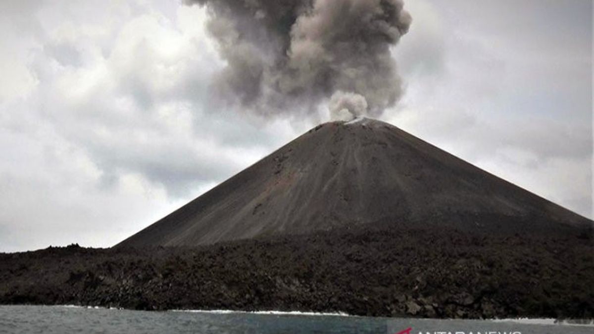


JAKARTA - Mount Anak Krakatau (GAK) monitoring post officer Andi stated that the status of GAK in the waters of the Sunda Strait has increased to level III from the previous level II since Sunday, April 24 at 18.00 WIB. That's the news that was reported by Antara from Bandar Lampung, Monday, April 25.
From the monitoring post on Sunday, GAK could be heard making a rumbling sound and it continued to erupt that emitting light from the fire. With a height of 3,000 meters and fire rays that reach a maximum of 200 meters from the top of the mountain.
The public, tourists, and fishermen should not approach GAK within a 5-kilometer radius in the current level III situation. However, the community can still carry out their usual activities and not be consumed by issues from irresponsible parties. Correct information only comes from the local Regional Disaster Management Agency (BPBD) or to the GAK Monitoring Post.
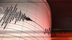
Based on the official release by the Indonesian Ministry of Energy and Mineral Resources (ESDM), 21 earthquake eruptions were recorded during April 1-24, 2022.
Then, 155 gusts earthquakes, 14 harmonics, 121 low-frequency earthquakes, 17 shallow volcanic earthquakes, 38 deep volcanic earthquakes, and continuous tremors with an amplitude of 0.5 - 55 mm (dominant 50mm) and recorded 2 local tectonic earthquakes, 6 times distant tectonic earthquakes and 1 earthquake felt with a scale of I MMI.

The energy of volcanic activity as reflected in the Real-time Seismic Amplitude Measurement (RSAM) value shows a fluctuation pattern with a tendency to increase sharply since April 15, 2022.
Then, visually, the height of the puff of smoke during the period from April 1-24, 2022 from the direction of the Pasauran and Kalianda PGA Posts and CCTV is generally clear until it is covered in fog.
When the weather is clear, you can see a puff of white crater smoke with thin to thick intensity, the height of the gust column is about 25-3000 meters from the top of the GAK peak, with weak to strong winds to the north, northeast, east, southeast, south, southwest, west and northwest.
Then, an eruption with a column height of 50-2000 meters was seen from the top of the mountain. The eruption ash column is white, gray to black with the dominant wind direction to the southeast and south.
Even though GAK is on alert status III, activities in a 5-kilometer radius around the area are still running as usual, including the activity of transportation ships transporting residents from Canti Pier to Sebesi Island, which still operates normally twice a day.
SEE ALSO:
-
 | BERNAS
Cerita Usaha Elon Musk Mengakuisisi Twitter Rp618 Triliun: Akan Sukseskah Dia?
22 April 2022, 16:30 -
 | BERNAS
Seluk Beluk Tiga Huruf yang Paling Ditunggu Kemunculannya Menjelang Lebaran, THR
18 April 2022, 07:45

Previously, the Head of the Geological Agency of the Ministry of Energy and Mineral Resources, Eko Budi Lelono in an online press meeting in Jakarta, stated that GAK had indeed erupted, as quoted from Antara, Wednesday, February 9, 2022.
"Currently we are still evaluating, so we have not upgraded the status of GAK, we are still evaluating the data thoroughly to ensure potential dangers in the future", he said.
Eko added that an emergency response team had been sent by the Geological Agency to evaluate the data in the field. In addition, his party has also coordinated with the Meteorology, Climatology, and Geophysics Agency (BMKG) and the local Disaster Management Agency (BPBD).
The Geological Agency's written report, Monday, February 7, said that the crater smoke was visible at an altitude of 25-50 meters. GAK eruption occurred twice, namely at 07.03 WIB, above the peak, and a burst of volcanic ash 600 meters was seen. The Geological Agency seismograph recorded a maximum amplitude of 50 mm and 103 seconds.
Possible Tsunami
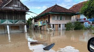
The main concern in the event of an eruption at GAK is a tsunami. As happened on Saturday, December 22, 2018, when the GAK eruption caused the foot of the mountain to collapse, causing a tsunami.
The tsunami waves hit Anyer in Banten at night, and without any warning. The brunt of the tsunami killed 473 people.
This time, the BMKG warned of the possibility of a tsunami appearing at night.
"Due to the increased activity of Mount Anak Krakatau, as informed by the Geological Disaster and Mitigation Agency, the public is advised to be aware of the potential for a tsunami, especially at night", said BMKG Head, Dwikorita Karnawati, as quoted by Antara on April 25.

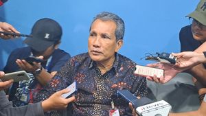
However, according to volcanologist Surono or known as Mbah Rono, the eruption of GAK this time is unlikely to cause a tsunami. Surono reasoned that the 2018 Anyer tsunami did not occur as a result of an eruption, but an avalanche of mountain cliffs below sea level.
"It was a landslide yesterday when there was a tsunami, it is unlikely that another landslide will occur. No tsunami at all. Don't worry, he exploded so that the material can build up so that his body is bigger", said Surono, as quoted by CNBC Indonesia on Tuesday, April 26.
Country of the Ring of Fire
Indonesia is a country in the Pacific Ring of Fire. This causes Indonesia to have many volcanoes. And volcanoes in Indonesia are mountains with large and explosive eruptions.
Apart from Krakatoa, there are 18 other volcanoes in Indonesia with a level II alert or danger status. Meanwhile, there are four that are in level III status, namely Sinabung, Merapi, Semeru, and Ili Lewotolok. And those with level l or normal status are 47 volcanoes.
This makes Indonesia a country with a greater potential for volcanic eruptions than other countries. Other disasters that arise due to volcanic eruptions are such as tsunamis and air pollution.

However, there is still a positive side as a result of volcanic eruptions, namely the areas affected by the eruption will have more fertile soil than others that are not affected by the eruption.
In the Journal of Society and Culture, it is stated that the fertile land of Java can support 1,200 people per mile. Meanwhile, Kalimantan only has 4-5 people in the same area. This is because the material released by the volcano that has erupted on the island of Java has indirectly fertilized the land.
History of the Krakatoa Explosion
The massive eruption of Krakatoa in 1883 made it known to the world and became one of the greatest historical events in Indonesia and the world. It is located on Rakata Island in the Sunda Strait which separates Java and Sumatra. Administratively, it is located in South Lampung Regency, Lampung Province.
Previously in 1680, Krakatoa had erupted. Then 1880 Krakatoa issued lava but did not erupt. After that, there was no more volcanic activity on Krakatoa until May 20, 1883.
After sleeping for 200 years, a small explosion appeared on Krakatoa, which marked the beginning of a massive eruption in the Sunda Strait, with a peak on August 26-27, 1883.

The magnitude of the eruption caused most of the volcanoes on Rakata Island to collapse into the sea. At that time Krakatoa released millions of tons of rock, dust, and magma which resulted in the closure of an area of 827,000 km2. Killed 36,000 people due to hot clouds and tsunamis.
The sound of Krakatoa's eruption was heard as far as Alice Springs, Australia, and Rodrigues Island near Africa, 4,653 km. The magnitude of the explosion was estimated at 30 thousand times the atomic bombs dropped on Hiroshima and Nagasaki at the end of World War II.
The eruption of Krakatoa at that time triggered global climate change. Causing the world to be dark for two and a half days due to volcanic ash covering the atmosphere. The sun's rays dimmed for almost a year.
Krakatoa erupted when the human population was dense enough. The era of science and technology has developed, the telegraph has been invented and submarine cables have been laid. At that time technology was growing.
But unfortunately at that time, the field of geology had not progressed. So that the geologists when the Krakatoa eruption occurred have not been able to provide a scientific statement.
The Birth of the Child of Krakatoa
After its massive eruption in mid-1883, Krakatoa went back to sleep for a few years. According to the Indonesian Geological Journal, Krakatoa experienced an underwater eruption on December 29, 1927.
This eruption made the view of water gush like a fountain in the area of Mount Krakatau. This eruption continued until January 15, 1929. According to geologists after the underwater eruption, there was a pile of material beside Krakatoa which formed a small island. This phenomenon is known as the birth of the child of Krakatoa.
The child of this mountain grew rapidly in the center of the Krakatoa area from a depth of 180 meters below the sea and emerged to the surface in 1929, and experienced several eruptions.
Measurement of the dimensions of the Anak Krakatau was carried out in 2000 and it is known that its height has reached 315 meters above sea level with a volume of 5.51 km3. It can be said that the children of Krakatau experience an average growth of four meters every year.

The journal also explains, that seeing the rapid growth of the child of Krakatoa, there is always the possibility that there will be another eruption that resembles the eruption in 1883.
If this happens again, then the Sunda Strait area is the one that will receive the biggest impact.
Currently, the status of Mount Anak Krakatau is level III, it is important for all parties to be aware of it and for the community around the area to seek information from trusted sources, not fake news or hoaxes.
The English, Chinese, Japanese, Arabic, and French versions are automatically generated by the AI. So there may still be inaccuracies in translating, please always see Indonesian as our main language. (system supported by DigitalSiber.id)
Most Popular Tags
#Prabowo Subianto #Flood #Palestine #bus accident #Indonesian Hajj PilgrimsPopular

Related News